
Moydow
Good walks are even better shared.
Overview
Moydow: A Hidden Gem of County Longford
Overview
Moydow, a delightful summit nestled in County Longford, stands proud at 200 meters. While it may not be among the giants of the Irish landscape, its modest elevation and rich history make it a worthwhile adventure for hikers of all levels.
Geology
The mountain is primarily composed of limestone from the Carboniferous period—perfect for both geology enthusiasts and those who enjoy a good fossil hunt. Keep your eyes peeled for the interesting rock formations and maybe, just maybe, a few ancient marine fossils peeking out from the ground.
Routes
The Moydow Loop Trail offers a scenic 6.5 km circular route through the charming countryside. It’s a moderate trail that takes approximately 2.5 hours to complete, allowing plenty of time to soak in the views and perhaps catch a fellow hiker who has taken a wrong turn!
Summit Features
At the summit, you’ll find a friendly stone cairn, welcoming every hiker to add a stone of their own—a tradition as old as time! There’s also a trig point, a perfect place for a celebratory selfie.
Terrain Type
Expect the terrain to be grassy with occasional rocky patches. Be cautious of muddy spots after rain; they can be sneakier than a cat on a hot tin roof!
Views
From the top, the views are nothing short of splendid. Lough Ree glistens in the north and the expansive fields of Longford stretch out before you. If you’re lucky enough to be there during spring or autumn, the colours will enchant you. Winter sunrises? Well, bring your camera!
Hazards
As with all adventures, keep your wits about you. Sudden weather changes can catch you off guard, so waterproofs can be your best mate. The ground can become quite slippery, so tread carefully!
Nearby Summits
Don't forget to check out nearby summits like Sliabh Baun and Big Wood, both of which offer their own unique hiking experiences.
Access
You can pull up to a small car park located 1 km to the west of the summit. If you're relying on public transport, buses from Longford will get you close to the action, followed by a brisk walk.
Facilities
After your hike, treat yourself at the local café in the village for a warm drink and a snack. Restrooms can also be found nearby, as no one wants to be caught out in nature!
History
The mountain's name, derived from 'Maigh Dubh', pays homage to the rich soils of the region. With historical remnants scattered about, it's a perfect spot for history enthusiasts and casual explorers alike.
So, whether you're an avid hiker or just someone looking to get a breath of fresh air, Moydow welcomes you with open arms—just watch out for the mud!
Happy hiking!
Explore routes near Moydow
Public walks starting within 80 km of this hill. Nearby does not mean a route reaches the summit; check its map and access before setting out.
No public routes are currently listed within 80 km of Moydow on Walkmates. This does not mean there are no paths here. Explore the map and check local access information before planning a walk.
Route planning notes
These notes describe possible approaches, not verified navigable routes or permission to cross land. Check current paths, local access rules and conditions before setting out.
Moydow Loop Trail
A scenic circular route around Moydow, taking in the lush countryside and historic sites.
Make a day of it, together
Find someone to share the walk with, or organise a day out along a route you like.
Hill facts and local notes
Classifications
Elevation
165m
541 ft
Prominence
108m
Coordinates
53.5738, -8.1653
M891582
OS Map
40
At the Summit
The summit features a distinctive stone cairn, which hikers often add to. There is also a modest trig point that is a popular photo spot.
Terrain & Geology
Moydow is primarily composed of limestone from the Carboniferous period, known for its fossilised remains of ancient marine life. This geology not only contributes to its unique landscape but also offers great insights into Ireland's geological history.
Views & Scenery
From the summit, you can enjoy views of Lough Ree to the north and the rolling fields of Longford. On a clear day, the distant hills of the Irish Midlands add to the appeal.
History & Heritage
Name Origin
The name Moydow is said to come from the Irish 'Maigh Dubh', meaning 'black plain', hinting at the dark rich soil in the area.
Historical Significance
Moydow is steeped in local folklore and history, with several ancient ruins nearby that are of interest to history buffs.
Getting There & Facilities
Check current local access restrictions, parking rules and transport timetables before travelling. These notes do not confirm public access to the summit.
Parking
There is a small car park at the start of the Moydow Loop Trail, approximately 1 km west of the summit.
Public Transport
Regular bus services from Longford town operate to nearby villages, with a short walk required to reach the trailhead.
Nearby Facilities
The nearby village has a quaint café that serves hot drinks and snacks, as well as public toilets available in the village centre.
Safety Information
Known Hazards
- Beware of sudden weather changes; bring waterproofs. The terrain can be slippery, especially after rain or during autumn.
- Occasional wildlife encounters; keep your food secure to avoid attracting curious creatures.
General Safety Tips
- Check weather conditions before setting out
- Carry appropriate clothing and equipment
- Let someone know your planned route
- Take a map, compass, and GPS device
- Carry emergency supplies: food, water, first aid kit, torch
Hills
Some common questions about the hills answered
Are there group walks up Moydow?
Many walkers use Walkmates to join or organise walks with others. You can check for group walks around Moydow through the maps
Are there other walkers around Moydow?
Activity varies by location and time, but Walkmates lets you see whether others have shared walks or shown interest in this area. Find other people through the walking friends search walking friends for Moydow search or of course create your own walk for Moydow
Can I organise a walk to Moydow?
Yes. If there aren’t any walks listed already, you can create a walk and make it available for others to join.
If you're signed up to Walkmates, you can create a walk to Moydow.
How do I find a walk up this hill?
There are often multiple ways to walk this hill, depending on experience and route preference. Walkmates helps you explore walks and routes that others have shared.
Can I suggest a new route up Moydow?
Yes. You can suggest or create routes to share with others. Walkmates focuses on the social side of walking, so routes are used to help people organise walks and explore areas together, rather than as detailed navigation tools or route libraries.
Other uses really appreciate knowledgeable walkers sharing their routes. Share your favourite route to Moydow here
The is an error or something incorrect about this hill. How do I let you know?
We always strive to keep the information on Walkmates as accurate as possible. If you find an error, please let us know through the contact form and we'll aim to correct it as quickly as possible
Community Discussion
Comments
Location
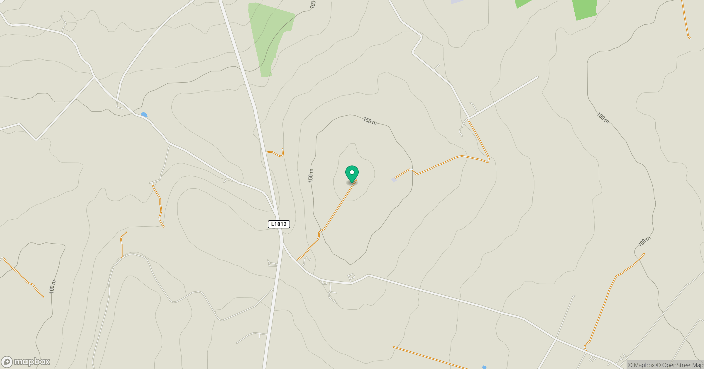
Grid reference: M891582
View on OpenStreetMapOpens a map in a new tab, centred on the hill.
Hills within 30 km
Straight-line distance, not a walking route or confirmation of access.
No comments yet. Be the first.