
Moveen Hill
Good walks are even better shared.
Overview
Moveen Hill: The Hidden Gem of Antrim Hills
Introduction
Nestled in the Antrim Hills, Moveen Hill is a delightful destination for hikers looking to escape the hustle and bustle of city life and immerse themselves in nature. Standing at an elevation of 358 meters, this Marilyn offers not just a challenge, but also breathtaking views and a chance to enjoy some fresh air.
Geology
Moveen Hill's fascinating geological makeup features limestone and sandstone, adding character to its landscape. The limestone provides unique habitats and supports a variety of flora and fauna, making it a treat for nature enthusiasts.
Routes
The most popular route begins at Ballygally, offering a moderate trek through stunning green pastures and rocky terrains. Perfect for those who enjoy an afternoon hike with just enough of a workout to warrant that extra slice of cake at the cafe afterward!
Summit Features
At the top, you'll find a cairn and a trig point. Make sure to take a moment to appreciate the beauty surrounding you – and for the more social hikers, capture some snaps for social media. After all, what’s a hike without a picture to prove you were there?
Terrain Type
Expect a mix of grassy slopes and rocky outcrops. The varied terrain keeps your hike interesting, so be prepared for a bit of everything as you make your way to the top.
Views
The panoramic views from Moveen Hill are spectacular. On a clear day, you can see the Antrim coastline, the Scottish Highlands in the distance, and the majestic Mourne Mountains. For the best views, try to hike during clear days in late spring or early autumn.
Hazards
While the hike is accessible for many, be mindful of steep drops near the summit and always check the weather forecast beforehand. The last thing you want is to be caught in a surprise downpour!
Access
Getting there is a breeze! There’s ample parking available in Ballygally, and local buses connect you to the area from Larne. The nearest town is charming Larne, where you can grab coffee and snacks before your adventure.
Facilities
Ballygally offers several facilities including cafes and public toilets, ensuring you’re well-prepared before setting off on your hike.
History
The name 'Moveen' reflects the hill's cultural roots, meaning 'little mound' in Irish. It's been a significant landmark throughout history, offering not just a physical challenge but also a connection to the local community and its heritage.
Conclusion
For those looking to enjoy the great outdoors, Moveen Hill is a delightful option. Remember to bring your camera, stay safe, and enjoy the natural beauty that the Antrim Hills have to offer!
Happy hiking!
Explore routes near Moveen Hill
Public walks starting within 80 km of this hill. Nearby does not mean a route reaches the summit; check its map and access before setting out.
No public routes are currently listed within 80 km of Moveen Hill on Walkmates. This does not mean there are no paths here. Explore the map and check local access information before planning a walk.
Route planning notes
These notes describe possible approaches, not verified navigable routes or permission to cross land. Check current paths, local access rules and conditions before setting out.
Trail from Ballygally
A moderately challenging route starting from the picturesque Ballygally, leading gently through lush, green landscapes to the summit.
Make a day of it, together
Find someone to share the walk with, or organise a day out along a route you like.
Hill facts and local notes
Classifications
Elevation
136m
446 ft
Prominence
119m
Coordinates
52.6570, -9.6899
Q857575
OS Map
63
At the Summit
The summit features a well-maintained cairn with an impressive trig point, perfect for those Instagram-worthy selfies.
Terrain & Geology
Moveen Hill is primarily composed of limestone, with patches of sandstone evident. This geological mix contributes to the varied landscape and rich biodiversity in the area.
Views & Scenery
From the summit, you can enjoy stunning views of the Antrim coastline, the distant Scottish peaks, and the majestic Mourne Mountains.
History & Heritage
Name Origin
The name 'Moveen' is derived from the Irish term meaning 'little mound' - quite fitting, don’t you think?
Historical Significance
Moveen Hill has been a significant landmark for local communities, often regarded as a point of spiritual and historical importance.
Getting There & Facilities
Check current local access restrictions, parking rules and transport timetables before travelling. These notes do not confirm public access to the summit.
Parking
There is a small parking area in Ballygally, just a short walk from the trailhead.
Public Transport
Ballygally is accessible via local buses from Larne, which connect to larger networks.
Nearby Facilities
There are cafes and public toilets available in Ballygally, making it a good base before or after your hike.
Safety Information
Known Hazards
- Beware of steep drops on the ascent, and always check the weather before heading out, as conditions can change rapidly in the hills.
General Safety Tips
- Check weather conditions before setting out
- Carry appropriate clothing and equipment
- Let someone know your planned route
- Take a map, compass, and GPS device
- Carry emergency supplies: food, water, first aid kit, torch
Hills
Some common questions about the hills answered
Are there group walks up Moveen Hill?
Many walkers use Walkmates to join or organise walks with others. You can check for group walks around Moveen Hill through the maps
Are there other walkers around Moveen Hill?
Activity varies by location and time, but Walkmates lets you see whether others have shared walks or shown interest in this area. Find other people through the walking friends search walking friends for Moveen Hill search or of course create your own walk for Moveen Hill
Can I organise a walk to Moveen Hill?
Yes. If there aren’t any walks listed already, you can create a walk and make it available for others to join.
If you're signed up to Walkmates, you can create a walk to Moveen Hill.
How do I find a walk up this hill?
There are often multiple ways to walk this hill, depending on experience and route preference. Walkmates helps you explore walks and routes that others have shared.
Can I suggest a new route up Moveen Hill?
Yes. You can suggest or create routes to share with others. Walkmates focuses on the social side of walking, so routes are used to help people organise walks and explore areas together, rather than as detailed navigation tools or route libraries.
Other uses really appreciate knowledgeable walkers sharing their routes. Share your favourite route to Moveen Hill here
The is an error or something incorrect about this hill. How do I let you know?
We always strive to keep the information on Walkmates as accurate as possible. If you find an error, please let us know through the contact form and we'll aim to correct it as quickly as possible
Community Discussion
Comments
Location
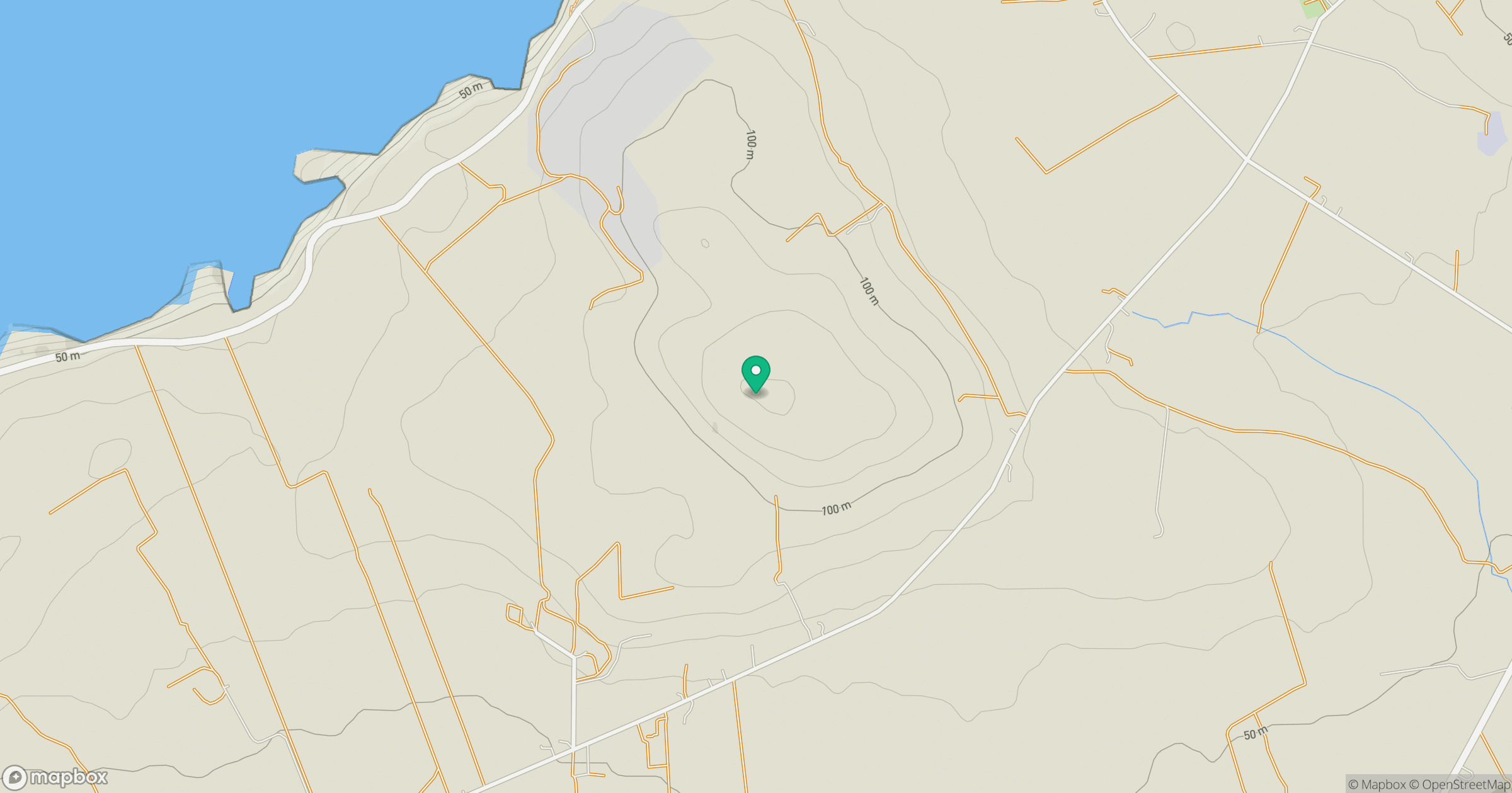
Grid reference: Q857575
View on OpenStreetMapOpens a map in a new tab, centred on the hill.
Hills within 30 km
Straight-line distance, not a walking route or confirmation of access.
No comments yet. Be the first.