
Knockroe
Good walks are even better shared.
Overview
Knockroe
Overview
Knockroe stands at a modest 401 meters, yet it’s nestled within the breathtaking Southern Mourne Mountains, offering exhilarating views and a heartwarming sense of Scottish charm right in Northern Ireland.
Geology
This mountain primarily features rugged granite, interspersed with pockets of basalt. These geological formations create a visual feast for both nature enthusiasts and budding geologists alike. You can often see how the elements have sculpted the terrain over ages—nature’s own artistry!
Routes
- Mourne Wall Route: An iconic trek along the historical Mourne Wall. This route, clocking in at 8 kilometers, offers a moderate challenge and is well-defined.
- Ballymartin Start: A gentler option for families or those looking for a stroll that leads to remarkable views without straining themselves.
Terrain
The schlep up Knockroe presents rocky patches interspersed with lush grass and vibrant heather, so dress accordingly. It’s a good idea to break in your sturdy boots!
Views
As you ascend, prepare to be captivated by the sweeping views of the Silent Valley Reservoir—especially in the golden light of sunset! If you’re lucky, the sea could even put on a sparkling show, making your hike a perfect photo op.
Hazards
Hikers are advised to be cautious of sudden weather fluctuations in the Mourne region. Those slippery rocks after rain are no laughing matter, and being mindful of the steep drop-offs at the summit is wise.
Nearby Summits
Knockroe is not alone in its majesty; nearby Slieve Donard and Slieve Commedagh offer worthy companions for any mountain bagger keen to explore further.
Access
The Carrick Little car park is your best bet for starting your adventure, conveniently located with ample space. If you're relying on public transport, buses run from Newcastle to help ecologically minded hikers.
Explore routes near Knockroe
Public walks starting within 80 km of this hill. Nearby does not mean a route reaches the summit; check its map and access before setting out.
No public routes are currently listed within 80 km of Knockroe on Walkmates. This does not mean there are no paths here. Explore the map and check local access information before planning a walk.
Route planning notes
These notes describe possible approaches, not verified navigable routes or permission to cross land. Check current paths, local access rules and conditions before setting out.
Mourne Wall Route
A scenic route following the historical Mourne Wall, offering stunning views and a relatively straightforward ascent.
Ballymartin Start
Starting from Ballymartin, this route includes some easy slopes followed by a gradual incline, perfect for family hikes.
Make a day of it, together
Find someone to share the walk with, or organise a day out along a route you like.
Hill facts and local notes
Classifications
Elevation
168m
551 ft
Prominence
107m
Coordinates
53.4199, -8.7422
M507413
OS Map
46
At the Summit
The summit proudly boasts a large stone cairn, providing a perfect spot for photos, as well as panoramic views of the surrounding mountains and valleys.
Terrain & Geology
Predominantly granite with some basaltic features, providing a diverse landscape that varies in texture and colour. The erosion patterns make for fascinating study and great photography opportunities.
Views & Scenery
From the summit, one can see the picturesque Silent Valley Reservoir, Slieve Donard, and the sprawling views of the Irish Sea on clear days.
History & Heritage
Name Origin
The name 'Knockroe' originates from the Irish 'Cnoc Ruadh', meaning 'red hill', which makes sense when the heather blooms.
Historical Significance
Local folklore holds that the Mourne Mountains are home to various myths and legends, making it a fascinating place for those interested in cultural histories.
Getting There & Facilities
Check current local access restrictions, parking rules and transport timetables before travelling. These notes do not confirm public access to the summit.
Parking
There is ample parking available at the Carrick Little car park, which serves as a popular starting point for many hikes in the Mournes.
Public Transport
The nearest bus stop is in Rostrevor, from where there are local buses operating regularly to the Mourne area. Check local timetables for details.
Nearby Facilities
Nearby in Newcastle, facilities include cafes, shops, and public toilets. Consider stopping at a local café for a well-deserved slice of cake.
Safety Information
Known Hazards
- Be mindful of sudden weather changes typical of the Mourne area, steep drop-offs near the summit, and potential slippery rocky sections after rain.
General Safety Tips
- Check weather conditions before setting out
- Carry appropriate clothing and equipment
- Let someone know your planned route
- Take a map, compass, and GPS device
- Carry emergency supplies: food, water, first aid kit, torch
Hills
Some common questions about the hills answered
Are there group walks up Knockroe?
Many walkers use Walkmates to join or organise walks with others. You can check for group walks around Knockroe through the maps
Are there other walkers around Knockroe?
Activity varies by location and time, but Walkmates lets you see whether others have shared walks or shown interest in this area. Find other people through the walking friends search walking friends for Knockroe search or of course create your own walk for Knockroe
Can I organise a walk to Knockroe?
Yes. If there aren’t any walks listed already, you can create a walk and make it available for others to join.
If you're signed up to Walkmates, you can create a walk to Knockroe.
How do I find a walk up this hill?
There are often multiple ways to walk this hill, depending on experience and route preference. Walkmates helps you explore walks and routes that others have shared.
Can I suggest a new route up Knockroe?
Yes. You can suggest or create routes to share with others. Walkmates focuses on the social side of walking, so routes are used to help people organise walks and explore areas together, rather than as detailed navigation tools or route libraries.
Other uses really appreciate knowledgeable walkers sharing their routes. Share your favourite route to Knockroe here
The is an error or something incorrect about this hill. How do I let you know?
We always strive to keep the information on Walkmates as accurate as possible. If you find an error, please let us know through the contact form and we'll aim to correct it as quickly as possible
Community Discussion
Comments
Location
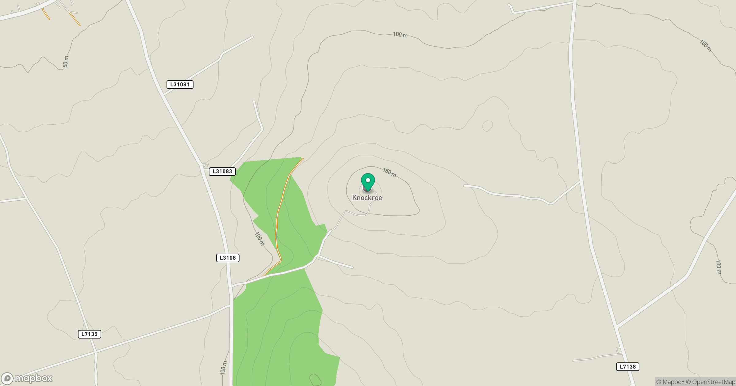
Grid reference: M507413
View on OpenStreetMapOpens a map in a new tab, centred on the hill.
Hills within 30 km
Straight-line distance, not a walking route or confirmation of access.
No comments yet. Be the first.