
Knockbreteen
Good walks are even better shared.
Overview
Knockbreteen: A Hiker's Delight
Overview
Nestled in the breathtaking landscape of County Kerry, Knockbreteen is a majestic peak that offers a rewarding experience for hikers of all abilities. At 649 meters, it may not be the highest in the region, but it certainly competes in terms of views!
Geology
Knockbreteen is primarily composed of sandstone, shaped over millennia by the forces of nature. The surrounding landscape shows clear evidence of glacial activity, making for interesting geological features and a rugged appearance.
Routes
There are several routes to the summit, each offering its own unique charm:
- Bending through the Breeches: A moderate 7.5 km loop taking approximately 3 hours. Perfect for a leisurely day out!
- Summit Loop from Kilgarvan: A challenging 10 km trek that's sure to test your mettle. Expect to spend about 5 hours navigating this route.
Summit Features
At the summit, you'll find a substantial stone cairn, providing a fantastic backdrop for photos or a place to rest your tired feet while enjoying the views.
Terrain
The terrain is a mix of grassy slopes and rocky outcrops, interspersed with some boggy areas – a trait of Irish hills! Be prepared for a bit of squelching if the weather's been wet.
Views
The vistas from Knockbreteen are nothing short of spectacular. Looking south, you’ll have a clear view of the Macgillycuddy's Reeks and Kenmare Bay. Perfect for a picnic, as long as the seagulls don't steal your sandwich!
Hazards
As with any mountain, be prepared for changing weather conditions and keep an eye on the ground to avoid slips in muddy conditions.
Access
Parking
The trailhead near Kilgarvan has parking available, but be prepared for it to fill up during peak hiking hours.
Public Transport
Buses from Killarney to Kilgarvan make accessing the mountain easier, though ensure to check the local timetables.
Nearest Town
The charming village of Kilgarvan is the closest spot for amenities and a friendly chat!
Facilities
Post-hike, you can find a few pubs and a café in Kilgarvan to refuel, but options are limited so plan ahead.
History
Name Meaning
The name derives from the Irish term 'Cnoc Bréithe,' translating to 'hill of the five peaks,' aptly describing its imposing ridges.
Significance
Knockbreteen features prominently in local folklore, revealing a fascinating cultural heritage that enriches the hiking experience.
Conclusion
Knockbreteen is a splendid choice for anyone looking to escape into nature, whether for a short hike or a more demanding adventure. Come for the views, stay for the stories!
Explore routes near Knockbreteen
Public walks starting within 80 km of this hill. Nearby does not mean a route reaches the summit; check its map and access before setting out.
No public routes are currently listed within 80 km of Knockbreteen on Walkmates. This does not mean there are no paths here. Explore the map and check local access information before planning a walk.
Route planning notes
These notes describe possible approaches, not verified navigable routes or permission to cross land. Check current paths, local access rules and conditions before setting out.
Bending through the Breeches
This route offers a leisurely ascent, winding through scenic moorland and offering views down to the Kerry coastline. Perfect for a pleasant half-day hike.
Summit Loop from Kilgarvan
A more challenging option that involves a steep ascent but rewards hikers with breathtaking panoramas from the summit. Ideal for those looking to stretch their legs a bit more.
Make a day of it, together
Find someone to share the walk with, or organise a day out along a route you like.
Hill facts and local notes
Classifications
Elevation
239m
784 ft
Prominence
104m
Coordinates
51.7686, -9.3769
W050582
OS Map
85
At the Summit
The summit is marked by a large stone cairn, which makes an excellent spot for a well-deserved snack break while soaking in the views of the surrounding peaks.
Terrain & Geology
Knockbreteen is primarily composed of sandstone, lending its rugged slopes a striking, weathered appearance. The hills have been shaped by glacial activity, and remnants of this can be seen in the surrounding landscape.
Views & Scenery
From the summit, one can see the majestic Macgillycuddy's Reeks and the glimmering waters of Kenmare Bay. Beware of getting lost in the horizon – it’s a lovely sight!
History & Heritage
Name Origin
The name Knockbreteen is derived from the Irish 'Cnoc Bréithe,' meaning 'hill of the five peaks,' reflecting the prominent ridges that characterize the mountain.
Historical Significance
Knockbreteen holds cultural significance in local folklore, often mentioned in stories reflecting the rich heritage of the area.
Getting There & Facilities
Check current local access restrictions, parking rules and transport timetables before travelling. These notes do not confirm public access to the summit.
Parking
Parking is available at the trailhead near Kilgarvan. It can get busy on weekends, so arrive early if you want a good spot!
Public Transport
Bus services from Killarney to Kilgarvan run regularly, though you may need to plan your hiking schedule around them.
Nearby Facilities
While facilities are limited in Kilgarvan, you can find a couple of pubs and a café to grab a bite pre- or post-hike. Toilets might be available in the village.
Safety Information
Known Hazards
- Watch for the sudden weather changes that can occur in the mountains, and be wary of slippery rocks and boggy ground after rain.
General Safety Tips
- Check weather conditions before setting out
- Carry appropriate clothing and equipment
- Let someone know your planned route
- Take a map, compass, and GPS device
- Carry emergency supplies: food, water, first aid kit, torch
Hills
Some common questions about the hills answered
Are there group walks up Knockbreteen?
Many walkers use Walkmates to join or organise walks with others. You can check for group walks around Knockbreteen through the maps
Are there other walkers around Knockbreteen?
Activity varies by location and time, but Walkmates lets you see whether others have shared walks or shown interest in this area. Find other people through the walking friends search walking friends for Knockbreteen search or of course create your own walk for Knockbreteen
Can I organise a walk to Knockbreteen?
Yes. If there aren’t any walks listed already, you can create a walk and make it available for others to join.
If you're signed up to Walkmates, you can create a walk to Knockbreteen.
How do I find a walk up this hill?
There are often multiple ways to walk this hill, depending on experience and route preference. Walkmates helps you explore walks and routes that others have shared.
Can I suggest a new route up Knockbreteen?
Yes. You can suggest or create routes to share with others. Walkmates focuses on the social side of walking, so routes are used to help people organise walks and explore areas together, rather than as detailed navigation tools or route libraries.
Other uses really appreciate knowledgeable walkers sharing their routes. Share your favourite route to Knockbreteen here
The is an error or something incorrect about this hill. How do I let you know?
We always strive to keep the information on Walkmates as accurate as possible. If you find an error, please let us know through the contact form and we'll aim to correct it as quickly as possible
Community Discussion
Comments
Location
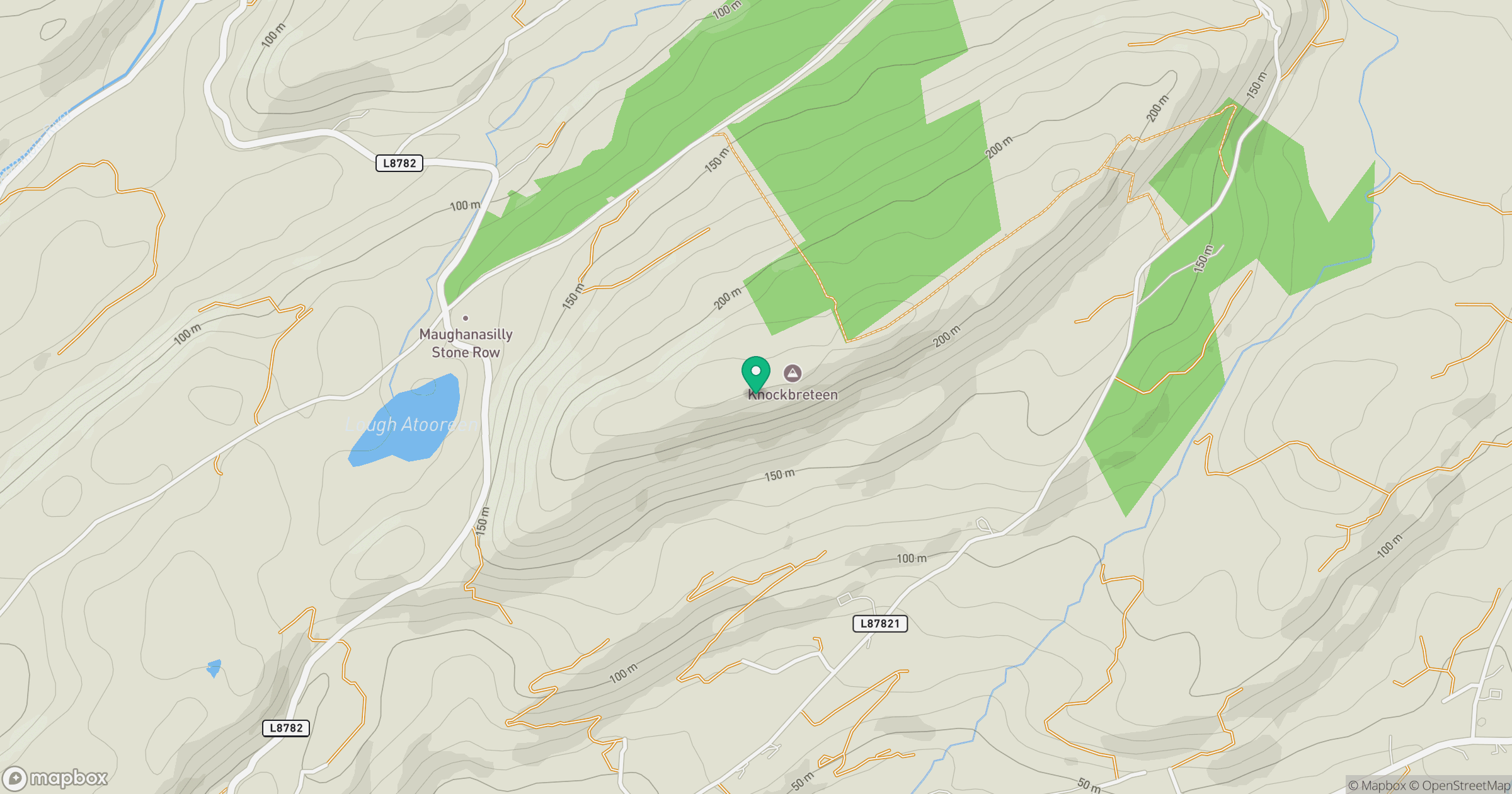
Grid reference: W050582
View on OpenStreetMapOpens a map in a new tab, centred on the hill.
Hills within 30 km
Straight-line distance, not a walking route or confirmation of access.
No comments yet. Be the first.