

Hoober Stand
Good walks are even better shared.
SK4098 : Hoober Stand
Rude Health Photo source
Overview
Hoober Stand
Overview
Nestled in South Yorkshire, Hoober Stand rises modestly at an elevation of 300 meters, yet it offers one of the best vantage points in the region. Its well-maintained paths make it a go-to for casual walkers and seasoned hikers alike.
Geology
Hoober Stand stands proudly on Pennine sandstone, renowned for its rock-solid structure. You'll notice fascinating layers of sediment that tell the story of ancient riverbeds, likely home to water nymphs and other creatures (or so the legends say).
Routes
The Hoober Stand Circular Walk is a delightful 5km loop that takes approximately 1.5 hours to complete. It’s a moderate walk that weaves through picturesque meadows, with a few amusing encounters from local sheep who seem to think they own the place.
Summit Features
Reaching the summit rewards you with a stunning view and a chance to see the iconic stone tower of Hoober Stand itself. At the tower, you might even encounter others who are as taken in by the beauty of this spot.
Terrain
Expect a mix of grassy slopes, rocky patches, and a few muddy surprises. Good walking boots will be your best friend here, especially if the weather has been particularly generous with rain.
Views
From the top, the expansive views encompass the Dearne Valley. On particularly clear days, adventurous souls might even spot the far-off hills of the Peak District trying to flex their muscles.
Hazards
Keep a watchful eye on the weather as it can change quicker than you can say 'scone'. Famous for its wind, the summit can be breezy, so hold onto your hats!
Access
The nearest parking is conveniently located at the foot of Hoober Stand, accessible by car. If you're relying on public transport, some buses run to Rotherham and villages close by, though you may need a gentle walk from there
Facilities
While Hoober Stand doesn’t have a café on the hill, a short trip into the nearby town offers delightful spots for a cuppa and a comfort break. Bring your own picnic to enjoy at the summit as there are no fancy tables up there!
History
The name Hoober potentially originates from Old Norse meaning 'hill'. The tower itself is a testament to the area's rich history, dating back to 1745. Once a beacon for navigators, it now serves as a popular landmark for hikers seeking their next adventure.
Hoober Stand may not stand the tallest, but it certainly stands out. So, lace up those boots, grab your camera, and spend a day enjoying everything this charming hill has to offer.
Conclusion
Whether you’re a local or a visitor, Hoober Stand is an engaging spot that caters to outdoor enthusiasts. So why not take a walk up and soak in its charming atmosphere?
Explore routes near Hoober Stand
Walks starting near this hill. Open a route to check its map, distance and full itinerary.
Elsecar Greenway and the Old Canal
View route
Thrybergh Reservoir Circuit
View route
Worsbrough Mill and Reservoir Circuit
View route
Wharncliffe Woods Plank Gate Return
View route
Route planning notes
These notes describe possible approaches. Check a route's map and access information when planning your walk.
Hoober Stand Circular Walk
A lovely circular route that provides a scenic view of the surrounding countryside while guiding you to the summit and back.
Make a day of it, together
Find someone to share the walk with, or organise a day out along a route you like.
Photo Gallery
View all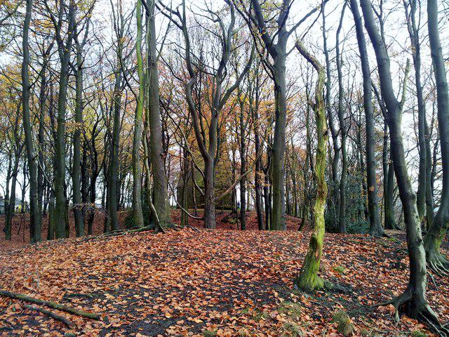 Photo could not load
SK4098 : Hoober Stand
Rude Health
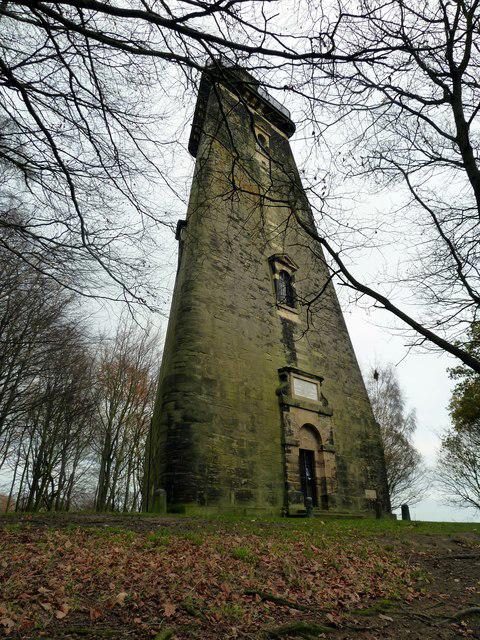 Photo could not load
SK4098 : Hoober Stand
Graham Hogg
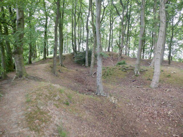 Photo could not load
SK4098 : Quarries, Hoober Plantation
Richard Webb
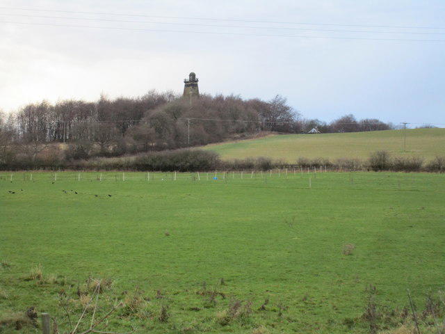 Photo could not load
SK4098 : Hoober Stand
Jonathan Thacker
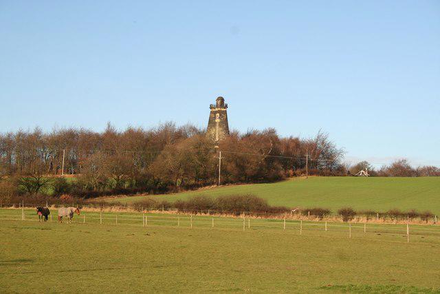 Photo could not load
SK4098 : Hoober Stand
Richard Croft
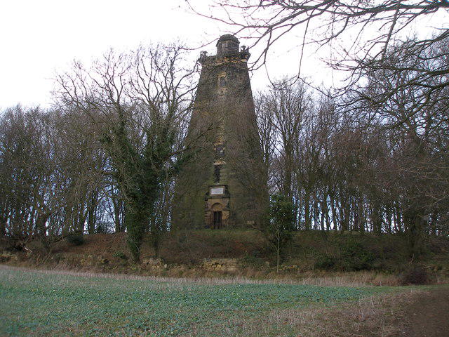 Photo could not load
SK4098 : Hoober Stand
John Slater
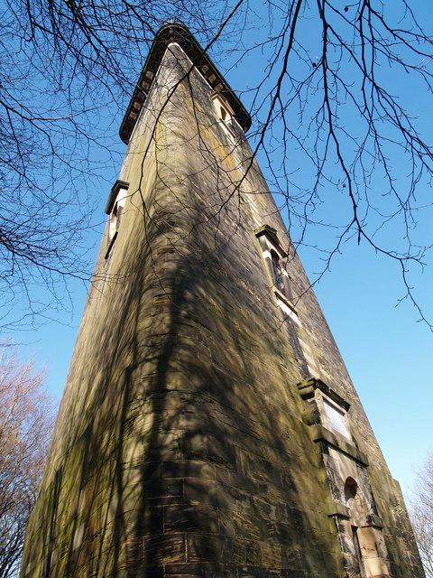 Photo could not load
SK4098 : Hoober Stand
Clive Nicholson
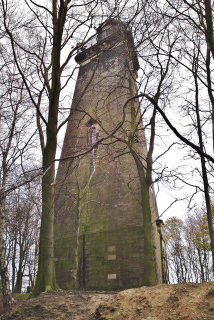 Photo could not load
SK4098 : Hoober Stand - to celebrate defeat of the Jacobite rebellion in 1745, the '45
Chris Morgan
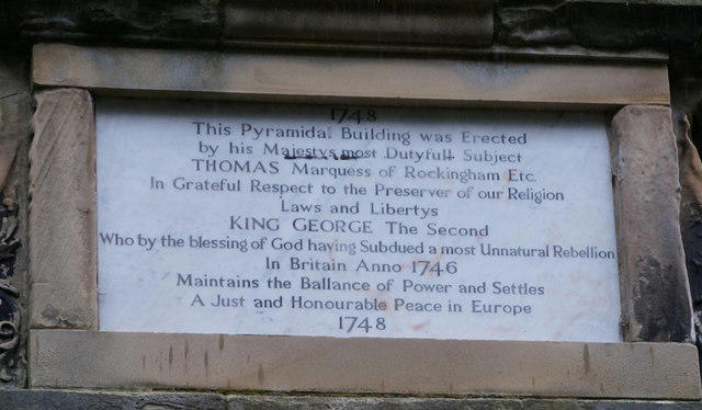 Photo could not load
SK4098 : Inscription above the door at Hoober Stand
Ian S
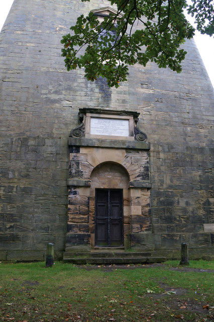
SK4098 : The entrance to Hoober Stand
Ian S
Hill facts and local notes
Classifications
Elevation
155m
509 ft
Prominence
52m
Coordinates
53.4821, -1.3875
SK407985
OS Map
111
Explorer: 278S
At the Summit
At the summit stands a historic stone tower, known as the Hoober Stand, which offers panoramic views and is a popular photo spot for visitors.
Terrain & Geology
Hoober Stand is primarily composed of Pennine sandstone, which is known for its durability and provides a solid footing for hikers. The surrounding area features classic carboniferous limestone, which creates interesting geological formations and supports diverse ecosystems.
Views & Scenery
From the summit, admire the sprawling landscapes of Dearne Valley and, on clear days, glimpse the distant peaks of the Peak District.
History & Heritage
Name Origin
The name 'Hoober' is believed to derive from the Old Norse word for 'hill', signifying its elevated position.
Historical Significance
Historically, Hoober Stand was built in 1745 as a landmark and has since played a role in local folklore and visual navigation.
Getting There & Facilities
Parking
You can park at the small car park located at Hoober Stand itself, which accommodates several vehicles. Always best to arrive early to secure a spot!
Public Transport
Regular bus services run to nearby Rotherham, with further connections to local villages. Check schedules before you head out!
Nearby Facilities
Although facilities are minimal on the hill, the nearest town has cafes and toilets. Bring your own snacks to enjoy at the top!
Safety Information
Known Hazards
- Be cautious of muddy paths after rain. The area can also be windy at the summit, so dress appropriately to avoid being blown away (not literally, of course).
General Safety Tips
- Check weather conditions before setting out
- Carry appropriate clothing and equipment
- Let someone know your planned route
- Take a map, compass, and GPS device
- Carry emergency supplies: food, water, first aid kit, torch
Hills
Some common questions about the hills answered
Are there group walks up Hoober Stand?
Many walkers use Walkmates to join or organise walks with others. You can check for group walks around Hoober Stand through the maps
Are there other walkers around Hoober Stand?
Activity varies by location and time, but Walkmates lets you see whether others have shared walks or shown interest in this area. Find other people through the walking friends search walking friends for Hoober Stand search or of course create your own walk for Hoober Stand
Can I organise a walk to Hoober Stand?
Yes. If there aren’t any walks listed already, you can create a walk and make it available for others to join.
If you're signed up to Walkmates, you can create a walk to Hoober Stand.
How do I find a walk up this hill?
There are often multiple ways to walk this hill, depending on experience and route preference. Walkmates helps you explore walks and routes that others have shared.
Can I suggest a new route up Hoober Stand?
Yes. You can suggest or create routes to share with others. Walkmates focuses on the social side of walking, so routes are used to help people organise walks and explore areas together, rather than as detailed navigation tools or route libraries.
Other uses really appreciate knowledgeable walkers sharing their routes. Share your favourite route to Hoober Stand here
The is an error or something incorrect about this hill. How do I let you know?
We always strive to keep the information on Walkmates as accurate as possible. If you find an error, please let us know through the contact form and we'll aim to correct it as quickly as possible
Community Discussion
Comments
Location
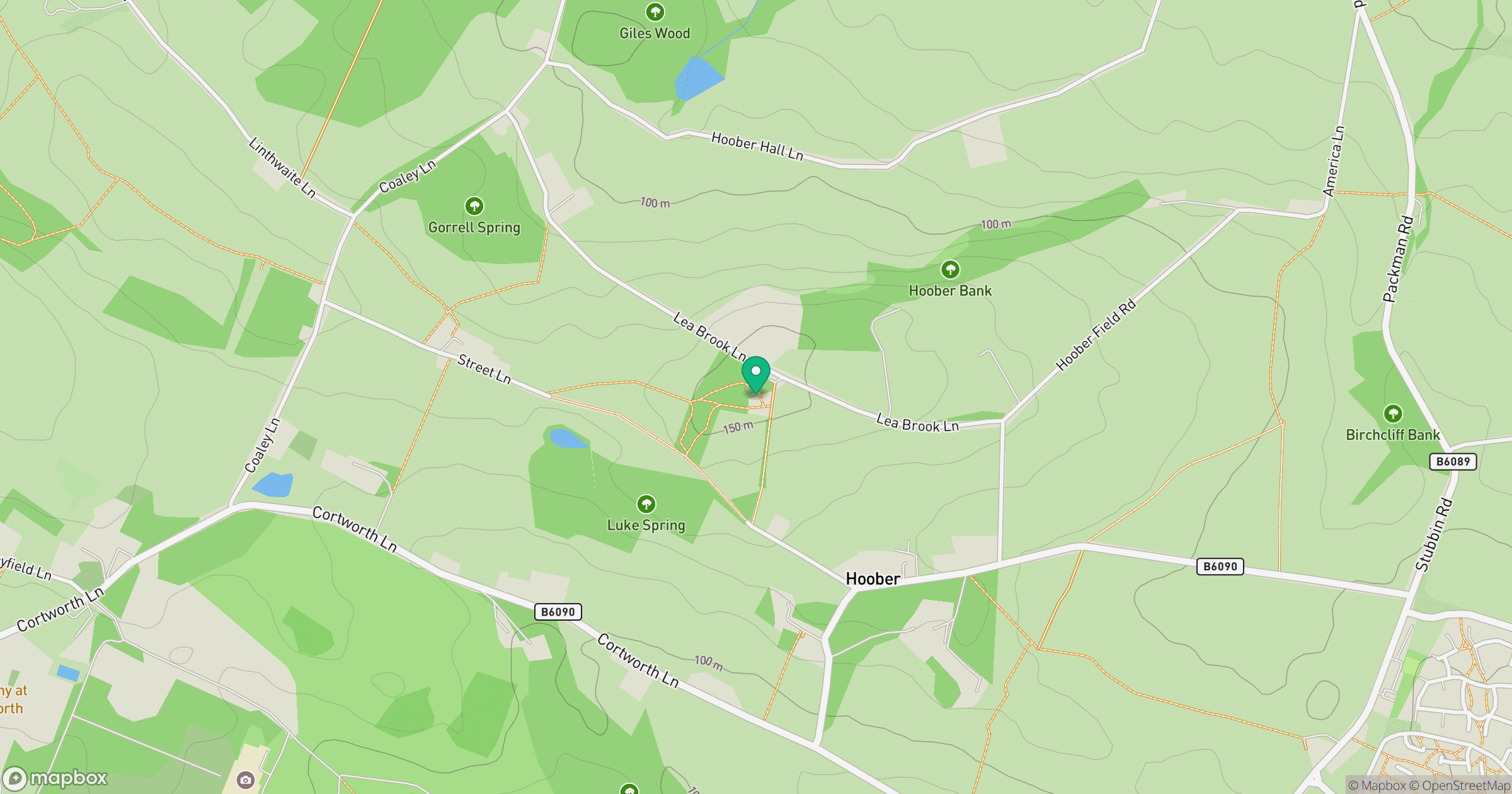
Grid reference: SK407985
View on OpenStreetMapOpens a map in a new tab, centred on the hill.
Nearby Hills

Kinder Scout
636m
Rombalds Moor [Ilkley Moor]
402m
The Roaches
505m
Buckden Pike
702m

Pendle Hill
557m
No comments yet. Be the first.