
Crocknagapple
Good walks are even better shared.
Overview
Crocknagapple: A Hiker's Guide
Introduction
Crocknagapple, rising proudly to 640 meters, is not just a footnote in the map of Northern Ireland; it is a hidden gem waiting to be discovered. Surrounded by lush green pastures and craggy hills, this Marilyn stands out as a lovely getaway for both seasoned hikers and newcomers alike.
Geology
The mountain's geological composition does not just serve as a base for hikers but holds tales of the Earth’s ancient past. Formed from granite and schist, Crocknagapple stands testament to shifts in the Earth's crust—a history lesson in rock form! The granite layer sparkles like a diamond (well, almost) under the sun, enticing geologists and adventurers.
Routes
The Crocknagapple Loop is particularly recommended. Spanning approximately 7.5 km, it takes around 3.5 hours to complete and offers moderate difficulty. The track meanders through picturesque green fields, each step a postcard-perfect view, and leads up to the summit where you can catch your breath and take in the breathtaking scenery.
Summit Features
At the summit, you are greeted by a robust cairn, a true symbol of achievement for those who make the climb. It’s an ideal spot for a rest, a picnic, or that all-important social media upload!
Terrain Type
Expect a mix of grassy paths and rocky outcrops—perfect for those who enjoy a bit of adventure in their step! The varied terrain adds a sparkle of excitement to your journey.
Views
From the summit, the sweeping views are simply phenomenal! You can gaze upon the majestic Mourne Mountains and even spot the coastline of County Down when the sky is clear. To witness it at its best, plan your outing in spring or autumn.
Hazards
While the path is generally forgiving, do keep an eye out for changing weather conditions; they can be as unpredictable as a teenager's mood. Plus, be polite to the local sheep—they have a claim to the land!
Nearby Summits
Crocknagapple is flanked by the towering Slieve Donard and Slieve Meelmore, both offering challenges and captivating views of their own. If you feel ambitious, why not make a day of it?
Access
Accessing Crocknagapple is relatively straightforward. There’s a small parking area at the starting point, but it’s wise to get there early as it fills quickly. Public transport options are limited, but the village of Annalong is the nearest stop. Newcastle, the closest town, is just a short distance away, providing several facilities.
Facilities
After conquering the summit, reward yourself with a meal or a drink at one of Newcastle's fine establishments. You’ve earned it!
History
The name Crocknagapple reflects its rich history. Seeing this beauty not only makes you a hiker but a part of its story, woven into the landscape for generations. And who knows? You might just step into folklore!
Conclusion
So lace up those hiking boots and embrace the adventure! Crocknagapple awaits, ready to show you why it deserves a place on every outdoor enthusiast's list. Happy hiking!
Explore routes near Crocknagapple
Public walks starting within 80 km of this hill. Nearby does not mean a route reaches the summit; check its map and access before setting out.
Route planning notes
These notes describe possible approaches, not verified navigable routes or permission to cross land. Check current paths, local access rules and conditions before setting out.
Crocknagapple Loop
A scenic loop starting from the nearest farm, this route meanders through lush grasslands and offers a pleasant ascent to the summit.
Make a day of it, together
Find someone to share the walk with, or organise a day out along a route you like.
Hill facts and local notes
Classifications
Elevation
372m
1,220 ft
Prominence
116m
Coordinates
54.3473, -8.1745
G887443
OS Map
16 17
At the Summit
The summit boasts a delightful cairn with stunning, panoramic views over the surrounding countryside, perfect for that summit selfie.
Terrain & Geology
Crocknagapple is primarily composed of granite and schist, with interesting layers that tell a tale of ancient volcanic activity mixed with glacial erosion. Don't worry; it's not going to erupt anytime soon.
Views & Scenery
From the summit, you can spot the majestic Mourne Mountains and the distant coastlines of County Down. On a clear day, the scenery is absolutely to die for!
History & Heritage
Name Origin
The name 'Crocknagapple' is derived from the Irish 'Cnoc na gCeapall', meaning 'Hill of the Horse', a nod to the area's agricultural history.
Historical Significance
Crocknagapple offers not just a magnificent view, but also a window into the rich cultural history of the region, making it a popular spot for local folklore.
Getting There & Facilities
Check current local access restrictions, parking rules and transport timetables before travelling. These notes do not confirm public access to the summit.
Parking
There is a small parking area near the farm where the route begins. Spaces are limited, so arrive early to avoid disappointment.
Public Transport
The nearest bus stop is at the village of Annalong, about 5 km away, where you might need to do a bit of hiking to reach the starting point.
Nearby Facilities
While there are no facilities directly on the mountain, Newcastle features several cafés, restaurants, and plenty of traditional Irish pubs for post-hike relaxation.
Safety Information
Known Hazards
- Be cautious of sudden weather changes as conditions can change faster than you can say 'Crocknagapple'. Also, watch out for sheep—they have the right of way!
General Safety Tips
- Check weather conditions before setting out
- Carry appropriate clothing and equipment
- Let someone know your planned route
- Take a map, compass, and GPS device
- Carry emergency supplies: food, water, first aid kit, torch
Hills
Some common questions about the hills answered
Are there group walks up Crocknagapple?
Many walkers use Walkmates to join or organise walks with others. You can check for group walks around Crocknagapple through the maps
Are there other walkers around Crocknagapple?
Activity varies by location and time, but Walkmates lets you see whether others have shared walks or shown interest in this area. Find other people through the walking friends search walking friends for Crocknagapple search or of course create your own walk for Crocknagapple
Can I organise a walk to Crocknagapple?
Yes. If there aren’t any walks listed already, you can create a walk and make it available for others to join.
If you're signed up to Walkmates, you can create a walk to Crocknagapple.
How do I find a walk up this hill?
There are often multiple ways to walk this hill, depending on experience and route preference. Walkmates helps you explore walks and routes that others have shared.
Can I suggest a new route up Crocknagapple?
Yes. You can suggest or create routes to share with others. Walkmates focuses on the social side of walking, so routes are used to help people organise walks and explore areas together, rather than as detailed navigation tools or route libraries.
Other uses really appreciate knowledgeable walkers sharing their routes. Share your favourite route to Crocknagapple here
The is an error or something incorrect about this hill. How do I let you know?
We always strive to keep the information on Walkmates as accurate as possible. If you find an error, please let us know through the contact form and we'll aim to correct it as quickly as possible
Community Discussion
Comments
Location
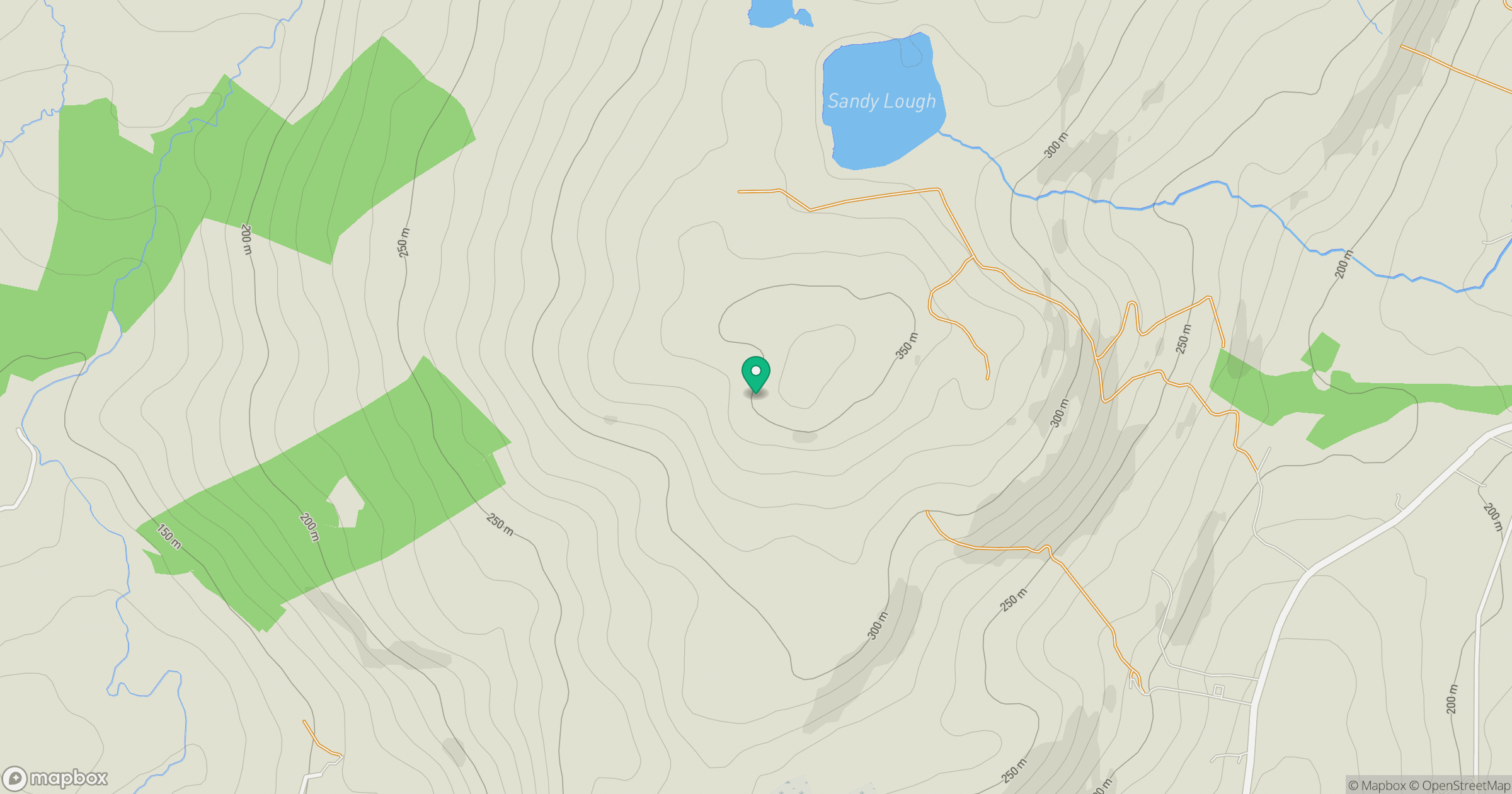
Grid reference: G887443
View on OpenStreetMapOpens a map in a new tab, centred on the hill.
Hills within 30 km
Straight-line distance, not a walking route or confirmation of access.
No comments yet. Be the first.