

Braunton Burrows
Good walks are even better shared.
SS4534 : Vehicle tracks on the dunes
Rod Allday Photo source
Overview
Braunton Burrows
Braunton Burrows, located along the spectacular North Devon Coast, is one of the most remarkable coastal dune systems in the UK. This area is not just sand and sun; it is a haven for biodiversity and offers endless opportunities for nature lovers and hikers alike.
Geology
The dunes here are a fascinating composition of sand, clay, and other sediments shaped by wind and tidal forces over the ages. The dynamic environment contributes to a unique ecosystem that changes with the tides, providing numerous habitats for wildlife. It's like Mother Nature's own craft project - constantly evolving and never quite the same.
Routes
Braunton Burrows Circular Walk
- Distance: 5.0 km
- Time: Approximately 2 hours
- Difficulty: Easy
This delightful circular route winds through the breathtaking dunes and marshlands, showcasing the area’s diverse flora and fauna. Perfect for families and casual walkers, it’s an easy jaunt that won’t have you gasping for breath like you just sprinted up a mountain!
Views
Climb to the tops of the dunes, and you’re in for some stunning views! You’ll see the sweeping North Devon coastline stretching out before you, with Saunton Sands on one side and the distant beauty of Exmoor on the other. The best season for these views would be spring, when the wildflowers flourish, and the landscape is a riot of colours.
Hazards
While the sands might look inviting, they can shift unexpectedly. Always stick to the well-marked paths to avoid ending up in a sand trap! Also, be prepared for weather changes; the coastal climate can play tricks on you, so wear layers!
Access
Getting to Braunton Burrows is straightforward. The nearest parking is available at the Braunton Burrows car park, providing easy access to the dunes. If public transport is more your style, there’s a bus service from Barnstaple to Braunton, requiring just a short walk to reach the Burrows. The closest town is charming Braunton, where you’ll find plenty of cafes and facilities.
History
The name 'Braunton' holds historical significance, coming from the Old English term for 'brown farm', nodding towards the sandy soils of the area. This site has considerable importance for conservation and ecology, supporting unique species and providing crucial habitats, making it a treasured spot for environmentalists.
In summary, whether you're a keen hiker, a wildlife enthusiast, or simply seeking a picturesque spot to unwind, Braunton Burrows offers a little bit of everything. Remember, it’s not just a walk in the park; it's an adventure waiting to unfold!
Happy trails!
Explore routes near Braunton Burrows
Walks starting near this hill. Open a route to check its map, distance and full itinerary.
Braunton Walk with Men Walking & Talking
View route
Milton Damerel Level 3 walk
View route
Lynmouth, Watersmeet and Ash Bridge woodland circuit
View route
Cookworthy Woods Level 2 walk
View route
Route planning notes
These notes describe possible approaches. Check a route's map and access information when planning your walk.
Braunton Burrows Circular Walk
A scenic circular route that allows hikers to explore the stunning dunes and wildlife, offering both coastal views and a glimpse into the unique ecosystems.
Make a day of it, together
Find someone to share the walk with, or organise a day out along a route you like.
Photo Gallery
View all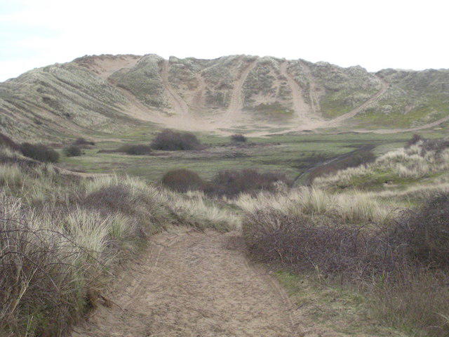 Photo could not load
SS4534 : Vehicle tracks on the dunes
Rod Allday
Hill facts and local notes
Classifications
Elevation
44m
145 ft
Prominence
32m
Coordinates
51.0906, -4.2085
SS454346
OS Map
180
Explorer: 139
At the Summit
While there is no traditional summit as such, the area features diverse habitats, with the tops of the dunes offering panoramic views of the surrounding coastline and marshland.
Terrain & Geology
Braunton Burrows is situated on a dynamic coastal dune system formed from a mixture of sands and clay, resulting from the interaction of wind and coastal processes, making it a unique geological feature.
Views & Scenery
From the higher dunes, one can see the expansive North Devon coastline, as well as landmarks such as Saunton Sands and the distant Exmoor hills.
History & Heritage
Name Origin
The name 'Braunton' derives from the Old English 'Brūnetūn', meaning 'brown farm', indicative of the area's sandy soils.
Historical Significance
Braunton Burrows has been important for biodiversity, serving as a habitat for a plethora of species, including rare plants and migratory birds.
Getting There & Facilities
Parking
Parking is available at the Braunton Burrows car park, which can accommodate several vehicles and is within walking distance to the dune areas.
Public Transport
The nearest bus service operates from Barnstaple to Braunton, with a short walk required to reach the Burrows.
Nearby Facilities
There are several cafés and restaurants in Braunton, along with public toilets available near the car park.
Safety Information
Known Hazards
- Watch for shifting sands and ensure to stay on marked paths. The coastal weather can change rapidly; dress appropriately.
General Safety Tips
- Check weather conditions before setting out
- Carry appropriate clothing and equipment
- Let someone know your planned route
- Take a map, compass, and GPS device
- Carry emergency supplies: food, water, first aid kit, torch
Hills
Some common questions about the hills answered
Are there group walks up Braunton Burrows?
Many walkers use Walkmates to join or organise walks with others. You can check for group walks around Braunton Burrows through the maps
Are there other walkers around Braunton Burrows?
Activity varies by location and time, but Walkmates lets you see whether others have shared walks or shown interest in this area. Find other people through the walking friends search walking friends for Braunton Burrows search or of course create your own walk for Braunton Burrows
Can I organise a walk to Braunton Burrows?
Yes. If there aren’t any walks listed already, you can create a walk and make it available for others to join.
If you're signed up to Walkmates, you can create a walk to Braunton Burrows.
How do I find a walk up this hill?
There are often multiple ways to walk this hill, depending on experience and route preference. Walkmates helps you explore walks and routes that others have shared.
Can I suggest a new route up Braunton Burrows?
Yes. You can suggest or create routes to share with others. Walkmates focuses on the social side of walking, so routes are used to help people organise walks and explore areas together, rather than as detailed navigation tools or route libraries.
Other uses really appreciate knowledgeable walkers sharing their routes. Share your favourite route to Braunton Burrows here
The is an error or something incorrect about this hill. How do I let you know?
We always strive to keep the information on Walkmates as accurate as possible. If you find an error, please let us know through the contact form and we'll aim to correct it as quickly as possible
Community Discussion
Comments
Location
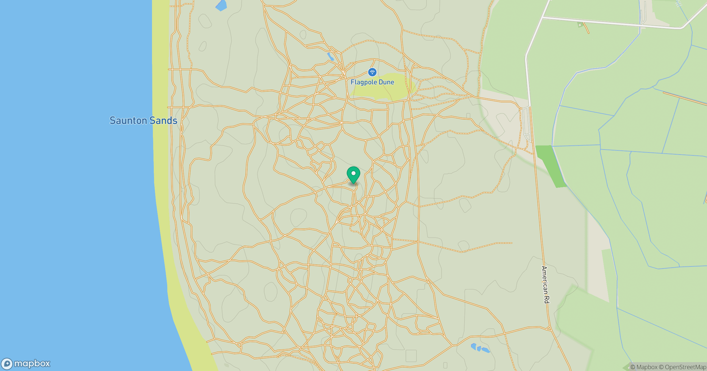
Grid reference: SS454346
View on OpenStreetMapOpens a map in a new tab, centred on the hill.
Nearby Hills

High Willhays
622m

Brent Tor
334m
Rhossili Down - The Beacon
193m

Dunkery Beacon
520m
Brown Willy
420m
No comments yet. Be the first.