

Ballyroon Mountain
Good walks are even better shared.
Overview
Ballyroon Mountain: A Hidden Gem of the Slieve Bloom Mountains
Nestled within the lush landscape of the Slieve Bloom Mountains, Ballyroon Mountain is an excellent destination for those looking to escape the humdrum of daily life. Elevating at 300 meters, it offers a moderate challenge that's perfect for a weekend outing or a spirited midweek jaunt.
Geology
The unique geology of Ballyroon encourages all geology buffs to come armed with curiosity. Composed predominantly of sandstone and limestone, it is a testament to the rugged evolution of this region dating back to the Carboniferous period. Keep a lookout for interesting sediment layers that tell a story of ancient oceans!
Hiking Routes
Ballyroan Trail
This pleasant trail begins in the charming village of Ballyroan, winding through pastoral scenery before it leads you upwards towards the summit. This route covers roughly 4 km and is doable in about 2.5 hours, perfect for families or those looking to take their time and enjoy the flora and fauna along the way.
The Climb from Glenbarrow
If you're in the mood for a bit more of a workout, the climb from Glenbarrow is about 5.5 km and can be tackled in about 3 hours. This challenging route takes a more direct ascent but offers an exhilarating sense of achievement at the top.
Terrain and Views
The terrain here is mainly grassy, with rocky outcrops appearing occasionally to challenge your footing. But fear not! The real prize comes once you reach the summit, where a sturdy cairn stands watch over breathtaking vistas. Take a moment to bask in the glory of the Slieve Bloom range and, if you're lucky, you might even spot the distant Wicklow Mountains shimmering in the sunlight.
Hazards
As with all mountain hikes, it's important to be aware of some potential hazards. Paths can be slippery, particularly after a good rain, so sturdy footwear is highly recommended. Additionally, weather can change quickly, especially in the Irish hills, so it’s wise to be prepared. And while livestock grazing on the open trails adds to the charm, it’s best to keep a respectful distance.
Access Information
Getting here is straightforward! Parking is plentiful in Ballyroan Village, with space for your motor vehicle and a picturesque setting to start your hike. If you're hoping to avoid the drive, public transport is also an option, with buses from Portlaoise making regular appearances (just mind the schedule!).
After your hike, don’t forget to treat yourself at the local café where pastries await to renew your energy!
In Conclusion
Ballyroon Mountain isn’t just another peak; it’s a place steeped in local history, geology, and stunning vistas that will leave you coming back for more. So lace up those boots, grab a mate, and venture out into the wild – who knows what stories you might uncover on the journey!
Explore routes near Ballyroon Mountain
Public walks starting within 80 km of this hill. Nearby does not mean a route reaches the summit; check its map and access before setting out.
No public routes are currently listed within 80 km of Ballyroon Mountain on Walkmates. This does not mean there are no paths here. Explore the map and check local access information before planning a walk.
Route planning notes
These notes describe possible approaches, not verified navigable routes or permission to cross land. Check current paths, local access rules and conditions before setting out.
Ballyroan Trail
A scenic route starting from the village of Ballyroan, winding through lush greenery before tackling the summit.
The Climb from Glenbarrow
A more direct approach from Glenbarrow, testing both your legs and your sense of direction, with a rewarding ascent.
Make a day of it, together
Find someone to share the walk with, or organise a day out along a route you like.
Photo Gallery
View all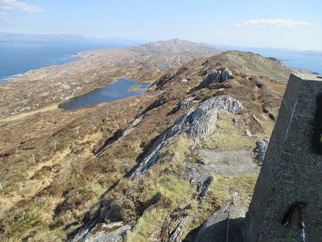 Photo could not load
V7334 : Summit and Lough
kevin higgins
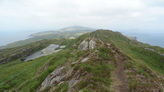 Photo could not load
V7334 : Doo Lough & view ENE at Ballyroon Mountain, Tooreen, Sheep's Head
Colin Park
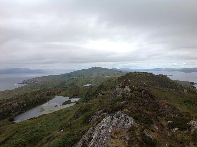 Photo could not load
V7334 : View down the spine of Sheep's head peninsula
Philip Cornwall
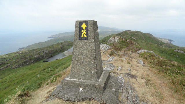 Photo could not load
V7334 : Trig point at Ballyroon Mountain, Tooreen, Sheep's Head
Colin Park
Hill facts and local notes
Classifications
Elevation
239m
784 ft
Prominence
134m
Coordinates
51.5460, -9.8199
V738341
OS Map
88
At the Summit
At the summit, hikers will find a cairn marking the peak along with spectacular panoramic views of the surrounding mountains.
Terrain & Geology
The mountain is primarily composed of sandstone and limestone, offering a glimpse into the geological history of the region formed during the Carboniferous period. You’ll find some fascinating sedimentary structures if you keep your eyes peeled!
Views & Scenery
On a clear day, the views extend to the nearby Slieve Bloom range and the rolling hills of Laois. Keep an eye out for the distant hills of the Wicklow Mountains!
History & Heritage
Name Origin
The name 'Ballyroon' is derived from the Irish 'Baile Uí Ruadháin', meaning 'townland of the O'Rohan', hinting at its rich feudal history.
Historical Significance
Historically, Ballyroon Mountain has been a landmark for local communities, a place for storytelling and perhaps an odd elf spotting or two!
Getting There & Facilities
Check current local access restrictions, parking rules and transport timetables before travelling. These notes do not confirm public access to the summit.
Parking
Parking is available at Ballyroan Village (V740350), which provides ample space for cars and a scenic start.
Public Transport
Buses are available from Portlaoise to Ballyroan, though check local schedules as they can be as elusive as the return of the sun on a rainy day.
Nearby Facilities
The nearest café is in Ballyroan, offering a warm cup of tea and a pastry to fuel up before your hike or to reward yourself after.
Safety Information
Known Hazards
- Slippery paths in wet conditions, potential for sudden weather changes, and livestock on the lower slopes are all possible hazards to be aware of.
General Safety Tips
- Check weather conditions before setting out
- Carry appropriate clothing and equipment
- Let someone know your planned route
- Take a map, compass, and GPS device
- Carry emergency supplies: food, water, first aid kit, torch
Hills
Some common questions about the hills answered
Are there group walks up Ballyroon Mountain?
Many walkers use Walkmates to join or organise walks with others. You can check for group walks around Ballyroon Mountain through the maps
Are there other walkers around Ballyroon Mountain?
Activity varies by location and time, but Walkmates lets you see whether others have shared walks or shown interest in this area. Find other people through the walking friends search walking friends for Ballyroon Mountain search or of course create your own walk for Ballyroon Mountain
Can I organise a walk to Ballyroon Mountain?
Yes. If there aren’t any walks listed already, you can create a walk and make it available for others to join.
If you're signed up to Walkmates, you can create a walk to Ballyroon Mountain.
How do I find a walk up this hill?
There are often multiple ways to walk this hill, depending on experience and route preference. Walkmates helps you explore walks and routes that others have shared.
Can I suggest a new route up Ballyroon Mountain?
Yes. You can suggest or create routes to share with others. Walkmates focuses on the social side of walking, so routes are used to help people organise walks and explore areas together, rather than as detailed navigation tools or route libraries.
Other uses really appreciate knowledgeable walkers sharing their routes. Share your favourite route to Ballyroon Mountain here
The is an error or something incorrect about this hill. How do I let you know?
We always strive to keep the information on Walkmates as accurate as possible. If you find an error, please let us know through the contact form and we'll aim to correct it as quickly as possible
Community Discussion
Comments
Location
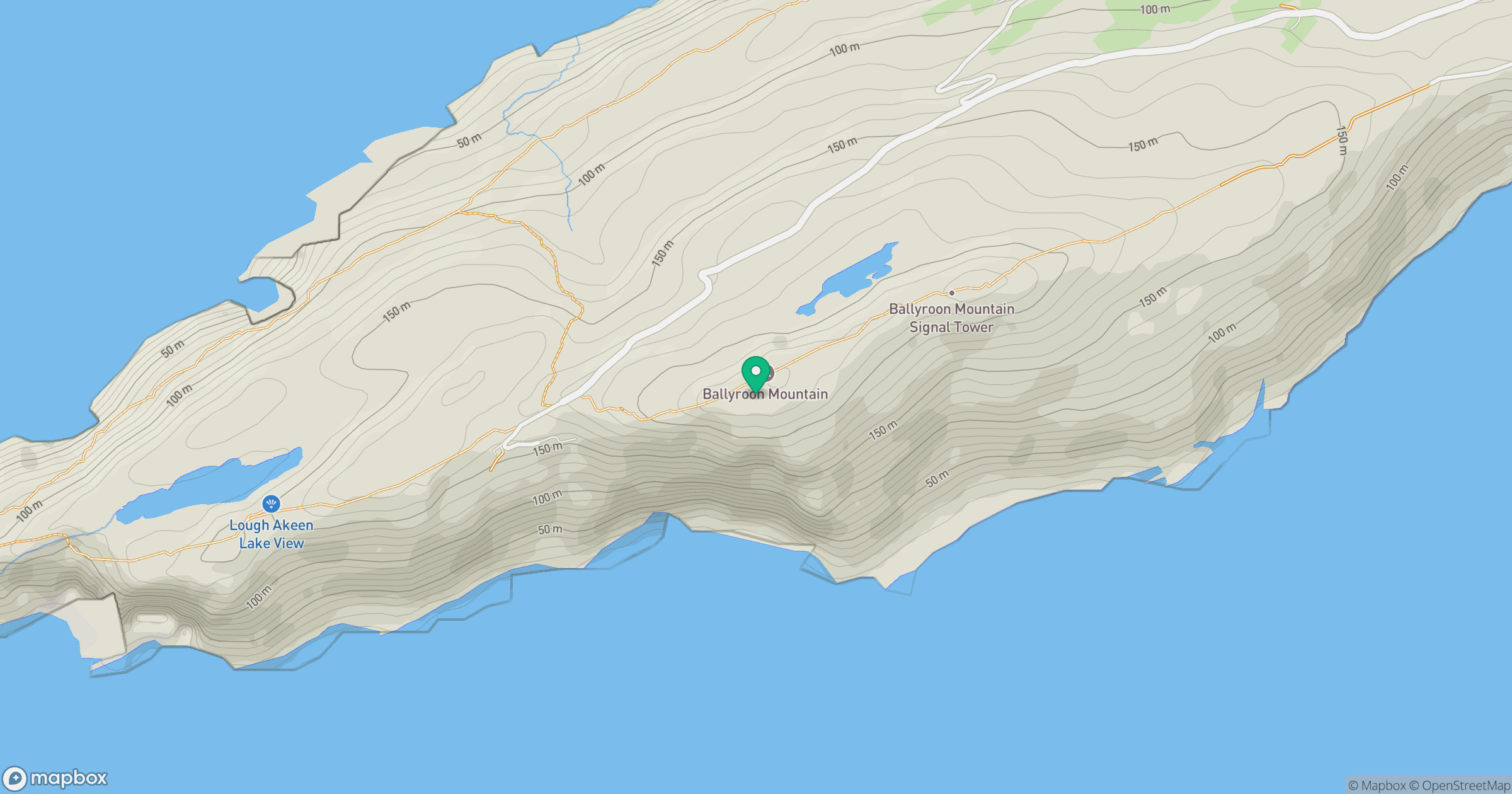
Grid reference: V738341
View on OpenStreetMapOpens a map in a new tab, centred on the hill.
Hills within 30 km
Straight-line distance, not a walking route or confirmation of access.
Knocknamaddree [Cnoc na Madrai]
313m
Mizen Peak
232m
Caher Mountain [Cathair]
338m
Brow Head
108m
Knockaphuca [Cnoc an Phuca]
237m
No comments yet. Be the first.