
Aghaglasheen
Good walks are even better shared.
Overview
Aghaglasheen: A Hidden Gem for Hikers
Aghaglasheen may not be the highest peak around, but it certainly offers a wealth of experience for those who venture to its summit. Standing at 608 meters, it is a proud representative of the traditional Irish landscape.
Geology
Composed mainly of granitic rock, Aghaglasheen showcases the rugged beauty that Donegal is famous for. A product of ancient volcanic activity, the rock contributes to the rich biodiversity of the area, making it a photographer's haven.
Routes
The most popular route begins at the Glenveagh National Park. This moderate trail of 9 km takes about 3.5 hours to complete and offers hikers a variety of scenic views as they make their ascent towards the summit. Bring your camera; you’ll want to capture the panoramic vistas that unfold along the way!
Route Highlights
The highlight of the hike is undoubtedly reaching the summit, where a humble cairn welcomes you. It’s an excellent spot for a picnic or just a brief moment to bask in your accomplishment.
Terrain and Views
Expect rocky paths mixed with grassy patches and some boggy areas—typical for hills in this part of Ireland. The summit reveals breathtaking vistas including the Derryveagh Mountains and the Atlantic Ocean beyond. Do make a note that spring and early summer are prime times for stunning scenery, as wildflowers dot the landscape.
Hazards
As with many mountains, Aghaglasheen comes with its fair share of risks. Sudden weather changes can occur, so be prepared for wind and rain regardless of the forecast. Additionally, watch your step, especially over rocky and boggy sections, as they can be quite slippery.
Nearby Summits
For those who want more of a challenge, nearby summits like Mullaghduff and Errigal await, with higher elevations and stunning views as well.
Access and Facilities
To reach Aghaglasheen, drive to the Glenveagh National Park visitor centre, where parking is readily available. The nearest town, Letterkenny, is about 30 km away and offers a selection of eateries and accommodations. At the visitor centre, you can also find a café and restrooms, perfect for a pre-hike recharge.
History
The name Aghaglasheen translates from Irish as 'the field of the little stream,' which is a nod to the enchanting landscape you’ll encounter. The area is rich in heritage, with layers of history revealing stories from ancient settlements to more modern times.
In summary, Aghaglasheen may not be the towering giant of the mountains, but it certainly provides a rewarding experience filled with natural beauty, history, and a touch of adventure for all who choose to wander its paths.
Ready your boots, pack your snacks, and head out to discover this elegant peak!
Explore routes near Aghaglasheen
Public walks starting within 80 km of this hill. Nearby does not mean a route reaches the summit; check its map and access before setting out.
No public routes are currently listed within 80 km of Aghaglasheen on Walkmates. This does not mean there are no paths here. Explore the map and check local access information before planning a walk.
Route planning notes
These notes describe possible approaches, not verified navigable routes or permission to cross land. Check current paths, local access rules and conditions before setting out.
Glenveagh National Park Route
A stunning, scenic trail starting from Glenveagh National Park leading towards the peak. The route winds through lush landscapes and offers views of the surrounding valleys.
Make a day of it, together
Find someone to share the walk with, or organise a day out along a route you like.
Hill facts and local notes
Classifications
Elevation
132m
433 ft
Prominence
132m
Coordinates
54.2569, -9.9603
F723360
OS Map
22
At the Summit
The summit features a modest cairn that offers a few resting spots, making it a perfect spot for a bite to eat or just catching your breath while admiring the view.
Terrain & Geology
Aghaglasheen is primarily composed of granitic rock, which forms a rugged terrain. Its geological structure is characteristic of ancient volcanic activity in the region, leading to fertile soil and diverse habitats for wildlife.
Views & Scenery
From the summit, hikers are treated to breathtaking views of the Derryveagh Mountains, the Atlantic Ocean, and the picturesque fields of Donegal.
History & Heritage
Name Origin
The name Aghaglasheen derives from the Irish 'Achadh Glaisín,' meaning 'the field of the little stream.'
Historical Significance
The area is rich in history, with evidence of settlements dating back to the Neolithic era. It is part of the ancient landscape that holds cultural significance for the local Gaelic community.
Getting There & Facilities
Check current local access restrictions, parking rules and transport timetables before travelling. These notes do not confirm public access to the summit.
Parking
Parking is available at the Glenveagh National Park visitor centre, which has ample space for vehicles.
Public Transport
Limited public transport is available; the nearest bus service connects to Letterkenny, where taxis can take you closer to Glenveagh.
Nearby Facilities
Near the visitor centre, facilities include a café, restrooms, and even a small shop offering local crafts and snacks.
Safety Information
Known Hazards
- Beware of sudden weather changes, as conditions can shift quickly in mountainous regions. Keep an eye out for loose rocks and boggy areas that may require careful footing.
General Safety Tips
- Check weather conditions before setting out
- Carry appropriate clothing and equipment
- Let someone know your planned route
- Take a map, compass, and GPS device
- Carry emergency supplies: food, water, first aid kit, torch
Hills
Some common questions about the hills answered
Are there group walks up Aghaglasheen?
Many walkers use Walkmates to join or organise walks with others. You can check for group walks around Aghaglasheen through the maps
Are there other walkers around Aghaglasheen?
Activity varies by location and time, but Walkmates lets you see whether others have shared walks or shown interest in this area. Find other people through the walking friends search walking friends for Aghaglasheen search or of course create your own walk for Aghaglasheen
Can I organise a walk to Aghaglasheen?
Yes. If there aren’t any walks listed already, you can create a walk and make it available for others to join.
If you're signed up to Walkmates, you can create a walk to Aghaglasheen.
How do I find a walk up this hill?
There are often multiple ways to walk this hill, depending on experience and route preference. Walkmates helps you explore walks and routes that others have shared.
Can I suggest a new route up Aghaglasheen?
Yes. You can suggest or create routes to share with others. Walkmates focuses on the social side of walking, so routes are used to help people organise walks and explore areas together, rather than as detailed navigation tools or route libraries.
Other uses really appreciate knowledgeable walkers sharing their routes. Share your favourite route to Aghaglasheen here
The is an error or something incorrect about this hill. How do I let you know?
We always strive to keep the information on Walkmates as accurate as possible. If you find an error, please let us know through the contact form and we'll aim to correct it as quickly as possible
Community Discussion
Comments
Location
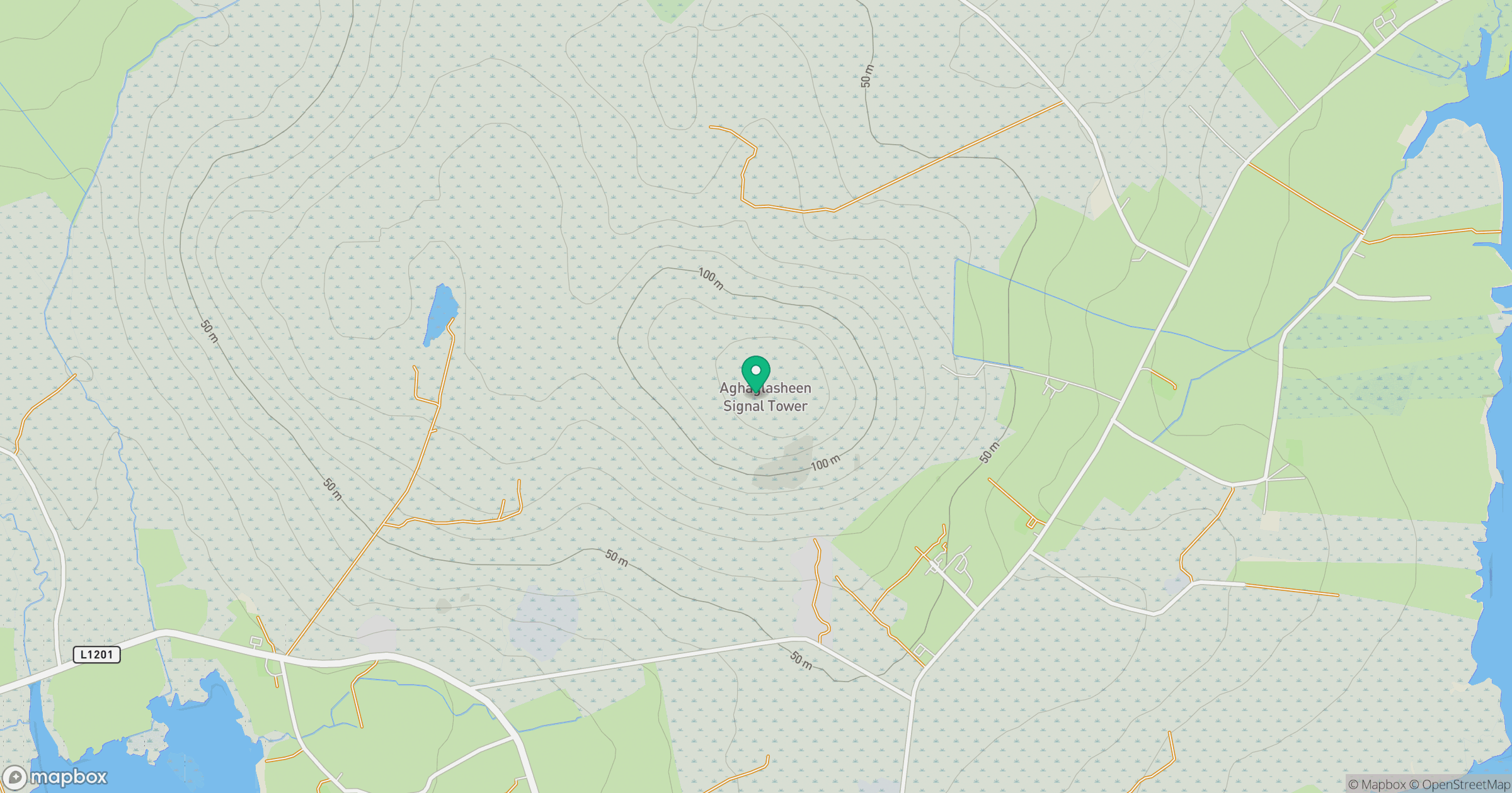
Grid reference: F723360
View on OpenStreetMapOpens a map in a new tab, centred on the hill.
Hills within 30 km
Straight-line distance, not a walking route or confirmation of access.
No comments yet. Be the first.