

Sgurr nan Each
Good walks are even better shared.
NH1869 : View N from col leading up to Sgurr nan Each, Fannichs
Colin Park Photo source
Explore routes near Sgurr nan Each
Walks starting near this hill. Open a route to check its map, distance and full itinerary.
Beinn Eighe Lancaster Wreckage at Coire Mhic Fhearchair
View route
Fairy Lochs Liberator Wreckage Circuit
View route
Glen Affric: Coire Loch Woodland Trail
View route
Loch Migdale from Torroy: Spinningdale pinewood and loch shore walk
View route
Route planning notes
These notes describe possible approaches. Check a route's map and access information when planning your walk.
The Ben Nevis Route
A moderately challenging ascent from the west, taking in stunning views of nearby peaks and glens.
Drumfearn Approach
An easier route suitable for families, this approach leads through lush woodlands before ascending towards the summit.
Make a day of it, together
Find someone to share the walk with, or organise a day out along a route you like.
Photo Gallery
View all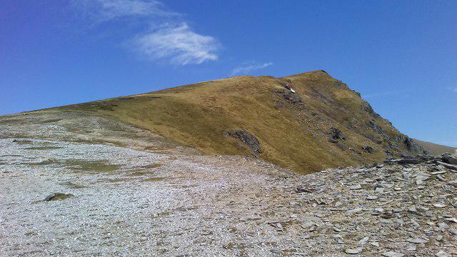 Photo could not load
NH1869 : View N from col leading up to Sgurr nan Each, Fannichs
Colin Park
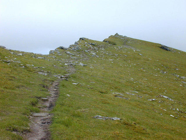 Photo could not load
NH1869 : The summit of Sgurr nan Each
Nigel Brown
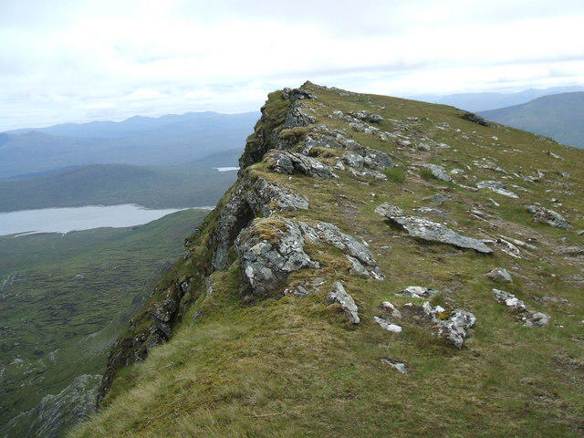 Photo could not load
NH1869 : Sgurr nan Each
David Brown
Hill facts and local notes
Classifications
Elevation
923m
3,028 ft
Prominence
109m
Coordinates
57.6810, -5.0463
NH184697
OS Map
20
Explorer: 436S
At the Summit
The summit features a prominent cairn, which is a favourite spot for a photo op. There’s also a panoramic viewpoint, ideal for taking a breather (and multiple selfies).
Terrain & Geology
Sgurr nan Each is primarily composed of metamorphic rock, predominantly schist, which has been shaped by glacial activity over millennia, giving rise to its rugged appearance and steep slopes.
Views & Scenery
From the summit, one can see the stunning Loch Lochy, the Great Glen, and beyond to the majestic peaks of the Nevis range.
History & Heritage
Name Origin
Sgurr nan Each translates to 'Peak of the Horses' in Gaelic, possibly referencing the steep nature of the terrain.
Historical Significance
The area is steeped in history, being part of the traditional lands of the clan Cameron, and features prominently in local folklore.
Getting There & Facilities
Parking
Parking can be found at the small layby near the Drumfearn Approach, but spaces fill up quicker than a mid-summer BBQ grill.
Public Transport
The nearest bus service runs from Fort William to Spean Bridge; please check local service times as they're more fickle than a cat’s mood.
Nearby Facilities
While there are no facilities at the summit, nearby Spean Bridge has a shop, café, and public toilets, perfect for recharging after your trek.
Safety Information
Known Hazards
- Watch out for sudden weather changes typical of the Highlands, and beware of slippery rocks and boggy sections.
General Safety Tips
- Check weather conditions before setting out
- Carry appropriate clothing and equipment
- Let someone know your planned route
- Take a map, compass, and GPS device
- Carry emergency supplies: food, water, first aid kit, torch
Hills
Some common questions about the hills answered
Are there group walks up Sgurr nan Each?
Many walkers use Walkmates to join or organise walks with others. You can check for group walks around Sgurr nan Each through the maps
Are there other walkers around Sgurr nan Each?
Activity varies by location and time, but Walkmates lets you see whether others have shared walks or shown interest in this area. Find other people through the walking friends search walking friends for Sgurr nan Each search or of course create your own walk for Sgurr nan Each
Can I organise a walk to Sgurr nan Each?
Yes. If there aren’t any walks listed already, you can create a walk and make it available for others to join.
If you're signed up to Walkmates, you can create a walk to Sgurr nan Each.
How do I find a walk up this hill?
There are often multiple ways to walk this hill, depending on experience and route preference. Walkmates helps you explore walks and routes that others have shared.
Can I suggest a new route up Sgurr nan Each?
Yes. You can suggest or create routes to share with others. Walkmates focuses on the social side of walking, so routes are used to help people organise walks and explore areas together, rather than as detailed navigation tools or route libraries.
Other uses really appreciate knowledgeable walkers sharing their routes. Share your favourite route to Sgurr nan Each here
The is an error or something incorrect about this hill. How do I let you know?
We always strive to keep the information on Walkmates as accurate as possible. If you find an error, please let us know through the contact form and we'll aim to correct it as quickly as possible
Community Discussion
Comments
Location
View the hill's mapped position and surrounding paths.
Grid reference: NH184697
View on OpenStreetMapOpens a map in a new tab, centred on the hill.
Nearby Hills
Seana Bhraigh
926m
Mullach Coire Mhic Fhearchair
1,015m
An Teallach - Bidein a' Ghlas Thuill
1,063m
An Teallach - Sgurr Fiona
1,059m
Sgurr a' Choire Ghlais
1,084m
No comments yet. Be the first.