

Rhymney Hill
Good walks are even better shared.
SO1209 : Survey Pillar - Toppled
Adrian Dust Photo source
Overview
Rhymney Hill
Overview
Rhymney Hill, standing proudly at 496 meters, is a delightful destination for hikers seeking a blend of challenges and breathtaking vistas. Nestled in the heart of the Brecon Beacons, you can explore its beautiful surroundings without the need for crampons and ice axes—unless you’re exceptionally unlucky with the weather!
Geology
The hill comprises volcanic rock, offering a unique geological composition that adds to its charm. The mix of sandstone and limestone suggests a tumultuous ancient past, giving you plenty of geological fodder to ponder while you catch your breath at the summit.
Routes
One of the best ways to explore Rhymney Hill is via the Pen y Cae Ridge route. Clocking in at about 9.5 km, this moderate trail takes approximately 3.5 hours, depending on how often you stop to admire the views—no judgment here!
Summit Features
At the top, you’ll find a trig point and a stone cairn that beckons weary hikers to rest and snap photos. Don’t forget to strike your best adventure pose!
Terrain Type
The terrain varies from grassy knolls to rocky outcrops, with a few boggy patches for those who enjoy a bit of splashing around. Wear sturdy boots to save yourself from an impromptu footbath!
Views
You won't want to miss the expansive views from the summit. On a clear day, you can spot:
- The majestic peaks of the Brecon Beacons,
- The rolling hills of the Vale of Glamorgan,
- A potentially distant glimpse of the Severn Estuary.
For the best viewing experience, spring and autumn are your best bets. Try to awake while dawn is still yawning!
Hazards
Although the ascent shouldn’t present any life-changing challenges, beware of muddy patches—these deceptively slippery patches may catch you off guard. Bring out your inner ballerina at your own risk!
Nearby Summits
If you’re feeling sprightly, consider tackling nearby peaks such as:
- Pen y Fan (886 meters)
- Corn Du (873 meters)
Access
Park at a small lay-by off the A465, but do arrive early to secure your spot. Alternatively, hop on a bus from Merthyr Tydfil for a scenic ride followed by a fair walk to the trailhead. The nearest town, Tredegar, is only a stone's throw away and has all the conveniences you need.
Facilities
Tredegar offers a few cafés and public toilets, ensuring you’re well-fuelled before your adventure.
History
The name Rhymney suggests a connection to water, highlighting its historical significance to local communities. The area also boasts a rich mining history, reflective of the industrial era in South Wales.
Whether you’re a seasoned trekker or just looking to stretch your legs, Rhymney Hill is sure to leave a mark on your heart—and perhaps a muddy boot-print or two!
Enjoy your hike and remember, every step counts!
Explore routes near Rhymney Hill
Walks starting near this hill. Open a route to check its map, distance and full itinerary.
Merthyr Tydfil with Men Walking & Talking
View route
A Very Merry Winter Walk ending with Cake & a Hot Drink!
View route
Aberdare Walk with Men Walking & Talking
View route
Pen y Fan via Corn Du from Storey Arms
View route
Route planning notes
These notes describe possible approaches. Check a route's map and access information when planning your walk.
Pen y Cae Ridge
A scenic trek along the ridge offering fascinating views and varying terrains.
Make a day of it, together
Find someone to share the walk with, or organise a day out along a route you like.
Photo Gallery
View all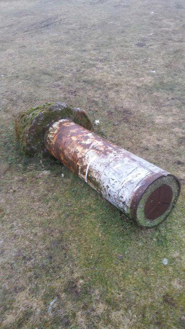 Photo could not load
SO1209 : Survey Pillar - Toppled
Adrian Dust
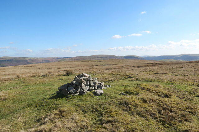 Photo could not load
SO1208 : Carn ar Fryn Rhymni / A cairn on Rhymney Hill
Alan Richards
Hill facts and local notes
Classifications
Elevation
457m
1,499 ft
Prominence
78m
Coordinates
51.7727, -3.2682
SO125089
OS Map
161
Explorer: OL13S 166E
At the Summit
The summit boasts a prominent trig point and a stone cairn, serving as a great spot for a photo op or a quick snack while soaking in the views.
Terrain & Geology
Rhymney Hill is primarily composed of volcanic rock, resulting from ancient geological activity. The hill features a mix of sandstone and limestone, closely related to the South Wales Coalfield.
Views & Scenery
From the summit, you can glimpse the majestic peaks of the Brecon Beacons, the rolling hills of the Vale of Glamorgan, and on a clear day, even the distant Severn Estuary.
History & Heritage
Name Origin
The name Rhymney is derived from 'RHY' meaning 'stream' in Welsh, reflecting the historic significance of water in the region.
Historical Significance
The hill has a rich mining history due to its location within the coalfield, and remains a reminder of the industrial past of South Wales.
Getting There & Facilities
Parking
There is a small lay-by by the A465 where you can park your car, though it can fill up quickly during weekends.
Public Transport
Bus services from Merthyr Tydfil offer access to the vicinity, but expect a decent walk to the trailhead.
Nearby Facilities
Tredegar has a few cafes, shops, and public toilets, making it a convenient stop for refreshments before or after your hike.
Safety Information
Known Hazards
- Watch out for muddy patches, particularly after rain; it's not just an obstacle but could turn into a slippery dance if you're not careful!
General Safety Tips
- Check weather conditions before setting out
- Carry appropriate clothing and equipment
- Let someone know your planned route
- Take a map, compass, and GPS device
- Carry emergency supplies: food, water, first aid kit, torch
Hills
Some common questions about the hills answered
Are there group walks up Rhymney Hill?
Many walkers use Walkmates to join or organise walks with others. You can check for group walks around Rhymney Hill through the maps
Are there other walkers around Rhymney Hill?
Activity varies by location and time, but Walkmates lets you see whether others have shared walks or shown interest in this area. Find other people through the walking friends search walking friends for Rhymney Hill search or of course create your own walk for Rhymney Hill
Can I organise a walk to Rhymney Hill?
Yes. If there aren’t any walks listed already, you can create a walk and make it available for others to join.
If you're signed up to Walkmates, you can create a walk to Rhymney Hill.
How do I find a walk up this hill?
There are often multiple ways to walk this hill, depending on experience and route preference. Walkmates helps you explore walks and routes that others have shared.
Can I suggest a new route up Rhymney Hill?
Yes. You can suggest or create routes to share with others. Walkmates focuses on the social side of walking, so routes are used to help people organise walks and explore areas together, rather than as detailed navigation tools or route libraries.
Other uses really appreciate knowledgeable walkers sharing their routes. Share your favourite route to Rhymney Hill here
The is an error or something incorrect about this hill. How do I let you know?
We always strive to keep the information on Walkmates as accurate as possible. If you find an error, please let us know through the contact form and we'll aim to correct it as quickly as possible
Community Discussion
Comments
Location
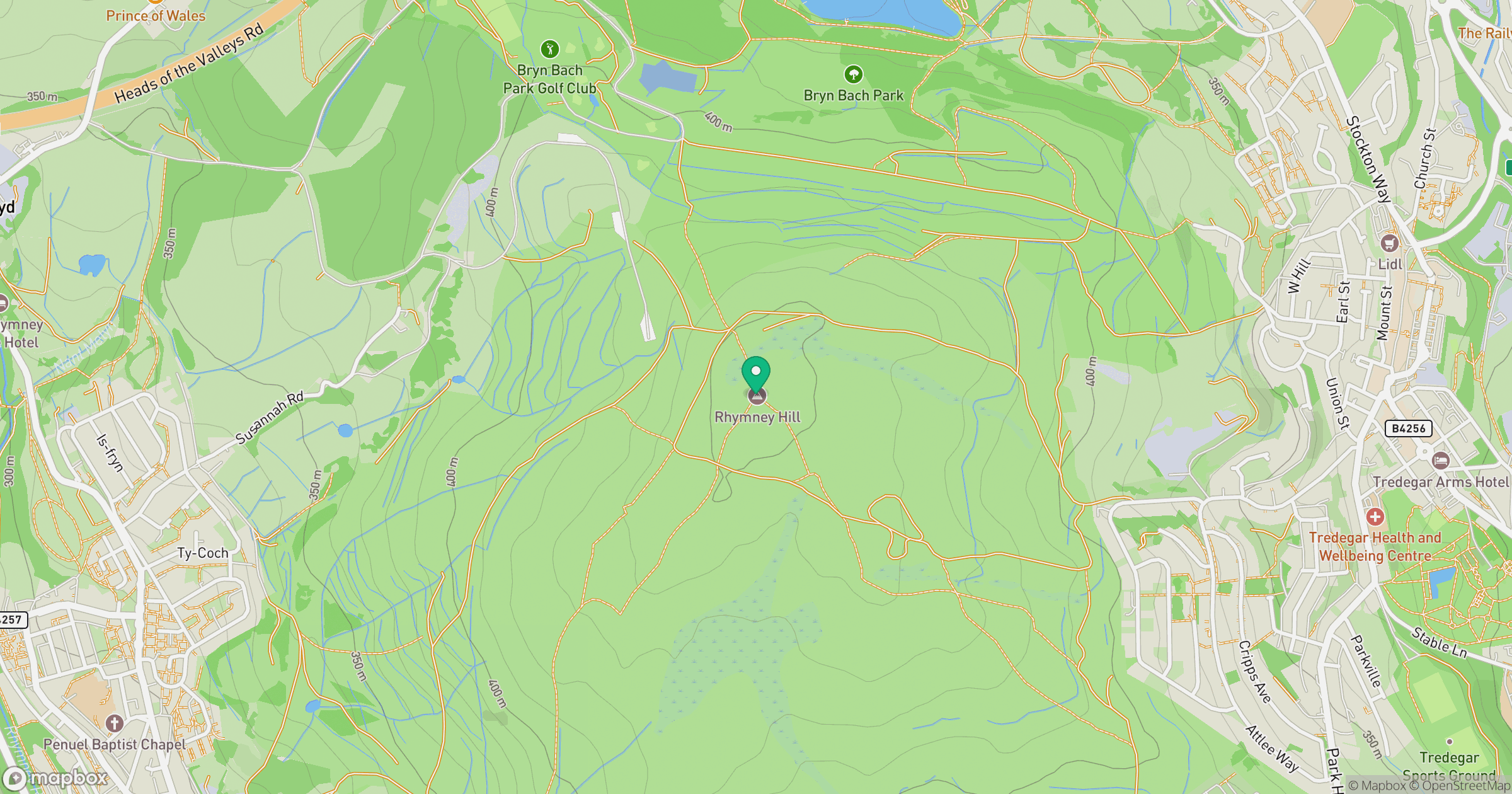
Grid reference: SO125089
View on OpenStreetMapOpens a map in a new tab, centred on the hill.


No comments yet. Be the first.