

Painswick Beacon
Good walks are even better shared.
SO8612 : Golf green within Painswick hill fort
Tim Heaton Photo source
Overview
Painswick Beacon is a 283 m Cotswold hill above Painswick in Gloucestershire. Its limestone grassland, Kimsbury hillfort earthworks and trig-point viewpoint overlook the Severn Vale and Malvern Hills.
Painswick Beacon
Painswick Beacon rises to 283 m above Painswick in Gloucestershire. DoBIH records 76 m of prominence and identifies it as a Tump. A trig pillar is a well-known viewpoint within the Kimsbury hillfort earthworks.
Landscape and history
Inferior Oolite limestone supports open grassland beside an active golf course. Former quarries and the multiple banks and ditches of the scheduled Iron Age hillfort are prominent features. Local volunteers have managed scrub and woodland glades, and cattle grazing helps maintain the grassland.
Walking
The two Miles without Stiles circuits start at SO876126 by the Royal William end of the Beacon road. Both pass the hillfort, with a short detour to the trig viewpoint. The full circuit returns through Castle End and Pope’s Wood; the shorter alternative returns by the golf-course road and the Cotswold Way. Follow the detailed route directions and allow for the complete return. Stile-free does not mean level or step-free.
Visiting
Views extend across the Severn Vale and towards the Malvern Hills. Stay on the signed outer paths around golf play, take care on steep earthworks and road crossings, and give cattle space. Public toilets are in Painswick at Stamages Lane Car Park.
Explore routes near Painswick Beacon
Walks starting near this hill. Open a route to check its map, distance and full itinerary.
Woodchester Park: Tinkley Gate, lakes and Mansion woodland walk
View route
Cheltenham Walk with Men Walking & Talking
View route
Cirencester Walk with Men Walking & Talking
View route
Winchcombe and Belas Knap: Cotswold Way and Sudeley Valley circuit
View route
Route planning notes
These notes describe possible approaches. Check a route's map and access information when planning your walk.
Painswick Beacon and Pope’s Wood circuit
Start at the Royal William-end parking area, SO876126. Follow the woodland edge beside the golf course to the hillfort. Visit the trig viewpoint by a short spur, rejoin the circuit and descend the hollow way. Turn right at the road, then after about 100 m cross to the field-edge path. Turn right along the next road, then cross the main road onto the Castle End bridleway. Continue into Pope’s Wood and take the uphill right fork back to the start. Allow about 1½ hours for the published circuit of roughly 3¼ km, plus the trig-point detour off the plotted line.
Painswick Beacon golf-course circuit
From SO876126 follow the same woodland-edge approach to the hillfort and trig-viewpoint diversion, then descend the hollow way to the road. Turn left here instead of following the Pope’s Wood circuit. After about 200 m, turn left onto the Beacon road. At the golf-course crossing, take the signed Cotswold Way left and follow the eastern side of the hillfort back to SO876126. This is Route B in the official leaflet. Watch for golf play.
Make a day of it, together
Find someone to share the walk with, or organise a day out along a route you like.
Photo Gallery
View all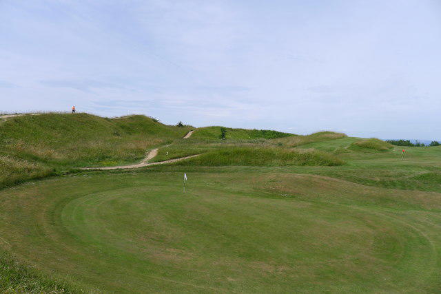 Photo could not load
SO8612 : Golf green within Painswick hill fort
Tim Heaton
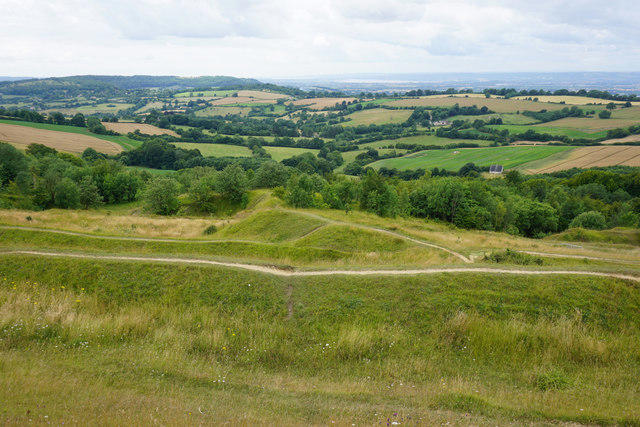 Photo could not load
SO8612 : Ramparts on Painswick Beacon
Bill Boaden
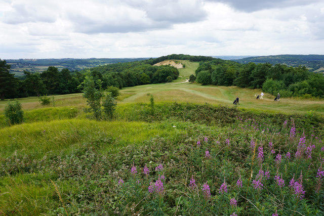 Photo could not load
SO8611 : Painswick Golf Course
Bill Boaden
 Photo could not load
SO8612 : Golfcourse on Painswick Beacon
Sarah Charlesworth
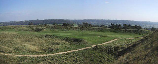 Photo could not load
SO8612 : Greens inside the Hillfort
Sarah Charlesworth
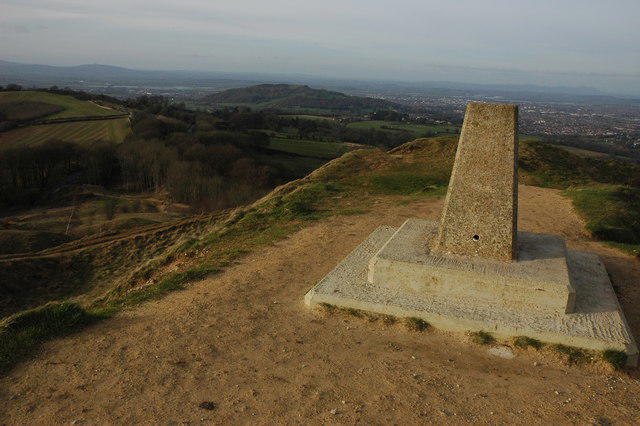 Photo could not load
SO8612 : Trig point on Painswick Beacon
Philip Halling
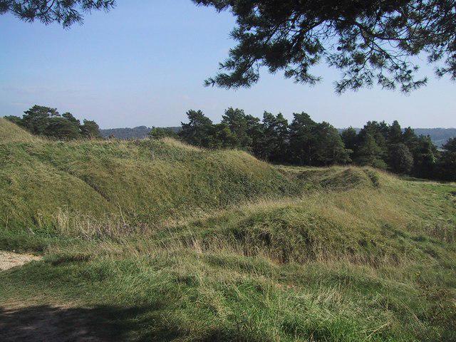 Photo could not load
SO8612 : The Banks and Ditches of the Hillfort
Sarah Charlesworth
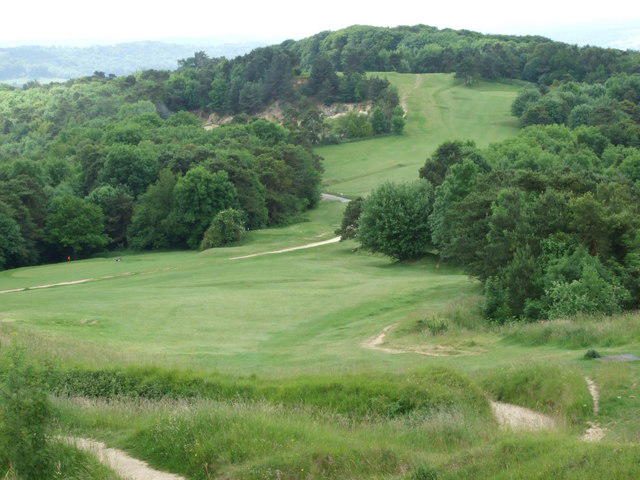 Photo could not load
SO8612 : Painswick Beacon (Looking from the Trig Point Across the Golf Course)
Mark Holland
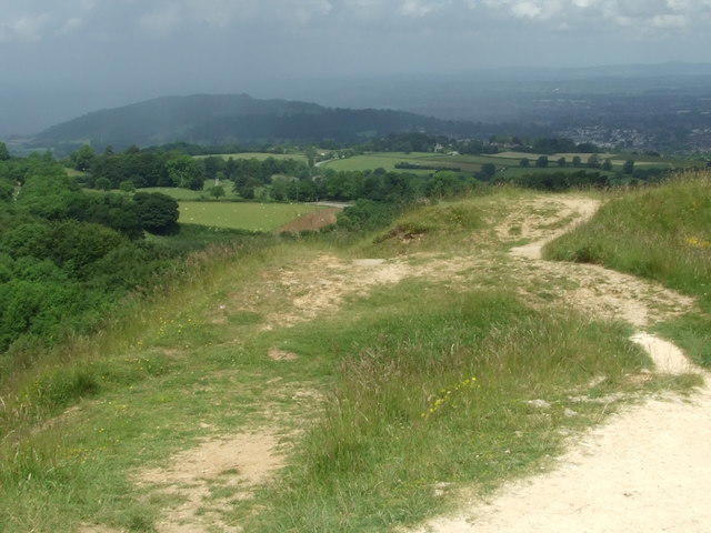 Photo could not load
SO8612 : Painswick Beacon Taken from the Trig point facing along the access path
Mark Holland
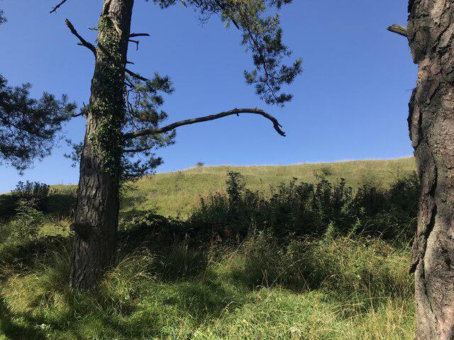
SO8612 : Painswick Beacon
don cload
Hill facts and local notes
Classifications
Elevation
283m
928 ft
Prominence
76m
Coordinates
51.8065, -2.1929
SO868120
OS Map
162
Explorer: 179
At the Summit
Trig-point viewpoint among the banks and ditches of Kimsbury hillfort.
Terrain & Geology
The hill is formed from Inferior Oolite limestone. Former quarries expose freestone on the western side, and hard ragstone limestone caps the Beacon.
Views & Scenery
Views reach across the Severn Vale towards Gloucester and the Malvern Hills, with the Stroud valleys below and Welsh hills visible in clear weather.
History & Heritage
Name Origin
Painswick Local History Society links the town’s name to Pain fitz John, a medieval lord of the manor: Wyke became Pain’s Wick. The hillfort is also known as Kimsbury hillfort or Castle Godwyn.
Historical Significance
Kimsbury is a scheduled Iron Age hillfort with multiple ramparts and ditches. Quarrying and the golf course have altered its interior, where Iron Age and Romano-British finds have been recorded. Historic England describes possible use by Royalist troops during the 1643 siege of Gloucester.
Getting There & Facilities
Parking
The Miles without Stiles routes start at the small parking area at SO876126, at the end of the Beacon road from the Royal William on the A46. The Walkers’ car park on Golf Course Road, SO867104 near the Rococo Gardens end, is a separate approach. Leave access clear.
Public Transport
Stagecoach West route 166 serves Royal William stops on the A46 near the northern route start, as well as Painswick and Stroud. Check the timetable for your travel day and return journey. The stop and parking area are separate; take care on the road approach.
Nearby Facilities
The Royal William near the northern start is listed for refreshments; check opening times. Public toilets are at Stamages Lane Car Park in Painswick. Bring water for the walk.
Safety Information
Known Hazards
- Active golf course: follow signed outer paths, watch for play and take care at fairway crossings.
- Steep, uneven ramparts, hollows and former quarry ground need care; protect the earthworks by using established paths.
- The full Pope’s Wood circuit includes road walking and crossings. Take care with traffic, including on approaches from the A46.
- Cattle graze the Beacon. Give them space, keep dogs under close control and follow on-site signs.
Seasonal Hazards
Wet grass and woodland paths can be slippery, especially on the steeper slopes.
General Safety Tips
- Check weather conditions before setting out
- Carry appropriate clothing and equipment
- Let someone know your planned route
- Take a map, compass, and GPS device
- Carry emergency supplies: food, water, first aid kit, torch
Hills
Some common questions about the hills answered
Are there group walks up Painswick Beacon?
Many walkers use Walkmates to join or organise walks with others. You can check for group walks around Painswick Beacon through the maps
Are there other walkers around Painswick Beacon?
Activity varies by location and time, but Walkmates lets you see whether others have shared walks or shown interest in this area. Find other people through the walking friends search walking friends for Painswick Beacon search or of course create your own walk for Painswick Beacon
Can I organise a walk to Painswick Beacon?
Yes. If there aren’t any walks listed already, you can create a walk and make it available for others to join.
If you're signed up to Walkmates, you can create a walk to Painswick Beacon.
How do I find a walk up this hill?
There are often multiple ways to walk this hill, depending on experience and route preference. Walkmates helps you explore walks and routes that others have shared.
Can I suggest a new route up Painswick Beacon?
Yes. You can suggest or create routes to share with others. Walkmates focuses on the social side of walking, so routes are used to help people organise walks and explore areas together, rather than as detailed navigation tools or route libraries.
Other uses really appreciate knowledgeable walkers sharing their routes. Share your favourite route to Painswick Beacon here
The is an error or something incorrect about this hill. How do I let you know?
We always strive to keep the information on Walkmates as accurate as possible. If you find an error, please let us know through the contact form and we'll aim to correct it as quickly as possible
Community Discussion
Comments
Location
View the hill's mapped position and surrounding paths.
Grid reference: SO868120
View on OpenStreetMapOpens a map in a new tab, centred on the hill.
Nearby Hills
Worcestershire Beacon
425m
Titterstone Clee Hill
533m
Glastonbury Tor
158m

The Wrekin
407m
Long Mynd - Pole Bank
517m
No comments yet. Be the first.