

Cairnsmore [Black Craig of Dee]
Good walks are even better shared.
NX5875 : Rock outcrops on Black Craig of Dee, Galloway Forest
Anthony O'Neil Photo source
Explore routes near Cairnsmore [Black Craig of Dee]
Walks starting near this hill. Open a route to check its map, distance and full itinerary.
Kirroughtree Little Bruntis Lochs and Woodland Trail
View route
Loch Trool: Full Loch and Oak Woodland Circuit
View route
Knockman Wood Cairn and Woodland Trail
View route
Wood of Cree Waterfalls and Scrubland Circuit
View route
Route planning notes
These notes describe possible approaches. Check a route's map and access information when planning your walk.
Cairnsmore Circular Route
A popular circular hike starting from the village of Carsphairn, offering lovely views and a comfortable walking path with a few steeper sections.
Direct Ascent Route
A more direct route from the southeast, suitable for those yearning for a challenge and who don’t mind a bit of heather-bashing.
Make a day of it, together
Find someone to share the walk with, or organise a day out along a route you like.
Photo Gallery
View all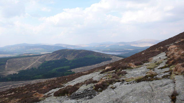 Photo could not load
NX5875 : Rock outcrops on Black Craig of Dee, Galloway Forest
Anthony O'Neil
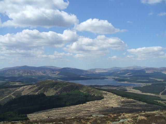 Photo could not load
NX5875 : View from Cairnsmore of Dee
Iain Russell
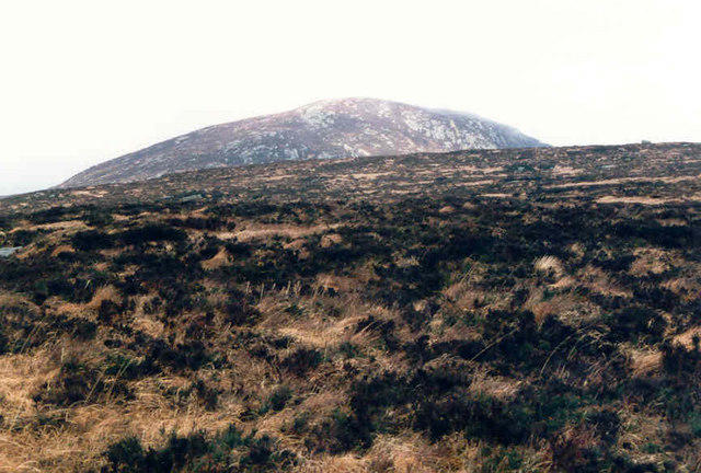 Photo could not load
NX5875 : Cairnsmore of Dee
Billy McCrorie
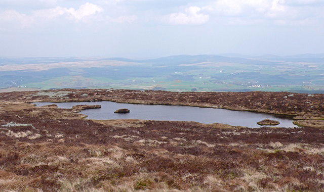 Photo could not load
NX5875 : Lochan on the summit of Black Craig of Dee, Galloway Forest
Anthony O'Neil
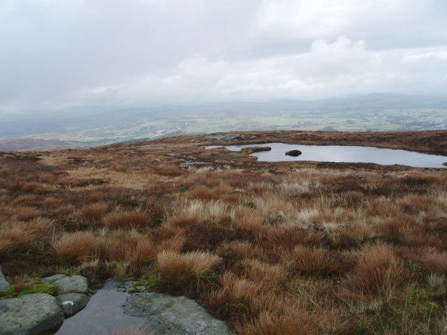 Photo could not load
NX5875 : Summit lochan on Cairnsmore of Dee
Bob Peace
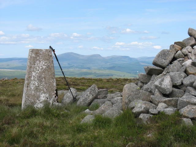 Photo could not load
NX5875 : Summit trig and cairn on Cairnsmore of Dee
David Purchase
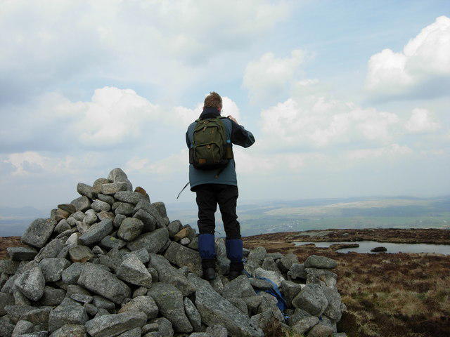 Photo could not load
NX5875 : Cairn and lochan on Black Craig of Dee, Galloway Forest
Mrs Anna Walton (friend)
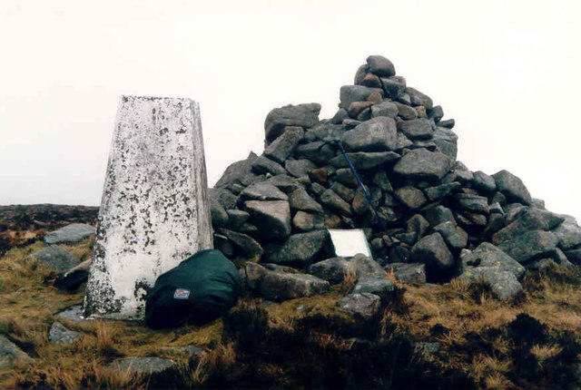 Photo could not load
NX5875 : Cairnsmore of Dee Trig Point
Billy McCrorie
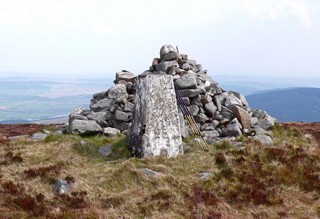 Photo could not load
NX5875 : Triangulation pillar on Black Craig of Dee, Galloway Forest
Anthony O'Neil
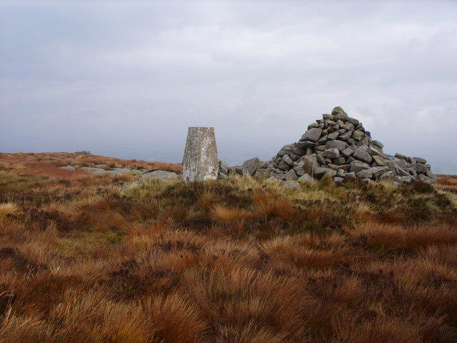
NX5875 : Cairnsmore or Black Craig of Dee Summit
Mark McKie
Hill facts and local notes
Classifications
Elevation
493m
1,617 ft
Prominence
295m
Coordinates
55.0563, -4.2186
NX583757
OS Map
77
Explorer: 319
At the Summit
The summit features an impressive cairn and a trig point. On a clear day, it feels like you’re on top of the world—unless your experience is clouded by a sudden British downpour, that is.
Terrain & Geology
The mountain is primarily composed of volcanic rock known as igneous granite, which gives it a rugged appearance. The ancient geological formations date back to the Caledonian orogeny, and the surrounding area showcases various geological features shaped by glacial activity.
Views & Scenery
From the summit, you can gaze over the rolling hills of the Southern Uplands, see the distant peaks of the Galloway Hills, and catch glimpses of the Solway Firth.
History & Heritage
Name Origin
Cairnsmore translates from Scots Gaelic to 'big cairn,' reflecting its notable summit feature.
Historical Significance
The area is rich in history, with ancient burial cairns located nearby, which speak of past inhabitants and their customs.
Getting There & Facilities
Parking
Parking is available at the Carsphairn Village Hall car park, which is free and can accommodate several vehicles.
Public Transport
Buses run from Dumfries to Carsphairn, but service may be limited. It’s best to check local timetables before setting out.
Nearby Facilities
There are few facilities in Carsphairn; however, a local café serves excellent coffee and homemade cakes, perfect for topping up your energy levels post-hike.
Safety Information
Known Hazards
- Potential for sudden weather changes. Fog can roll in quickly, reducing visibility. Be mindful of the terrain—steep drop-offs and uneven ground exist.
General Safety Tips
- Check weather conditions before setting out
- Carry appropriate clothing and equipment
- Let someone know your planned route
- Take a map, compass, and GPS device
- Carry emergency supplies: food, water, first aid kit, torch
Hills
Some common questions about the hills answered
Are there group walks up Cairnsmore [Black Craig of Dee]?
Many walkers use Walkmates to join or organise walks with others. You can check for group walks around Cairnsmore [Black Craig of Dee] through the maps
Are there other walkers around Cairnsmore [Black Craig of Dee]?
Activity varies by location and time, but Walkmates lets you see whether others have shared walks or shown interest in this area. Find other people through the walking friends search walking friends for Cairnsmore [Black Craig of Dee] search or of course create your own walk for Cairnsmore [Black Craig of Dee]
Can I organise a walk to Cairnsmore [Black Craig of Dee]?
Yes. If there aren’t any walks listed already, you can create a walk and make it available for others to join.
If you're signed up to Walkmates, you can create a walk to Cairnsmore [Black Craig of Dee].
How do I find a walk up this hill?
There are often multiple ways to walk this hill, depending on experience and route preference. Walkmates helps you explore walks and routes that others have shared.
Can I suggest a new route up Cairnsmore [Black Craig of Dee]?
Yes. You can suggest or create routes to share with others. Walkmates focuses on the social side of walking, so routes are used to help people organise walks and explore areas together, rather than as detailed navigation tools or route libraries.
Other uses really appreciate knowledgeable walkers sharing their routes. Share your favourite route to Cairnsmore [Black Craig of Dee] here
The is an error or something incorrect about this hill. How do I let you know?
We always strive to keep the information on Walkmates as accurate as possible. If you find an error, please let us know through the contact form and we'll aim to correct it as quickly as possible
Community Discussion
Comments
Location
View the hill's mapped position and surrounding paths.
Grid reference: NX583757
View on OpenStreetMapOpens a map in a new tab, centred on the hill.

No comments yet. Be the first.