

Beinn a' Mhonicag
Good walks are even better shared.
NN2885 : Small cairn on Beinn a’ Mhonicag
Steven Brown Photo source
Explore routes near Beinn a' Mhonicag
Walks starting near this hill. Open a route to check its map, distance and full itinerary.
Banavie to Glen Loy Aqueduct: Neptune’s Staircase Canal Towpath
View route
Ben Nevis via Mountain Path
View route
Fort Augustus to Kytra Lock: Caledonian Canal Towpath
View route
Glen Affric: Coire Loch Woodland Trail
View route
Route planning notes
These notes describe possible approaches. Check a route's map and access information when planning your walk.
Glen Loy Route
Starting from Glen Loy, this route takes you through some scenic woodlands before merging onto the mountain paths that lead to the summit.
Make a day of it, together
Find someone to share the walk with, or organise a day out along a route you like.
Photo Gallery
View all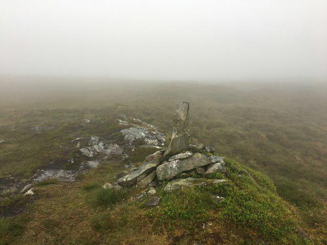 Photo could not load
NN2885 : Small cairn on Beinn a’ Mhonicag
Steven Brown
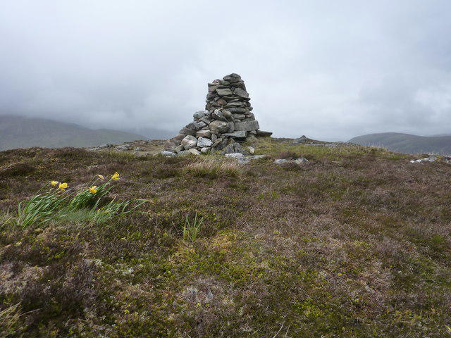 Photo could not load
NN2885 : Daffodils beside one of Beinn a' Mhonicag's cairns
Peter Aikman
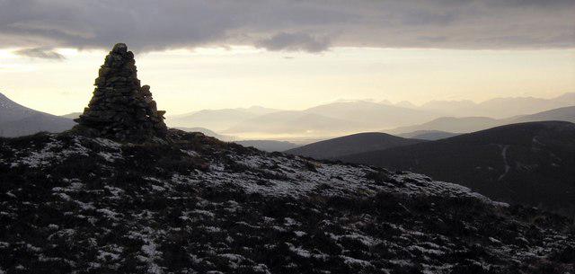 Photo could not load
NN2885 : Summit Cairn, Beinn a' Mhonicag
Colin Kinnear
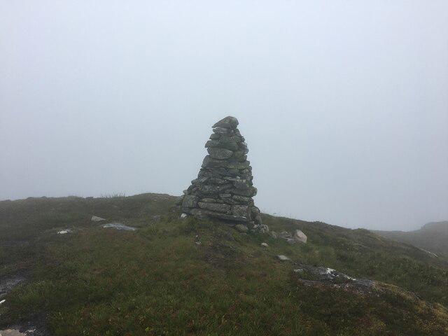 Photo could not load
NN2885 : Cairn on Beinn a’ Mhonicag
Steven Brown
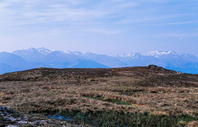 Photo could not load
NN2885 : Summit area of Beinn a' Mhonicag
Trevor Littlewood
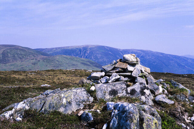 Photo could not load
NN2885 : Summit area of Beinn a' Mhonicag
Trevor Littlewood
Hill facts and local notes
Classifications
Elevation
567m
1,860 ft
Prominence
268m
Coordinates
56.9290, -4.8150
NN287854
OS Map
34 41
Explorer: 400
At the Summit
The summit features a well-constructed stone cairn that provides a perfect photo opportunity to flaunt your achievement on social media.
Terrain & Geology
The mountain is primarily composed of granite, which offers a good look at the rugged and ancient geological processes that shaped the Highlands. Look out for interesting glacial features as you traverse the landscape!
Views & Scenery
From the summit, enjoy panoramic views of Loch Lochy, the Great Glen, and the looming peaks of the Nevis Range. On a clear day, you might even see the distant silhouette of Ben Nevis!
History & Heritage
Name Origin
The name 'Beinn a' Mhonicag' translates to 'Hill of the Hillock', capturing the essence of this interesting summit.
Historical Significance
This mountain has been a favourite among hikers for its accessibility and stunning views, making it a notable part of the local culture.
Getting There & Facilities
Parking
There's parking available at the end of the Glen Loy forest road (NN234860). Arrive early during weekends, as it tends to fill up faster than a café on a rainy day.
Public Transport
The nearest bus stop is in Fort William, which is about 12 km away. From there, local taxis are available.
Nearby Facilities
While facilities are sparse on the mountain itself, Fort William boasts an array of cafes, pubs, and toilets to restock and refuel post-hike.
Safety Information
Known Hazards
- Watch out for sudden weather changes common in the Highlands, as well as slippery rocks and muddy paths, especially in spring.
General Safety Tips
- Check weather conditions before setting out
- Carry appropriate clothing and equipment
- Let someone know your planned route
- Take a map, compass, and GPS device
- Carry emergency supplies: food, water, first aid kit, torch
Hills
Some common questions about the hills answered
Are there group walks up Beinn a' Mhonicag?
Many walkers use Walkmates to join or organise walks with others. You can check for group walks around Beinn a' Mhonicag through the maps
Are there other walkers around Beinn a' Mhonicag?
Activity varies by location and time, but Walkmates lets you see whether others have shared walks or shown interest in this area. Find other people through the walking friends search walking friends for Beinn a' Mhonicag search or of course create your own walk for Beinn a' Mhonicag
Can I organise a walk to Beinn a' Mhonicag?
Yes. If there aren’t any walks listed already, you can create a walk and make it available for others to join.
If you're signed up to Walkmates, you can create a walk to Beinn a' Mhonicag.
How do I find a walk up this hill?
There are often multiple ways to walk this hill, depending on experience and route preference. Walkmates helps you explore walks and routes that others have shared.
Can I suggest a new route up Beinn a' Mhonicag?
Yes. You can suggest or create routes to share with others. Walkmates focuses on the social side of walking, so routes are used to help people organise walks and explore areas together, rather than as detailed navigation tools or route libraries.
Other uses really appreciate knowledgeable walkers sharing their routes. Share your favourite route to Beinn a' Mhonicag here
The is an error or something incorrect about this hill. How do I let you know?
We always strive to keep the information on Walkmates as accurate as possible. If you find an error, please let us know through the contact form and we'll aim to correct it as quickly as possible
Community Discussion
Comments
Location
View the hill's mapped position and surrounding paths.
Grid reference: NN287854
View on OpenStreetMapOpens a map in a new tab, centred on the hill.
Nearby Hills
Stob Choire Claurigh
1,177m
Stob Ban
977m
Aonach Mor
1,220m
Aonach Beag
1,234m
Carn Mor Dearg
1,220m
No comments yet. Be the first.