

Winter Hill
Good walks are even better shared.
SD6623 : Winter Hill
Rude Health Photo source
Overview
Winter Hill
Winter Hill offers both challenge and charm, standing as a proud sentinel in the West Pennine Moors. At 482 meters, it invites hikers to enjoy a rewarding climb with spectacular views from its summit.
Geology
The mountain showcases impressive millstone grit, known for its durability and unique formations. Explore the rocky outcrops that add character, while being mindful of the echo of boots on stone reverberating like a distant choir.
Routes
The Two Lads Loop takes you on a memorable journey through moors to the summit. With a distance of 7.5 km, it's perfect for those looking to stretch their legs without biting off more than they can chew.
Rivington Pike Trail is a shorter, yet equally captivating route. At just 5.0 km, this trail offers lush woodlands leading gracefully to Winter Hill, ideal for family outings.
Summit Features
The summit is crowned with a trig point and a scenic cairn, providing the perfect backdrop for a celebratory selfie. Don't forget to strike a pose while plotting your next move on the moors!
Terrain Type
Expect a delightful mix of grassy moorland dotted with rocky patches and vibrant heather. Perfect for those who enjoy a bit of an adventure and perhaps an impromptu game of hide and seek amongst the vegetation.
Views
The highlights from the summit include sights of Manchester and, with luck, the peaks of Snowdonia. Spring and early autumn bask in splendid views; a sunrise here can make you forget about everything else—especially your alarm clock.
Hazards
As with any moorland hike, remain cautious of rapid weather changes and uneven terrain. Hikers are encouraged to be equipped for all seasons and to keep their eyes peeled for those pesky holes!
Nearby Summits
Explore the beauty of Rivington Pike just down the trail, or tackle Boulsworth Hill for an added challenge.
Access
Easy parking is found at Rivington Hall Barn, with ample spaces. Regular buses run to the area, making it accessible for day trippers from Bolton and Horwich.
Facilities
Rivington’s pubs and cafes offer a glorious array of refreshments and rest stops, while public toilets keep the adventurers comfortable.
History
Winter Hill's name hints at its frosty façade in winter months, drawing countless explorers each year. It lays claim to rich historical significance as a telecommunications hub for the region.
In conclusion, whether you’re a seasoned hiker or just fancy a gentle stroll with nature, Winter Hill is a gem of the West Pennine Moors, just waiting to be explored!
Happy hiking!
Explore routes near Winter Hill
Walks starting near this hill. Open a route to check its map, distance and full itinerary.
Brockholes Reserve Tour
View route
Brockholes Wildflower Year guided walk
View route
Brockholes Reserve Tour
View route
History of Christmas guided walk
View route
Route planning notes
These notes describe possible approaches. Check a route's map and access information when planning your walk.
Winter Hill via Rivington Pike
This popular route starts at Rivington Hall Barn and ascends past Rivington Pike, a famous local landmark. The path leads through the terraced gardens and up to the summit of Winter Hill, offering fantastic views of the surrounding countryside and beyond. The return follows the same path, providing a pleasant and familiar walk.
Winter Hill Circular via Two Lads
Begin at the Wilderswood car park near Horwich and follow the path to the twin cairns known as Two Lads. From there, continue ascending to the summit of Winter Hill. The circular route descends via the Belmont Road track, offering a mix of open moorland and well-defined paths.
Winter Hill and White Coppice Loop
Starting at White Coppice, this route takes you through scenic moorland trails to the summit of Winter Hill. The return loop passes through Anglezarke Reservoir and woodland trails, giving a varied and picturesque experience. It's a slightly longer route but worth it for the diversity of terrain.
Winter Hill from Belmont Reservoir
This quieter route begins at Belmont Reservoir and follows a steady incline across moorland to the summit of Winter Hill. Ideal for walkers seeking a more peaceful experience, this out-and-back trail provides excellent views of the West Pennine Moors.
Winter Hill via Smithills Moor
Starting at Walker Fold car park, this route traverses Smithills Moor and ascends to the summit of Winter Hill. The trail offers a mix of grassy tracks and rugged paths, with beautiful views across Bolton and the surrounding areas. The return journey retraces the same route.
Make a day of it, together
Find someone to share the walk with, or organise a day out along a route you like.
Photo Gallery
View all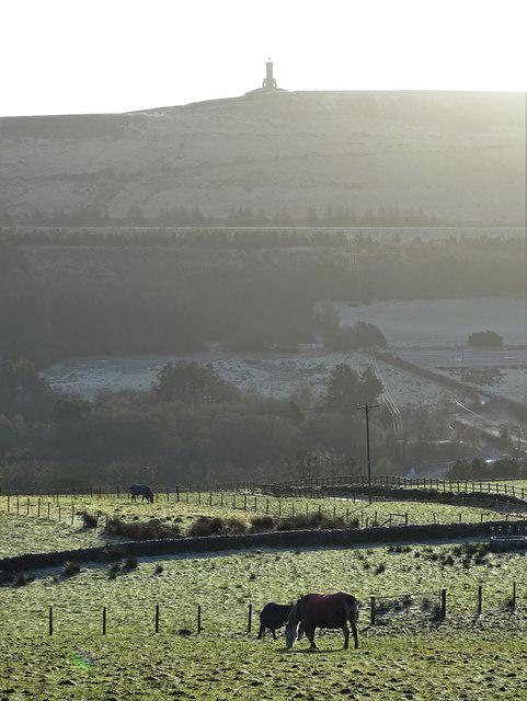 Photo could not load
SD6622 : Horses near Kiln Bank
Neil Theasby
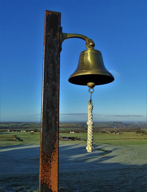 Photo could not load
SD6623 : Bell on Darwen Golf Course
Neil Theasby
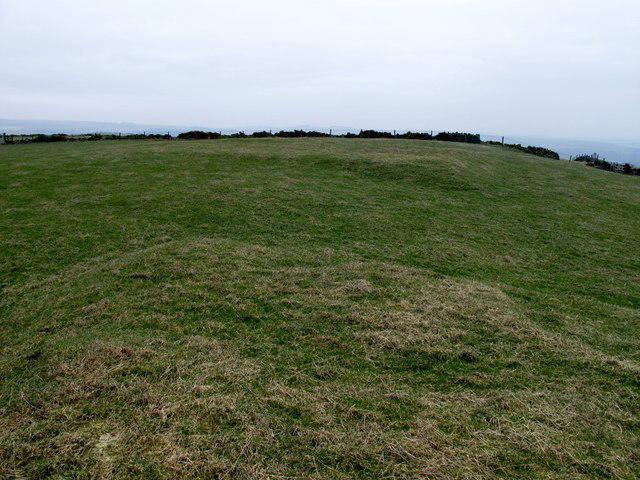 Photo could not load
SD6623 : Winter Hill
Rude Health
Hill facts and local notes
Classifications
Elevation
280m
919 ft
Prominence
44m
Coordinates
53.7033, -2.5020
SD669230
OS Map
103
Explorer: 287
At the Summit
The summit is marked by a trig point and a large stone cairn, providing a perfect vantage point for those who have achieved the climb. On a clear day, you might even spot the distant peaks of the Lake District.
Terrain & Geology
Winter Hill is primarily composed of millstone grit, a hard sandstone that has weathered into distinctive outcrops. The hillside features both rocky areas and patches of heather, making it a charming spot for nature lovers.
Views & Scenery
On a clear day, view the Manchester skyline to the south, and as far as the Welsh mountains to the west.
History & Heritage
Name Origin
The name 'Winter Hill' is thought to derive from its position, often covered in frost and snow during the winter months.
Historical Significance
Historically, Winter Hill has been a location for various romantic hikes and has hosted notable events, including significant telecommunications infrastructure.
Getting There & Facilities
Parking
The nearest parking is available at Rivington Hall Barn, providing ample space for vehicles and easy access to the trails.
Public Transport
Regular bus services run from Bolton and Horwich, with stops close to Rivington.
Nearby Facilities
There are several cafes and pubs in Rivington that offer refreshments, and public toilets are available at Rivington Hall.
Safety Information
Known Hazards
- Beware of sudden weather changes typical of moorland areas. The terrain can be uneven with hidden holes in the vegetation.
General Safety Tips
- Check weather conditions before setting out
- Carry appropriate clothing and equipment
- Let someone know your planned route
- Take a map, compass, and GPS device
- Carry emergency supplies: food, water, first aid kit, torch
Hills
Some common questions about the hills answered
Are there group walks up Winter Hill?
Many walkers use Walkmates to join or organise walks with others. You can check for group walks around Winter Hill through the maps
Are there other walkers around Winter Hill?
Activity varies by location and time, but Walkmates lets you see whether others have shared walks or shown interest in this area. Find other people through the walking friends search walking friends for Winter Hill search or of course create your own walk for Winter Hill
Can I organise a walk to Winter Hill?
Yes. If there aren’t any walks listed already, you can create a walk and make it available for others to join.
If you're signed up to Walkmates, you can create a walk to Winter Hill.
How do I find a walk up this hill?
There are often multiple ways to walk this hill, depending on experience and route preference. Walkmates helps you explore walks and routes that others have shared.
Can I suggest a new route up Winter Hill?
Yes. You can suggest or create routes to share with others. Walkmates focuses on the social side of walking, so routes are used to help people organise walks and explore areas together, rather than as detailed navigation tools or route libraries.
Other uses really appreciate knowledgeable walkers sharing their routes. Share your favourite route to Winter Hill here
The is an error or something incorrect about this hill. How do I let you know?
We always strive to keep the information on Walkmates as accurate as possible. If you find an error, please let us know through the contact form and we'll aim to correct it as quickly as possible
Community Discussion
Comments
Location
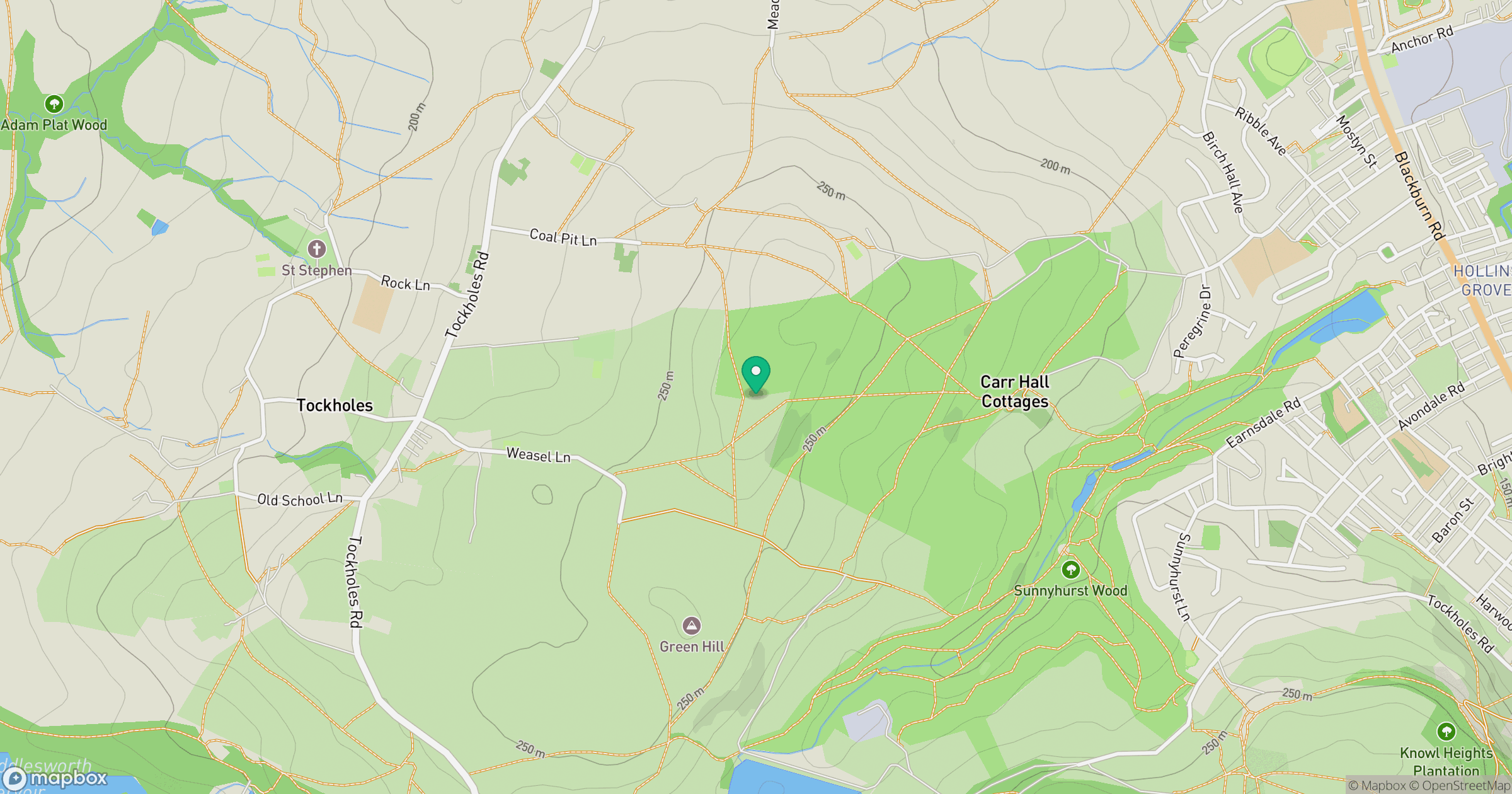
Grid reference: SD669230
View on OpenStreetMapOpens a map in a new tab, centred on the hill.




No comments yet. Be the first.