

Stirling Castle
Good walks are even better shared.
NS7894 : Stirling Castle: interior of the Chapel Royal
Lairich Rig Photo source
Overview
Stirling Castle: A Jewel of Scottish History
Nestled atop a stunning volcanic crag, Stirling Castle commands respect with its imposing structure and storied past.
Geology
This castle is not just an architectural marvel; its underpinnings are steeped in history too! Constructed on a resilient basalt crag, it stands as a testament to ancient volcanic activity that shaped this corner of Scotland millions of years ago. You’re not just walking on solid ground; you’re treading on a geological narrative!
Access and Parking
Accessing the castle is a breeze. The Stirling Castle Car Park is your best bet, conveniently sitting just a short walk to the castle entry. Watch out for the pay-and-display signs, though; we wouldn’t want a parking ticket to spoil your grand day out! If you’re relying on public transport, good news! Regular buses operate from nearby towns, and the local train station in Stirling is well-connected too.
Routes
The main route to explore today is simply named Castle Approach. This path is paved and well-maintained, making your journey pleasant and wheelchair accessible. Clocking in at 1 kilometre and taking roughly 30 minutes, it’s as easy as pie—and we all know how easy pie is!
Summit Features
Upon reaching the summit, you’ll be treated to breathtaking vistas that include the Wallace Monument and the Ochil Hills. The castle itself, with its battlements and towers, showcases an impressive array of architectural styles, making this an Instagram dream.
Terrain and Hazards
The terrain is primarily paved, coupled with some grassy areas ideal for a picnic or a lazy sunbathe. Honestly, who can resist sprawled out on the grass, soaking up those Scottish rays? There are no significant hazards here, but do wear comfortable footwear for all the exploring you’ll want to do!
Seasonality of Views
For the best views, spring and summer are your go-tos. The landscape bursts alive with colourful blooms, a perfect backdrop to this historical giant.
Nearby Summits
If you've got a bit more energy left, consider making your way to the nearby Wallace Monument. It’s only about a short jaunt away and provides a different perspective on the landscape.
Facilities
Once you’ve worked up an appetite from all that walking (or perhaps just the thrill of standing on such hallowed ground), there’s a lovely café on-site as well as a gift shop and clean toilets near the entrance. Everything you need to make your visit comfortable!
History
To dive into a bit of historical context, Stirling Castle holds an array of significance in Scotland’s royalty realms since the 12th century. The name itself derives from the Old English term 'styrling', resonating with the area’s rich heritage and tales.
So lace up those hiking boots (or perhaps hiking slippers if you prefer comfort), grab your pals, and embark on a journey to one of Scotland's most cherished landmarks. It promises not just a hike, but a historical experience that is sure to tickle your fancy!
Happy hiking!
Explore routes near Stirling Castle
Walks starting near this hill. Open a route to check its map, distance and full itinerary.
King's Park and the Golf Course
View route
King's Park to Cambusbarron
View route
Fallin Bing Wednesday Walk
View route
Strathallan Court Strollers and Stragglers
View route
Route planning notes
These notes describe possible approaches. Check a route's map and access information when planning your walk.
Castle Esplanade and Back Walk Circuit
This popular circular route begins at the Castle Esplanade, offering a mix of history and natural beauty. The route follows the Back Walk, a historic pathway that loops around the base of Stirling Castle, providing excellent viewpoints of the surrounding landscape. The trail passes through wooded areas and includes interpretive signs about the area's history.
Stirling Castle to Gowan Hill and Beheading Stone
This route starts at Stirling Castle and leads to nearby Gowan Hill, a historically significant location known for the Beheading Stone. The trail offers expansive views over Stirling and the surrounding countryside. It's a short but steep walk with some uneven paths, making it a good option for those looking for a quick adventure.
Heritage Walk: Stirling Castle to Cambuskenneth Abbey
A scenic walk linking Stirling Castle with the historic Cambuskenneth Abbey. The route starts at the castle and descends through the Old Town, crossing the River Forth via the Stirling Old Bridge. It offers a fascinating journey through centuries of history, with plenty of opportunities to explore landmarks along the way.
King's Knot and King's Park Loop
This gentle circular route begins at Stirling Castle and explores the King's Knot, a striking earthwork thought to be part of a royal garden. The trail continues into King's Park, a peaceful green space with wide paths and scenic views of the castle. Ideal for families and those seeking a less strenuous walk.
Stirling Castle to Abbey Craig and Wallace Monument
A more challenging route that connects Stirling Castle with the iconic Wallace Monument on Abbey Craig. The path descends through the town and climbs towards Abbey Craig, providing panoramic views of the Ochil Hills and the River Forth. This route combines historical landmarks with a rewarding hill climb.
Make a day of it, together
Find someone to share the walk with, or organise a day out along a route you like.
Photo Gallery
View all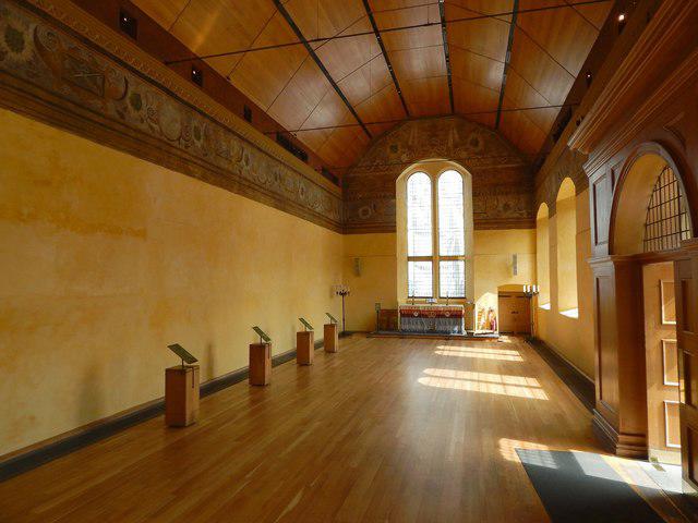 Photo could not load
NS7894 : Stirling Castle: interior of the Chapel Royal
Lairich Rig
 Photo could not load
NS7894 : Stirling Castle: the Chapel Royal
Lairich Rig
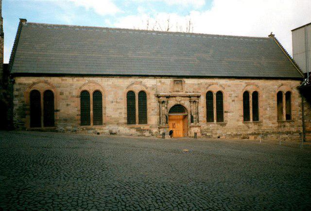 Photo could not load
NS7894 : Stirling Castle, Chapel Royal
Jonathan Thacker
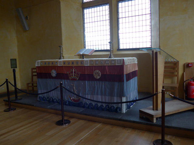 Photo could not load
NS7894 : Altar, Chapel Royal, Stirling Castle
Basher Eyre
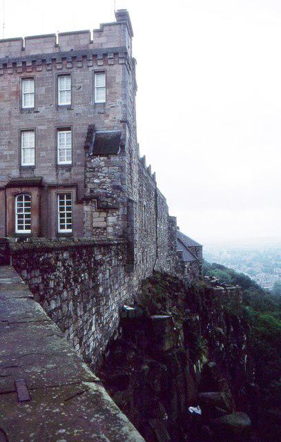 Photo could not load
NS7894 : King's Old Building, Stirling Castle
Richard Sutcliffe
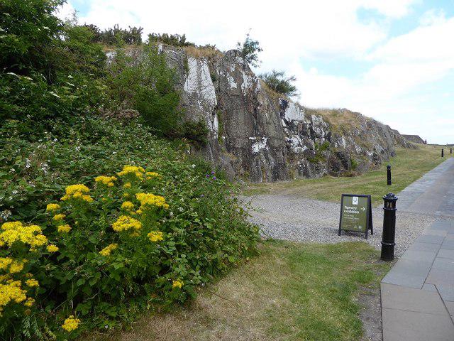 Photo could not load
NS7894 : Exposed natural rock in Nether Bailey, Stirling Castle
David Gearing
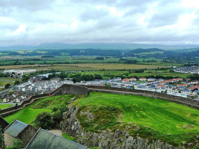 Photo could not load
NS7894 : Stirling Castle View
Mary and Angus Hogg
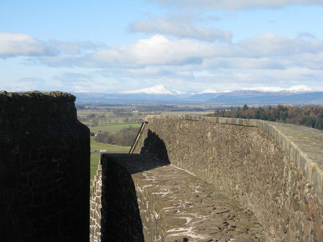 Photo could not load
NS7994 : View from Stirling Castle
M J Richardson
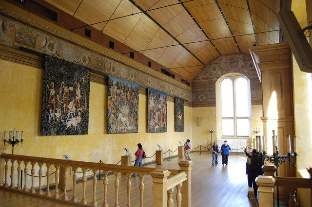 Photo could not load
NS7894 : Chapel Royal Interior
Bill Harrison
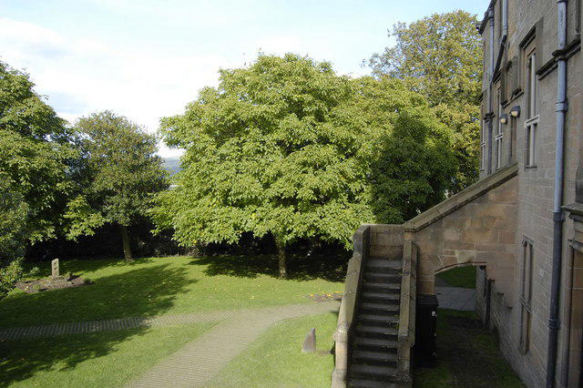
NS7894 : Chapel Gardens, Stirling Castle
Bill Harrison
Hill facts and local notes
Classifications
Elevation
105m
344 ft
Prominence
79m
Coordinates
56.1242, -3.9496
NS789941
OS Map
57
Explorer: 348 366W
At the Summit
The summit features the impressive Stirling Castle itself, with its distinctive battlements and towers, as well as stunning views over the River Forth and the City of Stirling.
Terrain & Geology
Stirling Castle is built on a volcanic crag, comprising mainly of basalt, offering a solid foundation and picturesque views of the surrounding landscape. The rock formations narrate the story of volcanic activity from millions of years ago, making it a geological wonder as well as a historic one.
Views & Scenery
The Wallace Monument and the Ochil Hills are prominent landmarks visible from the summit, framed by the picturesque Scottish landscape.
History & Heritage
Name Origin
The name 'Stirling' is derived from the Old English term 'styrling,' meaning 'stirling,' reflecting the area’s historical significance.
Historical Significance
Stirling Castle has played a pivotal role in Scotland's history, serving as a royal residence and military stronghold since the 12th century.
Getting There & Facilities
Parking
Stirling Castle Car Park, located just a short walk from the castle entrance, with pay-and-display facilities available.
Public Transport
Regular bus services operate from various towns in the area, with the closest train station in Stirling City Centre.
Nearby Facilities
The castle has facilities including a café, gift shop, and toilets situated near the entrance.
Safety Information
Known Hazards
- None in particular, though wear comfortable shoes as some areas of the castle can be uneven.
General Safety Tips
- Check weather conditions before setting out
- Carry appropriate clothing and equipment
- Let someone know your planned route
- Take a map, compass, and GPS device
- Carry emergency supplies: food, water, first aid kit, torch
Hills
Some common questions about the hills answered
Are there group walks up Stirling Castle?
Many walkers use Walkmates to join or organise walks with others. You can check for group walks around Stirling Castle through the maps
Are there other walkers around Stirling Castle?
Activity varies by location and time, but Walkmates lets you see whether others have shared walks or shown interest in this area. Find other people through the walking friends search walking friends for Stirling Castle search or of course create your own walk for Stirling Castle
Can I organise a walk to Stirling Castle?
Yes. If there aren’t any walks listed already, you can create a walk and make it available for others to join.
If you're signed up to Walkmates, you can create a walk to Stirling Castle.
How do I find a walk up this hill?
There are often multiple ways to walk this hill, depending on experience and route preference. Walkmates helps you explore walks and routes that others have shared.
Can I suggest a new route up Stirling Castle?
Yes. You can suggest or create routes to share with others. Walkmates focuses on the social side of walking, so routes are used to help people organise walks and explore areas together, rather than as detailed navigation tools or route libraries.
Other uses really appreciate knowledgeable walkers sharing their routes. Share your favourite route to Stirling Castle here
The is an error or something incorrect about this hill. How do I let you know?
We always strive to keep the information on Walkmates as accurate as possible. If you find an error, please let us know through the contact form and we'll aim to correct it as quickly as possible
Community Discussion
Comments
Location
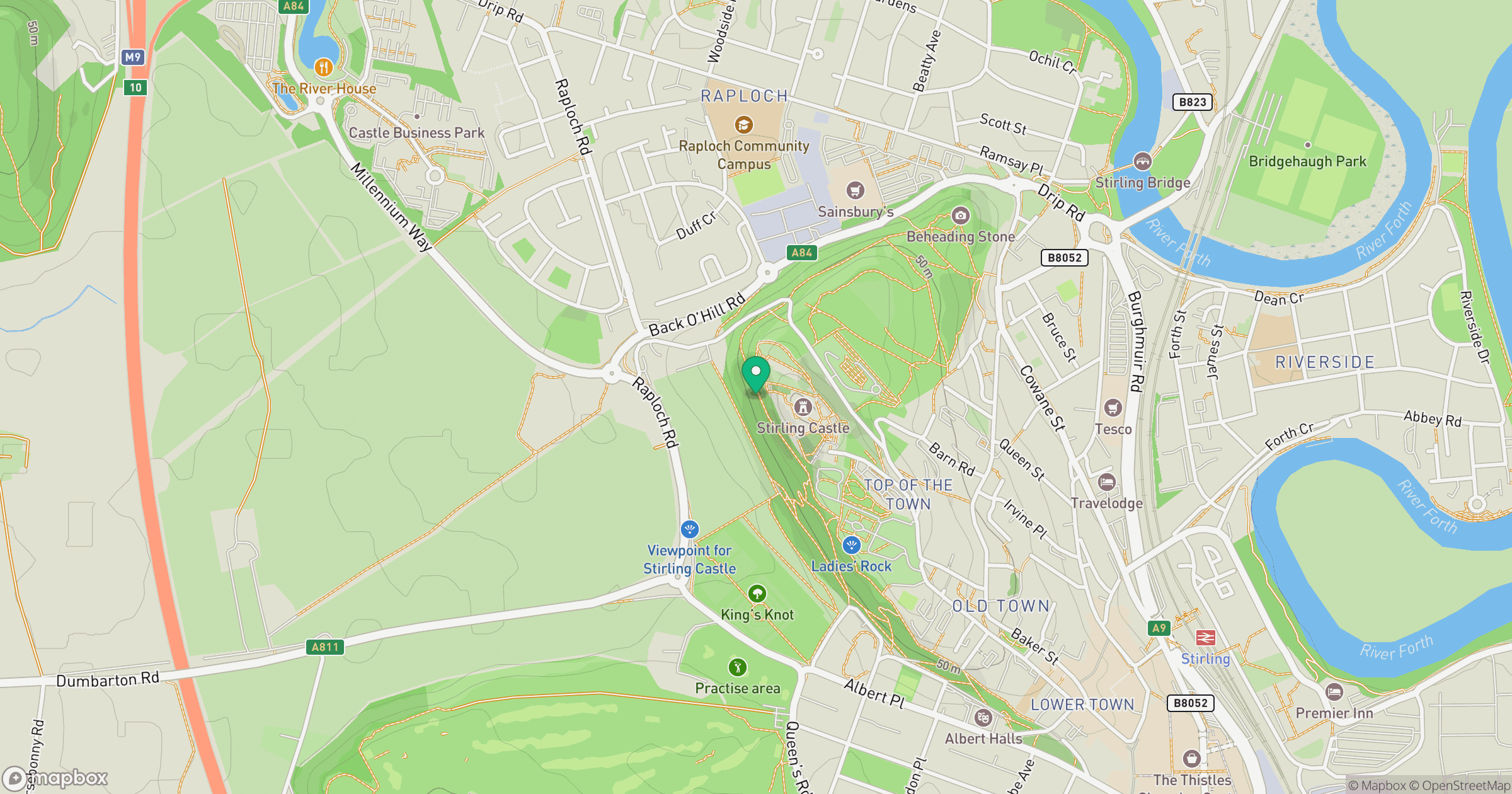
Grid reference: NS789941
View on OpenStreetMapOpens a map in a new tab, centred on the hill.


No comments yet. Be the first.