
St Gwynno Forest
Good walks are even better shared.
Overview
St Gwynno Forest
Nestled in the heart of South Wales, St Gwynno Forest is a pocket of tranquillity and natural beauty that appeals to both seasoned hikers and casual strollers. With its lush woodlands and scenic trails, it's the perfect spot to escape the hustle and bustle of daily life.
Geology
The forest predominantly consists of Devonian sandstone that has weathered beautifully over the years. Unique rock formations can be found interspersed throughout the forest, providing a fascinating glimpse into the geological history of the area.
Access and Parking
For those driving in, there’s a quaint little car park near the entrance. Bear in mind, it can get a bit mad on weekends, so arriving early could save you the bother of having to park down the street.
If you're making the trek via public transport, catch a bus from Cardiff that leads to Treforest and enjoy a pleasant 20-minute walk to the forest entrance. The local bus service keeps things simple.
Trails and Routes
St Gwynno offers numerous routes suitable for different skill levels.
- Gwynno Reservoir Loop: A delightful 5.5 km loop that offers stunning views, perfect for families or those looking for a gentle jaunt.
- St Gwynno Trail: This moderate 3 km trail winds through the forest, showcasing the local flora and fauna with sections of breathtaking woodland views.
Views
As you gain elevation (not that we’re telling you to climb Everest), be prepared to be wowed by impressive views stretching out to the distant peaks of the Brecon Beacons. The best seasons to soak all this in are spring and autumn when nature dons its finest attire, while early mornings or late afternoons provide a photographer’s dream lighting!
Hazards
Keep your wits about you! The paths can be a tad uneven and slippery, especially after rain. Also, make sure to check for ticks after your hike - they love to surprise unsuspecting nature lovers.
Summit Features
While there isn't a definitive peak, the forest does have a few hills that provide charming spots to stop, rest your legs, and appreciate the view.
Nearby Summits
If you're feeling ambitious, try to venture out to nearby summits like Mynydd y Glo or Mynydd Pennygadair for a more strenuous hike.
Facilities
Bring your own picnic goodies as there are no facilities within the forest itself. However, the nearest cafes and toilets can be found in Treforest, allowing you to refresh before setting off.
History
The name St Gwynno holds a rich heritage, named after the saint who is believed to have blessed the region with peace. A visit here not only offers natural beauty but a pinch of cultural insight too.
Whether you lace up your boots for a hearty hike or a gentle woodland stroll, St Gwynno Forest is sure to leave a lasting impression. Enjoy the fresh air and don’t forget to stop and smell the wildflowers!
Happy hiking!
Explore routes near St Gwynno Forest
Walks starting near this hill. Open a route to check its map, distance and full itinerary.
Aberdare Walk with Men Walking & Talking
View route
Merthyr Tydfil with Men Walking & Talking
View route
Cardiff: Hailey Park to Blackweir Bridge on the Taff Trail
View route
Pen y Fan via Corn Du from Storey Arms
View route
Route planning notes
These notes describe possible approaches. Check a route's map and access information when planning your walk.
Gwynno Reservoir Loop
A beautiful circular route around the Gwynno Reservoir that offers stunning views of the water and surrounding woodland.
St Gwynno Trail
This trail meanders through parts of the forest, showcasing local flora and fauna, culminating at a scenic viewpoint.
Make a day of it, together
Find someone to share the walk with, or organise a day out along a route you like.
Hill facts and local notes
Classifications
Elevation
361m
1,184 ft
Prominence
49m
Coordinates
51.6528, -3.3941
ST036958
OS Map
170
Explorer: 166E
At the Summit
The forest itself doesn't have a conventional summit, but there are several hills providing picturesque vantage points adorned with viewpoints and benches for a contemplative sit.
Terrain & Geology
The area primarily comprises Devonian sandstone, which has weathered over time to create unique rock formations and appealing landscapes. The forest floor is also a rich layer of clay and loam, making it a nutrient-rich habitat.
Views & Scenery
From higher vantage points, expect to see sweeping views of the surrounding valleys and the distinct peaks of the Brecon Beacons in the distance.
History & Heritage
Name Origin
St Gwynno is named after the local patron saint, and 'Gwynno' can be translated as 'blessed' or 'holy'.
Historical Significance
The area is steeped in legends associated with the early Christian saint Gwynno who is said to have brought peace and prosperity to the region.
Getting There & Facilities
Parking
There is a small car park near the entrance to St Gwynno Forest, ideal for starting hikes. However, parking tends to be limited during peak weekends.
Public Transport
The nearest bus service runs from Cardiff to the village of Treforest, from where it is about a 20-minute walk to the forest entrance.
Nearby Facilities
There are no facilities within the forest itself, but the nearest available amenities, including cafes and toilets, can be found in Treforest.
Safety Information
Known Hazards
- Uneven terrain and potentially slippery paths, particularly when wet. Wildlife is generally not a concern; however, as in all wooded areas, ticks might occasionally be found.
General Safety Tips
- Check weather conditions before setting out
- Carry appropriate clothing and equipment
- Let someone know your planned route
- Take a map, compass, and GPS device
- Carry emergency supplies: food, water, first aid kit, torch
Hills
Some common questions about the hills answered
Are there group walks up St Gwynno Forest?
Many walkers use Walkmates to join or organise walks with others. You can check for group walks around St Gwynno Forest through the maps
Are there other walkers around St Gwynno Forest?
Activity varies by location and time, but Walkmates lets you see whether others have shared walks or shown interest in this area. Find other people through the walking friends search walking friends for St Gwynno Forest search or of course create your own walk for St Gwynno Forest
Can I organise a walk to St Gwynno Forest?
Yes. If there aren’t any walks listed already, you can create a walk and make it available for others to join.
If you're signed up to Walkmates, you can create a walk to St Gwynno Forest.
How do I find a walk up this hill?
There are often multiple ways to walk this hill, depending on experience and route preference. Walkmates helps you explore walks and routes that others have shared.
Can I suggest a new route up St Gwynno Forest?
Yes. You can suggest or create routes to share with others. Walkmates focuses on the social side of walking, so routes are used to help people organise walks and explore areas together, rather than as detailed navigation tools or route libraries.
Other uses really appreciate knowledgeable walkers sharing their routes. Share your favourite route to St Gwynno Forest here
The is an error or something incorrect about this hill. How do I let you know?
We always strive to keep the information on Walkmates as accurate as possible. If you find an error, please let us know through the contact form and we'll aim to correct it as quickly as possible
Community Discussion
Comments
Location
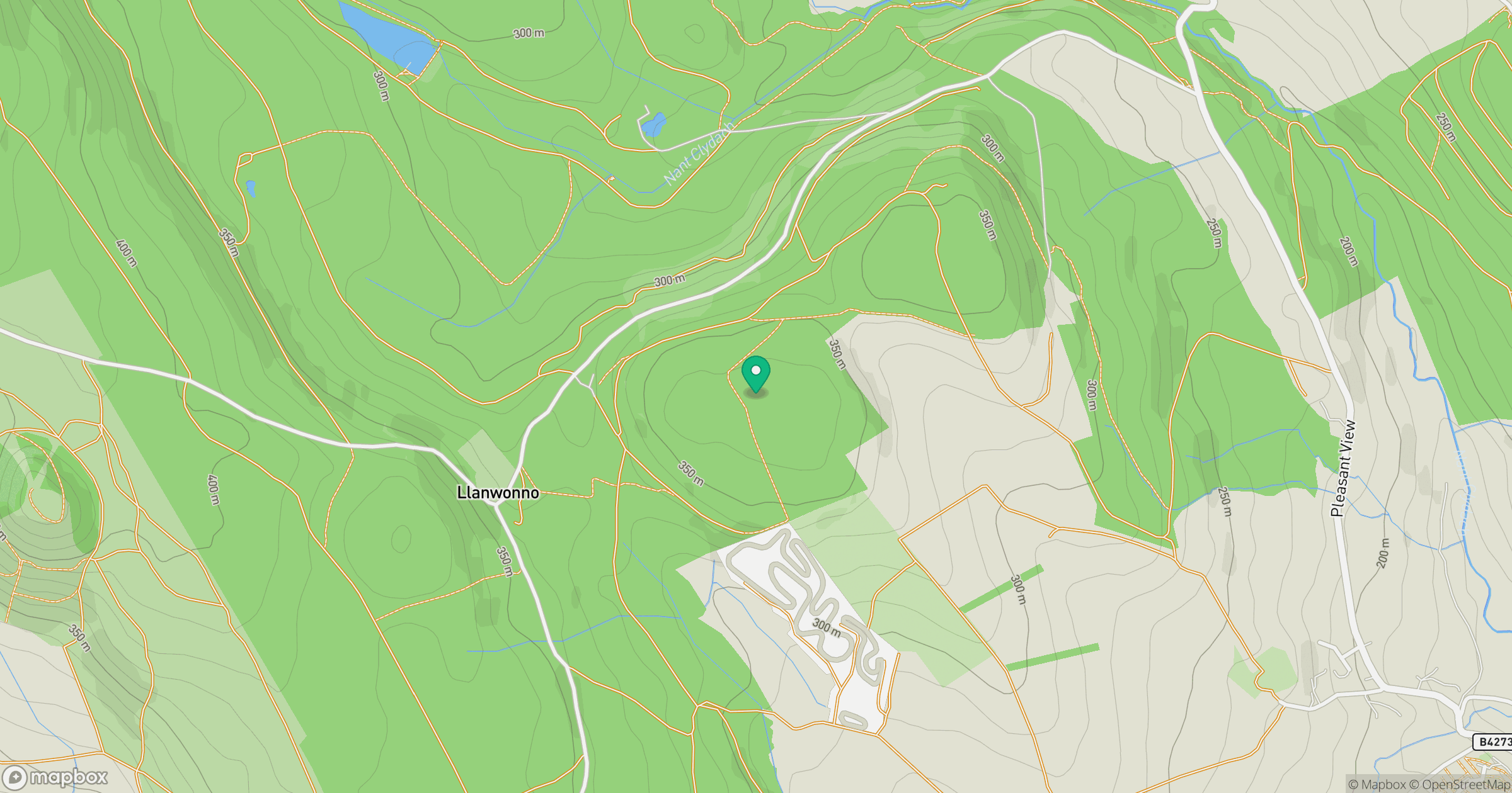
Grid reference: ST036958
View on OpenStreetMapOpens a map in a new tab, centred on the hill.



No comments yet. Be the first.