

Musbury Castle
Good walks are even better shared.
SY2894 : Musbury: Musbury Castle
Martin Bodman Photo source
Overview
Musbury Castle
Introduction
Musbury Castle, perched at a modest elevation of 86 meters, is a captivating historical site located in Dorset, England. Often overshadowed by its more prominent counterparts, this hill fort offers a unique blend of scenic views and rich history. While you might not need climbing gear, sturdy shoes are recommended for a comfortable trek up to the summit.
Geology
The area surrounding Musbury Castle is a treasure trove of Jurassic limestone, providing a glimpse into the geological history of the region. The formations reflect the ancient seabed, with interesting rock features that add character to the landscape.
Access and Parking
Getting to Musbury Castle is a doddle! Head to the village of Musbury where you'll find a small, convenient car park. From there, you'll walk just about 1 km through picturesque countryside before arriving at the hill fort.
As for public transport, local bus services to Musbury run every couple of hours, so plan your journey well so you don't miss the last one—no one enjoys a long night under the stars without the right gear!
The Ascent
One of the most delightful parts about visiting Musbury Castle is the approach. Starting in the charming village, you’ll find the route straightforward and well-marked. With a distance of approximately 2.5 km, you can expect to take roughly 1.5 hours, allowing time to soak in the beautiful countryside.
Summit Features
Upon reaching the summit, visitors are greeted by the well-preserved earthworks of the Iron Age hill fort. You’ll feel like an ancient warrior as you stand on the ramparts, with views that could make anyone consider a change in career to tour guiding!
Views and Best Times to Visit
From the summit, you can relish in sweeping views of the River Axe as it winds through the landscape, not forgetting the distant sight of the Jurassic Coast—a UNESCO World Heritage Site. For the best experience, visiting in spring or early autumn provides clearer skies and vibrant scenery, perfect for an Instagram snap.
Hazards
While the path is generally easy-going, be aware of the occasional slippery sections, especially after rain. It's not quite a rocky mountain adventure, but a little caution goes a long way.
Nearby Attractions
If you fancy a bit more walking, Coly Hill is nearby, standing at 100 meters and offering a fun addition to your day out.
Final Thoughts
Musbury Castle may not be the highest hill in the land, but it certainly packs a punch in terms of history and natural beauty. Plan a visit, wear comfortable shoes, and don't forget your camera—after all, a picture is worth a thousand footsteps!
Last Updated
2023-10-01
Source
Data sourced from Ordnance Survey and local historical records.
Explore routes near Musbury Castle
Walks starting near this hill. Open a route to check its map, distance and full itinerary.
Langdon Hill Circular
View route
Wellington (Somerset) Walk with Men Walking & Talking
View route
Taunton Walk with Men Walking & Talking
View route
Killerton to Clyston Mill: Broadclyst farmland and heritage walk
View route
Route planning notes
These notes describe possible approaches. Check a route's map and access information when planning your walk.
Musbury Village to Musbury Castle
A charming ascent from the village of Musbury, winding through scenic countryside to the historic hill fort.
Make a day of it, together
Find someone to share the walk with, or organise a day out along a route you like.
Photo Gallery
View all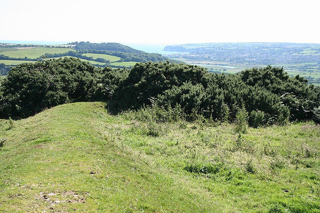 Photo could not load
SY2894 : Musbury: Musbury Castle
Martin Bodman
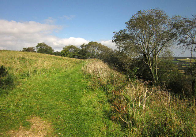 Photo could not load
SY2894 : Musbury Castle
Derek Harper
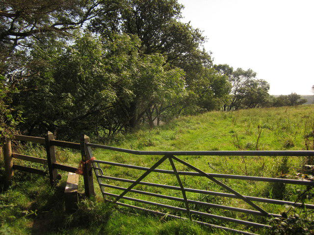 Photo could not load
SY2894 : Gate and stile, Musbury Castle
Derek Harper
Hill facts and local notes
Classifications
Elevation
179m
587 ft
Prominence
48m
Coordinates
50.7433, -3.0179
SY282942
OS Map
193
Explorer: 116
At the Summit
The summit boasts remnants of the Iron Age hill fort, with earthworks and a commanding view over the landscape.
Terrain & Geology
Musbury Castle is predominantly composed of Jurassic limestone, with notable cartographic features shaped by glacial activity.
Views & Scenery
Panoramic views of the River Axe and the rolling Dorset countryside, with glimpses of the Jurassic Coast in the distance.
History & Heritage
Name Origin
The name 'Musbury' originates from the Old English 'Musa' meaning 'moss' or 'swampy locality'.
Historical Significance
Musbury Castle is an important archaeological site, reflecting the strategic military landscape of the Iron Age.
Getting There & Facilities
Parking
There is a small car park in Musbury village, just 1 km from the trailhead.
Public Transport
The nearest bus stop is in the village, serviced by local buses every couple of hours.
Nearby Facilities
A quaint café in Musbury offering refreshments, though facilities are limited; plan accordingly.
Safety Information
Known Hazards
- Occasional slippery paths after rain. Be wary of your footing near the steep slopes.
General Safety Tips
- Check weather conditions before setting out
- Carry appropriate clothing and equipment
- Let someone know your planned route
- Take a map, compass, and GPS device
- Carry emergency supplies: food, water, first aid kit, torch
Hills
Some common questions about the hills answered
Are there group walks up Musbury Castle?
Many walkers use Walkmates to join or organise walks with others. You can check for group walks around Musbury Castle through the maps
Are there other walkers around Musbury Castle?
Activity varies by location and time, but Walkmates lets you see whether others have shared walks or shown interest in this area. Find other people through the walking friends search walking friends for Musbury Castle search or of course create your own walk for Musbury Castle
Can I organise a walk to Musbury Castle?
Yes. If there aren’t any walks listed already, you can create a walk and make it available for others to join.
If you're signed up to Walkmates, you can create a walk to Musbury Castle.
How do I find a walk up this hill?
There are often multiple ways to walk this hill, depending on experience and route preference. Walkmates helps you explore walks and routes that others have shared.
Can I suggest a new route up Musbury Castle?
Yes. You can suggest or create routes to share with others. Walkmates focuses on the social side of walking, so routes are used to help people organise walks and explore areas together, rather than as detailed navigation tools or route libraries.
Other uses really appreciate knowledgeable walkers sharing their routes. Share your favourite route to Musbury Castle here
The is an error or something incorrect about this hill. How do I let you know?
We always strive to keep the information on Walkmates as accurate as possible. If you find an error, please let us know through the contact form and we'll aim to correct it as quickly as possible
Community Discussion
Comments
Location
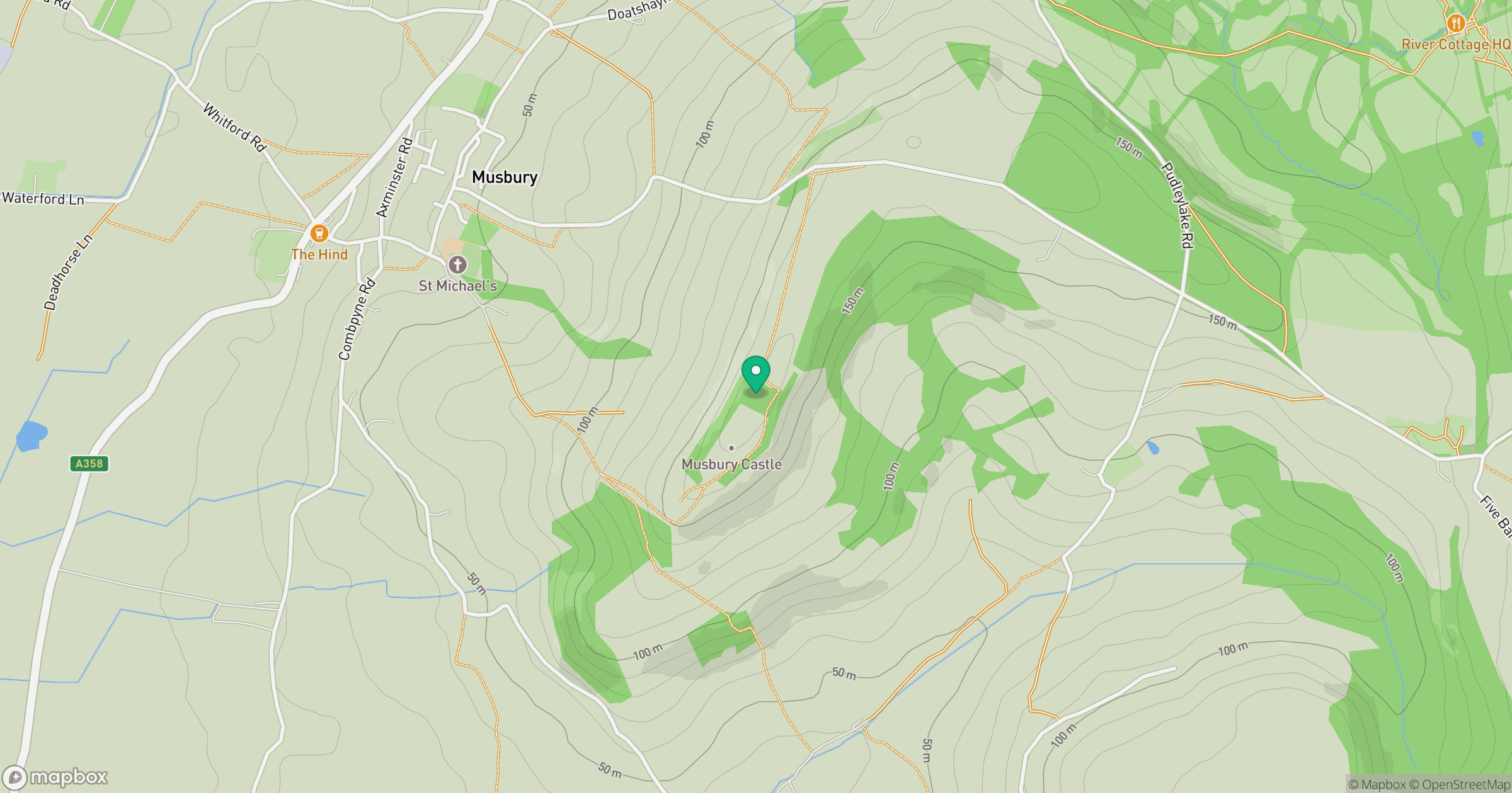
Grid reference: SY282942
View on OpenStreetMapOpens a map in a new tab, centred on the hill.




No comments yet. Be the first.