

Moel Fynydd [Craig y Castell]
Good walks are even better shared.
SH6916 : North from Cadair Idris.
Roger Whitfield Photo source
Explore routes near Moel Fynydd [Craig y Castell]
Walks starting near this hill. Open a route to check its map, distance and full itinerary.
Cadair Idris - Pony Path
View route
Mawddach Trail: Penmaenpool to Dolgellau Riverside Return
View route
Mawddach Trail: Penmaenpool to Arthog Estuary Return
View route
Coed y Brenin: Pont Ty'n-y-groes and Mawddach Forest Trail
View route
Route planning notes
These notes describe possible approaches. Check a route's map and access information when planning your walk.
Craig y Castell Circular
A charming circuit around Moel Fynydd that provides a fantastic combination of valleys and hilltops, perfect for leisurely strolls.
Direct Ascent from SH697161
A straightforward ascent directly to the summit with stunning views along the way.
Make a day of it, together
Find someone to share the walk with, or organise a day out along a route you like.
Photo Gallery
View all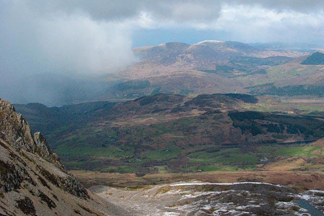 Photo could not load
SH6916 : North from Cadair Idris.
Roger Whitfield
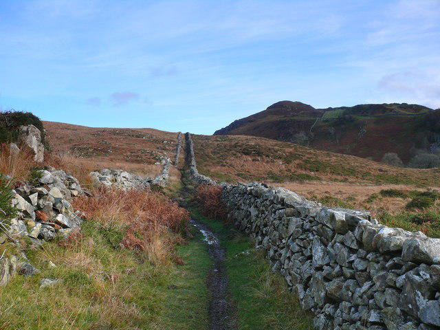 Photo could not load
SH6916 : Golygfa o gopa 321m / A view of peak 321m
Ian Medcalf
Hill facts and local notes
Classifications
Elevation
321m
1,053 ft
Prominence
153m
Coordinates
52.7277, -3.9298
SH697161
OS Map
124
Explorer: OL18W OL23W
At the Summit
The summit is crowned with a small stone cairn, offering a great vantage point for photos and contemplation.
Terrain & Geology
The mountain is primarily formed of volcanic rock, giving it a unique landscape characterised by rugged terrain and a mixture of grassy slopes. The underlying geology includes remnants of ancient lava flows.
Views & Scenery
Glimpses of the nearby Berwyn Range, the picturesque Dee Valley, and on a clear day, the Snowdon massif.
History & Heritage
Name Origin
Moel Fynydd translates to 'the hill of the mountain', quite a mouthful, isn't it?
Historical Significance
Historically, the area has been a site of ancient settlements and is rich in Welsh heritage, providing insight into the lives of our ancestors.
Getting There & Facilities
Parking
There is a small car park at SH695157, a 1 km walk from the mountain's base.
Public Transport
Buses from nearby towns like Corwen and Llangollen operate regularly but check local schedules for service updates.
Nearby Facilities
While there are no facilities on the mountain itself, Corwen has several cafes, toilets, and shops for supplies.
Safety Information
Known Hazards
- Wet and boggy patches can be deceptive; proper footwear is advised. As with many Welsh hills, sudden weather changes can occur.
General Safety Tips
- Check weather conditions before setting out
- Carry appropriate clothing and equipment
- Let someone know your planned route
- Take a map, compass, and GPS device
- Carry emergency supplies: food, water, first aid kit, torch
Hills
Some common questions about the hills answered
Are there group walks up Moel Fynydd [Craig y Castell]?
Many walkers use Walkmates to join or organise walks with others. You can check for group walks around Moel Fynydd [Craig y Castell] through the maps
Are there other walkers around Moel Fynydd [Craig y Castell]?
Activity varies by location and time, but Walkmates lets you see whether others have shared walks or shown interest in this area. Find other people through the walking friends search walking friends for Moel Fynydd [Craig y Castell] search or of course create your own walk for Moel Fynydd [Craig y Castell]
Can I organise a walk to Moel Fynydd [Craig y Castell]?
Yes. If there aren’t any walks listed already, you can create a walk and make it available for others to join.
If you're signed up to Walkmates, you can create a walk to Moel Fynydd [Craig y Castell].
How do I find a walk up this hill?
There are often multiple ways to walk this hill, depending on experience and route preference. Walkmates helps you explore walks and routes that others have shared.
Can I suggest a new route up Moel Fynydd [Craig y Castell]?
Yes. You can suggest or create routes to share with others. Walkmates focuses on the social side of walking, so routes are used to help people organise walks and explore areas together, rather than as detailed navigation tools or route libraries.
Other uses really appreciate knowledgeable walkers sharing their routes. Share your favourite route to Moel Fynydd [Craig y Castell] here
The is an error or something incorrect about this hill. How do I let you know?
We always strive to keep the information on Walkmates as accurate as possible. If you find an error, please let us know through the contact form and we'll aim to correct it as quickly as possible
Community Discussion
Comments
Location
View the hill's mapped position and surrounding paths.
Grid reference: SH697161
View on OpenStreetMapOpens a map in a new tab, centred on the hill.
No comments yet. Be the first.