

Meall an t-Seallaidh
Good walks are even better shared.
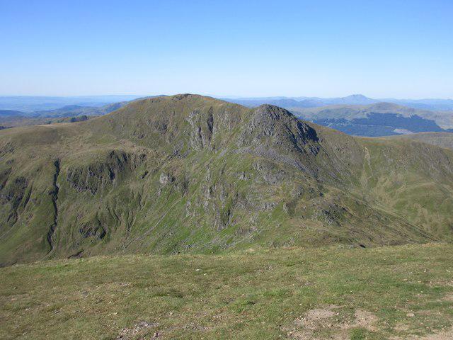
NN5423 : At the summit of Meall an t-Seallaidh - view towards Loch Earn
Colin Park Photo source
Overview
Meall an t-Seallaidh
Nestled in the captivating Scottish Highlands, Meall an t-Seallaidh stands tall at 823 meters, offering both adventure and visual delight for those brave enough to tackle its slopes. Its official Munro status means that it’s a must for the ‘Munro Baggers’ among us—those dedicated souls chasing every notable Scottish peak.
Geology
The geological composition of Meall an t-Seallaidh mainly consists of schist and granite. This unique mix not only contributes to the ruggedness of its terrain but also narrates the history of this beautiful region over millennia. Whether you're a geology buff or just enjoying the view, you'll appreciate the natural artistry on display.
Routes
The most popular route to the summit is the Northwest Ridge Route, a scenic path making its way over 7.5 km of picturesque landscape. This moderately difficult course takes around 3.5 hours to conquer, so pack your sandwiches and enjoy the journey to the top. Don’t forget to stop and take in the sights along the way—after all, sometimes the journey is just as rewarding as reaching the destination!
Summit Features
Once you reach the summit, you'll be greeted by an impressive cairn—a testament to the countless climbers who have stood in awe of the views. The panoramic vista from the top is breathtaking; on clear days, you can spot some of Scotland's most famous peaks including the grandeur of Ben Nevis.
Terrain Type
Expect a delightful variety of terrains: from rocky trails to gentle grassy slopes, with portions that will keep you on your toes, particularly during a wet spell. It's all part of the adventure—sometimes your shoes will have other ideas about where to go!
Views
The views from the summit are absolutely phenomenal. With highlights like the rugged profile of Ben Cruachan proudly on display, you'll want to make sure your camera is ready to capture the moment. The best times to visit for optimal scenery are in spring and autumn, with the added bonus of beautiful colours and clear skies.
Hazards
A word to the wise: be wary of the notorious Scottish weather, which can be as unpredictable as a cat on a hot tin roof. Ensure you're properly equipped and prepared for sudden changes. Also, keep aware of slippery areas especially after the rain; mud can be sneakier than you think!
Access
To reach Meall an t-Seallaidh, the Invervar car park is your best bet, easily reachable with ample parking space. Public transport options are nearby, but securing a taxi from places like Killin might be necessary to arrive at the foot of this fine hill.
Facilities
After your hike, head to the friendly village of Killin, where you’ll find cafes and shops to replenish your energy—just what tired legs crave!
History
The mountain's name is beautifully evocative—'Hill of the Lookout'—a nod to the stunning panoramas that have attracted explorers for generations. Historically significant, it represents a touchstone in the fabric of the local Highland culture.
So lace up those boots, grab your walking stick, and head out to Meall an t-Seallaidh. Adventure awaits, and who knows—you might even bag a munchable snack at the summit!
Explore routes near Meall an t-Seallaidh
Walks starting near this hill. Open a route to check its map, distance and full itinerary.
Killin: Falls of Dochart, Finlarig and Moirlanich Longhouse
View route
Loch Lubnaig: West Shore Railway Path from Ben Ledi Car Park
View route
Loch Katrine: Trossachs Pier to Stronachlachar
View route
Loch Katrine: Brenachoile Point Shore Walk from Trossachs Pier
View route
Route planning notes
These notes describe possible approaches. Check a route's map and access information when planning your walk.
Northwest Ridge Route
A scenic ascent that meanders along the northwest ridge with splendid views of the surrounding landscape. A delight for both seasoned hikers and enthusiastic novices.
Make a day of it, together
Find someone to share the walk with, or organise a day out along a route you like.
Photo Gallery
View all Photo could not load
NN5423 : At the summit of Meall an t-Seallaidh - view towards Loch Earn
Colin Park
 Photo could not load
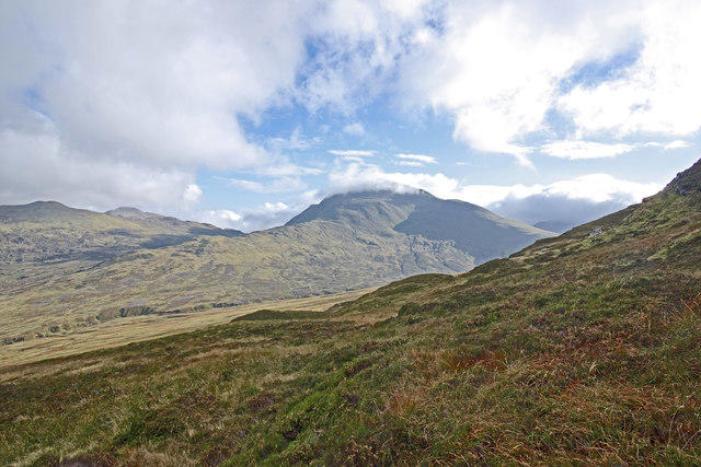
NN5423 : View to Loch Earn
Adam Ward
 Photo could not load
NN5423 : Summit trig point of Meall an t-Seallaidh
Colin Park
 Photo could not load
NN5423 : Trig on Meall an t-Seallaidh
Gordon Brown
 Photo could not load
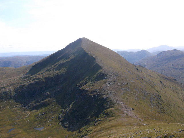
NN5423 : Meall an t-Seallaidh summit cairn with Loch Earn in the background
Paul Simonite
Hill facts and local notes
Classifications
Elevation
853m
2,798 ft
Prominence
428m
Coordinates
56.3804, -4.3626
NN542234
OS Map
51
Explorer: OL46N 365N
At the Summit
The summit features a prominent cairn, a well-deserved rest spot for those who have huffed and puffed their way to the top. The panorama is simply breathtaking.
Terrain & Geology
Mainly composed of schist and granite, providing a rugged landscape that showcases the fascinating geological history of the region.
Views & Scenery
On a clear day, summits such as Ben Nevis and the ominous outline of Ben Cruachan can be seen from the summit, creating an awe-inspiring display of raw natural beauty.
History & Heritage
Name Origin
The name 'Meall an t-Seallaidh' translates roughly to 'Hill of the Lookout', which is reflective of its panoramic views, making it an obvious favourite among hikers.
Historical Significance
Historically, the mountain has been a vista point for local clans and a scenic escape, deeply ingrained in Highland culture.
Getting There & Facilities
Parking
Parking is available at the Invervar car park (NN628296), which accommodates several vehicles and is the preferred starting point for many hikers aiming for Meall an t-Seallaidh.
Public Transport
Regular bus services run to nearby villages such as Killin and Aberfeldy, where one may need to arrange a taxi to the car park.
Nearby Facilities
After a rewarding hike, the village of Killin offers facilities such as cafes, shops, and public toilets. Just what tired legs need after a long trek!
Safety Information
Known Hazards
- Ensure to be cautious of sudden changes in weather, as conditions can change faster than you can say 'Are we there yet?'. Also, watch for slippery rocks and potential boggy areas in wetter seasons.
General Safety Tips
- Check weather conditions before setting out
- Carry appropriate clothing and equipment
- Let someone know your planned route
- Take a map, compass, and GPS device
- Carry emergency supplies: food, water, first aid kit, torch
Hills
Some common questions about the hills answered
Are there group walks up Meall an t-Seallaidh?
Many walkers use Walkmates to join or organise walks with others. You can check for group walks around Meall an t-Seallaidh through the maps
Are there other walkers around Meall an t-Seallaidh?
Activity varies by location and time, but Walkmates lets you see whether others have shared walks or shown interest in this area. Find other people through the walking friends search walking friends for Meall an t-Seallaidh search or of course create your own walk for Meall an t-Seallaidh
Can I organise a walk to Meall an t-Seallaidh?
Yes. If there aren’t any walks listed already, you can create a walk and make it available for others to join.
If you're signed up to Walkmates, you can create a walk to Meall an t-Seallaidh.
How do I find a walk up this hill?
There are often multiple ways to walk this hill, depending on experience and route preference. Walkmates helps you explore walks and routes that others have shared.
Can I suggest a new route up Meall an t-Seallaidh?
Yes. You can suggest or create routes to share with others. Walkmates focuses on the social side of walking, so routes are used to help people organise walks and explore areas together, rather than as detailed navigation tools or route libraries.
Other uses really appreciate knowledgeable walkers sharing their routes. Share your favourite route to Meall an t-Seallaidh here
The is an error or something incorrect about this hill. How do I let you know?
We always strive to keep the information on Walkmates as accurate as possible. If you find an error, please let us know through the contact form and we'll aim to correct it as quickly as possible
Community Discussion
Comments
Location
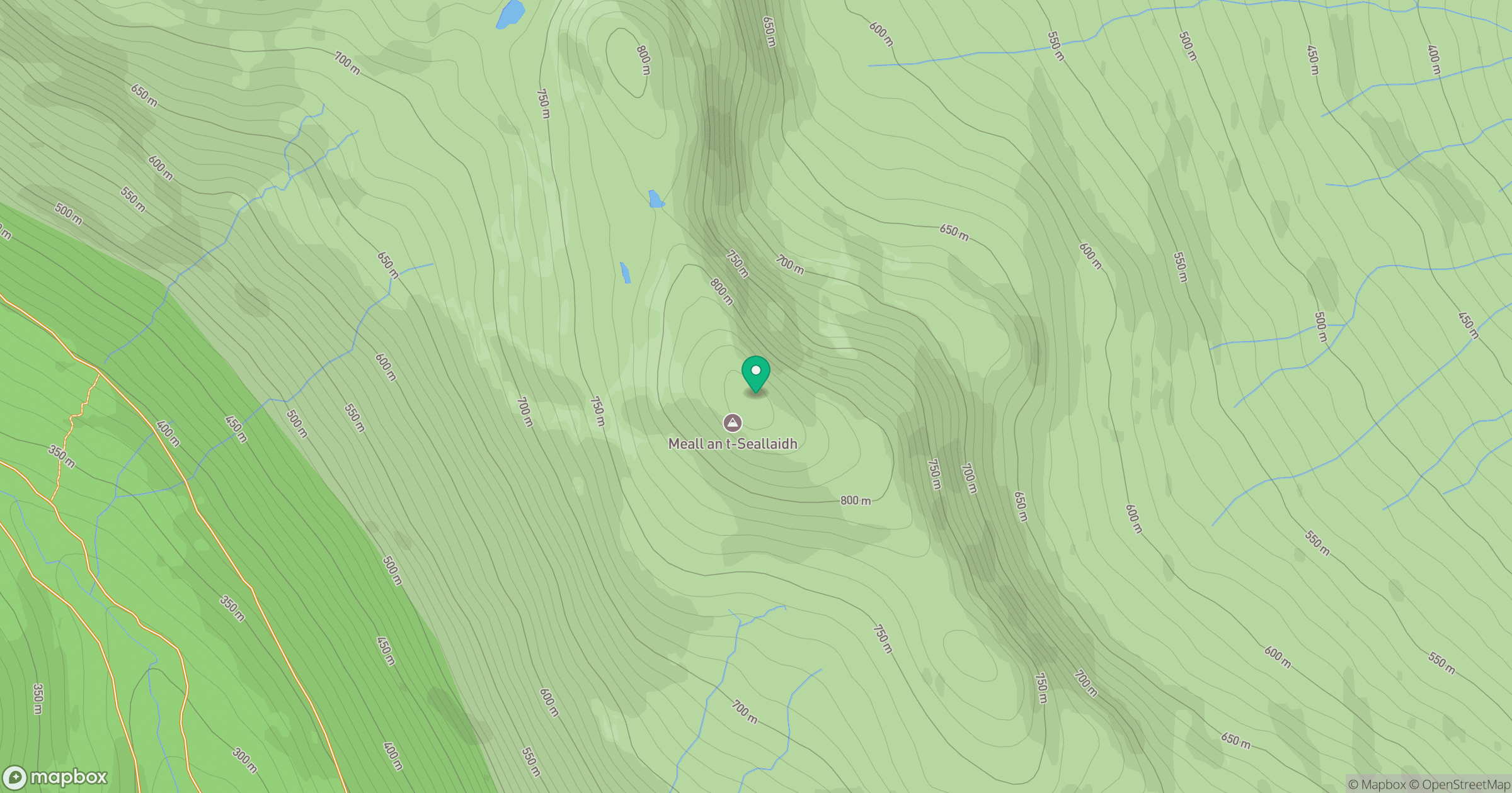
Grid reference: NN542234
View on OpenStreetMapOpens a map in a new tab, centred on the hill.
No comments yet. Be the first.