

Hollingbury Castle
Good walks are even better shared.
TQ3208 : Northern approach to Hill Fort
Peter Holmes Photo source
Overview
Hollingbury Castle
Overview
Nestled on the outskirts of Brighton, Hollingbury Castle offers a delightful mix of history, beautiful views, and accessible walking routes. At 211 meters tall, it's not the highest peak in the South Downs, but it certainly packs a punch in the beauty department!
Geology
Hollingbury Castle is primarily made of chalk, characteristic of the South Downs region. This unique geology creates a rich habitat supporting diverse flora and fauna. The area around the castle is also dotted with typical downland vegetation, making it a feast for the eyes.
Routes
The main route, the Hollingbury Hill Circuit, is a moderate walk that takes you around the hill, allowing you to soak in the scenic beauty while exploring the historic sites. It covers approximately 3.5 km and generally takes 1.5 hours to complete, making for an excellent half-day hike.
Summit Features
While Hollingbury may lack a trig point, its summit is crowned with the remnants of a prehistoric hill fort. The banks and ditches are a testament to the ancient people who once called these hills home. Be sure to take some time to explore these historic features before setting your sights on the stunning views!
Views
From the summit, you can enjoy panoramic views of Brighton to the south, with the glistening English Channel just a stone's throw away. On clear days, the Isle of Wight is also visible, so don't forget your camera!
Best Seasons
Spring and early summer are the best times to visit, with blooming wildflowers enhancing the landscape and visibility typically at its best.
Hazards
As with all outdoor activities, be prepared for the weather. The chalky ground can become slippery when wet, and gusty winds can surprise those at the summit. Always check the forecast before you venture out.
Nearby Summits
For those eager to explore further, nearby summits include Ditchling Beacon and Devil's Dyke, both offering rewarding walks and spectacular vistas.
Access
The nearest parking area is at Hollingbury Castle car park, which is quite popular, especially on sunny weekends. For those relying on public transport, frequent bus services operate from Brighton to the surrounding areas, bringing you not far from the hill.
Facilities
While there are no facilities at the hill itself, nearby Brighton is bursting with cafes, shops, and public toilets to cater to all your needs.
History
The name 'Hollingbury' means ‘fortress of the people’, showcasing its historical significance as a defensive site. Evidence from the Iron Age sets this location apart, offering a fascinating glimpse into Britain's past.
So lace up those hiking boots, pack plenty of water, and get ready for a day of adventure at Hollingbury Castle!
Explore routes near Hollingbury Castle
Walks starting near this hill. Open a route to check its map, distance and full itinerary.
Ashdown Forest Wellington Crash Site and Airman's Grave
View route
Seven Sisters Birling Gap and Friston Forest Circular
View route
Hellingly to Horam: Cuckoo Trail railway bridges and old station return
View route
Twilight wildlife walk at Old Lodge
View route
Route planning notes
These notes describe possible approaches. Check a route's map and access information when planning your walk.
Hollingbury Hill Circuit
A delightful circular route starting from the Hollingbury Castle car park, allowing hikers to explore the hill's natural beauty and historic features.
Make a day of it, together
Find someone to share the walk with, or organise a day out along a route you like.
Photo Gallery
View all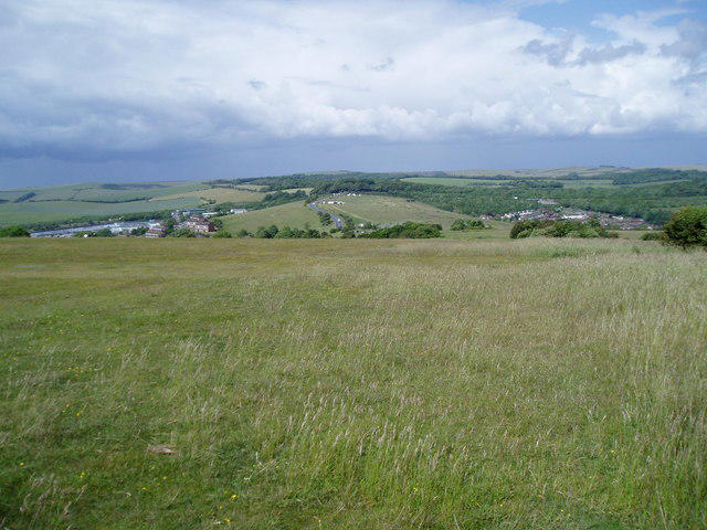 Photo could not load
TQ3208 : Northern approach to Hill Fort
Peter Holmes
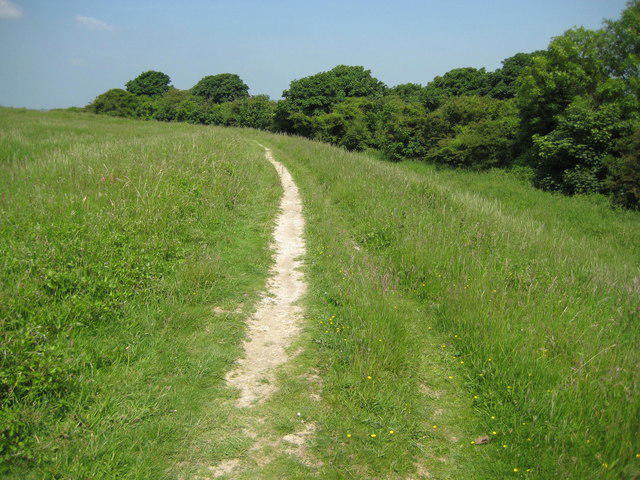 Photo could not load
TQ3207 : Hollingbury hillfort (2)
Nigel Cox
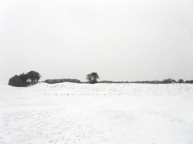 Photo could not load
TQ3207 : Hollingbury Castle
Simon Carey
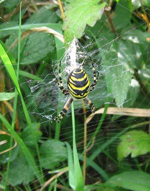 Photo could not load
TQ3207 : Wasp Spider, Hollingbury hillfort
Peter Whitcomb
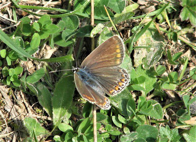 Photo could not load
TQ3207 : Common blue butterfly, Hollingbury Castle
Patrick Roper
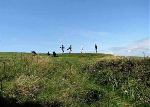 Photo could not load
TQ3207 : Golfers at Hollingbury Castle
Patrick Roper
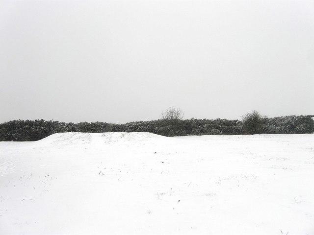 Photo could not load
TQ3207 : Tumulus, Hollingbury Castle
Simon Carey
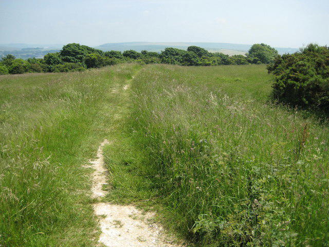 Photo could not load
TQ3207 : Hollingbury hillfort (1)
Nigel Cox
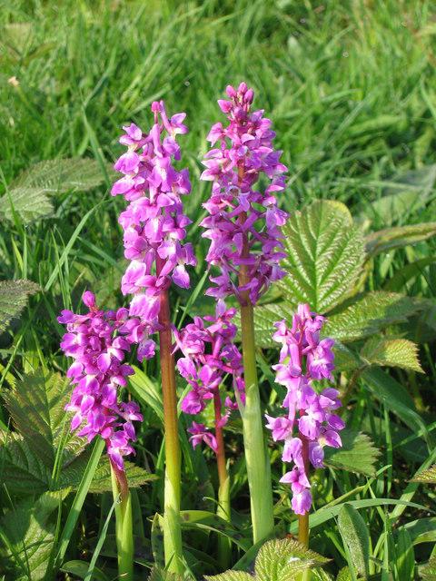 Photo could not load
TQ3207 : Early Purple Orchids
Peter Whitcomb
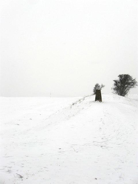
TQ3207 : Trig Point, Hollingbury Castle
Simon Carey
Hill facts and local notes
Classifications
Elevation
178m
584 ft
Prominence
45m
Coordinates
50.8560, -0.1238
TQ321079
OS Map
198
Explorer: OL11 122
At the Summit
The summit is adorned with remnants of the Iron Age hill fort, featuring banks and ditches that provide a peek into the distant past. There's no trig point here, but the views more than make up for it.
Terrain & Geology
Hollingbury Castle is primarily composed of the distinctive chalk of the South Downs, providing fascinating insights into the geological history of southern England. The surrounding area features typical downland flora and ancient earthworks.
Views & Scenery
Spectacular views of Brighton, the English Channel, and the sprawling South Downs National Park are all visible from the summit. On a clear day, you can even spot the Isle of Wight!
History & Heritage
Name Origin
The name ‘Hollingbury’ is derived from the Old English 'Hullingburh', meaning 'fortress of the people', indicating its historical significance as a defensive site.
Historical Significance
Hollingbury Castle itself was a fortified settlement, with archaeological findings from the Iron Age providing vital links to Britain's ancient history.
Getting There & Facilities
Parking
The nearest parking is available at the Hollingbury Castle car park, which provides ample space but can be busy on weekends.
Public Transport
Regular bus services run from Brighton to the nearby areas, with the closest stop being a short walk away.
Nearby Facilities
There are no facilities directly on the hill, but the nearby town of Brighton offers a plethora of cafes, shops, and public toilets.
Safety Information
Known Hazards
- As with any hill-walking, be mindful of sudden changes in weather, particularly strong winds at the summit. The terrain can also be uneven in places.
General Safety Tips
- Check weather conditions before setting out
- Carry appropriate clothing and equipment
- Let someone know your planned route
- Take a map, compass, and GPS device
- Carry emergency supplies: food, water, first aid kit, torch
Hills
Some common questions about the hills answered
Are there group walks up Hollingbury Castle?
Many walkers use Walkmates to join or organise walks with others. You can check for group walks around Hollingbury Castle through the maps
Are there other walkers around Hollingbury Castle?
Activity varies by location and time, but Walkmates lets you see whether others have shared walks or shown interest in this area. Find other people through the walking friends search walking friends for Hollingbury Castle search or of course create your own walk for Hollingbury Castle
Can I organise a walk to Hollingbury Castle?
Yes. If there aren’t any walks listed already, you can create a walk and make it available for others to join.
If you're signed up to Walkmates, you can create a walk to Hollingbury Castle.
How do I find a walk up this hill?
There are often multiple ways to walk this hill, depending on experience and route preference. Walkmates helps you explore walks and routes that others have shared.
Can I suggest a new route up Hollingbury Castle?
Yes. You can suggest or create routes to share with others. Walkmates focuses on the social side of walking, so routes are used to help people organise walks and explore areas together, rather than as detailed navigation tools or route libraries.
Other uses really appreciate knowledgeable walkers sharing their routes. Share your favourite route to Hollingbury Castle here
The is an error or something incorrect about this hill. How do I let you know?
We always strive to keep the information on Walkmates as accurate as possible. If you find an error, please let us know through the contact form and we'll aim to correct it as quickly as possible
Community Discussion
Comments
Location
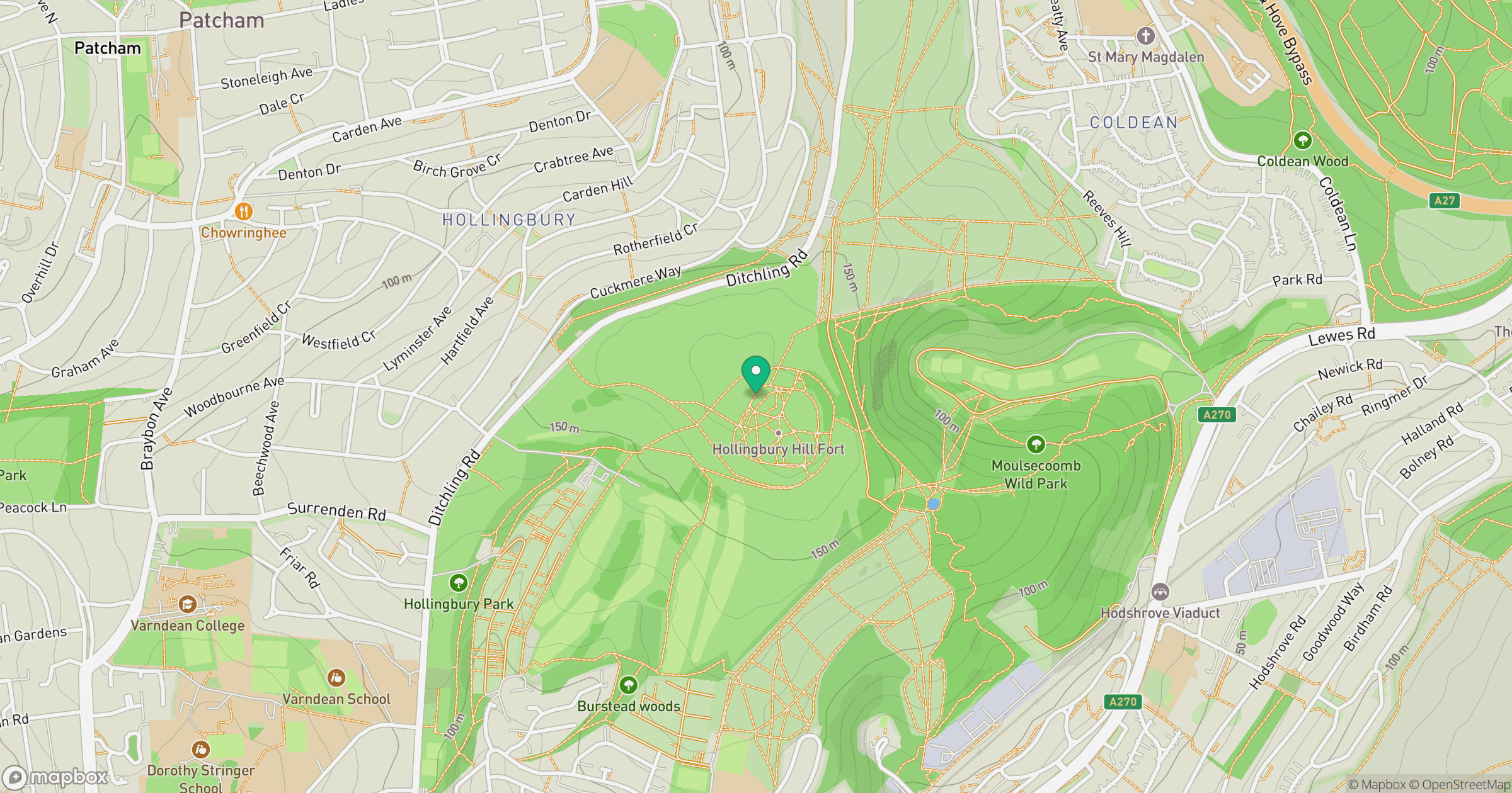
Grid reference: TQ321079
View on OpenStreetMapOpens a map in a new tab, centred on the hill.
Nearby Hills
Ditchling Beacon
248m
Leith Hill
294m
Worcestershire Beacon
425m
Glastonbury Tor
158m
Titterstone Clee Hill
533m
No comments yet. Be the first.