

Green Bell
Good walks are even better shared.
NY7001 : Lune Springs
John H Darch Photo source
Overview
Green Bell Hike Overview
Green Bell, standing at 598 meters, is a delightful Wainwright and a perfect choice for those looking for a hike that combines beautiful surroundings with a bit of a workout. Nestled in the scenic Lake District, Green Bell is the underdog of the mountain world but has much to offer to adventurous souls.
Geology
Composed primarily of volcanic rock, Green Bell presents a rocky yet manageable ascent. The surrounding landscape features layers of sedimentary rock, creating a rich palette for geological enthusiasts. Perfect for anyone who thought geology was just about rocks and ore.
Routes to the Summit
There are several routes leading up to this splendid peak. The Bink Moss Route provides a lovely mix of farmland and woodland scenery, gradually ascending to the summit. Alternatively, the Swindale Route is more challenging but rewards you with sweeping views across the valleys.
Summit Features
At the top, hikers are greeted by a sturdy stone cairn that offers a perfect backdrop for those Instagram shots. And don’t forget, the real treasure is the view—the sense of achievement as you look down on the world below is second to none.
Terrain Type
Expect to encounter rocky paths interspersed with lush grassy sections and the occasional boggy spot, which adds a hint of adventure. A well-placed splash could just spark joy!
The Views
The panorama from Green Bell will leave your jaw firmly on the floor. With sights stretching to Helvellyn and beyond, it’s a feast for the eyes. Late spring and early autumn offer the best visibility, so pick your time wisely!
Hazards
Though not the most treacherous of hikes, do heed the warnings about rapidly changing weather. No one likes being caught in the fog, least of all when you’re at the top.
Access and Facilities
For access, ample parking is available at a small layby, and public transport links from Penrith get you here with relative ease. The nearest town, Bampton, is brimming with charm and has a tearoom to revive your spirits post-hike.
Conclusion
Whether you’re a seasoned hiker or a newbie looking to build your confidence, Green Bell promises a rewarding experience that balances effort with the sheer delight of being out in nature. So pack your bags, lace up those boots, and remember: the only thing monumental about this adventure is the memories you'll create!
Happy Hiking!
Explore routes near Green Bell
Walks starting near this hill. Open a route to check its map, distance and full itinerary.
Sizergh: Park End Moss and Brigsteer Park Wood Circuit
View route
Ingleton Waterfalls Walk
View route
Pen-y-ghent from Horton in Ribblesdale
View route
Yorkshire Three Peaks Challenge – Gentle Pace
View route
Route planning notes
These notes describe possible approaches. Check a route's map and access information when planning your walk.
Bink Moss Route
This route starts at the minor road leading to Bink Moss and follows a well-trodden path through lush farmland before ascending towards the summit.
Swindale Route
A scenic alternative which begins at Swindale, meandering through picturesque valleys and ending with a challenging ascent to the peak.
Make a day of it, together
Find someone to share the walk with, or organise a day out along a route you like.
Photo Gallery
View all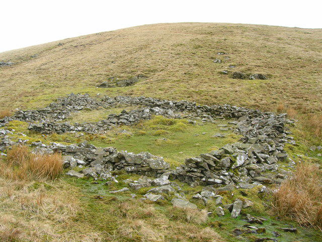 Photo could not load
NY7001 : Lune Springs
John H Darch
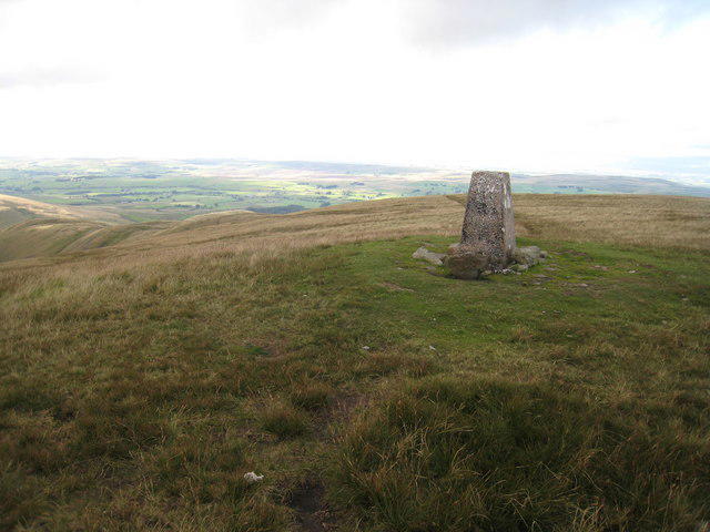 Photo could not load
NY6901 : Trig point on Green Bell
Philip Barker
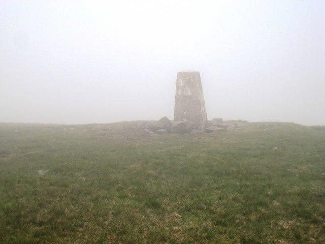 Photo could not load
NY6901 : Stones on Green Bell, Howgill Fells
Philip Barker
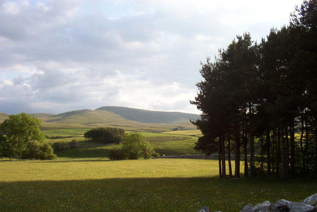 Photo could not load
NY6901 : Green Bell
David McMumm
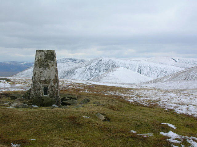 Photo could not load
NY6901 : Triangulation Pillar on the summit of Green Bell (1985'/605m)
John H Darch
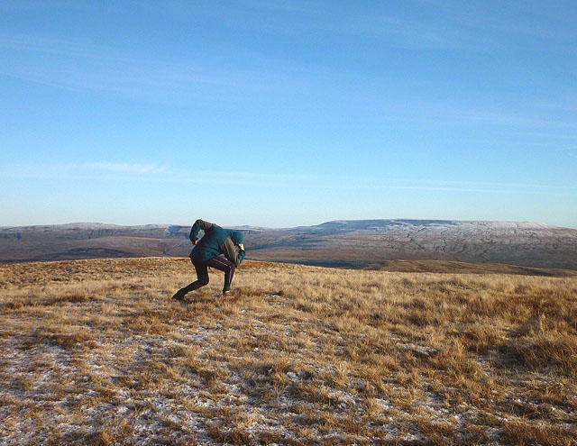 Photo could not load
NY6901 : The Fool on the Hill
Karl and Ali
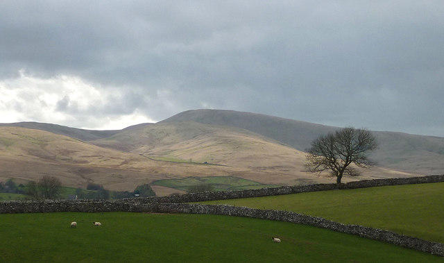 Photo could not load
NY6901 : Green Bell, the Howgill Fells
Karl and Ali
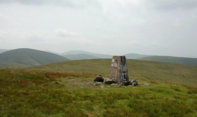 Photo could not load
NY6901 : Trig point on Green Bell
Trevor Littlewood
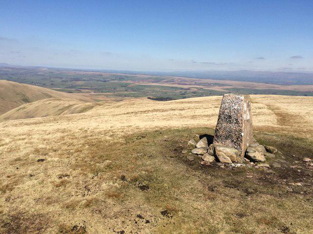 Photo could not load
NY6901 : Green Bell Trig point 1985' / 605m
John H Darch
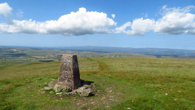
NY6901 : Summit trig point on Green Bell with view towards Cross Fell
Colin Park
Hill facts and local notes
Classifications
Elevation
605m
1,985 ft
Prominence
48m
Coordinates
54.4043, -2.4656
NY698010
OS Map
91
Explorer: OL19S
At the Summit
The summit boasts a classic stone cairn, which has become a favourite spot for hikers to gather their thoughts (and snacks). On a clear day, the panoramic views can take your breath away—hopefully not literally!
Terrain & Geology
Green Bell is primarily composed of volcanic rock, giving it a rugged terrain. The surrounding area features a mix of sedimentary deposits that provide a fascinating insight into the earth's geological history.
Views & Scenery
From the summit, you can see the stunning expanse of the Lake District including views of Helvellyn and the central fells, as well as the distant peaks of Scotland on a clear day.
History & Heritage
Name Origin
The name 'Green Bell' likely refers to the lush foliage that adorns its slopes, and ‘Bell’ may derive from the old Norse word for mountain.
Historical Significance
Green Bell is a notable feature of the Lake District, often overlooked due to the popularity of neighbouring peaks, yet it holds its own charm and rugged beauty.
Getting There & Facilities
Parking
There is a small layby on the minor road to the south of Bink Moss, which can accommodate a few cars. Be sure to tuck in neatly to avoid blocking traffic.
Public Transport
The nearest bus service is an hourly service from Penrith to Bampton. From there, it's a short walk to the start of the Bink Moss route.
Nearby Facilities
While there are no facilities at the summit, Bampton has a delightful tearoom and toilet services, perfect for a pre-hike pit stop.
Safety Information
Known Hazards
- Beware of sudden weather changes. Fog can roll in faster than a cat on a hot tin roof, obscuring visibility. Additionally, some rocky sections may be slippery when wet.
General Safety Tips
- Check weather conditions before setting out
- Carry appropriate clothing and equipment
- Let someone know your planned route
- Take a map, compass, and GPS device
- Carry emergency supplies: food, water, first aid kit, torch
Hills
Some common questions about the hills answered
Are there group walks up Green Bell?
Many walkers use Walkmates to join or organise walks with others. You can check for group walks around Green Bell through the maps
Are there other walkers around Green Bell?
Activity varies by location and time, but Walkmates lets you see whether others have shared walks or shown interest in this area. Find other people through the walking friends search walking friends for Green Bell search or of course create your own walk for Green Bell
Can I organise a walk to Green Bell?
Yes. If there aren’t any walks listed already, you can create a walk and make it available for others to join.
If you're signed up to Walkmates, you can create a walk to Green Bell.
How do I find a walk up this hill?
There are often multiple ways to walk this hill, depending on experience and route preference. Walkmates helps you explore walks and routes that others have shared.
Can I suggest a new route up Green Bell?
Yes. You can suggest or create routes to share with others. Walkmates focuses on the social side of walking, so routes are used to help people organise walks and explore areas together, rather than as detailed navigation tools or route libraries.
Other uses really appreciate knowledgeable walkers sharing their routes. Share your favourite route to Green Bell here
The is an error or something incorrect about this hill. How do I let you know?
We always strive to keep the information on Walkmates as accurate as possible. If you find an error, please let us know through the contact form and we'll aim to correct it as quickly as possible
Community Discussion
Comments
Location
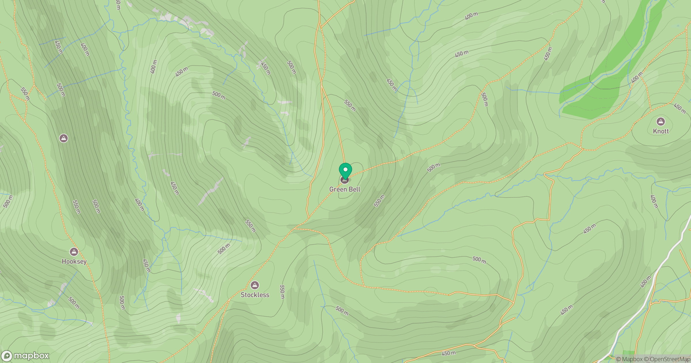
Grid reference: NY698010
View on OpenStreetMapOpens a map in a new tab, centred on the hill.



No comments yet. Be the first.