

Great Standrop
Good walks are even better shared.
NT9418 : The prominent tors of Great Standrop
Russel Wills Photo source
Overview
Great Standrop
Introduction
Great Standrop, standing tall at 576 meters, is a delightful Marilyn located in the heart of the North Pennines. This gem may not be the highest hill in the realm, but it certainly packs a punch with its captivating views and charming walks.
Geology
The mountain showcases an array of sedimentary rock formations, primarily limestone and sandstone. These geological wonders tell tales of a prehistoric sea that once covered the land. Fossils are common in the area, so keep an eye out; you never know what ancient secrets might be fossilised beneath your feet!
Routes
One of the most popular routes to the summit begins at Cow Green Reservoir. The 5.5 km journey may take approximately 2.5 hours to complete, depending on your pace and number of snacks consumed along the way. With a moderate difficulty, this route is suitable for most walkers, though perhaps best avoided on a rainy day unless you fancy a slip and slide!
Summit Features
Upon reaching the summit, you'll be greeted by a humble stone cairn that signals your success. It's the perfect spot for a celebratory snack or a much-needed breather before taking in the spectacular panoramic views of the surrounding hills.
Terrain Type
Expect a mixed bag of grassy slopes, rocky outcrops, and the occasional boggy section. A sturdy pair of walking boots will serve you well here, so it’s best to leave those flip-flops back at the car!
Views
From the summit, you’ll enjoy sweeping vistas of the North Pennines, with Cross Fell standing proud in the distance. This area is especially enchanting during the early spring and autumn, when the colours are at their peak, and the skies promise to be a palette of blue and gold.
Hazards
As with any hill walking, take heed of potential hazards. The terrain can be uneven, and weather changes quickly in the Pennines. Be prepared and don’t forget your waterproof jacket!
Nearby Summits
If you're in the mood to conquer more hills, nearby Cross Fell and Little Fell provide excellent options for a longer hike or a pleasant loop.
Access
Getting there is straightforward from the A689. Cow Green Reservoir car park is the ideal starting point. It’s a well-marked route with peaceful surroundings. Just so you know, public transport options are limited, so it might be wise to summon a trusty chauffeur if you're unable to drive.
Facilities
While Great Standrop may be somewhat remote in its amenities, the quaint town of Alston is just a hop and skip away for refreshments and public conveniences. Do stop by if hunger strikes!
Conclusion
In summary, Great Standrop is a charming destination that offers a taste of the wild heart of the North Pennines. With its welcoming summit, fascinating geology, and stunning views, it’s not just another hill—it’s an adventure waiting to happen!
Happy hiking!
Explore routes near Great Standrop
Walks starting near this hill. Open a route to check its map, distance and full itinerary.
Linhope Rig Ju88 crash site from Hartside
View route
Great Standrop and Little Standrop from Linhope (Ingram)
View route
Hedgehope Hill from Linhope
View route
Linhope Spout from Hartside
View route
Route planning notes
These notes describe possible approaches. Check a route's map and access information when planning your walk.
Cow Green Reservoir Route
This popular route starts from Cow Green Reservoir car park and take you through picturesque moorland before ascending to the summit of Great Standrop.
Make a day of it, together
Find someone to share the walk with, or organise a day out along a route you like.
Photo Gallery
View all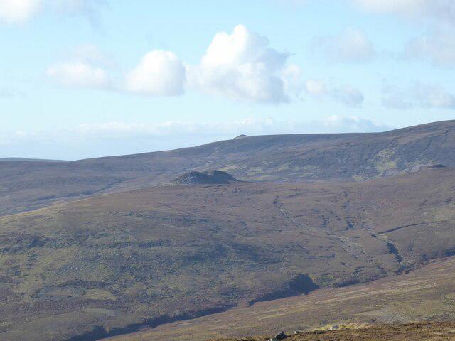 Photo could not load
NT9418 : The prominent tors of Great Standrop
Russel Wills
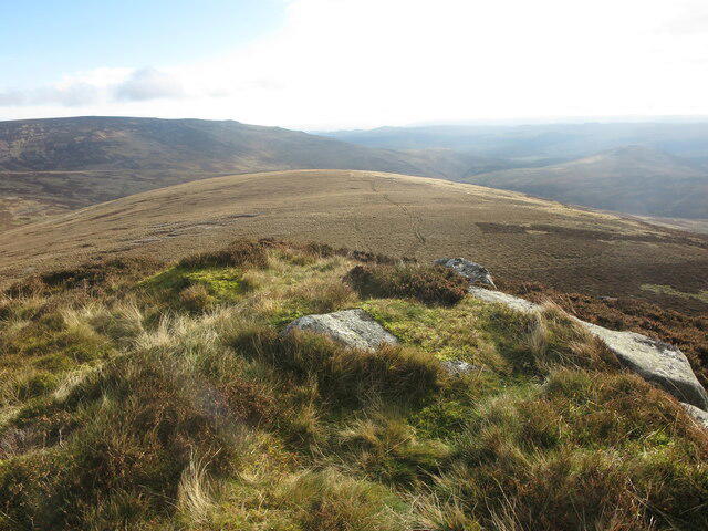 Photo could not load
NT9418 : Great Standrop
Geoff Holland
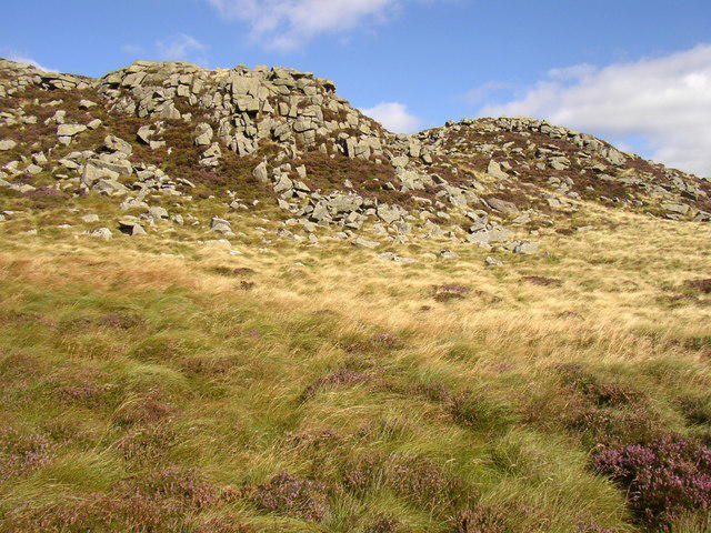 Photo could not load
NT9418 : Great Standrop, near Linhope, Ingram Valley
Kenneth Ross
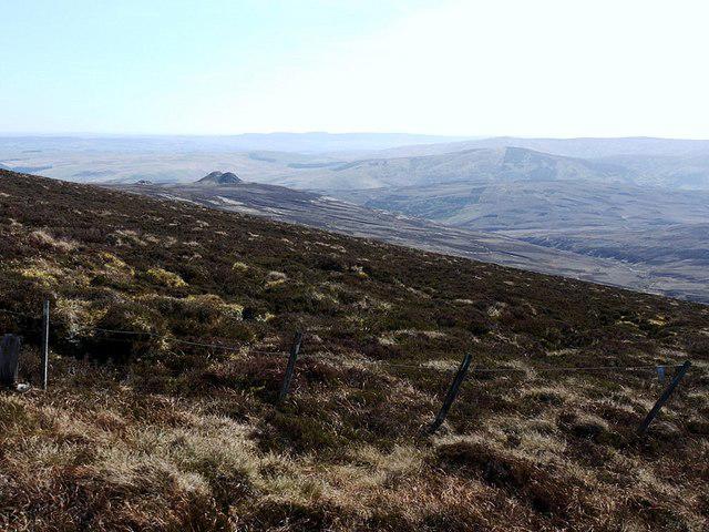 Photo could not load
NT9418 : Little & Great Standrop from ridge below Hedgehope Hill
Andrew Curtis
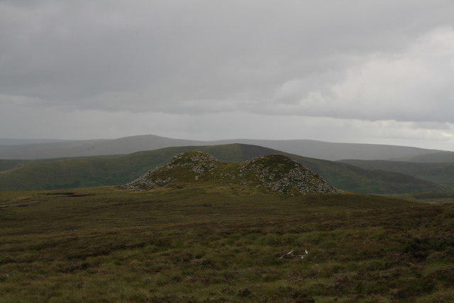 Photo could not load
NT9418 : Great Standrop
David Robinson
Hill facts and local notes
Classifications
Elevation
535m
1,755 ft
Prominence
23m
Coordinates
55.4566, -2.0920
NT942180
OS Map
80
Explorer: OL16E
At the Summit
The summit features a modest grass-covered dome with a small stone cairn marking the highest point. There is also a panoramic view from the top that makes every step worth the effort.
Terrain & Geology
Great Standrop is primarily composed of sedimentary rock formations typical of the North Pennines, with layers of limestone and sandstone that have witnessed the test of time. The surrounding area is rich in fossils and historical geological features, making it a fascinating spot for geology enthusiasts.
Views & Scenery
The summit offers breathtaking views of the surrounding North Pennines, including the impressive flanks of Cross Fell and the rich valleys below.
History & Heritage
Name Origin
The name 'Standrop' likely derives from 'stan' meaning stone and 'drop' which may refer to a steep place, quite fitting for a prominent hill!
Historical Significance
Great Standrop is part of the North Pennines Area of Outstanding Natural Beauty, a region recognised for its special landscape and biodiversity.
Getting There & Facilities
Parking
The nearest parking area is at Cow Green Reservoir car park, located off the A689 road. It is well-signposted and can accommodate several vehicles.
Public Transport
Public transport options are limited, but you can reach the area via bus services connecting to Alston Market Town, followed by a taxi to the reservoir.
Nearby Facilities
There are no facilities immediately at Great Standrop, but Alston offers cafes, shops, and toilets for hikers looking to grab a bite or refresh before their journey.
Safety Information
Known Hazards
- Uneven terrain and potential for sudden weather changes; ensure to wear appropriate footwear and carry waterproof gear.
General Safety Tips
- Check weather conditions before setting out
- Carry appropriate clothing and equipment
- Let someone know your planned route
- Take a map, compass, and GPS device
- Carry emergency supplies: food, water, first aid kit, torch
Hills
Some common questions about the hills answered
Are there group walks up Great Standrop?
Many walkers use Walkmates to join or organise walks with others. You can check for group walks around Great Standrop through the maps
Are there other walkers around Great Standrop?
Activity varies by location and time, but Walkmates lets you see whether others have shared walks or shown interest in this area. Find other people through the walking friends search walking friends for Great Standrop search or of course create your own walk for Great Standrop
Can I organise a walk to Great Standrop?
Yes. If there aren’t any walks listed already, you can create a walk and make it available for others to join.
If you're signed up to Walkmates, you can create a walk to Great Standrop.
How do I find a walk up this hill?
There are often multiple ways to walk this hill, depending on experience and route preference. Walkmates helps you explore walks and routes that others have shared.
Can I suggest a new route up Great Standrop?
Yes. You can suggest or create routes to share with others. Walkmates focuses on the social side of walking, so routes are used to help people organise walks and explore areas together, rather than as detailed navigation tools or route libraries.
Other uses really appreciate knowledgeable walkers sharing their routes. Share your favourite route to Great Standrop here
The is an error or something incorrect about this hill. How do I let you know?
We always strive to keep the information on Walkmates as accurate as possible. If you find an error, please let us know through the contact form and we'll aim to correct it as quickly as possible
Community Discussion
Comments
Location
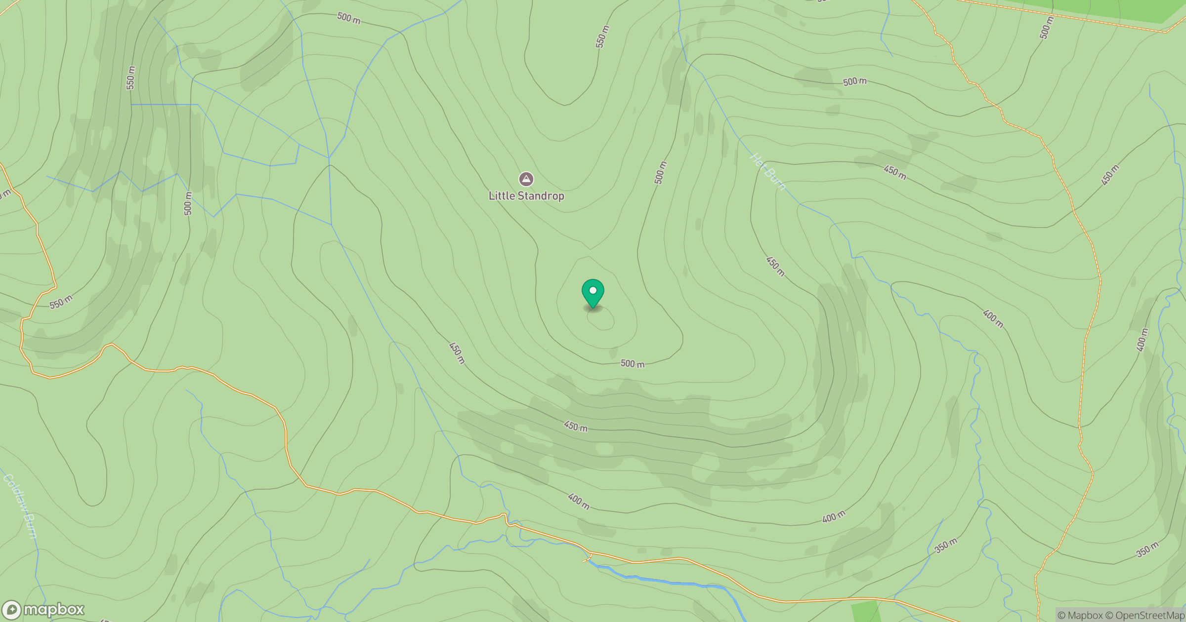
Grid reference: NT942180
View on OpenStreetMapOpens a map in a new tab, centred on the hill.




No comments yet. Be the first.