

Golden Cap
Good walks are even better shared.
SY4092 : West Dorset : Trig Point
Lewis Clarke Photo source
Overview
Golden Cap rises to 191 m above the Dorset coast between Seatown and Charmouth. Its golden Upper Greensand cap overlooks Lyme Bay, while paths link the summit with woodland and farmland on the wider National Trust estate. Expect steep climbs and exposed clifftops; check current Coast Path diversions before walking.
Golden Cap
Golden Cap stands 191 m above the Dorset coast between Seatown and Charmouth. A trig point marks the summit area; the recorded highest ground is 3 m to its north. Views follow the coast towards Lyme Regis and Chesil Beach, with Portland and Dartmoor visible in favourable conditions.
Current access warning
On 16 October 2026 the South West Coast Path Association was still displaying a February 2026 landslip closure at Stonebarrow, east of Charmouth. This affects approaches from Charmouth, rather than closing Golden Cap itself. Follow the current signed diversion and check the official notice before setting out. Do not follow old cliff-edge instructions or assume an old route distance still applies.
Choosing a walk
- Langdon Hill: follow the summit signs from the National Trust car park at SY412930, leave the woodland circuit and climb Golden Cap's eastern side. Return along the same approach. The Trust suggests 1–2 hours for the climb outing. The easy 2.24 km woodland loop is a different walk, with views of Golden Cap rather than an ascent of it.
- Seatown circuit: the South West Coast Path Association publishes a 7.2 km circuit over Golden Cap, past St Gabriel's Chapel and around Langdon Hill, returning on inland lanes. Its challenging grade reflects the steep climbing and descending. A direct return from the summit is a shorter alternative.
- Stonebarrow: Walking Britain's 8.1 km, 3.5-hour circuit starts at the eastern parking area, SY389935, and uses Upcot, St Gabriel's and Langdon Hill. The main National Trust visitor hub at SY382933 is a different start, so its distance and time cannot simply be substituted.
- Charmouth and Eype: longer coastal approaches are possible. The Charmouth-to-Seatown route is linear and needs return transport plus the current Stonebarrow diversion. An Eype Mouth out-and-back adds the climbs over Thorncombe Beacon and Doghouse Hill before Seatown and Golden Cap. Plan these using current mapping and allow for every climb on the return.
Landscape and history
The golden top is weathered Cretaceous Upper Greensand, above older Jurassic marine sediments. The rock sequence records a substantial break in geological time. Erosion and landsliding expose the geology but make the cliffs hazardous.
Four prehistoric bowl barrows on Golden Cap are scheduled; a fifth, eroding barrow is outside the protected group. Farther west, St Gabriel's Chapel and the surviving buildings mark a former medieval settlement. Keep to the paths and leave archaeological remains undisturbed.
Practicalities
Langdon Hill and Stonebarrow have National Trust parking, while Seatown's car park is independently operated. Check charges, access and opening on arrival. First Bus X51/X53 serve Chideock Bridge and Morcombelake Ship Knapp; allow time to walk between the bus stop and your chosen trailhead.
Take food and water. Seatown has toilets and refreshments, while Stonebarrow has seasonal facilities. The gentler woodland paths at Langdon are separate from the steep summit ascent. Spring flowers and autumn fungi provide interest on the estate, even when distant views are hidden.
Coastal safety
Stay far from cliff edges and bases: falls can happen suddenly in any season. Follow warning signs and diversions, avoid fresh slips, and keep dogs on leads. Mud, steps and gusts add to the difficulty. Check tides before a separate beach visit and never scramble up a cliff to escape the sea. In a coastal emergency, call 999 and ask for the Coastguard.
Explore routes near Golden Cap
Walks starting near this hill. Open a route to check its map, distance and full itinerary.
Langdon Hill Circular
View route
Dorchester Walk with Men Walking & Talking
View route
Weymouth to Sandsfoot Gardens: Rodwell Trail and Radipole waterside return
View route
Hardy's Cottage, Stinsford and Dorchester from Thorncombe Wood
View route
Route planning notes
These notes describe possible approaches. Check a route's map and access information when planning your walk.
Golden Cap from Langdon Hill (out and back)
Start at the National Trust Langdon Hill car park (SY412930). Follow signs through the woodland towards Golden Cap, leave the woodland circuit and climb the east side to the trig-point summit area. Return by the same approach. The National Trust suggests 1–2 hours for the climb outing. Its easy 2.24 km Langdon woodland loop is a separate walk and does not reach the summit.
Golden Cap, St Gabriel's Chapel and Langdon Hill from Seatown
From Seatown car park, join the westbound Coast Path from Sea Hill Lane and climb Golden Cap. Descend west on the zigzags, then turn inland to St Gabriel's Chapel. Climb back to Langdon Hill, follow the woodland circuit and return via Pettycrate Lane and Sea Hill Lane. This is the South West Coast Path Association's 7.2 km circuit; the steep summit section is omitted by its shorter alternative.
Charmouth to Seatown via Golden Cap (linear; diversion applies)
Plan this as a one-way Coast Path walk over Golden Cap, with the return journey arranged separately. A February 2026 landslip notice, still displayed on 16 October 2026, closes part of the path at Stonebarrow east of Charmouth. Follow the current signed diversion before continuing east towards Golden Cap and down to Seatown. Older cliff-edge instructions and distances should not be relied on; allow for the walk to Chideock Bridge if using the bus.
Golden Cap from Eype Mouth (coastal out and back)
Follow the signed Coast Path west from Eype Mouth, over Thorncombe Beacon and Doghouse Hill to Seatown. Continue west up Golden Cap, then retrace the route to Eype Mouth. Repeated steep climbs and descents make this substantially longer than a Seatown start. This is a planning outline of connected Coast Path sections; use current mapping and diversion notices.
Golden Cap from eastern Stonebarrow Hill via Upcot (circular)
Walking Britain's circuit starts at the eastern Stonebarrow Hill parking area (SY389935), continues via Upcot and St Gabriel's to Golden Cap, then returns through Langdon Hill and past Norchard Farm and Upcot. The published 8.1 km and 3.5 hours apply to this exact start. The National Trust visitor hub is farther west at SY382933; starting there changes the figures. Check parking access and current signs before setting off.
Make a day of it, together
Find someone to share the walk with, or organise a day out along a route you like.
Photo Gallery
View all Photo could not load
SY4092 : West Dorset : Trig Point
Lewis Clarke
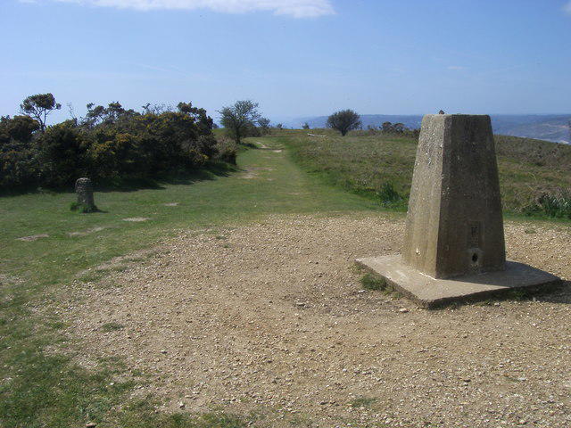 Photo could not load
SY4092 : Golden Cap
Shaun Ferguson
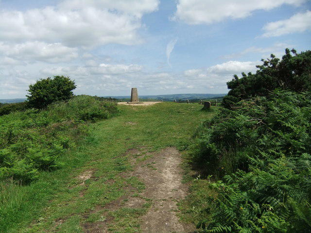 Photo could not load
SY4092 : Golden Cap
David Brown
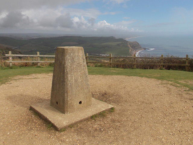 Photo could not load
SY4092 : Golden Cap: the trig point
Chris Downer
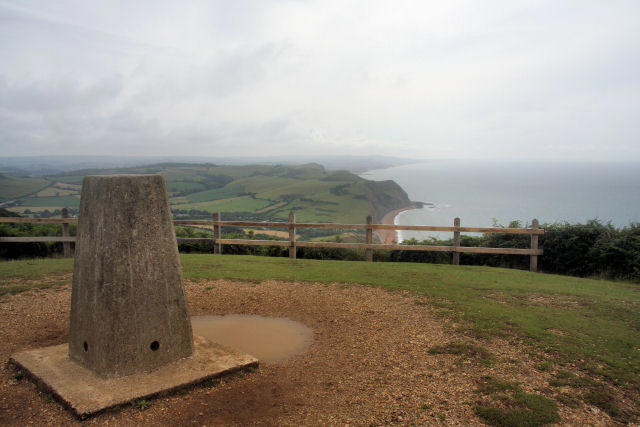 Photo could not load
SY4092 : Summit of Golden Cap
Bob Jones
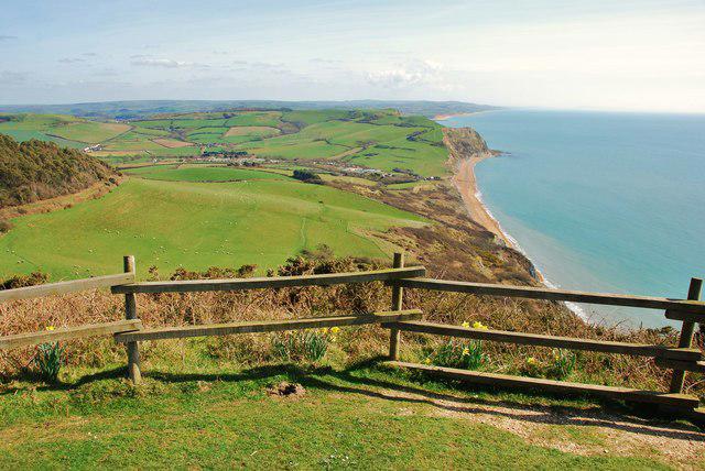 Photo could not load
SY4092 : Golden Cap: highest point on the south coast of England
Mr Eugene Birchall
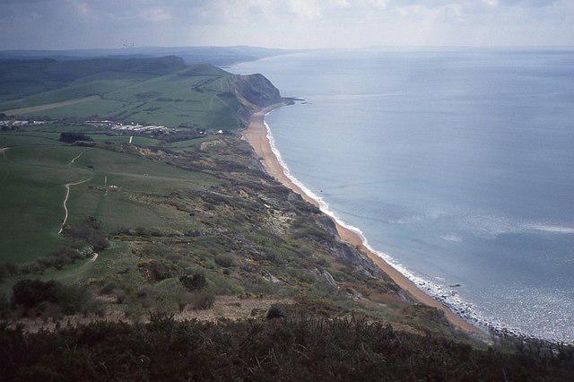 Photo could not load
SY4092 : Slopes of Golden Cap
Richard Webb
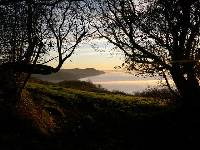 Photo could not load
SY4092 : Golden Cap in the distance
Ray Beer
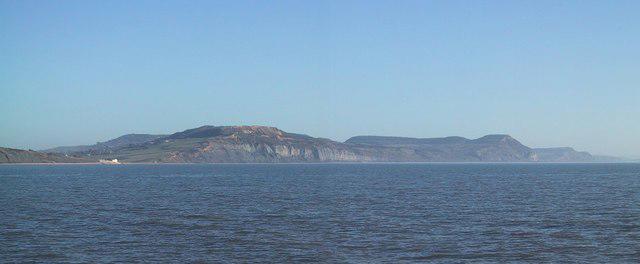 Photo could not load
SY4092 : View towards Stonebarrow Hill and Golden Cap from Lyme Regis
Sarah Charlesworth
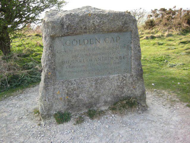
SY4092 : Memorial to the Earl of Antrim
Philip Halling
Hill facts and local notes
Classifications
Elevation
191m
627 ft
Prominence
63m
Coordinates
50.7264, -2.8412
SY407922
OS Map
193
Explorer: 116
At the Summit
The recorded highest point is ground 3 m north of the trig point. The summit area has open coastal views and prehistoric burial mounds; keep to paths and well back from cliff edges.
Terrain & Geology
Golden Cap has a Cretaceous Upper Greensand cap above older Jurassic marine clays, silts and associated sedimentary beds. Weathering changes the glauconitic sand to yellow-brown Foxmould, producing the distinctive golden colour. The contrast between the younger cap and older strata records a major gap in geological time. Coastal erosion and landsliding continue to reshape the cliffs.
Views & Scenery
Coastal views extend west towards Charmouth and Lyme Regis and east towards Seatown and Chesil Beach. In clear weather the wider panorama reaches Portland and, across Lyme Bay, Dartmoor.
Best Seasons
Spring bluebells brighten Langdon Woods and orchids occur in the estate meadows. Summer butterflies and autumn fungi add interest to the wider estate; distant summit views depend on visibility.
History & Heritage
Name Origin
The name refers to the golden-yellow weathered Upper Greensand capping the hill.
Historical Significance
Four Bronze Age bowl barrows on Golden Cap form a scheduled monument. A fifth, partly excavated barrow is subject to coastal erosion and is outside that scheduling. The wider estate includes the medieval settlement site and chapel ruins at Stanton St Gabriel; leave all archaeological remains undisturbed.
Getting There & Facilities
Parking
Choose parking for your route. National Trust car parks are at Langdon Hill (SY412930, nearest postcode DT6 6EP) and Stonebarrow Hill visitor hub (SY382933, DT6 6RA), reached by narrow lanes. Charges apply; National Trust members must validate parking. Seatown has a separate non-National Trust car park for the eastern coastal approach. Check current signs, hours and charges rather than relying on a postcode alone.
Public Transport
First Bus X51/X53 serve Chideock Bridge and Morcombelake Ship Knapp, with links to Bridport, Charmouth and Lyme Regis. Chideock is inland from Seatown, so allow an additional walk to the Coast Path and back to the bus stop. Check the timetable for your travel date and last return service.
Nearby Facilities
Plan to carry food and water for the summit. Toilets and refreshments are available at Seatown; the National Trust lists a seasonal coffee trailer and toilets at Stonebarrow. These facilities are away from the summit and have limited opening. Langdon Hill has a separate, more accessible woodland circuit; this does not make the steep summit route wheelchair-accessible.
Safety Information
Known Hazards
- Unstable cliffs can collapse without warning. Keep well back from cliff edges and bases; do not approach fresh landslips.
- Steep steps, mud and wet paths need care. Strong coastal gusts can affect balance.
- A February 2026 Coast Path landslip closure at Stonebarrow east of Charmouth was still listed on 16 October 2026. Follow current diversion and safety signs.
- Keep dogs on a lead near cliffs and livestock. Avoid unsigned paths down to beaches and never use cliffs as a shortcut.
- Beach visits add tidal-cutoff and falling-rock risks. In a coastal emergency call 999 and ask for the Coastguard.
Seasonal Hazards
Cliff falls are possible in every season, including dry summer weather. Prolonged rain, frost and storms can worsen instability and slippery ground. Check the forecast and current path notices; carry suitable footwear, layers, food, water and navigation.
General Safety Tips
- Check weather conditions before setting out
- Carry appropriate clothing and equipment
- Let someone know your planned route
- Take a map, compass, and GPS device
- Carry emergency supplies: food, water, first aid kit, torch
Hills
Some common questions about the hills answered
Are there group walks up Golden Cap?
Many walkers use Walkmates to join or organise walks with others. You can check for group walks around Golden Cap through the maps
Are there other walkers around Golden Cap?
Activity varies by location and time, but Walkmates lets you see whether others have shared walks or shown interest in this area. Find other people through the walking friends search walking friends for Golden Cap search or of course create your own walk for Golden Cap
Can I organise a walk to Golden Cap?
Yes. If there aren’t any walks listed already, you can create a walk and make it available for others to join.
If you're signed up to Walkmates, you can create a walk to Golden Cap.
How do I find a walk up this hill?
There are often multiple ways to walk this hill, depending on experience and route preference. Walkmates helps you explore walks and routes that others have shared.
Can I suggest a new route up Golden Cap?
Yes. You can suggest or create routes to share with others. Walkmates focuses on the social side of walking, so routes are used to help people organise walks and explore areas together, rather than as detailed navigation tools or route libraries.
Other uses really appreciate knowledgeable walkers sharing their routes. Share your favourite route to Golden Cap here
The is an error or something incorrect about this hill. How do I let you know?
We always strive to keep the information on Walkmates as accurate as possible. If you find an error, please let us know through the contact form and we'll aim to correct it as quickly as possible
Community Discussion
Comments
Location
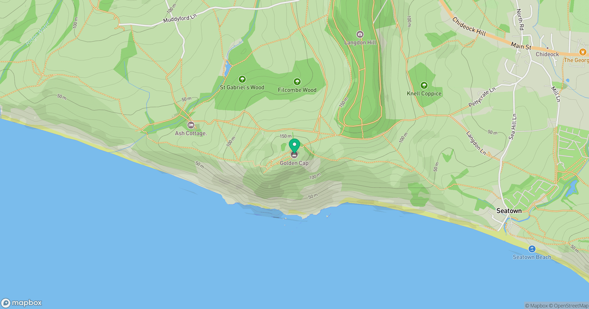
Grid reference: SY407922
View on OpenStreetMapOpens a map in a new tab, centred on the hill.



No comments yet. Be the first.