

Docker Knott
Good walks are even better shared.
SD6599 : Cairn, Docker Knott
Michael Graham Photo source
Overview
Docker Knott: The Lesser-Known Jewel of the Lake District
Docker Knott, soaring at 635 meters, may not be the highest summit in the Lake District, but its unique charm and stunning vistas make it a must-visit for hiking enthusiasts.
Geology
Docker Knott is a geological wonder, primarily made up of Skiddaw slate. This sedimentary rock harks back to the Ordovician period and is known for its fine texture. As you navigate the paths, keep an eye out for micro-fossils embedded within the rock layers—a thrilling find for geology buffs!
Routes
The Docker Knott Circular Route is a popular choice, starting from the picturesque village of Dockray. Spanning 8.5 km and taking approximately 3.5 hours, it’s a moderate trek that offers a bit of everything—woodlands, scenic vistas, and that rewarding summit experience.
Summit Features
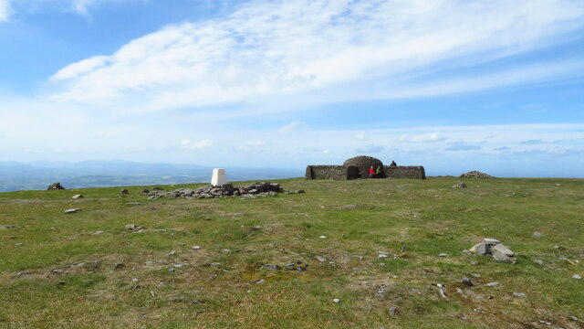
On reaching the summit, hikers are greeted by a modest stone cairn surrounded by breathtaking views. Make sure to snap a few photos; after all, it didn't take you long to walk up, did it?
Terrain Type
Expect a mix of grassy slopes and rocky patches, with a few boggy areas sprinkled in for that authentic Lake District experience. Gaiters are recommended if the umpteenth British drizzle has made an appearance!
Views
From the top, the sight of the Helvellyn range and Ullswater is simply unforgettable. Best times to witness such beauty? Late spring or early autumn, when the scenery is most vivid and the weather conditions are favourable.
Hazards
While hiking is generally safe, be cautious of slippery rocks, particularly after a downpour. A bit of mud never hurt anyone, but you don’t want to end up face-first in it!
Access
The nearest car park is situated in Dockray, offering a convenient base for your adventure. Public transport lovers can rejoice as there are regular bus routes from Penrith to the village, making it accessible without a car.
Facilities
After your workout, why not treat yourself? Dockray has a few delightful cafes—not to mention public toilets for post-hike freshening up. Perfect for refuelling before your trip back!
History
The name Docker comes from Old Norse, translating to 'ridge', while Knot may refer to a shape in the landscape. Historically, this area served as a landmark for local shepherds, standing as a steadfast companion in the rugged fells.
For those who don’t mind a bit of a climb to witness nature at its best, Docker Knott is waiting for you, undiscovered and ready. Pack your bags, lace up those boots, and enjoy the great outdoors!
Explore routes near Docker Knott
Walks starting near this hill. Open a route to check its map, distance and full itinerary.
Sizergh: Park End Moss and Brigsteer Park Wood Circuit
View route
Ingleton Waterfalls Walk
View route
Pen-y-ghent from Horton in Ribblesdale
View route
Yorkshire Three Peaks Challenge – Gentle Pace
View route
Route planning notes
These notes describe possible approaches. Check a route's map and access information when planning your walk.
Docker Knott Circular Route
A delightful circular walk starting from the village of Dockray, this route takes you through scenic landscapes and lush woodlands before ascending to the summit of Docker Knott.
Make a day of it, together
Find someone to share the walk with, or organise a day out along a route you like.
Photo Gallery
View all Photo could not load
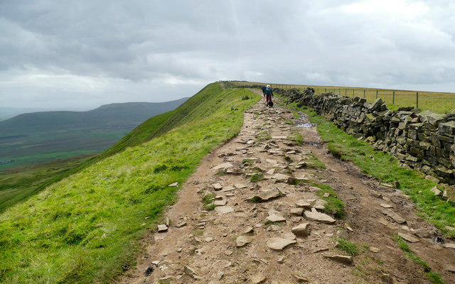
SD6599 : Cairn, Docker Knott
Michael Graham
 Photo could not load
SD6599 : Just three stones...
John H Darch
 Photo could not load
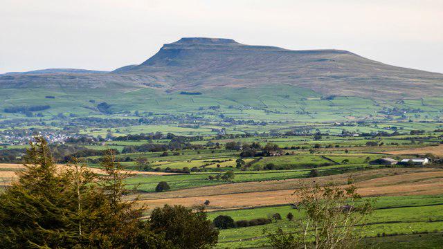
SD6599 : Docker Knott from Over Sale
Raymond Knapman
Hill facts and local notes
Classifications
Elevation
529m
1,736 ft
Prominence
20m
Coordinates
54.3936, -2.5367
SD652999
OS Map
97
Explorer: OL19S
At the Summit
The summit of Docker Knott features a small stone cairn and a fantastic 360-degree view of the surrounding fells, which can be quite a sight for sore eyes after a hearty ascent.
Terrain & Geology
Docker Knott is primarily composed of Skiddaw slate, which is known for its fine-grained texture and dark colour. The area is rich in geological history, showcasing sedimentary deposits from the Ordovician period.
Views & Scenery
The Helvellyn range, Ullswater, and the Pennines provide a picturesque backdrop from the summit. On a clear day, you may spot the distinctive shape of the High Street ridge.
History & Heritage
Name Origin
The name 'Docker' is believed to derive from Old Norse, meaning 'a ridge or a hill', while 'Knot' may refer to a knot or knoll in the landscape.
Historical Significance
Docker Knott has served as a landmark for travellers and local shepherds, providing a strategic viewpoint in the rugged Lake District.
Getting There & Facilities
Parking
You can park at the Dockray village car park, which provides a good starting point for your adventure. Be sure to check for any parking fees.
Public Transport
Regular bus services operate from Penrith to Dockray, making it accessible for those using public transport.
Nearby Facilities
There are several cafes in the nearby village of Dockray, as well as public toilets. Bring your own packed lunch to enjoy at the summit!
Safety Information
Known Hazards
- Watch out for slippery rocks and occasional boggy areas, especially in wet weather. Additionally, be mindful of sudden weather changes typical of the Lake District.
General Safety Tips
- Check weather conditions before setting out
- Carry appropriate clothing and equipment
- Let someone know your planned route
- Take a map, compass, and GPS device
- Carry emergency supplies: food, water, first aid kit, torch
Hills
Some common questions about the hills answered
Are there group walks up Docker Knott?
Many walkers use Walkmates to join or organise walks with others. You can check for group walks around Docker Knott through the maps
Are there other walkers around Docker Knott?
Activity varies by location and time, but Walkmates lets you see whether others have shared walks or shown interest in this area. Find other people through the walking friends search walking friends for Docker Knott search or of course create your own walk for Docker Knott
Can I organise a walk to Docker Knott?
Yes. If there aren’t any walks listed already, you can create a walk and make it available for others to join.
If you're signed up to Walkmates, you can create a walk to Docker Knott.
How do I find a walk up this hill?
There are often multiple ways to walk this hill, depending on experience and route preference. Walkmates helps you explore walks and routes that others have shared.
Can I suggest a new route up Docker Knott?
Yes. You can suggest or create routes to share with others. Walkmates focuses on the social side of walking, so routes are used to help people organise walks and explore areas together, rather than as detailed navigation tools or route libraries.
Other uses really appreciate knowledgeable walkers sharing their routes. Share your favourite route to Docker Knott here
The is an error or something incorrect about this hill. How do I let you know?
We always strive to keep the information on Walkmates as accurate as possible. If you find an error, please let us know through the contact form and we'll aim to correct it as quickly as possible
Community Discussion
Comments
Location
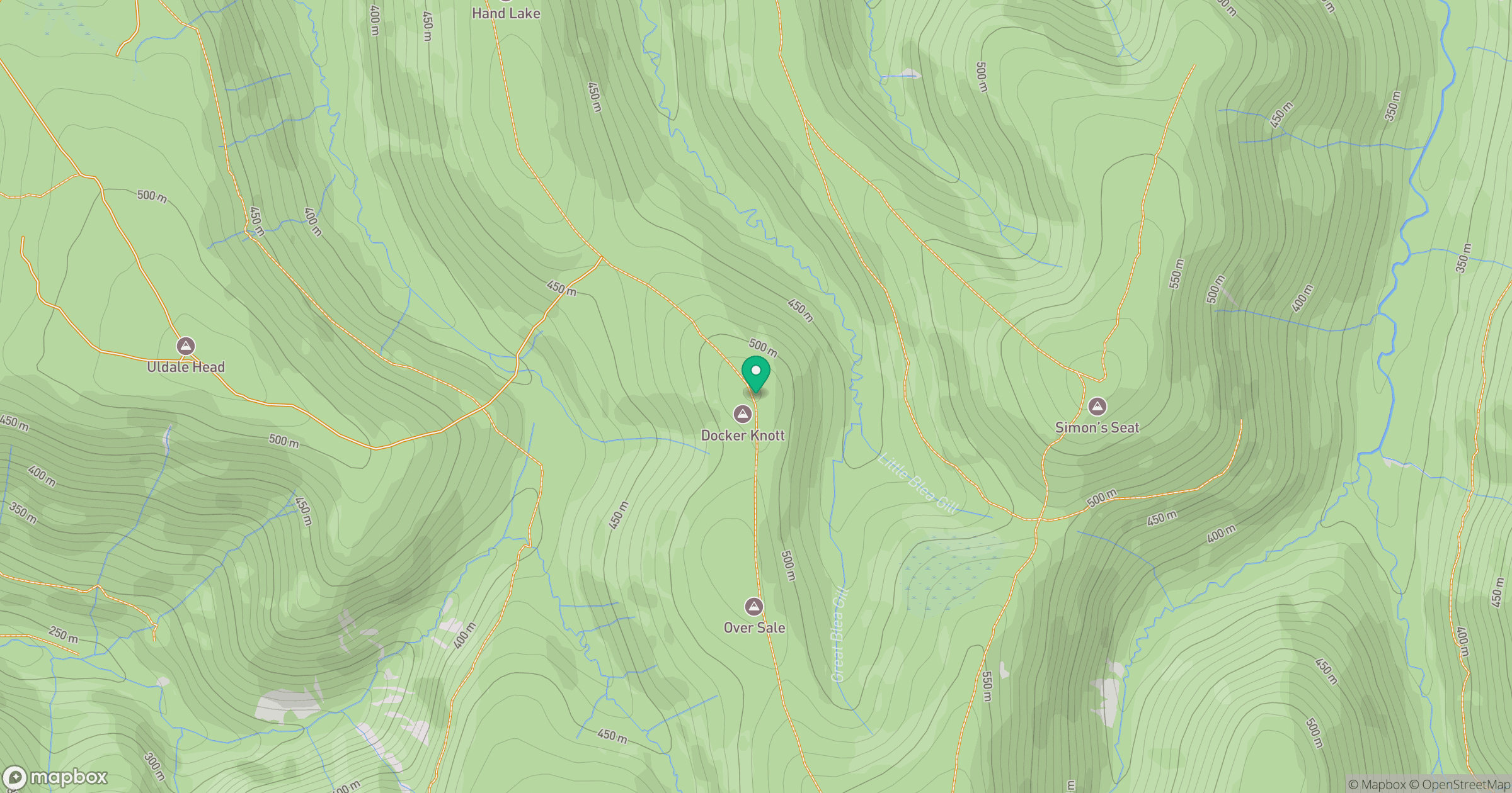
Grid reference: SD652999
View on OpenStreetMapOpens a map in a new tab, centred on the hill.
No comments yet. Be the first.