

Craig Cerrig-gleisiad
Good walks are even better shared.
SN9521 : Near the summit of Craig Cerrig-gleisaid
David Purchase Photo source
Overview
Craig Cerrig-gleisiad
Overview
Situated in the heart of the Brecon Beacons National Park, Craig Cerrig-gleisiad stands at a proud 800 meters (roughly 2,625 feet) above sea level. This Marilyn offers not just a pleasing challenge for the passionate hiker but also a delightful medley of landscapes that can make the oldest of souls feel like a kid again.
Geology
This mountain is predominantly made of sandstone, which offers both solid footing and fascinating geological features. The cliffs provide an unmistakable silhouette against the horizon, and close examination reveals intricate patterns formed by time and the elements.
Routes
Cwm Cadlan Route
Starting at Cwm Cadlan, this route meanders through beautiful valleys filled with flora and singing streams. A moderate trek of around 6.5 km takes approximately 3.5 hours and is perfect for those who fancy a leisurely stroll whilst getting a bit of exercise.
Craig Cerrig-gleisiad Ridge Walk
For those wanting to push their limits, the Ridge Walk is both challenging and rewarding, clocking in at about 8 km. Expect a 4-hour journey that includes some dramatic views and invigorating climbs.
Summit Features
The summit is topped with a well-constructed but humble cairn, serving as a perfect backdrop for your selfies while you enjoy the panoramic vistas.
Views
At the summit, clarity is your friend: you might just catch a glimpse of distant Pen y Fan – a sight that will make your legs ache less in remembrance of the climb! Spring and autumn are ideal seasons as the wildflowers add splashes of colour to your view.
Hazards
The cliffs may beckon, but do tread cautiously! Steep drop-offs and unpredictable weather are two things every hiker should keep an eye on. Always check the weather beforehand and be prepared for some good old British drizzle!
Nearby Summits
Adventurous spirits can extend their expedition by hiking to nearby peaks such as Fan Fawr (734 m) and Pen y Fan (886 m).
Access
The best way to access Craig Cerrig-gleisiad is from Cwm Cadlan car park (SN979239). A warning: it may fill up quickly, especially on weekends! Public transport may be a little bit of a trek, but Brecon's bus services do offer some connections on weekends.
Facilities
While the mountain itself offers no facilities, Brecon, the nearest town, has everything you need – cafés, public toilets, and shops to restock before your trek.
History
The name 'Craig Cerrig-gleisiad' hints at a heritage intertwined with the landscape, often echoing tales of ancient peoples and cultures that celebrated this very rock.
In conclusion, Craig Cerrig-gleisiad is not just a climb; it’s an adventure waiting to be told. Lace up those hiking boots, grab your pack, and let the wild whispers of the Brecon Beacons draw you in!
Happy hiking!
Explore routes near Craig Cerrig-gleisiad
Walks starting near this hill. Open a route to check its map, distance and full itinerary.
Pen y Fan via Corn Du from Storey Arms
View route
Brecon Basin to Brynich Aqueduct: Canal Towpath Walk
View route
Aircraft Crash Site - Wellington Bomber and Vampire Jet (Black Mountain range)
View route
Usk Reservoir: Glasfynydd Forest and Dam Circuit
View route
Route planning notes
These notes describe possible approaches. Check a route's map and access information when planning your walk.
Cwm Cadlan Route
A scenic route starting from Cwm Cadlan that takes you through lush valleys and past babbling brooks before ascending to the summit.
Craig Cerrig-gleisiad Ridge Walk
An exhilarating ridge walk that offers stunning panoramic views of the Brecon Beacons, with a few steep sections to challenge your legs.
Make a day of it, together
Find someone to share the walk with, or organise a day out along a route you like.
Photo Gallery
View all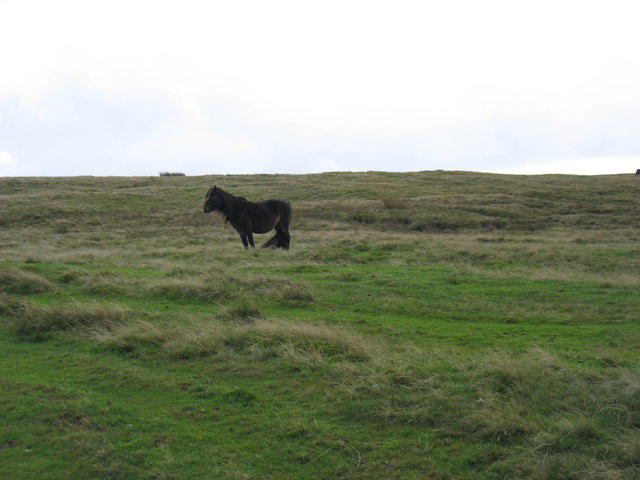 Photo could not load
SN9521 : Near the summit of Craig Cerrig-gleisaid
David Purchase
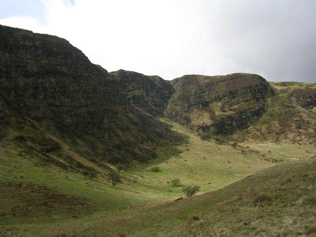 Photo could not load
SN9621 : Craig Cerrig Gleisiad
Oliver Dixon
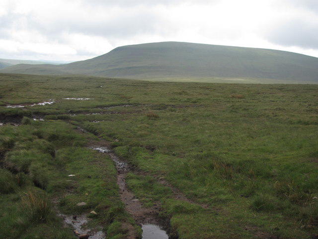 Photo could not load
SN9621 : Moorland between Craig Cerrig-gleisiad and Fan Fawr
John Light
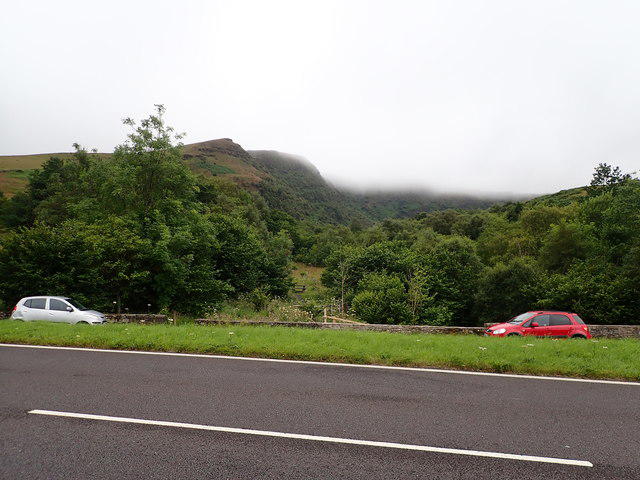 Photo could not load
SN9621 : Low cloud over Graig Cerrig-Gleisiad
Eirian Evans
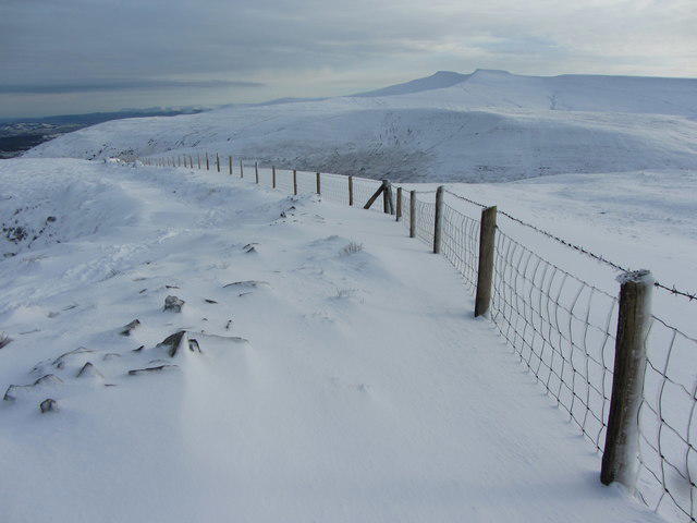 Photo could not load
SN9621 : View east from Craig Cerrig-gleisiad
Gareth James
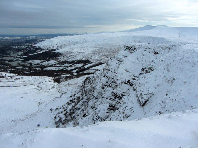 Photo could not load
SN9621 : The cliffs of Craig Cerrig-gleisiad
Gareth James
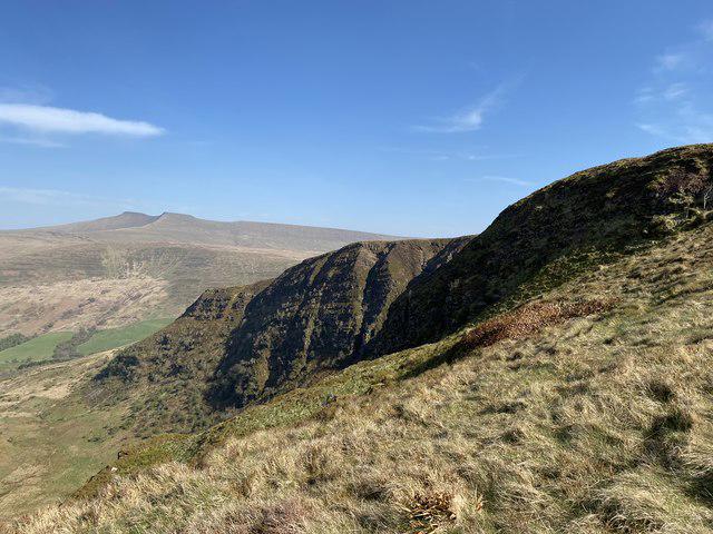 Photo could not load
SN9621 : Craig Cerrig-gleisiad
Alan Hughes
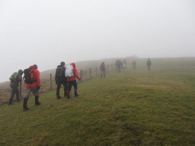 Photo could not load
SN9621 : Beacons Way on Craig Cerrig-gleisiad
Gareth James
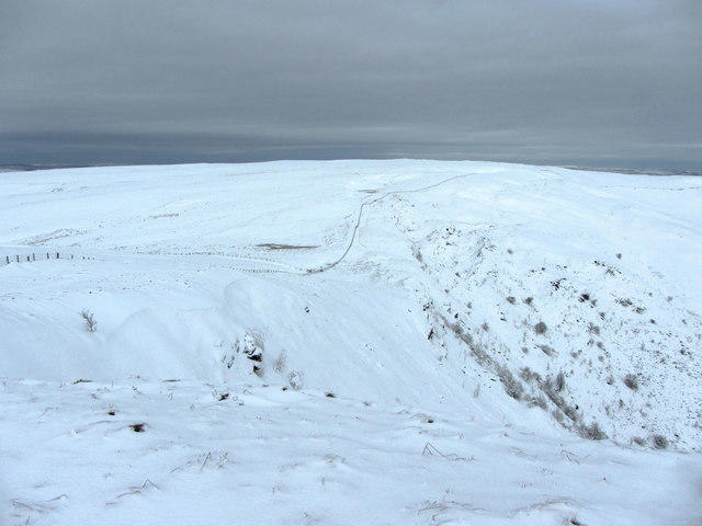 Photo could not load
SN9621 : View north from Craig Cerrig-gleisiad
Gareth James
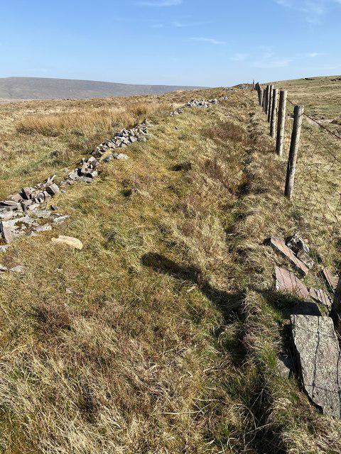
SN9621 : Wall and fence on Fan Frynych
Alan Hughes
Hill facts and local notes
Classifications
Elevation
629m
2,064 ft
Prominence
75m
Coordinates
51.8850, -3.5115
SN960217
OS Map
160
Explorer: OL12E
At the Summit
At the summit, you will find a prominent cairn that offers a perfect spot for photographs, alongside breathtaking views of the surrounding peaks and valleys.
Terrain & Geology
The mountain is primarily composed of sandstone, which forms spectacular cliff faces and interesting rock formations. Notably, the surrounding valleys exhibit interesting glacial and riverine features.
Views & Scenery
On a clear day, the summit offers views of Pen y Fan, Cribyn, and the distant Black Mountains, making it a photographer's dream.
History & Heritage
Name Origin
The name 'Craig Cerrig-gleisiad' translates to 'rock of the blue stones', potentially referencing the bluish hue of the surrounding rocks or the heather growing in the area.
Historical Significance
This mountain is significant not only for its beauty but also for the rich biodiversity in the area. A popular site for both hiking and bird-watching.
Getting There & Facilities
Parking
The nearest parking is at Cwm Cadlan car park (SN979239), offering ample space but can fill quickly during weekends.
Public Transport
The nearest public transport options are limited, but the Brecon Beacons Buses service runs on weekends, connecting to nearby villages.
Nearby Facilities
Amenities such as cafés and public toilets are found in Brecon, along with several local shops for supplies.
Safety Information
Known Hazards
- Be cautious of steep drop-offs, particularly near the edges of the cliffs. Weather can change suddenly, resulting in reduced visibility.
General Safety Tips
- Check weather conditions before setting out
- Carry appropriate clothing and equipment
- Let someone know your planned route
- Take a map, compass, and GPS device
- Carry emergency supplies: food, water, first aid kit, torch
Hills
Some common questions about the hills answered
Are there group walks up Craig Cerrig-gleisiad?
Many walkers use Walkmates to join or organise walks with others. You can check for group walks around Craig Cerrig-gleisiad through the maps
Are there other walkers around Craig Cerrig-gleisiad?
Activity varies by location and time, but Walkmates lets you see whether others have shared walks or shown interest in this area. Find other people through the walking friends search walking friends for Craig Cerrig-gleisiad search or of course create your own walk for Craig Cerrig-gleisiad
Can I organise a walk to Craig Cerrig-gleisiad?
Yes. If there aren’t any walks listed already, you can create a walk and make it available for others to join.
If you're signed up to Walkmates, you can create a walk to Craig Cerrig-gleisiad.
How do I find a walk up this hill?
There are often multiple ways to walk this hill, depending on experience and route preference. Walkmates helps you explore walks and routes that others have shared.
Can I suggest a new route up Craig Cerrig-gleisiad?
Yes. You can suggest or create routes to share with others. Walkmates focuses on the social side of walking, so routes are used to help people organise walks and explore areas together, rather than as detailed navigation tools or route libraries.
Other uses really appreciate knowledgeable walkers sharing their routes. Share your favourite route to Craig Cerrig-gleisiad here
The is an error or something incorrect about this hill. How do I let you know?
We always strive to keep the information on Walkmates as accurate as possible. If you find an error, please let us know through the contact form and we'll aim to correct it as quickly as possible
Community Discussion
Comments
Location
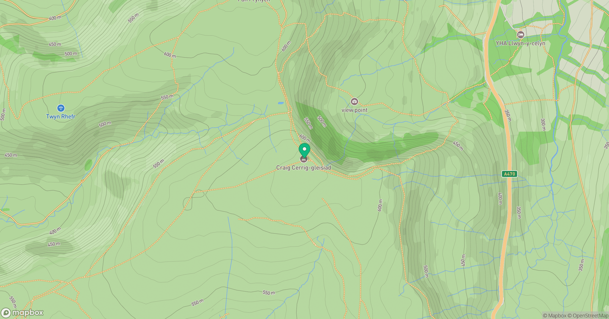
Grid reference: SN960217
View on OpenStreetMapOpens a map in a new tab, centred on the hill.


No comments yet. Be the first.