

Cissbury Ring
Good walks are even better shared.
TQ1408 : NE rampart of Cissbury Ring - and view beyond
Ian Hawfinch Photo source
Overview
Cissbury Ring is a 184 m chalk hill above Findon Valley, north of Worthing in the South Downs National Park. Its open grassland surrounds an Iron Age hillfort and much earlier Neolithic flint mines. A trig point marks the summit area, with broad coastal and downland views.
Cissbury Ring
Cissbury Ring rises to 184 m above Findon Valley, north of Worthing, in the South Downs National Park. Its 53 m prominence and summit position come from the Database of British and Irish Hills. The highest ground is beside the trig point within the hillfort.
Landscape and archaeology
The hill is a chalk spur with a clay-with-flints cap. Neolithic miners dug shafts and underground galleries to extract flint, leaving hollows and spoil mounds that remain visible in the grassland. These mines are older than the Iron Age hillfort, built around 400 BC.
The hillfort's banks and ditch enclose roughly 24 hectares. Historic England also records Bronze Age burial remains, Iron Age and Roman field systems, Roman settlement, medieval cultivation and later defensive uses. The surviving earthworks represent several periods, rather than one untouched fort.
Worthing's heritage guide suggests the modern name probably reflects sixteenth-century attempts to associate the site with the Saxon Cissa.
Walking routes
The Cissbury Ring Circular Walk described here follows the National Trust's history and nature trail. It starts and finishes at Storrington Rise car park, TQ129076, and covers 3.52 km in a published 1–1.5 hours. The route climbs to the ramparts, enters from the south, crosses to the trig point, and follows the eastern and northern earthworks before returning down the approach. National Trust grades it moderate. Steps, kissing gates and short steep sections make it unsuitable as a step-free outing.
The separate National Trust butterfly walk is a 4.8 km return circuit from the same car park, with 3 hours allowed for exploring wildlife habitat. Its easy grade applies to that itinerary, which uses steps and includes a stile. It explores ramparts, flint mines and adjoining grassland rather than specifying a trig-point visit. Use the mapped guide for the chosen trail; the two distances describe different routes.
A longer outing can link Cissbury with Chanctonbury Ring and the South Downs Way. That is a separate walk, not part of the short summit circuit.
Views and wildlife
The coastal plain and surrounding Downs spread out below the hill. In clear conditions the Isle of Wight and chalk cliffs beyond Brighton can be visible. Chanctonbury Ring lies to the north. Downland flowers and butterflies are a highlight in spring and summer, with chalkhill blues especially associated with July and August. Migrating birds use the hill in spring and autumn.
Access and facilities
Storrington Rise car park in Findon Valley, BN14 0HT, is the National Trust's recommended walking start but is not a Trust car park. Allow approximately 20 minutes uphill to the ring. Check signs before parking.
Metrobus 23 runs between Worthing and Crawley via Horsham and Findon Valley. Stagecoach 1 runs between Worthing and Midhurst via Findon. National Trust directions for the Storrington Rise approach use the May Tree Avenue stop on the A24, then the walk along May Tree Avenue and Storrington Rise. Check current timetables, stops and the last return service.
There are no toilets on the hill. Council-listed toilets are on Findon Road near Findon Valley library and Lime Tree Avenue, with seasonal hours; the accessible facility needs a RADAR key. Findon Valley has cafés, and the history trail identifies benches on the hill.
Walking safely and caring for the site
Chalk and flint paths, uneven earthworks and steps can become slippery in wet weather. Take care on slopes and rampart edges. Keep dogs on leads and give the grazing ponies space; do not feed them. Use the paths with care around the archaeological remains and follow local signs.
Other hills
Chanctonbury Ring is 242 m; Devil's Dyke, farther east, is 216.5 m in the Database of British and Irish Hills. These are separate hills with their own routes and access arrangements.
Explore routes near Cissbury Ring
Walks starting near this hill. Open a route to check its map, distance and full itinerary.
Littlehampton Walk & Talk
View route
Littlehampton Walk & Talk
View route
Littlehampton Walk & Talk
View route
Brighton Walk with Men Walking & Talking
View route
Route planning notes
These notes describe possible approaches. Check a route's map and access information when planning your walk.
Cissbury Ring Circular Walk
National Trust history and nature trail: start and finish at Storrington Rise car park (TQ129076). Climb to the ramparts, enter by the southern entrance, cross to the trig point, then follow the eastern and northern earthworks before descending by the original approach. Full circuit: 3.52 km; allow 1–1.5 hours. Steps, kissing gates and short steep sections; chalk can be slippery when wet.
Cissbury Ring Butterfly Walk
National Trust nature circuit from and back to Storrington Rise car park (TQ129076), exploring ramparts, northern grassland and flint-mine hollows, with the return by the wood edge. The published 4.8 km trail allows 3 hours for wildlife watching and includes steps, a stile and kissing gates. It does not specify a visit to the trig point.
Make a day of it, together
Find someone to share the walk with, or organise a day out along a route you like.
Photo Gallery
View all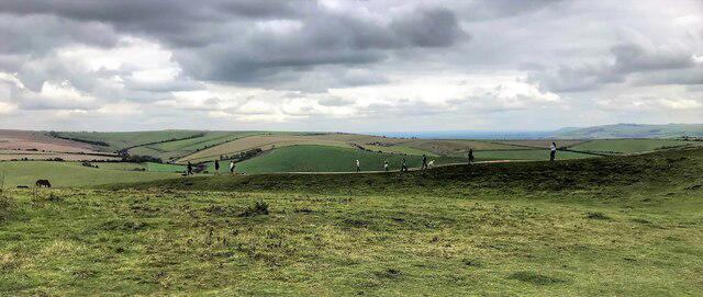 Photo could not load
TQ1408 : NE rampart of Cissbury Ring - and view beyond
Ian Hawfinch
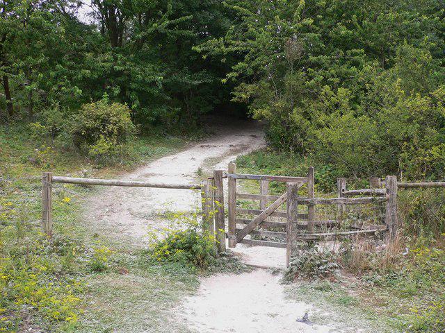 Photo could not load
TQ1308 : Gateway to Cissbury Ring
Shazz
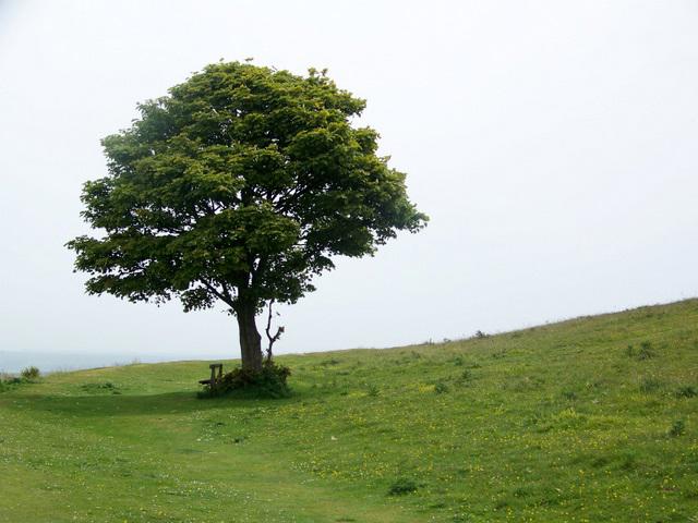 Photo could not load
TQ1308 : Tree, Cissbury Ring
Maigheach-gheal
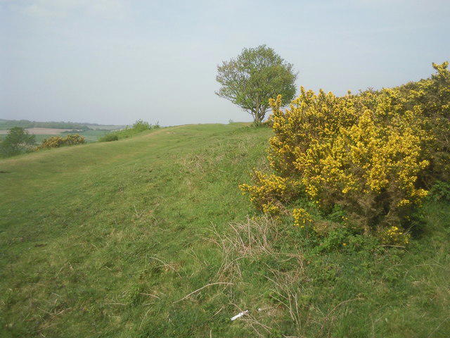 Photo could not load
TQ1308 : In the central area of Cissbury Ring
Marathon
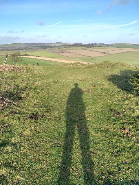 Photo could not load
TQ1408 : Looking from Cissbury Ring towards Canada Bottom and Stump Bottom
Martyn Pattison
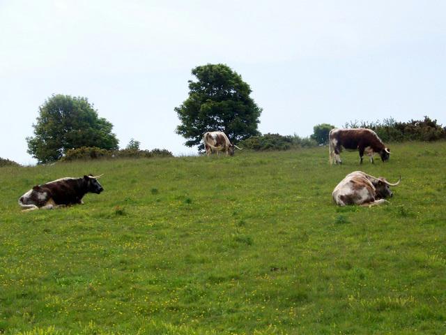 Photo could not load
TQ1408 : Longhorn Cattle, Cissbury Rings
Maigheach-gheal
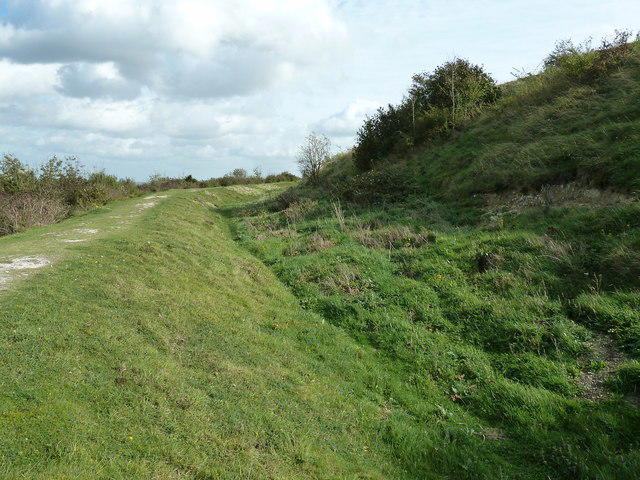 Photo could not load
TQ1408 : Ramparts on the NE side of Cissbury Ring
Dave Spicer
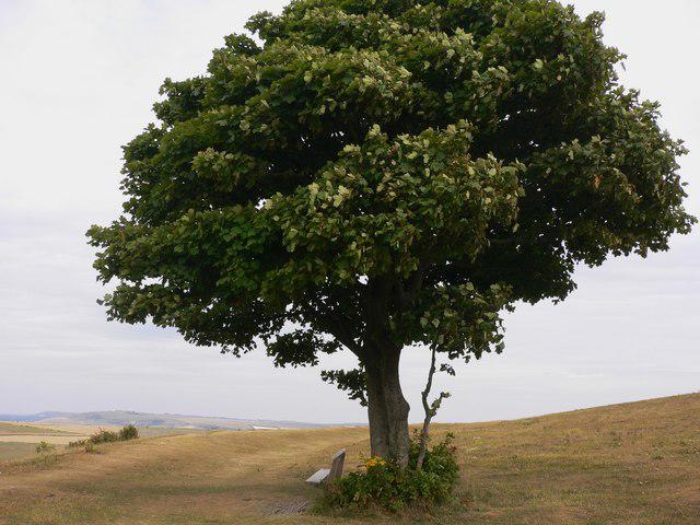 Photo could not load
TQ1408 : Seat under tree on top of Cissbury Hill
Shazz
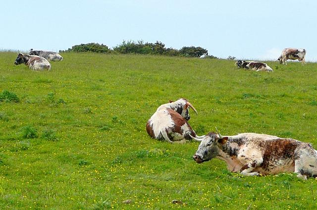 Photo could not load
TQ1408 : Cattle at Cissbury Ring
Graham Horn
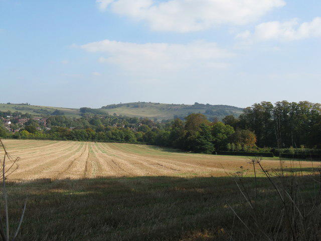
TQ1308 : Cissbury Ring viewed from the western side of Findon valley
Dave Spicer
Hill facts and local notes
Classifications
Elevation
184m
604 ft
Prominence
53m
Coordinates
50.8619, -0.3807
TQ140081
OS Map
198
Explorer: OL10 121
At the Summit
The highest ground is beside the trig point, within the hillfort. The surrounding ramparts, ditch and flint-mine hollows are archaeological earthworks rather than a separate rocky summit.
Terrain & Geology
A chalk spur capped by clay-with-flints forms the hill. Neolithic miners sank shafts and galleries to reach flint seams within the chalk; the surviving hollows and spoil mounds are evidence of extraction, rather than flint itself being evidence of human activity.
Views & Scenery
The views from the summit include the rolling hills of the South Downs, the coastal plain, and on a clear day, the distant Isle of Wight.
Best Seasons
Spring and summer bring chalk-downland flowers and butterflies. Chalkhill blues are especially associated with July and August; migratory birds use the hill in spring and autumn. Distant coastal views depend on visibility rather than a particular season.
History & Heritage
Name Origin
Worthing’s heritage guide suggests the modern name probably reflects sixteenth-century attempts to associate the site with the Saxon Cissa.
Historical Significance
Neolithic flint mines predate the hillfort, which Historic England dates to around 400 BC. The scheduled monument also contains Bronze Age burial remains, Iron Age and Roman fields and settlement, and evidence of medieval cultivation and later military use. Its banks, ditch and mining hollows preserve several distinct phases of activity.
Getting There & Facilities
Parking
National Trust directions use Storrington Rise car park, Findon Valley, BN14 0HT (TQ129076). It is not a National Trust car park; allow about 20 minutes uphill to the ring. The Trust lists 30 free spaces and 24-hour opening, but check local signs. The history and nature trail starts and finishes here.
Public Transport
Metrobus 23 links Worthing with Horsham and Crawley via Findon Valley; Stagecoach 1 links Worthing with Midhurst via Findon. For the Storrington Rise approach, National Trust directions use May Tree Avenue on the A24, followed by a walk along May Tree Avenue and Storrington Rise. Check the operators’ current timetables and return services; the hill is reached on foot.
Nearby Facilities
There are no toilets on the hill. Public toilets are on Findon Road by Findon Valley library and Lime Tree Avenue (BN14 0DH); council opening hours vary seasonally and the accessible toilet requires a RADAR key. Cafés are in Findon Valley. Benches are identified on the National Trust history trail.
Safety Information
Known Hazards
- Chalk and flint paths, steps and uneven earthworks can be slippery when wet; take care on slopes and rampart edges.
- Grazing ponies help manage the grassland. Do not feed them, give them space and keep dogs on a lead.
- The summit circuit has steps, kissing gates and steep sections; it is not a step-free route.
General Safety Tips
- Check weather conditions before setting out
- Carry appropriate clothing and equipment
- Let someone know your planned route
- Take a map, compass, and GPS device
- Carry emergency supplies: food, water, first aid kit, torch
Hills
Some common questions about the hills answered
Are there group walks up Cissbury Ring?
Many walkers use Walkmates to join or organise walks with others. You can check for group walks around Cissbury Ring through the maps
Are there other walkers around Cissbury Ring?
Activity varies by location and time, but Walkmates lets you see whether others have shared walks or shown interest in this area. Find other people through the walking friends search walking friends for Cissbury Ring search or of course create your own walk for Cissbury Ring
Can I organise a walk to Cissbury Ring?
Yes. If there aren’t any walks listed already, you can create a walk and make it available for others to join.
If you're signed up to Walkmates, you can create a walk to Cissbury Ring.
How do I find a walk up this hill?
There are often multiple ways to walk this hill, depending on experience and route preference. Walkmates helps you explore walks and routes that others have shared.
Can I suggest a new route up Cissbury Ring?
Yes. You can suggest or create routes to share with others. Walkmates focuses on the social side of walking, so routes are used to help people organise walks and explore areas together, rather than as detailed navigation tools or route libraries.
Other uses really appreciate knowledgeable walkers sharing their routes. Share your favourite route to Cissbury Ring here
The is an error or something incorrect about this hill. How do I let you know?
We always strive to keep the information on Walkmates as accurate as possible. If you find an error, please let us know through the contact form and we'll aim to correct it as quickly as possible
Community Discussion
Comments
Location
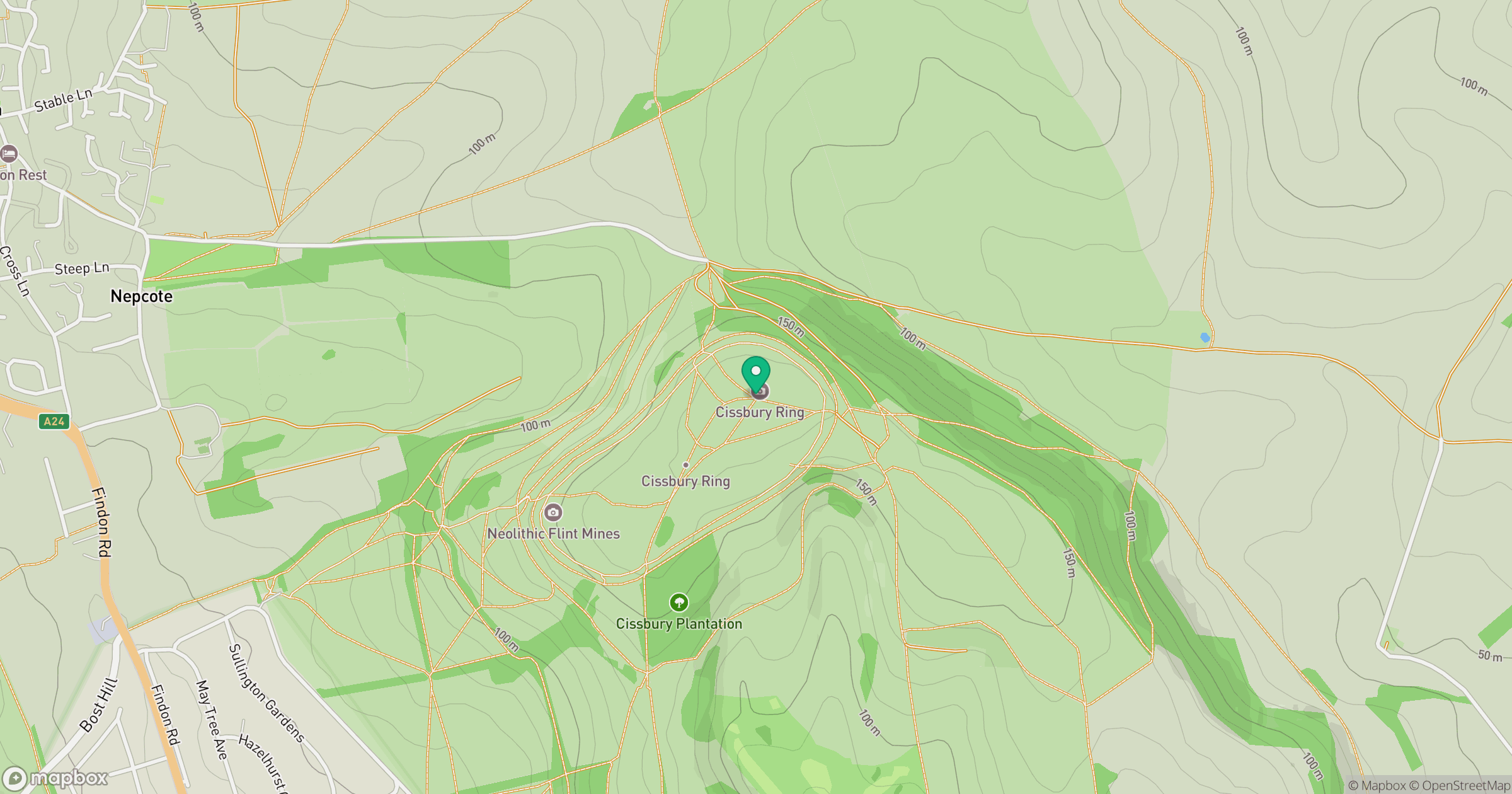
Grid reference: TQ140081
View on OpenStreetMapOpens a map in a new tab, centred on the hill.
Nearby Hills
Ditchling Beacon
248m
Leith Hill
294m
Worcestershire Beacon
425m
Glastonbury Tor
158m
Titterstone Clee Hill
533m
No comments yet. Be the first.