

Carn Brea
Good walks are even better shared.
SW6840 : The View from Carn Brea
Tony Atkin Photo source
Overview
Carn Brea
Carn Brea is the 228 m granite hill above Redruth in Cornwall, with 47 m of prominence and Tump classification. This is the Redruth hill, not Chapel Carn Brea in west Penwith. Hill Bagging
Summit, geology and history
The natural summit is a rock tor about 15 m southwest of the Basset Monument, at SW 68334 40720. The castle and memorial are separate landmarks. The exact rock top requires care, especially when wet; visiting the hill’s paths and viewpoints does not require climbing it.
BGS identifies Carn Brea as a granite satellite of the Carnmenellis intrusion. Nearby mineral lodes underpin the area’s mining history. BGS geological memoir
The scheduled remains include Neolithic enclosures, Iron Age defences, a medieval castle remodelled as a folly, and mining workings. The former fogou and “King’s Men” claims are not supported for this site and are omitted. Historic England
A complete return walk
The Redruth station, Carn Brea, Carn Marth and Gwennap Pit circular starts and ends at Redruth railway station. The published circuit links the castle and monument with mining tracks, Carn Marth’s quarry amphitheatre and trig point, then descends to Gwennap Pit before returning through farmland to Redruth. The publisher gives 8 miles, approximately 12.9 km, and a half day. No measured ascent or scalar walking time is supplied here. Use the linked route map; optional diversions and a climb onto the summit tor are not added to its totals. Full route
Access and planning
Carn Brea Parish Council records the hill’s common-land registration and public access on foot. Follow current notices and protect the archaeology. Remain outside mine workings and buildings; rocky paths can be slippery, and the longer circuit crosses main roads. Parish council access information
Arrive by train at Redruth, or check the station’s parking arrangements. Obtain provisions in town and do not assume there are hilltop toilets or drinking water. The exposed ridge offers views over Redruth and mining country towards the coast. National Rail
Information checked on 18 October 2026. The route page was last updated in March 2024 and contains older planning dates; check conditions and transport before travelling.
Explore routes near Carn Brea
Walks starting near this hill. Open a route to check its map, distance and full itinerary.
Tehidy lakes, Kennels Hill and North Cliffs woodland circuit
View route
Stithians Lake circular walk: dam, woodland and Penmarth
View route
Helston to southern Loe Pool: Penrose lakeside woodland walk
View route
Loe Pool: the full circuit from Helston
View route
Route planning notes
These notes describe possible approaches. Check a route's map and access information when planning your walk.
Redruth station, Carn Brea, Carn Marth and Gwennap Pit circular
Start and finish at Redruth railway station (SW700420). Follow the linked 10 Mile Hike itinerary out of Redruth to Carn Brea Castle and the Basset Monument, then take the old mining paths towards Carn Marth, its quarry amphitheatre and trig point. Descend on lanes to Gwennap Pit and return across fields and farmland to Redruth station. This is the publisher’s complete 8-mile circuit, approximately 12.9 km, using footpaths, rocky tracks and lanes with B3300 and A393 crossings. Allow a half day; no ascent total is established. The exact tor top is separate from the surrounding walking circuit and is not required for this walk. Use the publisher’s linked map for navigation; detours or a different start change the totals. Source: https://www.10milehike.com/carn-brea/
Make a day of it, together
Find someone to share the walk with, or organise a day out along a route you like.
Photo Gallery
View all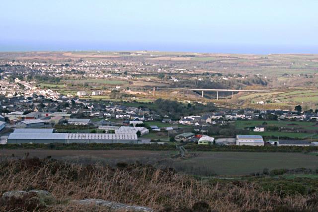 Photo could not load
SW6840 : The View from Carn Brea
Tony Atkin
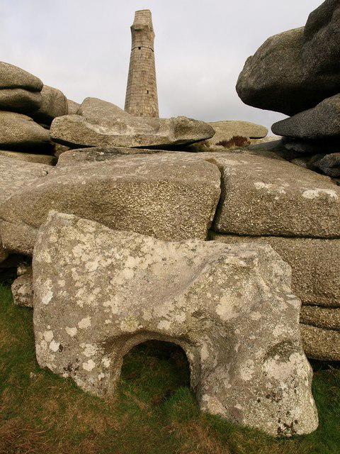 Photo could not load
SW6840 : Rocks and monument, Carn Brea
Derek Harper
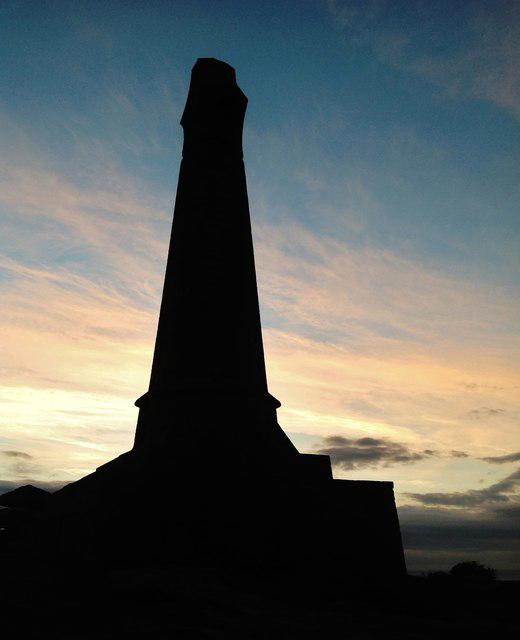 Photo could not load
SW6840 : Carn Brea
Ashley Dace
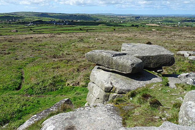 Photo could not load
SW6840 : Carn Brea Summit
Anne Burgess
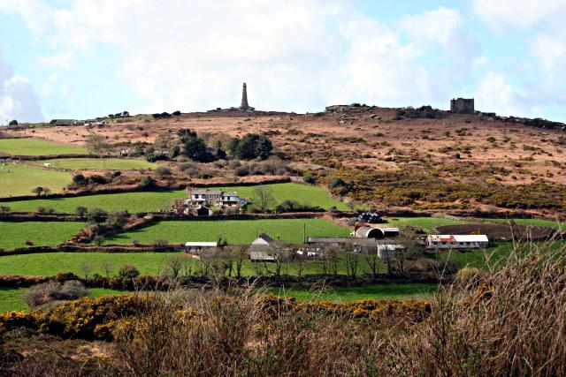 Photo could not load
SW6840 : Carn Brea Hill from the east
Tony Atkin
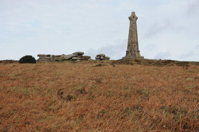 Photo could not load
SW6840 : Lord de Dunstanville and Basset monument, Carn Brea
Philip Halling
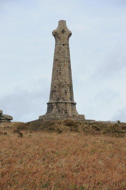 Photo could not load
SW6840 : Lord de Dunstanville and Basset monument, Carn Brea
Philip Halling
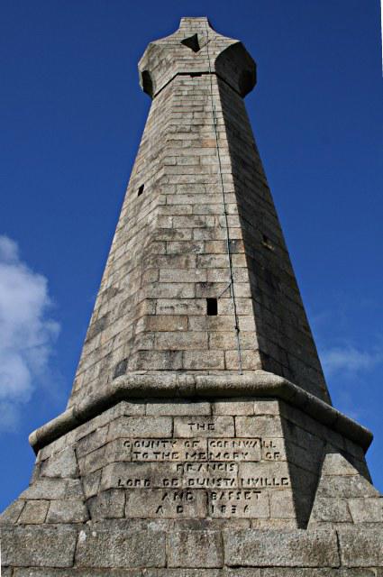 Photo could not load
SW6840 : The De Dunstanville Memorial on the Summit of Carn Brea
Tony Atkin
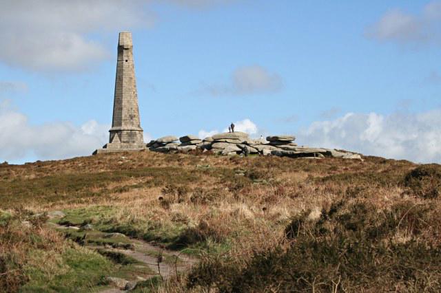 Photo could not load
SW6840 : Carn Brea Summit
Tony Atkin
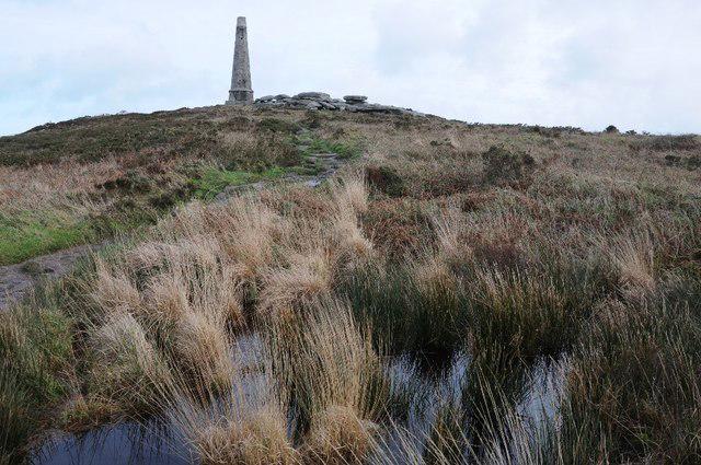
SW6840 : Waterlogged Carn Brea
Philip Halling
Hill facts and local notes
Classifications
Elevation
228m
748 ft
Prominence
47m
Coordinates
50.2209, -5.2491
SW683407
OS Map
203
Explorer: 104
At the Summit
The 228 m natural high point is the rock tor about 15 m southwest of the Basset Monument, at SW 68334 40720. A tor farther southwest is lower. Carn Brea Castle and the monument are nearby landmarks, rather than the natural summit.
Terrain & Geology
Carn Brea is a granite outcrop forming a satellite intrusion of the Carnmenellis granite. The British Geological Survey describes coarse granite here and the surrounding tin-and-copper mineralisation; its exposed tors are distinctive features of the hill. The former late-Devonian granite age is not supported by that account.
Views & Scenery
Open views over Redruth and the surrounding Cornish mining landscape towards the north coast, subject to visibility.
History & Heritage
Name Origin
The Cornish place-name elements are karn, meaning crag, tor or cairn, and bre, meaning hill. Akademi Kernewek records the hill as Karn Bre.
Historical Significance
Carn Brea contains a Neolithic hilltop enclosure, later Iron Age defences and settlement remains, a medieval castle subsequently remodelled as a folly, and extensive mining remains. Historic England lists the wider archaeological site as scheduled monument 1006704.
Getting There & Facilities
Parking
For the described full circular walk, use lawful parking in Redruth; National Rail lists parking at Redruth station, the start and finish. Check charges, availability and signs. This is a route-start option, not a claim that it is the closest parking to the hill.
Public Transport
Redruth railway station is the start and finish of the described circular walk. Check National Rail for current services and disruption; no bus connection to the hill is required for this itinerary.
Nearby Facilities
Use Redruth for provisions before the walk and refreshments afterwards. Carn Brea Castle operates separately as a restaurant; check its opening and booking arrangements. Do not rely on public toilets or water being available on the hill.
Safety Information
Known Hazards
- Wet granite can be slippery; climbing the summit tor is a separate challenge from walking to the monument.
- Keep to established paths around old mine and quarry workings; do not enter shafts, buildings or flooded quarries.
- The Redruth circuit crosses the B3300 and A393 and includes narrow lanes.
- The exposed hill can be windy; carry a map and allow daylight for the full return.
General Safety Tips
- Check weather conditions before setting out
- Carry appropriate clothing and equipment
- Let someone know your planned route
- Take a map, compass, and GPS device
- Carry emergency supplies: food, water, first aid kit, torch
Hills
Some common questions about the hills answered
Are there group walks up Carn Brea?
Many walkers use Walkmates to join or organise walks with others. You can check for group walks around Carn Brea through the maps
Are there other walkers around Carn Brea?
Activity varies by location and time, but Walkmates lets you see whether others have shared walks or shown interest in this area. Find other people through the walking friends search walking friends for Carn Brea search or of course create your own walk for Carn Brea
Can I organise a walk to Carn Brea?
Yes. If there aren’t any walks listed already, you can create a walk and make it available for others to join.
If you're signed up to Walkmates, you can create a walk to Carn Brea.
How do I find a walk up this hill?
There are often multiple ways to walk this hill, depending on experience and route preference. Walkmates helps you explore walks and routes that others have shared.
Can I suggest a new route up Carn Brea?
Yes. You can suggest or create routes to share with others. Walkmates focuses on the social side of walking, so routes are used to help people organise walks and explore areas together, rather than as detailed navigation tools or route libraries.
Other uses really appreciate knowledgeable walkers sharing their routes. Share your favourite route to Carn Brea here
The is an error or something incorrect about this hill. How do I let you know?
We always strive to keep the information on Walkmates as accurate as possible. If you find an error, please let us know through the contact form and we'll aim to correct it as quickly as possible
Community Discussion
Comments
Location
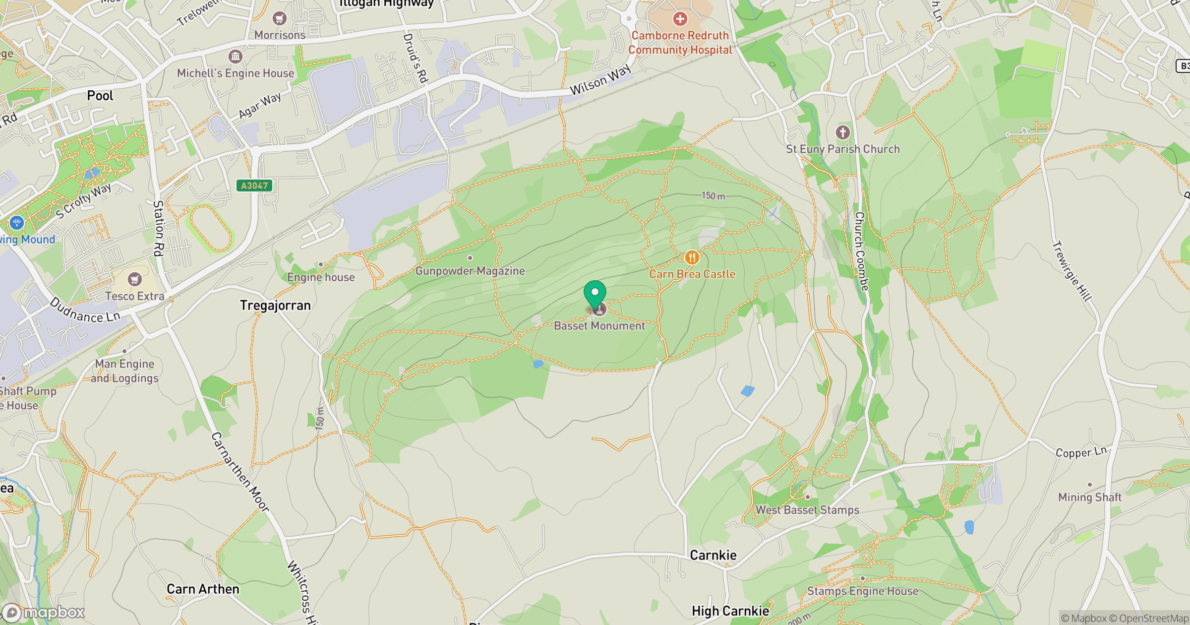
Grid reference: SW683407
View on OpenStreetMapOpens a map in a new tab, centred on the hill.


No comments yet. Be the first.