

Beinn a' Chleibh
Good walks are even better shared.
NN2525 : Beinn a' Chleibh from Ben Lui
Kathryn Mair Photo source
Overview
Beinn a' Chleibh
Nestled in the heart of the Scottish Highlands, Beinn a' Chleibh stands tall at an impressive 916 meters. This Munro beckons hikers with its height, stunning views, and well-established routes. The peak rises majestically and rewards those who make the effort to climb with spectacular panoramas.
Geology
This mountain is predominantly composed of ancient schist and granite that has stood the test of time for over 500 million years. The interaction between glacial activity and rising tectonic plates played a significant role in shaping Beinn a' Chleibh, making it a fascinating subject for geologists and curious hikers alike!
Hiking Routes
A popular route to the summit begins from the B8082 road. It’s about 8 km round trip with a moderate level of difficulty. Since the ascent is steep in parts, it’s advisable to take your time and enjoy the changing scenery. Remember, if you experience heavier breathing, it might just be your snack calling for a break!
Terrain Type
Expect a mix of grassy slopes and rocky outcrops. The paths can become boggy, especially after rains, so sturdy boots are recommended. Your feet will thank you later!
Summit Features
When you reach the summit, you will find a distinguishable rocky outcrop and a small cairn commemorating your triumph. It's an ideal spot to pause and soak in the views—after all, a summit selfie is practically a requirement!
Views
The vistas from Beinn a' Chleibh are nothing short of spectacular. To the north, the towering Ben More greets you, while to the west, the serene Loch Awe shimmers under the Highland sun. Spring and Autumn offer particularly splendid views, with flora and fauna putting on their best displays.
Hazards
Weather in the Highlands can change faster than you can say 'whisky'. It’s advisable to check conditions before heading out. Stay clear of bogs after a heavy downpour, as they can resemble treacherous traps!
Nearby Summits
Nearby hikers can also consider tackling Ben More and Stob Binnein while enjoying this stunning region. Each offers their own charm and challenges.
Access and Facilities
Accessible via the B8082 with parking laybys, Beinn a' Chleibh is relatively easy to approach for seasoned hikers and newcomers alike. The closest facilities are found in Crianlarich, including much-needed refreshments after an invigorating hike.
Conclusion
In conclusion, Beinn a' Chleibh is a gem of the Scottish Highlands, combining challenging ascents with rewarding beauty. Whether you're a seasoned Munro-bagger or a leisure walker looking for a stunning view, this mountain has something for everyone. Happy hiking!
Explore routes near Beinn a' Chleibh
Walks starting near this hill. Open a route to check its map, distance and full itinerary.
Beinn Ime from Succoth
View route
The Cobbler from Succoth Carpark
View route
Ben Lomond in the trossachs
View route
Loch Katrine: Brenachoile Point Shore Walk from Trossachs Pier
View route
Route planning notes
These notes describe possible approaches. Check a route's map and access information when planning your walk.
Via the B8082
A scenic approach from the Glen Lochay road that provides moderately steep ascent with stunning views.
Make a day of it, together
Find someone to share the walk with, or organise a day out along a route you like.
Photo Gallery
View all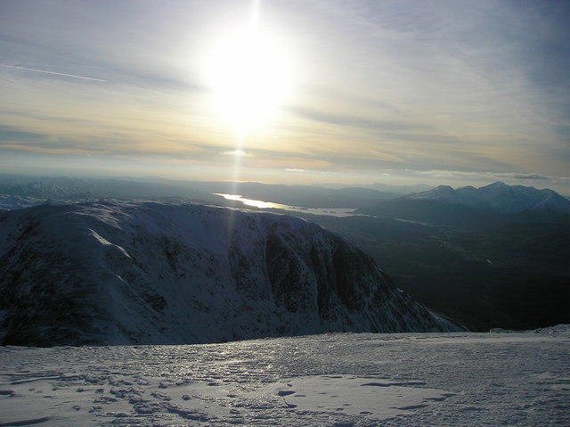 Photo could not load
NN2525 : Beinn a' Chleibh from Ben Lui
Kathryn Mair
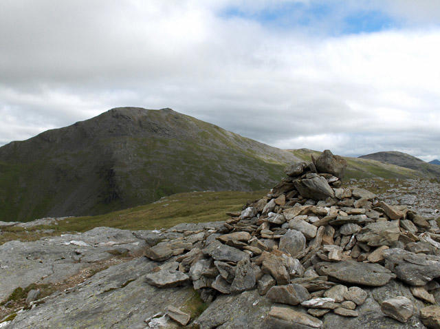 Photo could not load
NN2525 : Beinn a' Chleibh
Andrew Smith
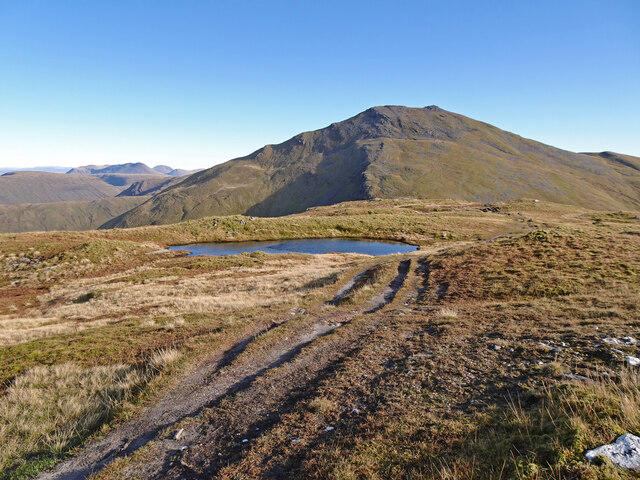 Photo could not load
NN2525 : Beinn a' Chleibh Summit View East
Adam Ward
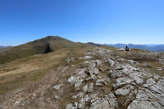 Photo could not load
NN2525 : Path linking Beinn a'Chleibh to Ben Lui
Andy Waddington
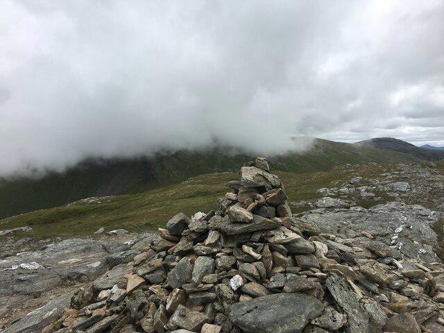 Photo could not load
NN2525 : Summit of Beinn a’ Cleibh
Steven Brown
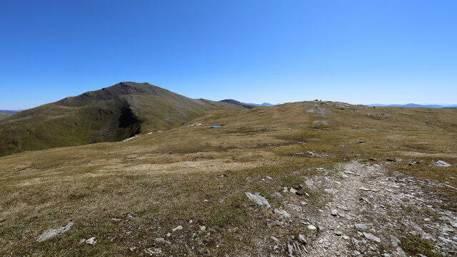 Photo could not load
NN2425 : Faint path on NW ridge of Beinn a'Chleibh
Andy Waddington
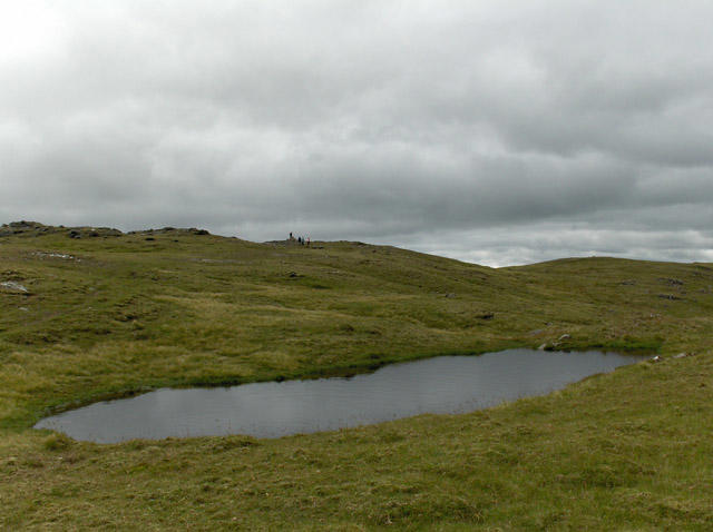 Photo could not load
NN2525 : Pool, Beinn a' Chleibh
Andrew Smith
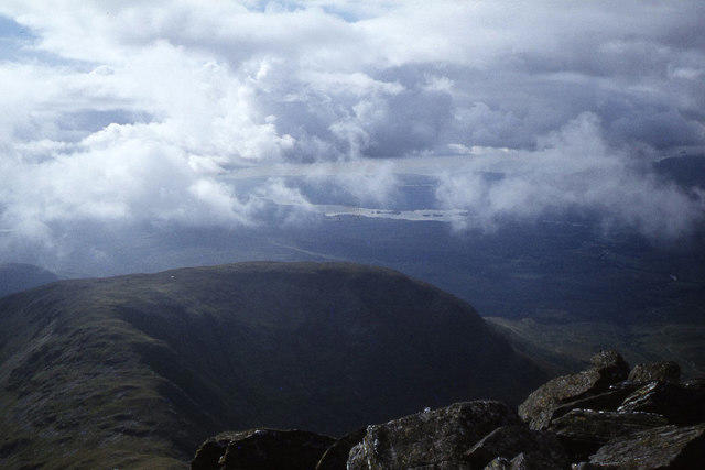 Photo could not load
NN2525 : View towards Beinn a' Chleibh from the summit of Ben Lui
Colin Park
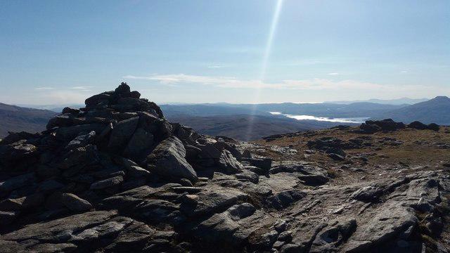 Photo could not load
NN2525 : Beinn a' Cleibh
Stephen Sweeney
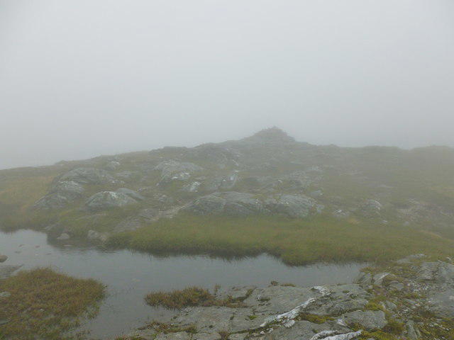
NN2525 : Summit cairn, Beinn a' Chleibh
Alan O'Dowd
Hill facts and local notes
Classifications
Elevation
916m
3,006 ft
Prominence
140m
Coordinates
56.3902, -4.8356
NN250256
OS Map
50
Explorer: OL39N 364N 377E
At the Summit
The summit comprises a prominent rocky outcrop with a natural, gentle cairn marking the highest point. It offers a perfect photo opportunity.
Terrain & Geology
Beinn a' Chleibh is primarily composed of ancient schist and granite, typical of the Highland landscape. The rocks observe a fascinating geological history, dating back more than 500 million years, with glacial activities shaping its current form.
Views & Scenery
From the summit, you can witness breathtaking views of the surrounding peaks including Ben More to the north and the vast expanse of Loch Awe to the west.
History & Heritage
Name Origin
The name 'Beinn a' Chleibh' translates from Gaelic to 'Mountain of the Cleibh,' which refers to a local term associated with a branch of the River Fillan.
Historical Significance
Like many Munros, Beinn a' Chleibh has cultural significance, featuring in local folklore and providing habitat for various wildlife.
Getting There & Facilities
Parking
There is a small layby near the start of the B8082, which provides the closest parking for hikers. Big enough for a few cars, but can fill up quickly during peak season.
Public Transport
The nearest train station is at Crianlarich, where local buses can transport visitors to nearby roads leading to the start of the route.
Nearby Facilities
Cafes and public toilets can be found in Crianlarich. Alternatively, you might pack a cheeky sandwich and save the cafe for after your climb.
Safety Information
Known Hazards
- Be wary of changes in weather, as conditions can become erratic. The boggy sections can also be treacherous following rainfall.
General Safety Tips
- Check weather conditions before setting out
- Carry appropriate clothing and equipment
- Let someone know your planned route
- Take a map, compass, and GPS device
- Carry emergency supplies: food, water, first aid kit, torch
Hills
Some common questions about the hills answered
Are there group walks up Beinn a' Chleibh?
Many walkers use Walkmates to join or organise walks with others. You can check for group walks around Beinn a' Chleibh through the maps
Are there other walkers around Beinn a' Chleibh?
Activity varies by location and time, but Walkmates lets you see whether others have shared walks or shown interest in this area. Find other people through the walking friends search walking friends for Beinn a' Chleibh search or of course create your own walk for Beinn a' Chleibh
Can I organise a walk to Beinn a' Chleibh?
Yes. If there aren’t any walks listed already, you can create a walk and make it available for others to join.
If you're signed up to Walkmates, you can create a walk to Beinn a' Chleibh.
How do I find a walk up this hill?
There are often multiple ways to walk this hill, depending on experience and route preference. Walkmates helps you explore walks and routes that others have shared.
Can I suggest a new route up Beinn a' Chleibh?
Yes. You can suggest or create routes to share with others. Walkmates focuses on the social side of walking, so routes are used to help people organise walks and explore areas together, rather than as detailed navigation tools or route libraries.
Other uses really appreciate knowledgeable walkers sharing their routes. Share your favourite route to Beinn a' Chleibh here
The is an error or something incorrect about this hill. How do I let you know?
We always strive to keep the information on Walkmates as accurate as possible. If you find an error, please let us know through the contact form and we'll aim to correct it as quickly as possible
Community Discussion
Comments
Location
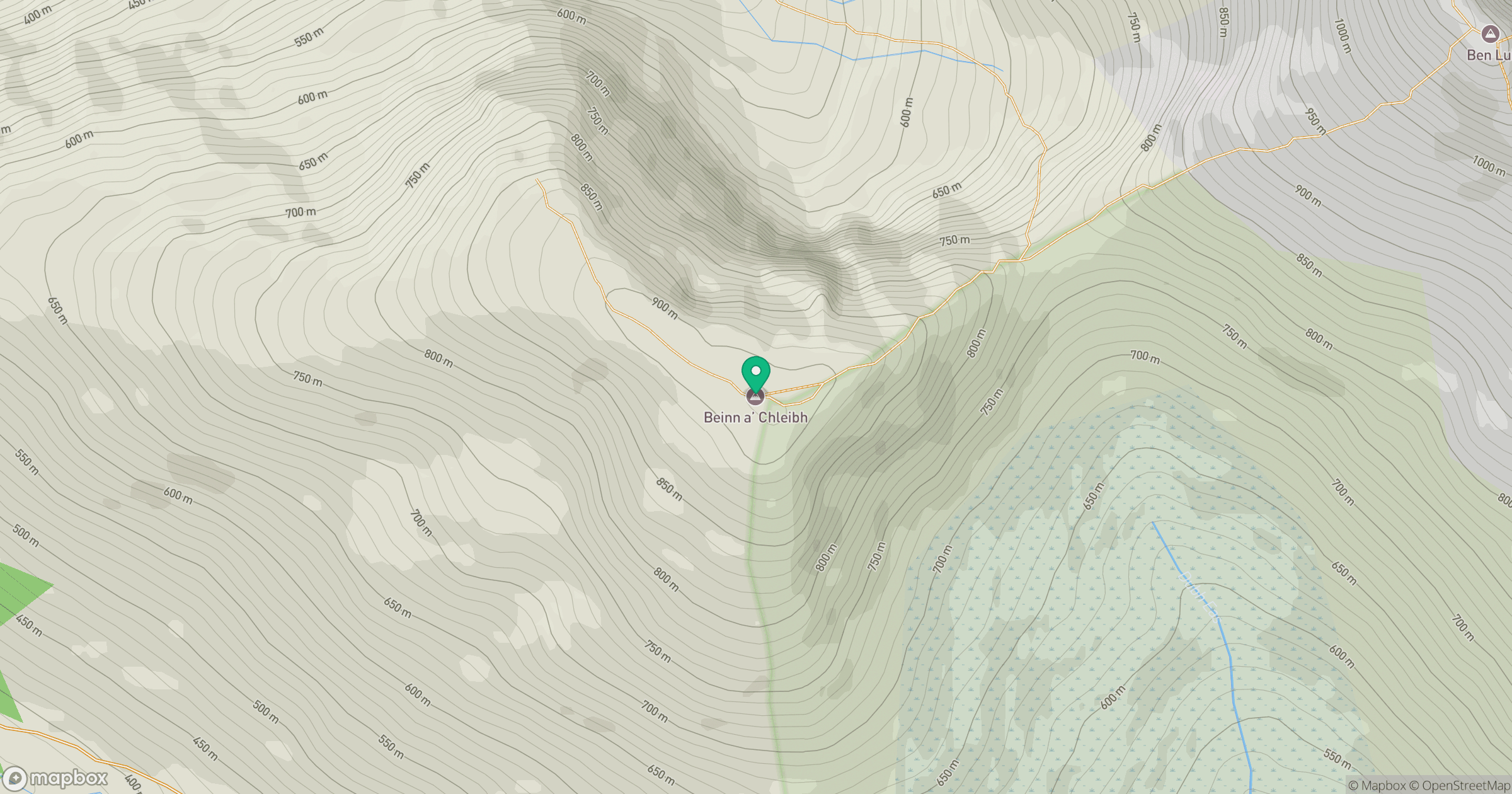
Grid reference: NN250256
View on OpenStreetMapOpens a map in a new tab, centred on the hill.
Nearby Hills
![Ben Lui [Beinn Laoigh]](https://cdn.walkmates.com/gallery-images/20d4da67f4984b329a102d7c3aba012b.jpg)
Ben Lui [Beinn Laoigh]
1,131m
Ben Vorlich
943m
Beinn Ime
1,012m
Beinn Dorain
1,076m
Beinn Narnain
927m
No comments yet. Be the first.