

Barden Fell
Good walks are even better shared.
SE1396 : Tank Roads on Barden Fell
Tony Simms Photo source
Overview
Barden Fell: The Jewel of the Yorkshire Dales
Introduction
If you're looking to escape the hustle and bustle of life and breathe in the fresh air while being surrounded by stunning vistas, then Barden Fell is your ticket. Sitting proudly at 381 meters, this Marilyn is an accessible yet rewarding hike that draws hikers to its limestone beauty.
Geology
Barden Fell is a limestone gem in the Yorkshire Dales, characterised by its dramatic limestone pavements and rolling grassy slopes. The karst landscape is dotted with fascinating rock formations created through years of natural erosion. It’s geology that’ll make you feel like you’ve walked into a natural museum.
Routes
The main route from Barden Bridge is both easy to navigate and offers beautiful woodland scenery. At just over 3 km, it’s perfect for a gentle afternoon stroll, while the circular route from Wharfe Valley provides a bit more challenge with its lovely terrain variety.
Summit Features
Upon reaching the summit, you’ll be greeted by a charming stone cairn and trig point. A glorious area to rest your weary limbs and ponder life’s great mysteries, such as how high is too high when it comes to a mound of rocks!
Terrain Type
Expect a mix of grassy meadows and rocky outcrops. While it’s predominantly moderate walking, do keep an eye out for those notorious boggy patches—nobody wants to lose a boot!
Views
The views from Barden Fell are nothing short of glorious. You’ll catch sights of the rolling Yorkshire Dales, stunning limestone valleys, and possibly even, if you squint hard enough, the distant moors that seem to stretch endlessly. The best parts of the year for the prettiest views? Spring and autumn take the crown.
Hazards
As always, a word of caution: be wary of slippery surfaces, especially after rain. The descent can be a little tricky, so take your time.
Access
Parking at Barden Bridge fills up quicker than a kid on a sugar rush, so get there early. Local buses serve this area, too, with Skipton being the nearest town where you can find all the amenities you need.
Facilities
After your adventure, head over to Appletreewick for a well-deserved pint or a slice of homemade cake—because, let’s be honest, how else are you supposed to replenish those lost calories?
History
With a name that suggests a hill of notable stature, Barden Fell certainly lives up to the legend. Its history of attracting outdoor enthusiasts and its geological significance adds to its allure.
Whether you're a seasoned hiker or just looking for a leisurely walk, Barden Fell welcomes you with open arms—but remember to bring your sense of adventure!
Explore routes near Barden Fell
Walks starting near this hill. Open a route to check its map, distance and full itinerary.
Richmond Yorkshire
View route
Barnard Castle: Flatts Wood and Cleveland Walk
View route
Buckden Pike Wellington Wreckage and Memorial
View route
Shildon Rail Trail: Old Town and Black Boy Line
View route
Route planning notes
These notes describe possible approaches. Check a route's map and access information when planning your walk.
Barden Fell from the Barden Bridge
This route starts from Barden Bridge and winds through scenic woodland before climbing steadily to the summit, rewarding hikers with panoramic views.
Circular Route from the Wharfe Valley
A lovely circular walk starting from the Wharfe Valley which covers varied terrain and offers diverse views of the surrounding countryside.
Make a day of it, together
Find someone to share the walk with, or organise a day out along a route you like.
Photo Gallery
View all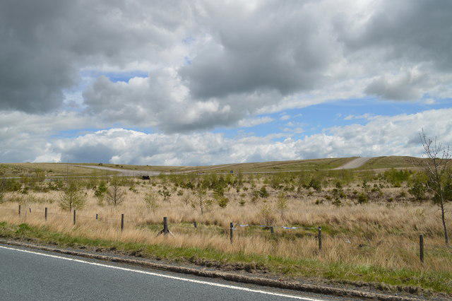 Photo could not load
SE1396 : Tank Roads on Barden Fell
Tony Simms
Hill facts and local notes
Classifications
Elevation
318m
1,042 ft
Prominence
80m
Coordinates
54.3660, -1.7888
SE138967
OS Map
99
Explorer: OL30N
At the Summit
The summit features a stone cairn and a trig point, providing a perfect backdrop for a celebratory selfie (or ten) once you've conquered the ascent!
Terrain & Geology
Barden Fell is primarily composed of limestone, with areas of sandstone that have eroded over millennia to create the distinctive rocky outcrops and scenic landscape. The region showcases classic karst features, including limestone pavements and deep gorges.
Views & Scenery
From the summit, you can see the majestic Yorkshire Dales, the nearby village of Appletreewick, and, on a clear day, the distant moors.
History & Heritage
Name Origin
The name 'Barden' is thought to derive from Old Norse, meaning 'the hill with the crest', an apt description for our charming little fell.
Historical Significance
Barden Fell has been a popular spot for hikers and nature-lovers alike, with its rich limestone geology and wildlife drawing many visitors over the years.
Getting There & Facilities
Parking
The nearest parking is at Barden Bridge, with a small lay-by accommodating several cars. It can get busy on weekends, so arrive early to snag a spot.
Public Transport
Barden Fell is accessible via local bus services from Skipton, with stops at nearby villages. Check local timetables for the best options.
Nearby Facilities
Pub and cafe facilities can be found in nearby Appletreewick, offering a nice spot to refuel and share tales of your adventure (or mishaps).
Safety Information
Known Hazards
- Watch out for slippery rocks, particularly after wet weather, and be mindful of loose stones on some of the steeper sections.
General Safety Tips
- Check weather conditions before setting out
- Carry appropriate clothing and equipment
- Let someone know your planned route
- Take a map, compass, and GPS device
- Carry emergency supplies: food, water, first aid kit, torch
Hills
Some common questions about the hills answered
Are there group walks up Barden Fell?
Many walkers use Walkmates to join or organise walks with others. You can check for group walks around Barden Fell through the maps
Are there other walkers around Barden Fell?
Activity varies by location and time, but Walkmates lets you see whether others have shared walks or shown interest in this area. Find other people through the walking friends search walking friends for Barden Fell search or of course create your own walk for Barden Fell
Can I organise a walk to Barden Fell?
Yes. If there aren’t any walks listed already, you can create a walk and make it available for others to join.
If you're signed up to Walkmates, you can create a walk to Barden Fell.
How do I find a walk up this hill?
There are often multiple ways to walk this hill, depending on experience and route preference. Walkmates helps you explore walks and routes that others have shared.
Can I suggest a new route up Barden Fell?
Yes. You can suggest or create routes to share with others. Walkmates focuses on the social side of walking, so routes are used to help people organise walks and explore areas together, rather than as detailed navigation tools or route libraries.
Other uses really appreciate knowledgeable walkers sharing their routes. Share your favourite route to Barden Fell here
The is an error or something incorrect about this hill. How do I let you know?
We always strive to keep the information on Walkmates as accurate as possible. If you find an error, please let us know through the contact form and we'll aim to correct it as quickly as possible
Community Discussion
Comments
Location
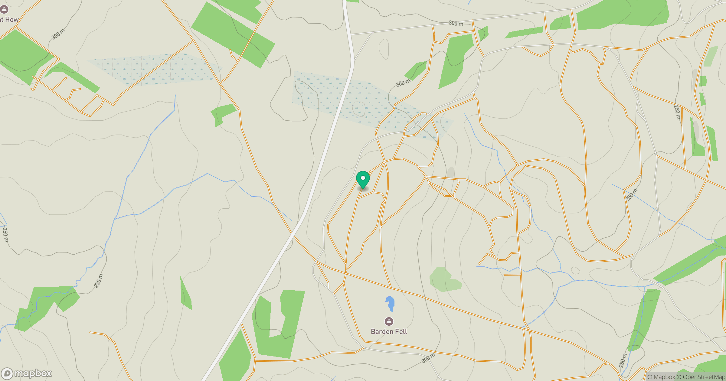
Grid reference: SE138967
View on OpenStreetMapOpens a map in a new tab, centred on the hill.
Nearby Hills
Buckden Pike
702m
Rombalds Moor [Ilkley Moor]
402m
Nine Standards Rigg
662m

Pen-y-ghent
694m

Whernside
737m
No comments yet. Be the first.