
A' Chailleach
Good walks are even better shared.
Overview
A' Chailleach: The Hag of the Highlands
Nestled in the heart of the Scottish Highlands, A' Chailleach rises majestically to 1004 meters, a true Munro that beckons hikers and outdoor enthusiasts alike. Known affectionately as 'the hag', this peak boasts intriguing myths and stunning natural beauty.
Geology
The mountain comprises ancient schist and granite, formations that have withstood the test of time, gifting us with landscapes of remarkable ruggedness. The trails here often expose fascinating rock formations and evidence of glacial carving, making the geology as intriguing as the views are splendid.
The Route
One of the most favoured routes to the summit is the Beinn na Lap Route. Starting from the village of Onich, this moderate trail of approximately 12 km takes around 6 hours to complete. Expect a delightful mix of grassy slopes and rocky sections, with plenty of viewpoints along the way - so don’t forget your camera!
Summit Features
At the top, hikers are greeted by a prominent stone cairn, emblematic of many Scottish peaks. It’s a perfect spot to rest the legs and take in sweeping vistas that will make your heart swell - don’t forget to check off Ben Nevis on your sight-seeing list!
Terrain and Hazards
The terrain can be a mix of rocky paths and grassy sections, with occasional boggy areas that could challenge the stoutest of boots. Always stay alert for unpredictable weather changes – the Highlands can throw a curveball faster than you can run downhill!
Views
As for views, they are nothing short of breathtaking. Look out for Ben Nevis to the southwest and the picturesque Loch Leven below. For optimal vistas, late spring to early autumn is recommended. However, for those brave enough to attempt winter climbs, make sure you’re well prepared – the beauty of snow-covered peaks is undeniable, yet they come with their own set of challenges.
Access and Facilities
Parking is conveniently located in Onich, with public transport available from Fort William. This nearby town offers various amenities to refuel after your hike. Enjoy a hearty meal or simply soak in the atmosphere - because after a descent like this, you’ve earned it!
History and Culture
Interestingly, the mountain's name translates to 'the hag' in Gaelic, linking it closely to the folklore that envelops this spectacular landscape. Not just a mountain, A' Chailleach is steeped in myth, culture, and history.
In summary, A' Chailleach is not just a trek; it's an experience woven into the very fabric of the Scottish Highlands. Prepare well, respect the mountain, and enjoy every moment of your adventure. Happy hiking!
Explore routes near A' Chailleach
Walks starting near this hill. Open a route to check its map, distance and full itinerary.
Ben Nevis via Mountain Path
View route
Banavie to Glen Loy Aqueduct: Neptune’s Staircase Canal Towpath
View route
Killin: Falls of Dochart, Finlarig and Moirlanich Longhouse
View route
Beinn Ime from Succoth
View route
Route planning notes
These notes describe possible approaches. Check a route's map and access information when planning your walk.
Beinn na Lap Route
Starting from the village of Onich, this popular trail leads climbers through beautiful landscapes and offers scenic views along the ascent.
Make a day of it, together
Find someone to share the walk with, or organise a day out along a route you like.
Hill facts and local notes
Classifications
Elevation
902m
2,960 ft
Prominence
138m
Coordinates
56.6780, -4.9575
NN189579
OS Map
41
Explorer: 384
At the Summit
The summit features a distinctive stone cairn, which makes for a perfect photo opportunity. Additionally, there's a rugged plateau offering ample space for a picnic, although don’t expect a five-star Michelin experience!
Terrain & Geology
A' Chailleach is primarily composed of ancient schist and granite, making it a geological wonder with breathtaking views of surrounding valleys and peaks. The hiking trails often reveal stunning rock formations and glacial features that are millions of years old.
Views & Scenery
From the summit, one can see the impressive peaks of Ben Nevis to the southwest, Loch Leven shimmering below, and the rugged beauty of the Glen Coe mountains.
History & Heritage
Name Origin
'A' Chailleach' translates roughly to 'the hag' in Gaelic, linking to the rich tapestry of mythology surrounding this region - a reminder that not all legendary figures need a good PR team.
Historical Significance
A' Chailleach holds not only geological significance but also cultural milestones, featuring in various local folklore as a place of pilgrimage.
Getting There & Facilities
Parking
The nearest parking can be found in Onich, with a small parking area suitable for day hikers. Arrive early; it gets filled faster than a pint in a local pub!
Public Transport
Accessible via bus services from Fort William, which provide a convenient option for those opting for a more eco-friendly approach.
Nearby Facilities
In Fort William, you'll find plenty of amenities, including cafes, shops, and toilets. Perfect for grabbing a warm cup of cocoa after your adventure!
Safety Information
Known Hazards
- Be cautious of sudden changes in weather, as the Highlands are notorious for turning from sunny to stormy faster than you can say 'nearly home'. Also, consider the potential for treacherous terrain especially in wet conditions.
General Safety Tips
- Check weather conditions before setting out
- Carry appropriate clothing and equipment
- Let someone know your planned route
- Take a map, compass, and GPS device
- Carry emergency supplies: food, water, first aid kit, torch
Hills
Some common questions about the hills answered
Are there group walks up A' Chailleach?
Many walkers use Walkmates to join or organise walks with others. You can check for group walks around A' Chailleach through the maps
Are there other walkers around A' Chailleach?
Activity varies by location and time, but Walkmates lets you see whether others have shared walks or shown interest in this area. Find other people through the walking friends search walking friends for A' Chailleach search or of course create your own walk for A' Chailleach
Can I organise a walk to A' Chailleach?
Yes. If there aren’t any walks listed already, you can create a walk and make it available for others to join.
If you're signed up to Walkmates, you can create a walk to A' Chailleach.
How do I find a walk up this hill?
There are often multiple ways to walk this hill, depending on experience and route preference. Walkmates helps you explore walks and routes that others have shared.
Can I suggest a new route up A' Chailleach?
Yes. You can suggest or create routes to share with others. Walkmates focuses on the social side of walking, so routes are used to help people organise walks and explore areas together, rather than as detailed navigation tools or route libraries.
Other uses really appreciate knowledgeable walkers sharing their routes. Share your favourite route to A' Chailleach here
The is an error or something incorrect about this hill. How do I let you know?
We always strive to keep the information on Walkmates as accurate as possible. If you find an error, please let us know through the contact form and we'll aim to correct it as quickly as possible
Community Discussion
Comments
Location
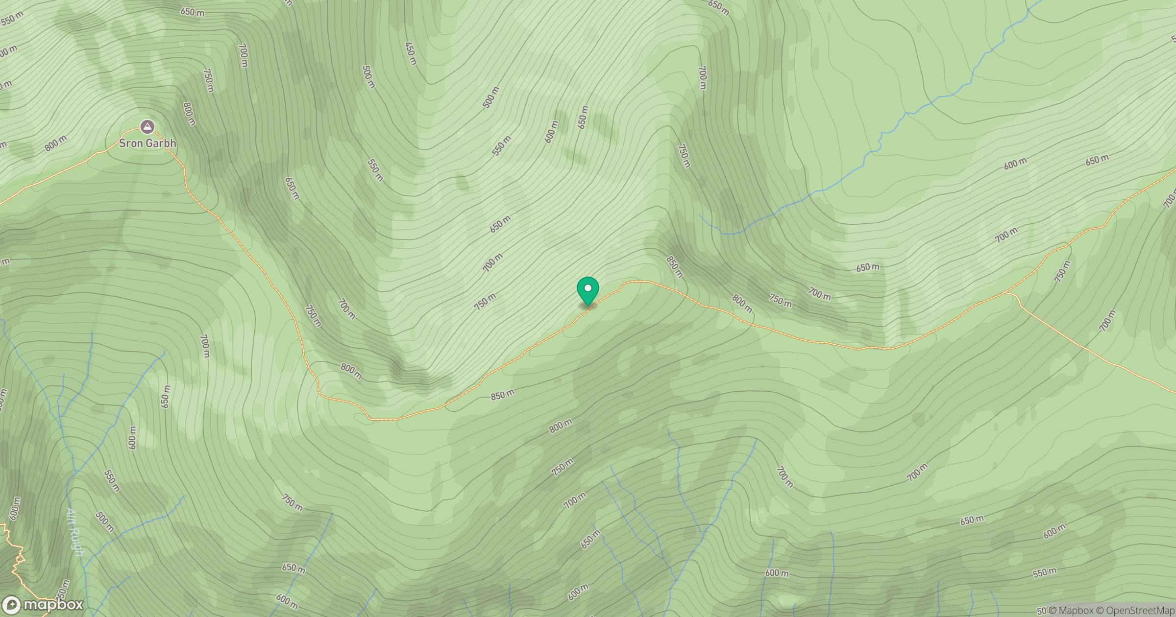
Grid reference: NN189579
View on OpenStreetMapOpens a map in a new tab, centred on the hill.
No comments yet. Be the first.