

Yeavering Bell
Good walks are even better shared.
NT9229 : The Hillfort Trail up the south flank of Yeavering Bell
Tim Heaton Photo source
Overview
Yeavering Bell
Yeavering Bell is a splendid hill located in the stunning Cheviots, known for its rich history and fascinating geology. Standing at an elevation of 400 meters, it may not be the highest peak in the region, but it certainly packs a punch when it comes to scenic beauty and historical significance.
Geology
The mountain is primarily made up of ancient volcanic rock, particularly basalt, which provides the rocky underfoot conditions favourable for hikers. The unique geological features are a result of ancient volcanic activity, making it a spot of interest for geologists and outdoor enthusiasts alike.
Hiking Routes
One of the most popular routes to the summit is the Yeavering Bell from Gleadscleugh. This moderate circular trek covers approximately 6.5 km and takes about 2.5 hours to complete. The path leads you through the rolling lushness of Gleadscleugh valley towards the summit. Along the way, you might encounter some delightful wildlife. Bring your binoculars—a twitcher’s paradise awaits!
Summit Features
Upon reaching the summit, you'll be greeted by a robust cairn and the fascinating remains of an Iron Age hillfort, giving a nod to the incredible history of the area. It’s a great spot to catch your breath and enjoy a well-deserved snack, all while admiring the spectacular views.
Views
From the top of Yeavering Bell, you'll experience panoramic views of the surrounding Cheviot Hills, the sprawling landscape of Northumberland National Park, and, on exceptionally clear days, the Scottish Borders in the distance. The best time to soak in these vistas is during late spring or early autumn when nature dazzles with vibrant hues.
Hazards
As is often said, mountain weather is as unpredictable as a cat on a hot tin roof. So, never underestimate the possibility of rapidly changing conditions. Additionally, watch your step for uneven terrain and potential bogs—your boots will thank you for keeping an eye out.
Access and Facilities
The nearest car park is located at Gleadscleugh, with ample space for vehicles. As for public transport, Wooler is the nearest town with bus services to the area, though it's a bit of a trek. Make sure to stock up on supplies at one of Wooler's quaint cafes since facilities near the mountain are limited. For a cozy break, you can also grab a cuppa in Wooler after your adventure.
History
The name Yeavering Bell carries historical weight—'Yeavering' comes from Old English, possibly meaning 'gift', while 'Bell' reflects the hill's shape. The area is steeped in history, featuring Iron Age sites and remnants of ancient settlements, making it a delight for those interested in the past.
In conclusion, Yeavering Bell might not be the highest peak, but it offers a delightful mix of hiking, history, and stunning views. Whether you're an experienced hiker, a family on a day out, or someone keen to learn about the rich history, Yeavering Bell is waiting to greet you!
Happy hiking!
Explore routes near Yeavering Bell
Walks starting near this hill. Open a route to check its map, distance and full itinerary.
Yeavering Bell and Easter Tor Circular
View route
Hethpool Linn and Yeavering Bell from Kirknewton
View route
College Valley: Cuddystone memorial and Hethpool Mill circuit
View route
Hethpool RAF100: Madam Law, The Curr and Black Sike aircraft walk
View route
Route planning notes
These notes describe possible approaches. Check a route's map and access information when planning your walk.
Classic Yeavering Bell Circular
This classic circular route begins at the small parking area near Kirknewton (grid ref NT9291929339). Follow the well-trodden path through the fields towards the base of Yeavering Bell. The ascent takes you up the southern slopes, offering views of the Iron Age hillfort remains at the summit. Descend via the northern side of the hill, looping back to the start point through a gentle track along the valley floor.
Yeavering Bell from Wooler
Starting in the market town of Wooler, this longer route follows the St. Cuthbert's Way trail towards Yeavering Bell. The path winds through heather moorland and farmland, gradually ascending to the hill's summit. This route provides a more extended experience with a mix of scenery and a rewarding view from the top, before retracing your steps back to Wooler.
Short Ascent from Hethpool
This is a shorter and more direct route starting at Hethpool car park. Follow the track towards the hill and ascend Yeavering Bell via its western flank. The route is steep but quick, leading directly to the summit where you can explore the hillfort remains. Descend using the same path or take a slightly longer loop back via the valley.
Hillfort Explorer Loop
This walk begins at the parking area close to Kirknewton (grid ref NT9291929339) and is geared towards history enthusiasts. It explores not only Yeavering Bell but also other nearby archaeological sites like the Gefrin Anglo-Saxon site. The route combines open countryside walking with a steady ascent to Yeavering Bell, followed by a loop through historical points of interest.
College Valley and Yeavering Bell
This scenic route starts at the entrance to the College Valley (permit required for vehicle access). It takes you through lush valley landscapes before ascending Yeavering Bell from the east. This route combines tranquillity with stunning views of the surrounding Cheviot Hills. Descend via the southern side and return along quiet valley tracks.
Make a day of it, together
Find someone to share the walk with, or organise a day out along a route you like.
Photo Gallery
View all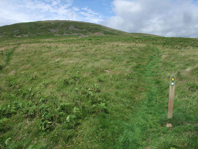 Photo could not load
NT9229 : The Hillfort Trail up the south flank of Yeavering Bell
Tim Heaton
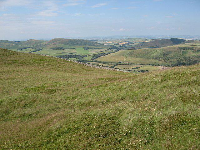 Photo could not load
NT9229 : Yeavering Bell
Richard Webb
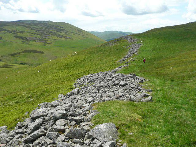 Photo could not load
NT9229 : Fortifications on Yeavering Bell Hillfort
Russel Wills
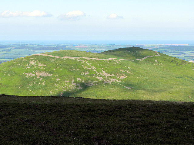 Photo could not load
NT9229 : Yeavering Bell
Andrew Curtis
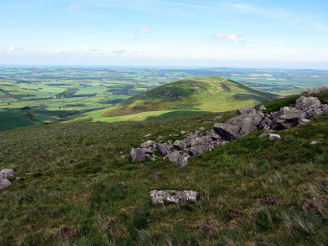 Photo could not load
NT9229 : Yeavering Bell from Easter Tor
Andrew Curtis
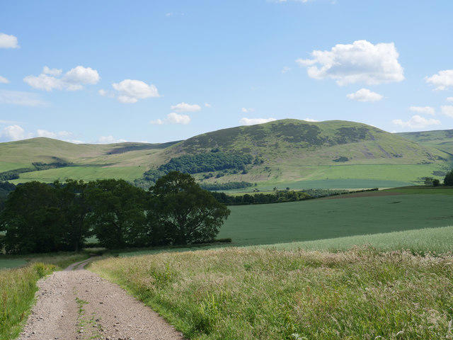 Photo could not load
NT9229 : View to Yeavering Bell
James T M Towill
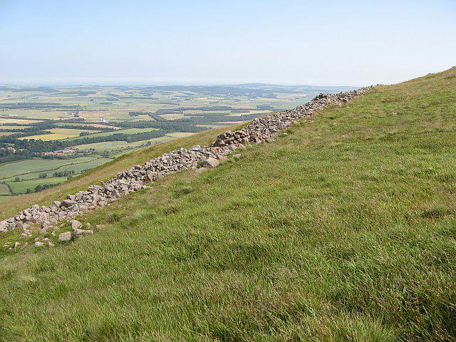 Photo could not load
NT9229 : Walls, Yeavering Bell
Richard Webb
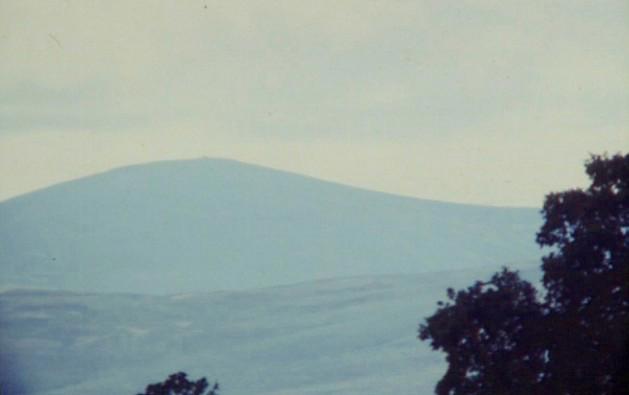 Photo could not load
NT9229 : Yeavering Bell
N T Stobbs
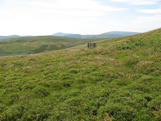 Photo could not load
NT9329 : Grouse butt, Yeavering Bell
Richard Webb
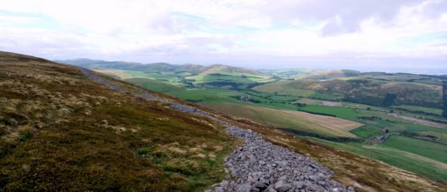
NT9229 : Yeavering Bell hill fort
Andrew Curtis
Hill facts and local notes
Classifications
Elevation
361m
1,184 ft
Prominence
93m
Coordinates
55.5577, -2.1138
NT929293
OS Map
74 75
Explorer: OL16E
At the Summit
At the summit, you'll find a prominent cairn and the remnants of an ancient hillfort, providing a tangible link to the past.
Terrain & Geology
Yeavering Bell is primarily composed of ancient volcanic rock, largely formed from basalt, providing a solid footing as you make your ascent. The rugged terrain has been sculpted by glacial action, making it a site of geological interest.
Views & Scenery
The summit boasts breathtaking views of the surrounding Cheviot Hills, the Northumberland National Park, and even the distant Scottish Borders on a clear day.
History & Heritage
Name Origin
Yeavering derives from the Old English 'geafara,' meaning 'gift,' while 'Bell' is derived from the shape of the hill, reminiscent of a bell.
Historical Significance
The area is rich in history, with evidence of Iron Age settlements and early Christian sites, making it a treasure trove for history buffs.
Getting There & Facilities
Parking
The nearest parking area is located at the Gleadscleugh valley car park, which has space for several vehicles and is accessible by car.
Public Transport
The nearest bus service runs from Wooler to the villages around the Cheviots, but check the local timetable for current routes and availability.
Nearby Facilities
In Wooler, you'll find cafes, public toilets, and basic shops. However, facilities near the mountain are limited, so stock up before heading out.
Safety Information
Known Hazards
- Beware of sudden changes in weather; conditions can deteriorate rapidly in the hills. Additionally, be cautious of uneven ground and the occasional boggy patch.
General Safety Tips
- Check weather conditions before setting out
- Carry appropriate clothing and equipment
- Let someone know your planned route
- Take a map, compass, and GPS device
- Carry emergency supplies: food, water, first aid kit, torch
Hills
Some common questions about the hills answered
Are there group walks up Yeavering Bell?
Many walkers use Walkmates to join or organise walks with others. You can check for group walks around Yeavering Bell through the maps
Are there other walkers around Yeavering Bell?
Activity varies by location and time, but Walkmates lets you see whether others have shared walks or shown interest in this area. Find other people through the walking friends search walking friends for Yeavering Bell search or of course create your own walk for Yeavering Bell
Can I organise a walk to Yeavering Bell?
Yes. If there aren’t any walks listed already, you can create a walk and make it available for others to join.
If you're signed up to Walkmates, you can create a walk to Yeavering Bell.
How do I find a walk up this hill?
There are often multiple ways to walk this hill, depending on experience and route preference. Walkmates helps you explore walks and routes that others have shared.
Can I suggest a new route up Yeavering Bell?
Yes. You can suggest or create routes to share with others. Walkmates focuses on the social side of walking, so routes are used to help people organise walks and explore areas together, rather than as detailed navigation tools or route libraries.
Other uses really appreciate knowledgeable walkers sharing their routes. Share your favourite route to Yeavering Bell here
The is an error or something incorrect about this hill. How do I let you know?
We always strive to keep the information on Walkmates as accurate as possible. If you find an error, please let us know through the contact form and we'll aim to correct it as quickly as possible
Community Discussion
Comments
Location
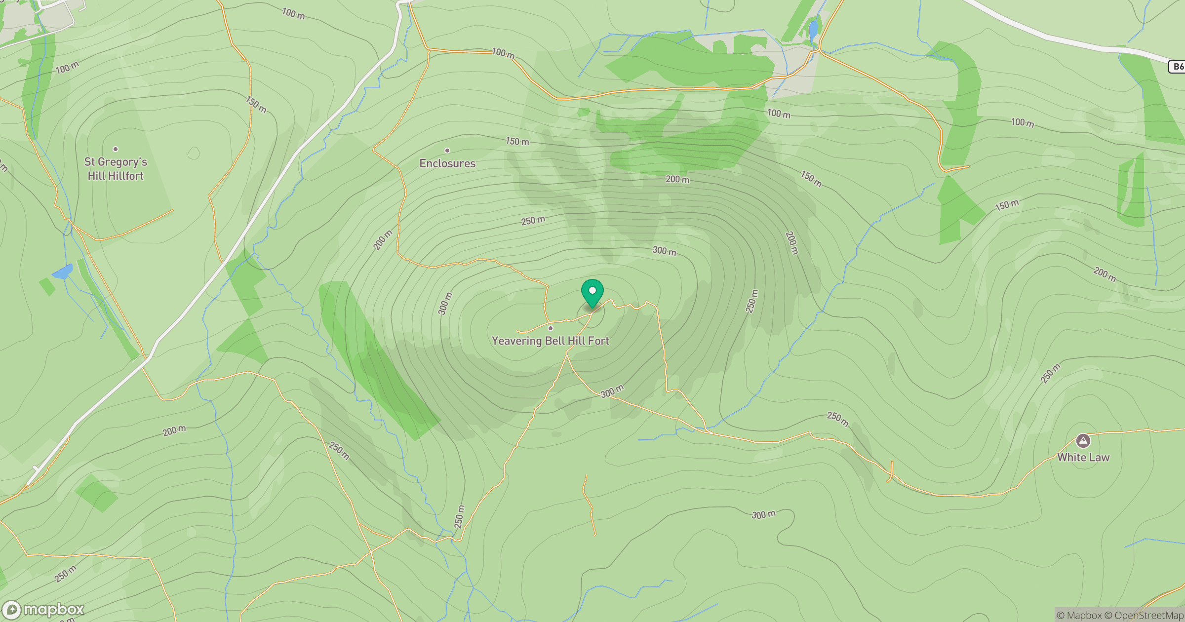
Grid reference: NT929293
View on OpenStreetMapOpens a map in a new tab, centred on the hill.





No comments yet. Be the first.