

Thieveley Pike
Good walks are even better shared.
SD8727 : Burnley seen from Thieveley Pike
Michael Steele Photo source
Overview
Thieveley Pike
Thieveley Pike, standing proudly at 397 meters, offers not just a climb but an adventure into the heart of the South Pennines. Its challenging ascent rewards hikers with stunning views and a remarkable sense of achievement.
Geology
The mountain is made primarily of durable gritstone, a rock type formed during the Carboniferous period. This geology leads to impressive rock formations and a vivid landscape that captures the beauty of the Pennines.
Routes
The popular Thieveley Pike Circular Route is the go-to for most hikers. This 5.5 km trek meanders through woodlands before revealing the rugged terrain near the summit. Anticipate a two-hour hike that, while moderate, will provide plenty of photo ops along the way!
Summit Features
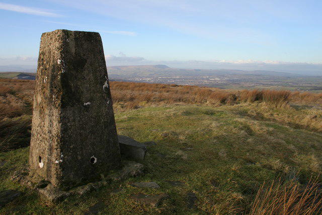
At the summit, you'll find a sturdy trig point along with a charming stone cairn. It's a fantastic place to take a breather and enjoy the panorama that unfolds around you. Don’t forget your camera!
Terrain and Views
Expect a mix of grassy trails and rocky pathways. The views are phenomenal; on a clear day, the Manchester skyline is visible alongside the rolling hills of the Peak District—just make sure your shoes have good grip, as the paths can be slippery!
Hazards
When embarking on your adventure, take care during inclement weather. The paths can get treacherous, and it’s wise to be equipped with proper hiking gear. Safety first, folks!
Access
Accessing Thieveley Pike is straightforward. The nearest parking is at the end of Thieveley Pike Road. Public transport services regularly run to Colne, the closest town, which also offers a plethora of cafes and the all-important public toilets.
History
The name Thieveley translates to 'Thief Wood', a curious nod to the area’s colourful history involving smugglers. This mountain has been a navigation point for local communities since the 19th century, serving as a striking landmark amidst the stunning landscape.
Conclusion
So, lace up your boots and head for Thieveley Pike; it's more than a hill—it's a slice of history wrapped in stunning views and an invigorating climb. Just remember, the only thing coming back from the summit should be your camera full of snaps, not your lunch!
Explore routes near Thieveley Pike
Walks starting near this hill. Open a route to check its map, distance and full itinerary.
Thieveley Pike, The Singing Ringing Tree loop from Holme Chapel
View route
Hardcastle Crags Estate Track to Gibson Mill
View route
Rochdale Walk with Men Walking & Talking
View route
Clitheroe Walk with Men Walking & Talking
View route
Route planning notes
These notes describe possible approaches. Check a route's map and access information when planning your walk.
Thieveley Pike Circular Route
A popular circular walk starting from the nearest car park, offering a mix of woodland paths and open moorland.
Make a day of it, together
Find someone to share the walk with, or organise a day out along a route you like.
Photo Gallery
View all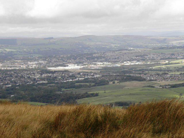 Photo could not load
SD8727 : Burnley seen from Thieveley Pike
Michael Steele
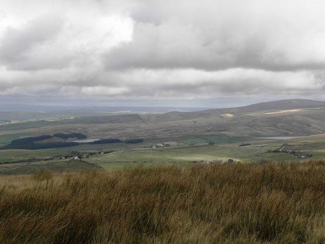 Photo could not load
SD8727 : Hurstwood and Cant Clough Reservoir from Thieveley Pike, Heald Moor
Michael Steele
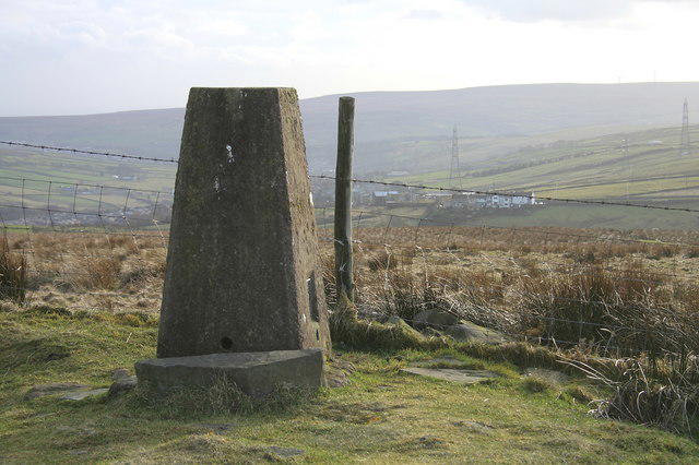 Photo could not load
SD8727 : Thieveley Pike
Kevin Rushton
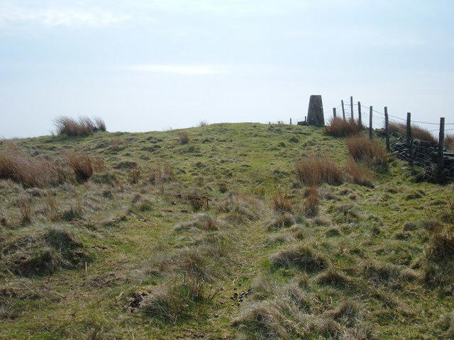 Photo could not load
SD8727 : Thieveley Pike
michael ely
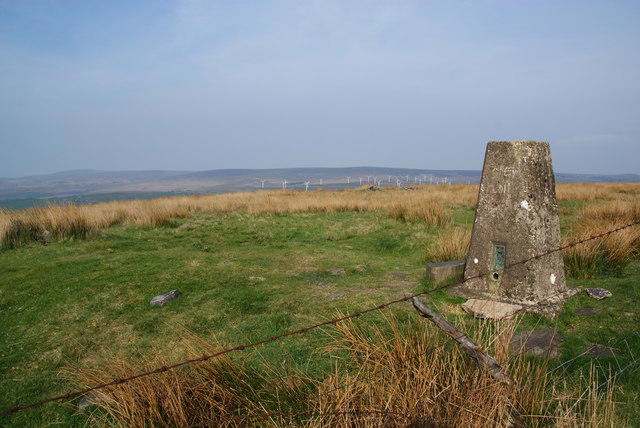 Photo could not load
SD8727 : Thieveley Pike
Bill Boaden
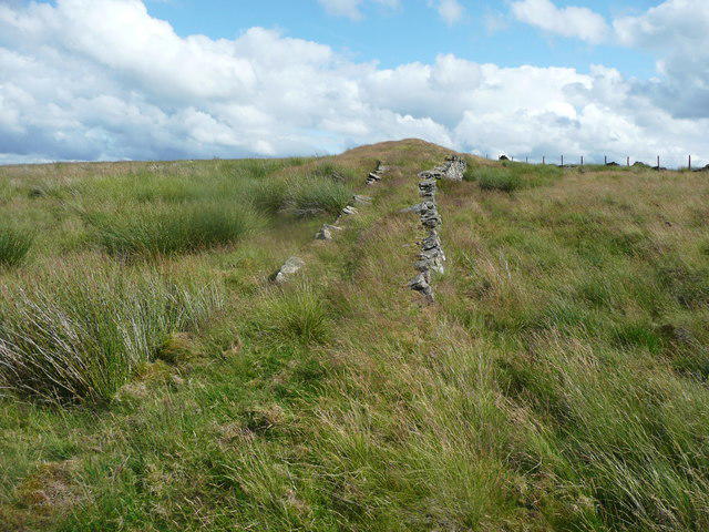 Photo could not load
SD8727 : Causeway on Thieveley Pike, Cliviger
Humphrey Bolton
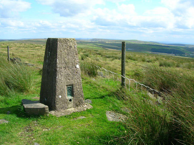 Photo could not load
SD8727 : Trig Point on Thieveley Pike, 1474' (449m)
John H Darch
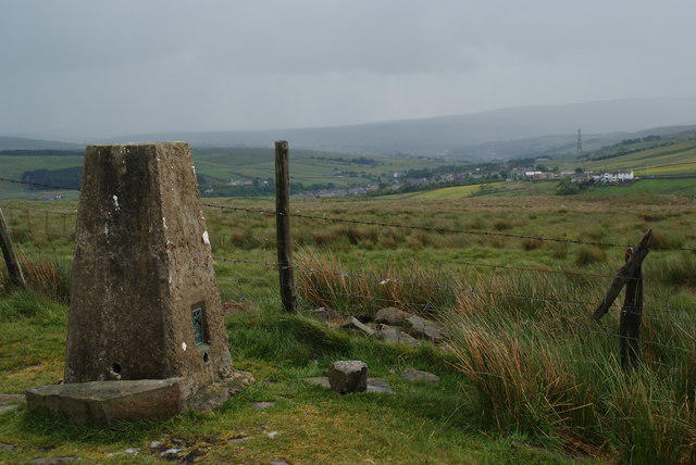 Photo could not load
SD8727 : The trig point on Thieveley Pike
Bill Boaden
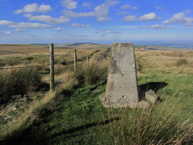 Photo could not load
SD8727 : Trig point on Thieveley Pike near Holme Chapel
Colin Park
SD8727 : Thieveley Pike
Kevin Rushton
Hill facts and local notes
Classifications
Elevation
449m
1,473 ft
Prominence
55m
Coordinates
53.7403, -2.1959
SD871271
OS Map
103
Explorer: OL21S
At the Summit
The summit features a well-maintained trig point and a small stone cairn, providing a perfect spot for a photo-op. The views from the top are particularly breathtaking, making the climb worth every footstep.
Terrain & Geology
Thieveley Pike is predominantly composed of gritstone, which is renowned for its durability and is particularly prominent in the South Pennines region. This area showcases geological layers formed during the Carboniferous period, creating fascinating rock formations and a varied topography.
Views & Scenery
From the summit, hikers can enjoy expansive views of the surrounding South Pennines, including landmarks such as the Manchester skyline on a clear day and the rolling hills of the Peak District.
History & Heritage
Name Origin
The name 'Thieveley' is thought to derive from 'Thief Wood', hinting at a nefarious past where smugglers may have used the area for clandestine activities.
Historical Significance
Thieveley Pike has historical significance as a viewpoint for the local population and has been a significant mark for navigation since the 19th century.
Getting There & Facilities
Parking
There is a small car park at the end of Thieveley Pike Road, which accommodates around 10 vehicles. It's advisable to arrive early during weekends to secure a spot.
Public Transport
Regular bus services run to the nearby village of Colne, from where it's a short walk to the start of the hiking route.
Nearby Facilities
There are no facilities directly on the mountain, but Colne offers several cafes, restaurants, and public toilets.
Safety Information
Known Hazards
- Unsuitable for hikers during extreme weather conditions. Paths can become slippery in wet weather, so good walking boots are a must!
General Safety Tips
- Check weather conditions before setting out
- Carry appropriate clothing and equipment
- Let someone know your planned route
- Take a map, compass, and GPS device
- Carry emergency supplies: food, water, first aid kit, torch
Hills
Some common questions about the hills answered
Are there group walks up Thieveley Pike?
Many walkers use Walkmates to join or organise walks with others. You can check for group walks around Thieveley Pike through the maps
Are there other walkers around Thieveley Pike?
Activity varies by location and time, but Walkmates lets you see whether others have shared walks or shown interest in this area. Find other people through the walking friends search walking friends for Thieveley Pike search or of course create your own walk for Thieveley Pike
Can I organise a walk to Thieveley Pike?
Yes. If there aren’t any walks listed already, you can create a walk and make it available for others to join.
If you're signed up to Walkmates, you can create a walk to Thieveley Pike.
How do I find a walk up this hill?
There are often multiple ways to walk this hill, depending on experience and route preference. Walkmates helps you explore walks and routes that others have shared.
Can I suggest a new route up Thieveley Pike?
Yes. You can suggest or create routes to share with others. Walkmates focuses on the social side of walking, so routes are used to help people organise walks and explore areas together, rather than as detailed navigation tools or route libraries.
Other uses really appreciate knowledgeable walkers sharing their routes. Share your favourite route to Thieveley Pike here
The is an error or something incorrect about this hill. How do I let you know?
We always strive to keep the information on Walkmates as accurate as possible. If you find an error, please let us know through the contact form and we'll aim to correct it as quickly as possible
Community Discussion
Comments
Location
View the hill's mapped position and surrounding paths.
Grid reference: SD871271
View on OpenStreetMapOpens a map in a new tab, centred on the hill.
Nearby Hills

Pendle Hill
557m
Winter Hill
456m
Rombalds Moor [Ilkley Moor]
402m

Pen-y-ghent
694m

Ingleborough
723m
No comments yet. Be the first.