

St Ann's Hill
Good walks are even better shared.
TQ0267 : Trees on St.Ann's Hill
Peter Trimming Photo source
Overview
St Ann's Hill: A Hidden Gem in Surrey's Countryside
Nestled in the picturesque Surrey Hills, St Ann's Hill offers a delightful escape for hikers seeking both tranquillity and a touch of adventure. At an elevation of 122 meters, it may not be Mont Blanc, but it packs a punch with its panoramic vistas and rich history.
Geology
The geology of St Ann's Hill is primarily chalk and clay, consisting of layers that reveal its ancient origins when this area was submerged under a warm, shallow sea. As you tread the paths, it's intriguing to think about the geological forces shaping this lovely landscape over millions of years.
Routes
A popular choice for walkers is the St Ann's Hill Circular Walk, which is around 4.5 km long and takes about 1.5 hours. This moderate route winds through beautiful woodlands before leading you to the summit, ideal for those looking to stretch their legs without too much faff. If you’re short on time, the Direct Ascent from the Car Park is a quick and easy route up, covering just 1.2 km in about half an hour. Perfect for a brisk climb!
Summit Features
Reaching the summit rewards you with a quaint trig point and a lovely bench—perfect for appreciating the yeoman scenery. Don’t forget to take a moment to enjoy the tranquillity before your descent.
Terrain
The terrain is mainly grassy, punctuated with sections of chalky trails and some rocky surfaces. Be careful, especially when wet—those chalk trails can turn as slippery as an eel!
Views and Best Seasons
From the top, the surrounding Surrey countryside unfolds before your eyes, with notable sights including the winding River Thames and the sprawling London skyline on a clear day. The best seasons to visit for stunning views are spring and autumn, when the landscape bursts with life and colour.
Hazards
As always, vigilance is key when hiking. The slippery chalk paths can catch you off guard, and it’s good to keep an eye out for any unexpected wildlife!
Nearby Summits
For those looking to extend their adventures, nearby Chobham Common and Cranleigh Hill provide ample additional hiking opportunities, each adding charm to your hiking spree.
Access
St Ann’s Hill is easily accessible, with a small car park located at the foot. Just a heads-up, it can fill up quickly, so aim to arrive early or consider carpooling! Public transport from Weybridge is also a viable option.
Facilities
While there are no facilities directly on the hill, nearby Chertsey and Weybridge boast plenty of cafés and pubs, perfect for replenishing your energy levels post-hike.
History
The name St Ann's Hill pays homage to St Anne, representing a rich tradition of naming significant landforms after saints. It’s not only a site of natural beauty but also of historical relevance, having served as a retreat for Edwardian society.
Whether you're up for a relaxed stroll or a brisk hike, St Ann's Hill is worth the trek. So lace up your boots, grab your walking stick, and enjoy all this splendid hill has to offer!
Explore routes near St Ann's Hill
Walks starting near this hill. Open a route to check its map, distance and full itinerary.
Virginia Water Circular
View route
Virginia Water Lake, Cascade and Five-Arch Bridge Circuit
View route
Savill Garden, Cow Pond and Copper Horse Walk
View route
Runnymede: Kennedy Memorial, Cooper’s Hill and Magna Carta
View route
Route planning notes
These notes describe possible approaches. Check a route's map and access information when planning your walk.
St Ann's Hill Circular Walk
A scenic circular route starting from the base of St Ann's Hill, meandering through the lovely woodland and providing elevated views.
Direct Ascent from the Car Park
A straightforward ascent directly from the car park, perfect for those looking for a quick jaunt up the hill.
Make a day of it, together
Find someone to share the walk with, or organise a day out along a route you like.
Photo Gallery
View all Photo could not load
TQ0267 : Trees on St.Ann's Hill
Peter Trimming
 Photo could not load
TQ0267 : Trees on St.Ann's Hill
Peter Trimming
 Photo could not load
TQ0267 : St Ann's Hill
Alan Hunt
 Photo could not load
TQ0267 : Viewpoint, St Ann's Hill
Des Blenkinsopp
 Photo could not load
TQ0267 : Platform near the Viewpoint
Des Blenkinsopp
 Photo could not load
TQ0267 : St Ann's Hill
Colin Smith
 Photo could not load
TQ0267 : Beacon on St.Ann's Hill, Runnymede
Peter Trimming
 Photo could not load
TQ0267 : St Ann's Hill Viewpoint
Colin Smith
 Photo could not load
TQ0267 : St Ann's Hill
Alan Hunt

TQ0267 : The beacon, St Ann's Hill
Alan Hunt
Hill facts and local notes
Classifications
Elevation
69m
226 ft
Prominence
46m
Coordinates
51.3987, -0.5255
TQ026676
OS Map
176
Explorer: 160
At the Summit
The summit features a well-maintained trig point and a small wooden bench for weary legs, providing the perfect spot to catch your breath—and a few stunning views!
Terrain & Geology
Primarily composed of chalk and clay, iconic for its undulating landscape and rich biodiversity. The hill reveals interesting sedimentary rocks formed millions of years ago in a shallow sea.
Views & Scenery
Views of the Surrey Countryside, including the River Thames and the scenic landscape stretching towards London.
History & Heritage
Name Origin
St Ann's Hill is named after St Anne, the mother of the Virgin Mary. It reflects the tradition of naming hills after saints in the region.
Historical Significance
Historically, St Ann's Hill has been a significant site due to its strategic views and was once a favourite retreat for Edwardian society.
Getting There & Facilities
Parking
There's a small car park at the foot of the hill on St Ann's Hill Road with limited capacity, so it’s best to arrive early or plan to share a ride.
Public Transport
The nearest train station is Weybridge, and from there, it’s a pleasant 30-minute walk to the hill. Buses are available but check local schedules.
Nearby Facilities
No facilities on the hill itself, but cafés and pubs can be found in nearby Chertsey and Weybridge, ideal for a post-hike pint or slice of cake.
Safety Information
Known Hazards
- Watch out for slippery chalk paths after rain; they can be as treacherous as a cat on a hot tin roof.
General Safety Tips
- Check weather conditions before setting out
- Carry appropriate clothing and equipment
- Let someone know your planned route
- Take a map, compass, and GPS device
- Carry emergency supplies: food, water, first aid kit, torch
Hills
Some common questions about the hills answered
Are there group walks up St Ann's Hill?
Many walkers use Walkmates to join or organise walks with others. You can check for group walks around St Ann's Hill through the maps
Are there other walkers around St Ann's Hill?
Activity varies by location and time, but Walkmates lets you see whether others have shared walks or shown interest in this area. Find other people through the walking friends search walking friends for St Ann's Hill search or of course create your own walk for St Ann's Hill
Can I organise a walk to St Ann's Hill?
Yes. If there aren’t any walks listed already, you can create a walk and make it available for others to join.
If you're signed up to Walkmates, you can create a walk to St Ann's Hill.
How do I find a walk up this hill?
There are often multiple ways to walk this hill, depending on experience and route preference. Walkmates helps you explore walks and routes that others have shared.
Can I suggest a new route up St Ann's Hill?
Yes. You can suggest or create routes to share with others. Walkmates focuses on the social side of walking, so routes are used to help people organise walks and explore areas together, rather than as detailed navigation tools or route libraries.
Other uses really appreciate knowledgeable walkers sharing their routes. Share your favourite route to St Ann's Hill here
The is an error or something incorrect about this hill. How do I let you know?
We always strive to keep the information on Walkmates as accurate as possible. If you find an error, please let us know through the contact form and we'll aim to correct it as quickly as possible
Community Discussion
Comments
Location
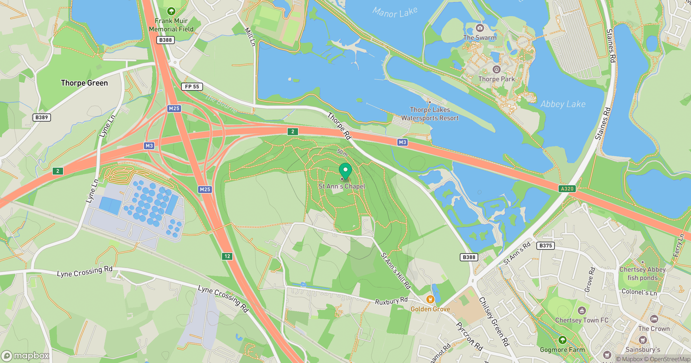
Grid reference: TQ026676
View on OpenStreetMapOpens a map in a new tab, centred on the hill.
Nearby Hills
Leith Hill
294m
Ditchling Beacon
248m
Worcestershire Beacon
425m
Glastonbury Tor
158m
Titterstone Clee Hill
533m
No comments yet. Be the first.