

St Abb's Head
Good walks are even better shared.
NT9169 : Light Keepers Cottages at St Abb's Head
Mat Fascione Photo source
Overview
St Abb's Head
St Abb's Head, a dramatic coastal headland in the Scottish Borders, is a must-visit for hiking enthusiasts and anyone with a penchant for breathtaking views. Towering at a modest 66 meters, this Marilyn may not break any height records, but its striking cliffs and scenic value surely do!
Geology
The geology of St Abb's Head is as intriguing as it is beautiful. Formed from ancient volcanic activity, the cliffs feature stunning basalt and andesite formations. If you listen closely, you might even hear them whispering tales of a fiery past!
Routes
The St Abb's Head Circular Walk is a popular route that spans approximately 5 kilometers. This moderate walk provides a perfect combination of exercise and stunning landscapes, taking around 1.5 hours to complete. With winding paths and scenic vistas, this walk offers a true taste of the coastal beauty.
Summit Features
At the summit, you’ll find the iconic St Abb's Head Lighthouse. Providing light to seafarers since the 19th century, this lighthouse also serves as a stunning backdrop for photos. Don’t forget to bring your camera—it’s not every day you get to stand atop a headland while gazing at the open sea!
Terrain
The terrain is varied, encompassing grassy paths and steep cliffs. Be prepared for a bit of a workout, but worry not; the views will make it all worthwhile. Just keep an eye on the ground, as it can get slippery after rain!
Views
The vistas from St Abb's Head are simply spectacular. On a clear day, enjoy glorious views of the Northumberland coastline and the Farne Islands—seals have been known to bask in the sun just off the shore, so keep your eyes peeled!
Best Seasons
The best seasons to visit are spring and summer when wildflowers bloom in abundance. Autumn is also a fantastic time to visit if you prefer crisp, clear days for viewing.
Hazards
While the walk is delightful, don’t let your guard down! The cliffs are steep and can become treacherous in wet conditions. Always stay aware of where you are, and keep a safe distance from the edge.
Nearby Summits
For those looking for additional adventures, Coldingham Hill, standing at 153 meters, is a great next stop. It’s a short drive away and boasts its own set of gorgeous views.
Access
Nearest parking can be found in St Abb's Village at the beginning of the trail. If you prefer using public transport, there are regular buses that service this picturesque area.
Facilities
While there are no facilities at the summit, you can find a lovely café in St Abb's Village, perfect for grabbing a well-deserved bite after your adventure.
History
The name of St Abb's Head has a fascinating origin, linked to St. Aebbe, a holy woman who established a religious community here in the 7th century. This rich history adds another layer of allure to the area, making it a place of spiritual and cultural significance.
In summary, whether you're an experienced hiker or a leisurely walker, St Abb's Head promises unforgettable experiences wrapped in natural beauty. Just don’t forget your camera; it’s a sight for sore eyes!
Explore routes near St Abb's Head
Walks starting near this hill. Open a route to check its map, distance and full itinerary.
St Abbs Head Lighthouse and Pettico Wick
View route
St Abbs Circular with seal pups at Horsecastle Bay
View route
Coldingham Creel Path and St Abbs Bay
View route
Cockburnspath to Dunglass Dean and Old Bridge
View route
Route planning notes
These notes describe possible approaches. Check a route's map and access information when planning your walk.
St Abb's Head Circular Walk
This popular circular route starts at the St Abb's Head Nature Reserve car park and follows well-marked paths along the dramatic coastal cliffs. Expect stunning views of the North Sea, seabird colonies, and the iconic lighthouse. The route loops back via Mire Loch for a more tranquil section through grassland and wetlands.
St Abb's Head and Coldingham Bay Walk
This route combines the dramatic cliffs of St Abb's Head with a visit to the picturesque Coldingham Bay. Starting at the visitor centre, the trail ascends to the lighthouse before descending towards Coldingham Sands, where you can enjoy the beach before looping back inland via farm tracks and grassy paths.
St Abb's Head via Pettico Wick Bay
This walk begins at the St Abb's Head Nature Reserve car park and takes in the rugged beauty of Pettico Wick Bay. From there, the route climbs to the lighthouse, providing panoramic views of the coastline, before looping back past Mire Loch. A shorter but scenic route ideal for birdwatchers and nature enthusiasts.
St Abb's Head and Eyemouth Coastal Path
A more challenging and longer walk, this route links St Abb's Head with the fishing village of Eyemouth. Starting at the nature reserve, follow the coastal path south, enjoying dramatic cliffs, hidden coves, and expansive sea views. The return can be made via bus or by retracing your steps.
St Abb's Head via Fancove Head
This alternative route provides a quieter experience of St Abb's Head, starting at the nature reserve and heading towards Fancove Head. The trail then loops back along the clifftop paths to the lighthouse and past Mire Loch. Expect fewer crowds and excellent wildlife spotting opportunities.
Make a day of it, together
Find someone to share the walk with, or organise a day out along a route you like.
Photo Gallery
View all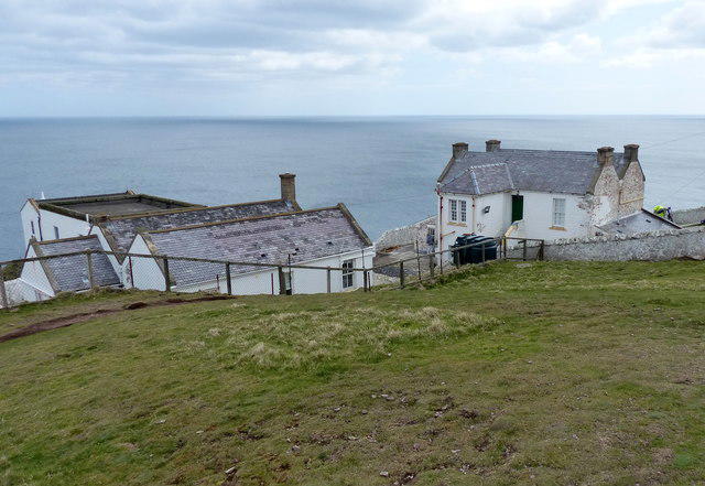 Photo could not load
NT9169 : Light Keepers Cottages at St Abb's Head
Mat Fascione
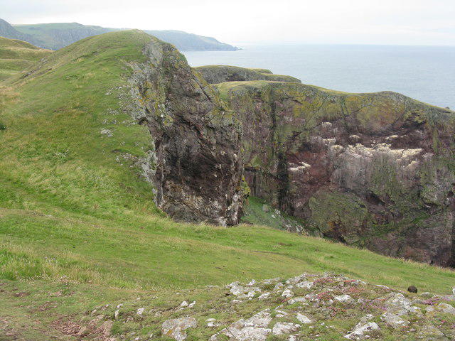 Photo could not load
NT9169 : Cliffs at St Abb's Head
M J Richardson
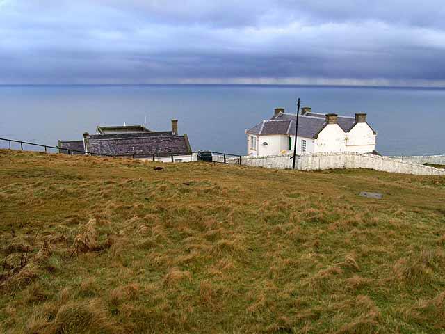 Photo could not load
NT9169 : Cottages at St Abb's Head
Oliver Dixon
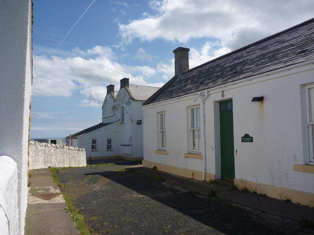 Photo could not load
NT9169 : Coastal Berwickshire : Streetscene at St. Abb's Head
Richard West
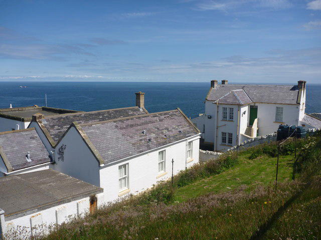 Photo could not load
NT9169 : Coastal Berwickshire : Lighthousekeepers' Houses and Cottages at St. Abb's Head
Richard West
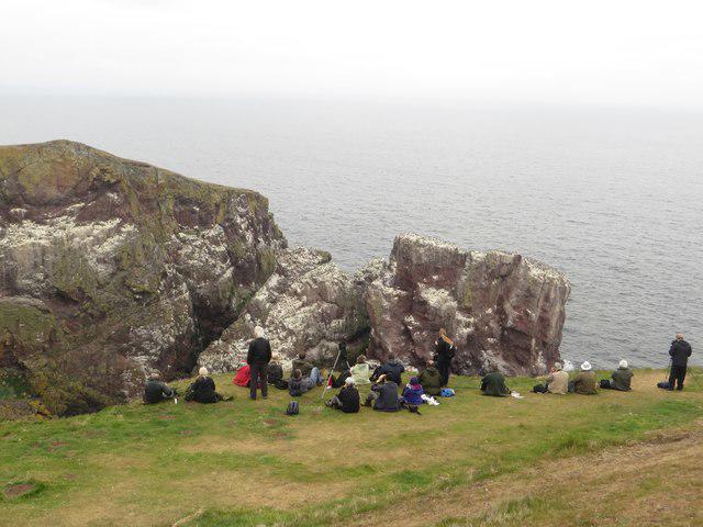 Photo could not load
NT9169 : Watching people watching birds
Graham Robson
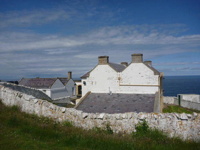 Photo could not load
NT9169 : Coastal Berwickshire : Lighthousekeepers' Houses at St. Abb's Head
Richard West
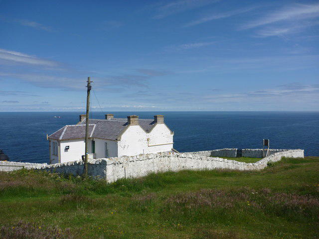 Photo could not load
NT9169 : Coastal Berwickshire : The Lighthousekeepers' Houses at St. Abb's Head
Richard West
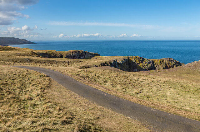 Photo could not load
NT9169 : West of St Abb's Head
Ian Capper
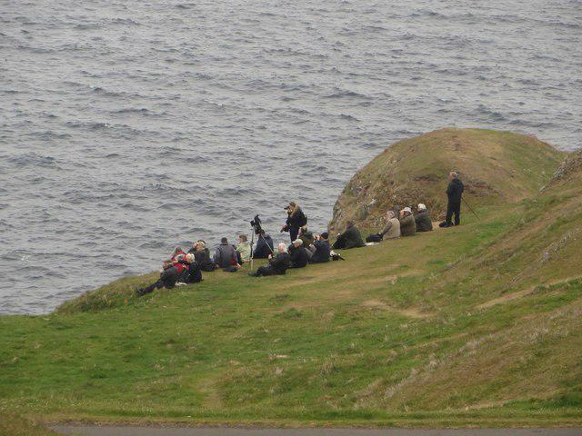
NT9169 : Bird watchers at St Abbs Head
Graham Robson
Hill facts and local notes
Classifications
Elevation
95m
311 ft
Prominence
70m
Coordinates
55.9155, -2.1418
NT912691
OS Map
67
Explorer: 346
At the Summit
The summit is marked by a prominent lighthouse (St Abb's Head Lighthouse) and a viewing platform offering panoramic views of the surrounding coastline.
Terrain & Geology
St Abb's Head is primarily composed of volcanic rock, specifically basalt and andesite, which can be observed in the sea cliffs surrounding the headland. The dramatic cliffs and diverse coastal habitats showcase the area's rich geological history, shaped by volcanic activity millions of years ago.
Views & Scenery
From the summit, hikers can see the Farne Islands, the Northumberland coastline, and possibly spot seals and seabirds.
History & Heritage
Name Origin
The name 'St Abb's Head' is derived from St. Aebbe, a holy woman who is believed to have established a religious community in the area in the 7th century.
Historical Significance
The headland is steeped in history, with evidence of early Christian settlements and a rich maritime heritage.
Getting There & Facilities
Parking
There is a small car park at the start of the trail located at NT903682, close to St Abb's Village.
Public Transport
Regular bus services run from nearby towns to St Abb's. Check local schedules for the most up-to-date information.
Nearby Facilities
There are no facilities directly at the summit, but St Abb's Village has a café and public toilets available.
Safety Information
Known Hazards
- Beware of steep cliffs and changing weather conditions, as well as slippery paths after rain.
General Safety Tips
- Check weather conditions before setting out
- Carry appropriate clothing and equipment
- Let someone know your planned route
- Take a map, compass, and GPS device
- Carry emergency supplies: food, water, first aid kit, torch
Hills
Some common questions about the hills answered
Are there group walks up St Abb's Head?
Many walkers use Walkmates to join or organise walks with others. You can check for group walks around St Abb's Head through the maps
Are there other walkers around St Abb's Head?
Activity varies by location and time, but Walkmates lets you see whether others have shared walks or shown interest in this area. Find other people through the walking friends search walking friends for St Abb's Head search or of course create your own walk for St Abb's Head
Can I organise a walk to St Abb's Head?
Yes. If there aren’t any walks listed already, you can create a walk and make it available for others to join.
If you're signed up to Walkmates, you can create a walk to St Abb's Head.
How do I find a walk up this hill?
There are often multiple ways to walk this hill, depending on experience and route preference. Walkmates helps you explore walks and routes that others have shared.
Can I suggest a new route up St Abb's Head?
Yes. You can suggest or create routes to share with others. Walkmates focuses on the social side of walking, so routes are used to help people organise walks and explore areas together, rather than as detailed navigation tools or route libraries.
Other uses really appreciate knowledgeable walkers sharing their routes. Share your favourite route to St Abb's Head here
The is an error or something incorrect about this hill. How do I let you know?
We always strive to keep the information on Walkmates as accurate as possible. If you find an error, please let us know through the contact form and we'll aim to correct it as quickly as possible
Community Discussion
Comments
Location
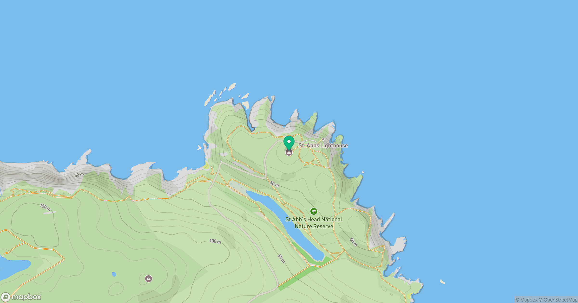
Grid reference: NT912691
View on OpenStreetMapOpens a map in a new tab, centred on the hill.




No comments yet. Be the first.