

Sron a' Chaoineidh
Good walks are even better shared.
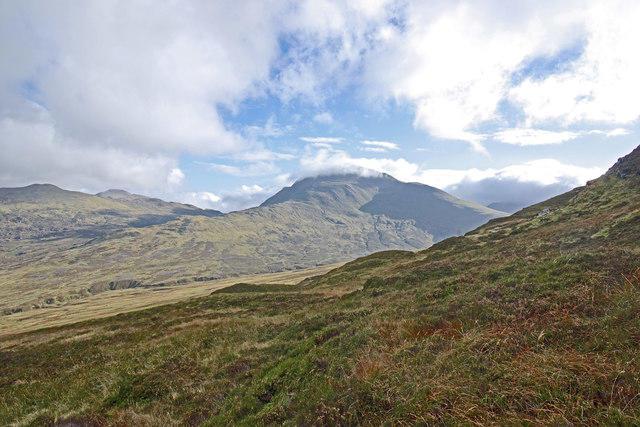
NN7736 : Sròn a' Chaoineidh
Richard Webb Photo source
Overview
Sron a' Chaoineidh
Sron a' Chaoineidh is a striking Munro located in the scenic Scottish Highlands, well-known among hikers for its stunning vistas and rugged beauty. Standing at an elevation of 711 meters, it may not be the tallest peak, but what it lacks in height, it makes up for in charm and character.
Geology
The mountain is primarily composed of ancient Lewisian gneiss and features some intriguing granite formations. This geology not only makes for interesting sites to explore but also adds to the flavors of the Highland landscape. Remember to take a moment to admire the ancient rocks - they’ve been bearing witness to the natural world for billions of years!
Routes
The most popular route to ascend Sron a' Chaoineidh begins at the car park off the A82, known as the Beinn a' Chroin Route. This moderate trail spans about 10.5 km and typically takes around 5 hours, making it suitable for those with a good level of fitness. As you walk, the lush glens and rustic charm of the Highlands surround you, with opportunities to spot wildlife and fellow hikers enjoying the crisp Scottish air.
Summit Features
Upon reaching the summit, hikers are greeted by a diminutive stone cairn which not only marks the highest point but also serves as a delightful perch to rest your weary legs. Don’t forget to snap a photo for the gram while you sip your thermos brew; after all, it’s not every day you conquer a Munro!
Terrain Type
Prepare for a mix of rocky paths and grassy slopes, interspersed with patches of vibrant heather. While certain sections may be a bit challenging, they are rewarding and highlight the diverse Highland landscape.
Views
The panoramic views from the summit are simply spectacular. Look westward, and you’ll see the serene Loch Lomond glistening in the sunshine, while the majestic Ben Lawers range stands proudly in the distance. It truly is a feast for the eyes, especially during the warm hues of sunrise or sunset when the landscape comes alive with colour.
Hazards
As with any Highland adventure, keep an eye out for loose stones along the trails, and always be prepared for sudden weather changes. The sun may be shining down on you one minute, and the next you're dodging raindrops and wind; don't let Mother Nature catch you off guard!
Access
The trailhead is easily accessible, with parking available along the A82. For those relying on public transport, Arrochar is the nearest village where you can catch a bus from the local train station.
Facilities
While facilities are limited on the mountain itself, nearby Arrochar offers everything from cafes to shops, allowing you to refuel after your excursion.
History
The evocative name of Sron a’ Chaoineidh means 'The Nose of the Cradle', and pays homage to the mystical beauty of its surroundings. This mountain holds historical and cultural significance and has been a cherished hiking destination for many adventurers.
So, pack your boots, grab your pals, and get ready to explore Sron a' Chaoineidh; you won't regret it!
Explore routes near Sron a' Chaoineidh
Walks starting near this hill. Open a route to check its map, distance and full itinerary.
Kenmore: Drummond Hill Black Rock Trail above Loch Tay
View route
Aberfeldy: Glassie Woodland and River Tay Circular
View route
Crieff: Lady Mary's Walk and the River Earn
View route
Killin: Falls of Dochart, Finlarig and Moirlanich Longhouse
View route
Route planning notes
These notes describe possible approaches. Check a route's map and access information when planning your walk.
Beinn a' Chroin Route
Starting from the car park by the A82, this route offers a gradual ascent through scenic glens leading into the heart of the mountain. Keep an eye out for some cheeky sheep along the way!
Make a day of it, together
Find someone to share the walk with, or organise a day out along a route you like.
Photo Gallery
View all Photo could not load
NN7736 : Sròn a' Chaoineidh
Richard Webb
 Photo could not load
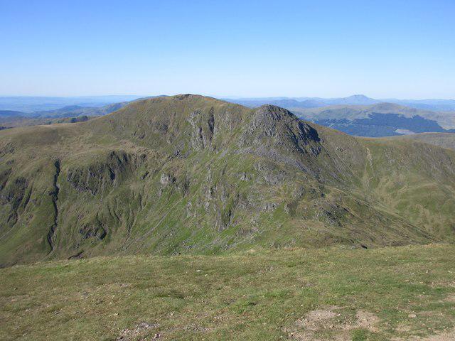
NN7736 : Sron a' Chaoineidh
Richard Webb
Hill facts and local notes
Classifications
Elevation
870m
2,855 ft
Prominence
88m
Coordinates
56.5076, -3.9992
NN770368
OS Map
51 52
Explorer: 379W
At the Summit
The summit is marked by a small stone cairn, providing a perfect spot for a celebratory selfie or a moment of reflection. If you need a break, it's a fine place to enjoy a cuppa!
Terrain & Geology
Sron a' Chaoineidh is primarily composed of ancient Lewisian gneiss and granitic intrusions, providing a rugged landscape that has withstood the test of time. The area's unique geology can reveal fascinating formations and outcrops along your route.
Views & Scenery
From the summit, you can admire views over to Loch Lomond, the Trossachs, and the distant peaks of the Ben Lawers range. On a clear day, the scenery is nothing short of breathtaking.
History & Heritage
Name Origin
The name 'Sron a' Chaoineidh' translates to 'The Nose of the Cradle', which is most likely a reference to its distinctive shape and the surrounding landscape.
Historical Significance
This mountain has been a favourite among hikers for generations, drawing the adventurous at heart seeking the unique beauty of the Scottish Highlands.
Getting There & Facilities
Parking
There is a parking area along the A82 at NN 753 232, which provides a good starting point for your hike.
Public Transport
The nearest train station is in Arrochar, from where you can catch a bus to the A82. Check local timetables for the latest services.
Nearby Facilities
There are modest facilities in Arrochar, including a few cafes and shops where you can grab a bite to eat or stock up on supplies before hitting the trail.
Safety Information
Known Hazards
- Be mindful of loose stones, especially on the ascent and descent. The weather can change quickly in the Highlands, so it’s wise to be prepared for rain or wind.
General Safety Tips
- Check weather conditions before setting out
- Carry appropriate clothing and equipment
- Let someone know your planned route
- Take a map, compass, and GPS device
- Carry emergency supplies: food, water, first aid kit, torch
Hills
Some common questions about the hills answered
Are there group walks up Sron a' Chaoineidh?
Many walkers use Walkmates to join or organise walks with others. You can check for group walks around Sron a' Chaoineidh through the maps
Are there other walkers around Sron a' Chaoineidh?
Activity varies by location and time, but Walkmates lets you see whether others have shared walks or shown interest in this area. Find other people through the walking friends search walking friends for Sron a' Chaoineidh search or of course create your own walk for Sron a' Chaoineidh
Can I organise a walk to Sron a' Chaoineidh?
Yes. If there aren’t any walks listed already, you can create a walk and make it available for others to join.
If you're signed up to Walkmates, you can create a walk to Sron a' Chaoineidh.
How do I find a walk up this hill?
There are often multiple ways to walk this hill, depending on experience and route preference. Walkmates helps you explore walks and routes that others have shared.
Can I suggest a new route up Sron a' Chaoineidh?
Yes. You can suggest or create routes to share with others. Walkmates focuses on the social side of walking, so routes are used to help people organise walks and explore areas together, rather than as detailed navigation tools or route libraries.
Other uses really appreciate knowledgeable walkers sharing their routes. Share your favourite route to Sron a' Chaoineidh here
The is an error or something incorrect about this hill. How do I let you know?
We always strive to keep the information on Walkmates as accurate as possible. If you find an error, please let us know through the contact form and we'll aim to correct it as quickly as possible
Community Discussion
Comments
Location
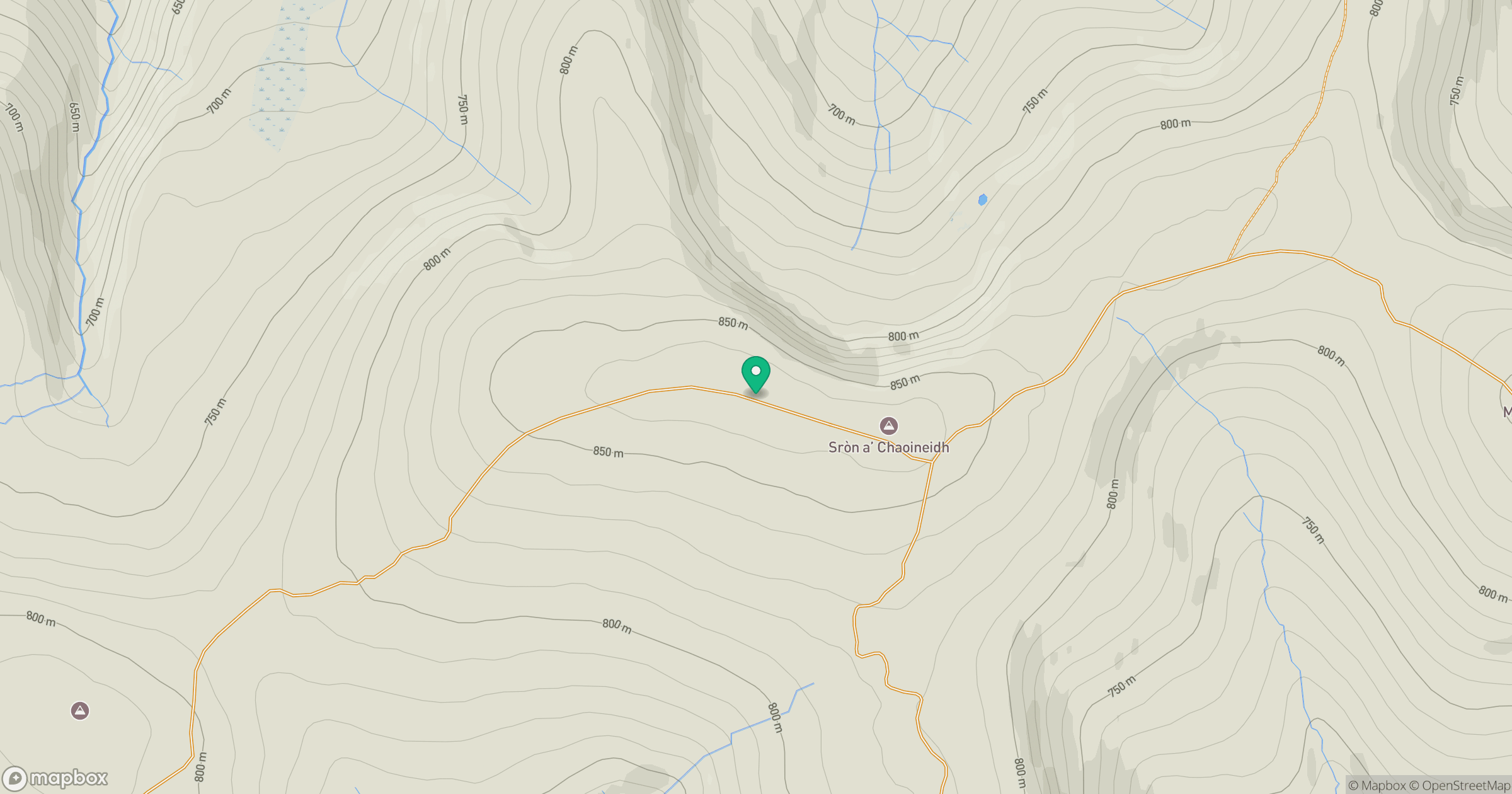
Grid reference: NN770368
View on OpenStreetMapOpens a map in a new tab, centred on the hill.
No comments yet. Be the first.