

Slievekirk
Good walks are even better shared.
C4508 : Summit, Slievekirk
Richard Webb Photo source
Explore routes near Slievekirk
Walks starting near this hill. Open a route to check its map, distance and full itinerary.
Portballintrae to Giant's Causeway: railway path and Blue Trail return
View route
Peatlands Park Red Trail: Annagarriff Wood and Derryadd Lough
View route
Florence Court: Riverside and Forest Circuit, County Fermanagh
View route
Portadown to Knock Bridge: Bann Boulevard and Moneypenny’s Lock
View route
Route planning notes
These notes describe possible approaches. Check a route's map and access information when planning your walk.
The Swivel Trail
A delightful loop starting from the base, gently ascending through lush heather and open moorland. The route treats hikers to stunning panoramic views and several scenic spots perfect for a quick rest.
Make a day of it, together
Find someone to share the walk with, or organise a day out along a route you like.
Photo Gallery
View all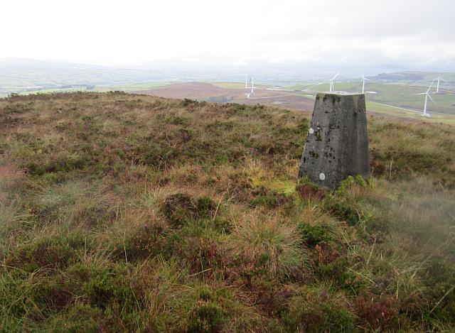 Photo could not load
C4508 : Summit, Slievekirk
Richard Webb
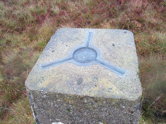 Photo could not load
C4508 : Slievekirk triangulation pillar
Richard Webb
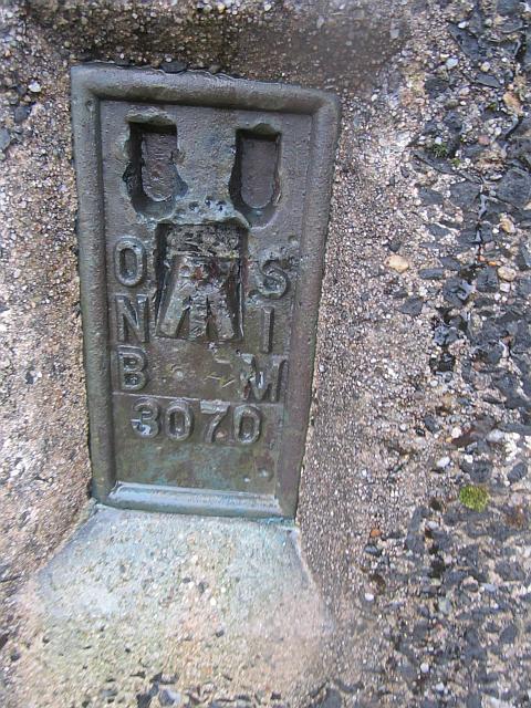 Photo could not load
C4508 : Slievekirk triangulation pillar
Richard Webb
Hill facts and local notes
Classifications
Elevation
370m
1,214 ft
Prominence
276m
Coordinates
54.9194, -7.2974
C451082
OS Map
07
At the Summit
The summit is marked by a modest cairn and offers a concrete trig point for the enthusiastic peak-bagger. Be sure to bring your camera for the inevitable 'Look Mom, I made it!' photos.
Terrain & Geology
Slievekirk is primarily composed of ancient metamorphic rocks, including schist and gneiss, that tell a tale of geological upheaval stretching back over a billion years. The area showcases glacial erosion patterns, with striking features like corries and ridges.
Views & Scenery
From the summit, bask in the beauty of the surrounding Sperrin Mountains, with views extending to the Mourne Mountains, Lough Neagh, and even distant glimpses of the Antrim Plateau.
History & Heritage
Name Origin
The name 'Slievekirk' derives from the Irish 'Sliabh Chaircc', translating to 'mountain of the church', possibly referencing ancient archaeological sites in the area.
Historical Significance
Historically, Slievekirk has been a site of local folklore and tales of ancient monks who sought solitude on its heights.
Getting There & Facilities
Parking
There is a small parking area at the trailhead near Cavanreagh, accommodating around 6-8 cars. Arrive early on weekends to secure your spot!
Public Transport
Bus routes from Derry and Belfast provide access to nearby villages, from which a taxi or local shuttle can reach the trailhead.
Nearby Facilities
Draperstown has several options for food and drink, including pubs and cafés. Public toilets are available in the town centre.
Safety Information
Known Hazards
- Beware of sudden weather changes, especially in winter months; fog can descend quickly. Ruts and muddy patches may appear after heavy rainfall, so sturdy footwear is advisable.
General Safety Tips
- Check weather conditions before setting out
- Carry appropriate clothing and equipment
- Let someone know your planned route
- Take a map, compass, and GPS device
- Carry emergency supplies: food, water, first aid kit, torch
Hills
Some common questions about the hills answered
Are there group walks up Slievekirk?
Many walkers use Walkmates to join or organise walks with others. You can check for group walks around Slievekirk through the maps
Are there other walkers around Slievekirk?
Activity varies by location and time, but Walkmates lets you see whether others have shared walks or shown interest in this area. Find other people through the walking friends search walking friends for Slievekirk search or of course create your own walk for Slievekirk
Can I organise a walk to Slievekirk?
Yes. If there aren’t any walks listed already, you can create a walk and make it available for others to join.
If you're signed up to Walkmates, you can create a walk to Slievekirk.
How do I find a walk up this hill?
There are often multiple ways to walk this hill, depending on experience and route preference. Walkmates helps you explore walks and routes that others have shared.
Can I suggest a new route up Slievekirk?
Yes. You can suggest or create routes to share with others. Walkmates focuses on the social side of walking, so routes are used to help people organise walks and explore areas together, rather than as detailed navigation tools or route libraries.
Other uses really appreciate knowledgeable walkers sharing their routes. Share your favourite route to Slievekirk here
The is an error or something incorrect about this hill. How do I let you know?
We always strive to keep the information on Walkmates as accurate as possible. If you find an error, please let us know through the contact form and we'll aim to correct it as quickly as possible
Community Discussion
Comments
Location
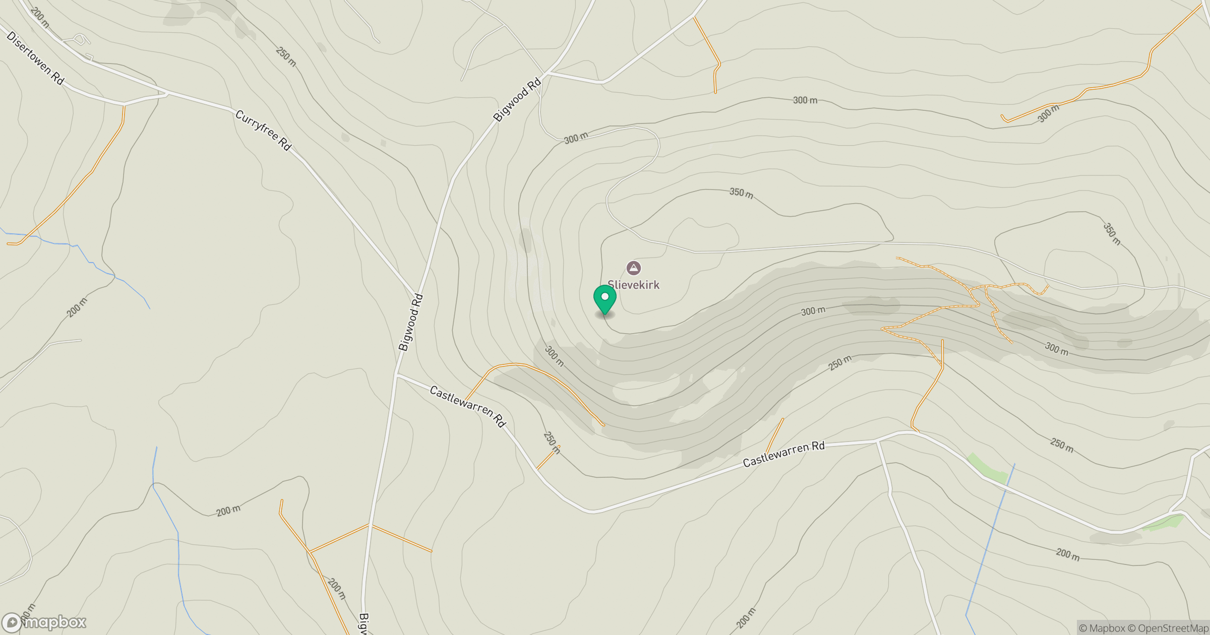
Grid reference: C451082
View on OpenStreetMapOpens a map in a new tab, centred on the hill.
No comments yet. Be the first.