

Polzeath Hill
Good walks are even better shared.
SW9378 : Francis Road, Polzeath
Derek Harper Photo source
Overview
Polzeath Hill
Polzeath Hill, standing at a proud 142 meters, may not be the tallest peak around but don’t let its modest elevation fool you. This charming Marilyn in beautiful Cornwall is steeped in breathtaking views and rich geological history. Nestled just above the coastal village of Polzeath, it’s a popular haunt for families, hikers, and those with a love for the great outdoors.
Geology
The hill is primarily composed of granite and slates, characteristic of the local geology influenced by ancient volcanic activity and subsequent weathering. This fascinating backdrop has carved a unique landscape, making it a delight for geology enthusiasts and landscape photographers alike.
Routes
Polzeath to the Summit
This delightful route starts from the heart of Polzeath village and winds its way through lush greenery, taking around 1.5 hours to reach the summit. It’s an easy hike, perfect for families, where the only pressure is racing your companions to the top.
The Coastal Path
For those feeling a bit adventurous, the Coastal Path route merges impressive views with a moderate hike through stunning scenery, connecting the summit with the picturesque South West Coast Path. Allow around three hours as you soak in the sea air and perhaps catch sight of some local wildlife.
Summit Features
On reaching the summit, you’ll be welcomed by a humble trig point that is just begging for a selfie or two. The views stretch towards the Atlantic Ocean and you might even spot a surfer riding the waves down below.
Terrain Type
Expect grassy paths with occasional rocky patches, particularly near the summit. Suitable footwear is recommended to prevent any missteps!
Views
On a clear day, the vistas from Polzeath Hill are nothing short of spectacular. You can admire the Camel Estuary’s winding curve and the vibrant landscape of Daymer Bay. For the best views, try visiting in spring or early summer when the scenery is at its most colourful.
Hazards
As with any outdoor adventure, caution is advised. Take care with the occasionally loose rocks at the summit and be vigilant after wet weather as paths can become slippery.
Nearby Summits
If you’re feeling particularly energetic, consider visiting Rostowrack Point and Pentire Head, both of which offer their own charming walks and views.
Access
Nearest Parking
There’s a handy public car park located on St. Minver Road, just a short jaunt from the trail.
Public Transport
Polzeath village is accessible via local bus services from Wadebridge, making it easy for hikers without a vehicle.
Nearest Town
Wadebridge, the closest town, is approximately 8 km away and presents a great opportunity for a post-hike cream tea!
Facilities
You’ll find various cafes and pubs in Polzeath—perfect for a bite to eat or quenching your thirst after your hike. Public toilets are also located conveniently near the beach.
History
Name Meaning
The name 'Polzeath' comes from the Cornish meaning 'the mouth of the stream', aptly reflecting the surrounding geography.
Significance
This hill, along with the village of Polzeath, has long been a favoured destination for both locals and holidaymakers, well-known for its lovely beaches and surf culture.
Whether you’re a seasoned hiker or someone just looking for a leisurely stroll with a view, Polzeath Hill is well worth a visit. Just remember to pack a picnic and perhaps a kite, as the winds can be quite friendly up there!
Explore routes near Polzeath Hill
Walks starting near this hill. Open a route to check its map, distance and full itinerary.
Padstow to Trevone coastal circular
View route
Wadebridge to Boscarne: Camel Valley Railway Walk
View route
Lanhydrock: Deer Wall, River Fowey and Woodland Circuit
View route
Ropehaven Cliffs and Black Head
View route
Route planning notes
These notes describe possible approaches. Check a route's map and access information when planning your walk.
Polzeath to the Summit
A scenic route starting from the village of Polzeath, winding up through lush greenery to the summit, ideal for families and casual hikers.
The Coastal Path
This route links the hill to the South West Coast Path, featuring stunning coastal views and wildlife. A must for those with a little more time and energy!
Make a day of it, together
Find someone to share the walk with, or organise a day out along a route you like.
Photo Gallery
View all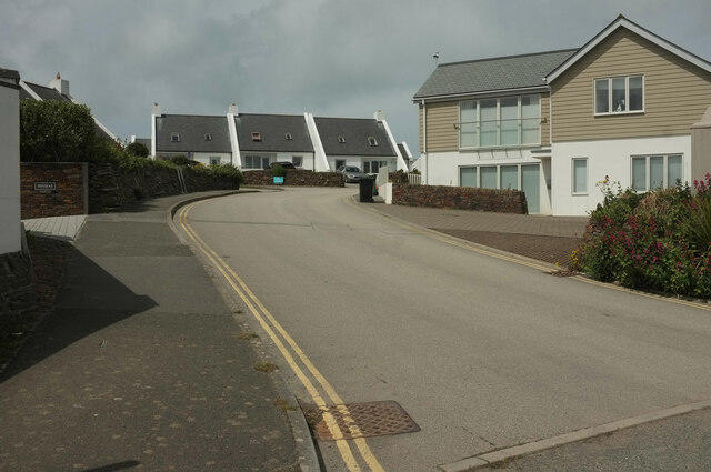 Photo could not load
SW9378 : Francis Road, Polzeath
Derek Harper
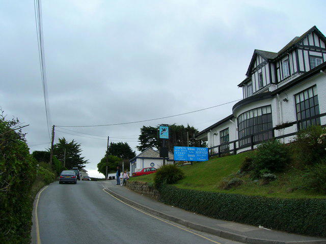 Photo could not load
SW9378 : The Oyster Catcher Polzeath Hill
William Bartlett
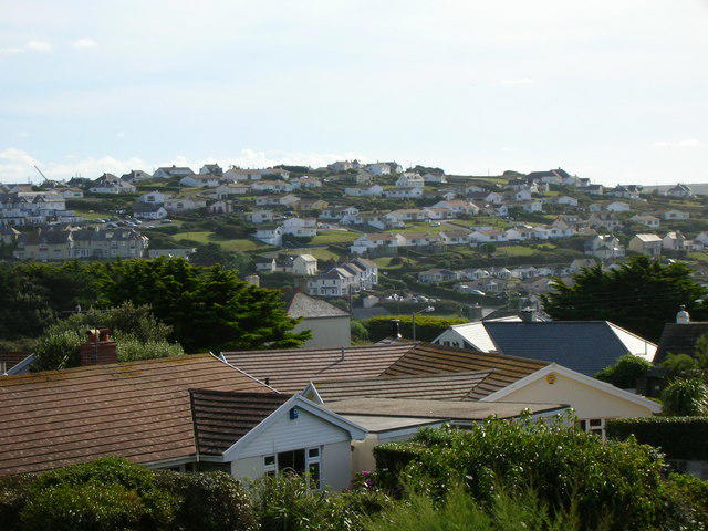 Photo could not load
SW9378 : Polzeath towards Trebetherick
William Bartlett
Hill facts and local notes
Classifications
Elevation
66m
217 ft
Prominence
38m
Coordinates
50.5701, -4.9199
SW933785
OS Map
200
Explorer: 106
At the Summit
The summit is adorned with a simple yet charming trig point, offering an inviting spot for photos and letting you catch your breath—possibly after racing your mate to the top!
Terrain & Geology
Composed primarily of granite and slates, characteristic of this coastal region, Polzeath Hill offers a glimpse into the earth's geological history, shaped by oceanic forces and natural erosion.
Views & Scenery
From the summit, gaze over the stunning Camel Estuary and the rolling waves of the Atlantic. Keep an eye out for the iconic Daymer Bay and the neighbouring cliffs.
History & Heritage
Name Origin
The name 'Polzeath' is derived from the Cornish language, meaning 'the mouth of the stream'. Quite fitting, considering the stream leads to the beautiful sea!
Historical Significance
Polzeath has been a popular holiday destination for centuries, known for its surf culture and as a quaint fishing village.
Getting There & Facilities
Parking
There is a public car park on St. Minver Road in Polzeath, just a short walk from the trailhead.
Public Transport
The nearest bus stop is in Polzeath village, serviced by local bus routes from Wadebridge and surrounding areas.
Nearby Facilities
There are several cafes and pubs in Polzeath for refreshments, along with public toilets available near the beach.
Safety Information
Known Hazards
- While the routes are generally safe, be mindful of loose rocks around the summit and slippery paths after rainfall.
General Safety Tips
- Check weather conditions before setting out
- Carry appropriate clothing and equipment
- Let someone know your planned route
- Take a map, compass, and GPS device
- Carry emergency supplies: food, water, first aid kit, torch
Hills
Some common questions about the hills answered
Are there group walks up Polzeath Hill?
Many walkers use Walkmates to join or organise walks with others. You can check for group walks around Polzeath Hill through the maps
Are there other walkers around Polzeath Hill?
Activity varies by location and time, but Walkmates lets you see whether others have shared walks or shown interest in this area. Find other people through the walking friends search walking friends for Polzeath Hill search or of course create your own walk for Polzeath Hill
Can I organise a walk to Polzeath Hill?
Yes. If there aren’t any walks listed already, you can create a walk and make it available for others to join.
If you're signed up to Walkmates, you can create a walk to Polzeath Hill.
How do I find a walk up this hill?
There are often multiple ways to walk this hill, depending on experience and route preference. Walkmates helps you explore walks and routes that others have shared.
Can I suggest a new route up Polzeath Hill?
Yes. You can suggest or create routes to share with others. Walkmates focuses on the social side of walking, so routes are used to help people organise walks and explore areas together, rather than as detailed navigation tools or route libraries.
Other uses really appreciate knowledgeable walkers sharing their routes. Share your favourite route to Polzeath Hill here
The is an error or something incorrect about this hill. How do I let you know?
We always strive to keep the information on Walkmates as accurate as possible. If you find an error, please let us know through the contact form and we'll aim to correct it as quickly as possible
Community Discussion
Comments
Location
View the hill's mapped position and surrounding paths.
Grid reference: SW933785
View on OpenStreetMapOpens a map in a new tab, centred on the hill.
Nearby Hills
Brown Willy
420m

Brent Tor
334m

High Willhays
622m
Rhossili Down - The Beacon
193m

Dunkery Beacon
520m
No comments yet. Be the first.