

Meall nan Eanchainn
Good walks are even better shared.
NN7836 : Hare hole
Richard Webb Photo source
Overview
Meall nan Eanchainn: A Hidden Gem in the Highlands
Nestled within the majestic folds of the Scottish Highlands, Meall nan Eanchainn stands proudly at an elevation of 600 meters. While not the most towering of peaks in the region, this Hewitt offers hikers a delightful adventure with breathtaking views and varied terrain.
Geology
The very rock beneath your feet is steeped in history, primarily composed of granite with splendid speckles of schist. This beautiful combination creates a dynamic landscape that supports diverse flora and fauna, making every step not just a hike, but a stroll through geological time.
The Routes
- Glen Ogle Approach: This popular route from the Glen Ogle car park is approximately 8 km and should take around 3.5 hours. The path is well-maintained with a gentle gradient, making it a favourite for families.
- Route from Strathyre: Slightly longer at 9.5 km, this track also leans toward the moderate side and will take roughly 4 hours. This route is ideal for those who prefer starting from a village setting, ultimately providing more varied landscapes and a chance to sample local charm.
Summit Features
When you reach the top, you will be greeted by a quaint little cairn representing persistence and triumph. It’s a perfect spot to pause for a selfie, commemorate your achievement, and maybe even enjoy a wee snack. Remember, calories consumed on a hike don't count!
Terrain Type
Expect a delightful mixture of grassy slopes, rocky outcrops, and yes, a boggy patch or two. Always a fun surprise for the unsuspecting hiker! Good footwear is a must unless you fancy a mud facial.
Views
Once at the summit, you’ll be rewarded with spectacular views of Loch Earn and majestic peaks like Ben Vorlich and Stuc a' Chroin. For the best experience, aim for early morning or late afternoon when the light casts a magical glow over the hills.
Hazards
Every adventure has its challenges. Be prepared for sudden weather shifts that can make your idyllic hike feel like a seafaring tale on a stormy night. And those rocks? They’re slippery when wet—treat them like a dance partner; otherwise, you might find yourself unexpectedly lying down!
Nearby Summits
For the ambitious hiker, consider tackling nearby giants like Ben Vorlich (985 meters) and Stuc a' Chroin (975 meters) for a day filled with peaks and picturesque views.
Access
Your journey begins at the Glen Ogle car park with plenty of space for cars looking to hit the trails. If public transport is more your style, local buses run from Callander to Strathyre, with a scenic walk to the starting point.
Facilities
Don’t fret about facilities; Callander, just 10 km away, boasts lovely cafes perfect for rewarding yourself with a delightful meal or snack after your hike.
History
The name itself, Meall nan Eanchainn, translates to 'hill of the horses', a nod to the area's pastoral heritage. Over the years, it has become a cherished destination for both seasoned hikers and those just wanting to dip their toes in the great Scottish outdoors.
In summary, Meall nan Eanchainn might not hold the title of tallest in the Highlands, but what it lacks in height, it certainly makes up for in charm and stunning beauty. Lace up those hiking boots and get ready for an adventure that holds stories in every stone!
Explore routes near Meall nan Eanchainn
Walks starting near this hill. Open a route to check its map, distance and full itinerary.
Kenmore: Drummond Hill Black Rock Trail above Loch Tay
View route
Aberfeldy: Glassie Woodland and River Tay Circular
View route
Crieff: Lady Mary's Walk and the River Earn
View route
Killin: Falls of Dochart, Finlarig and Moirlanich Longhouse
View route
Route planning notes
These notes describe possible approaches. Check a route's map and access information when planning your walk.
Glen Ogle Approach
A well-trodden path leading up from Glen Ogle car park, providing a steady gradient and stunning scenery.
Route from Strathyre
This route starts in the village of Strathyre and climbs steadily to the summit, rewarding hikers with panoramic views.
Make a day of it, together
Find someone to share the walk with, or organise a day out along a route you like.
Photo Gallery
View all Photo could not load
NN7836 : Hare hole
Richard Webb
 Photo could not load
NN7836 : Peat, Meall nan Eanchainn
Richard Webb
 Photo could not load
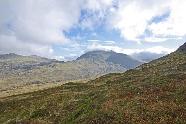
NN7836 : Meall nan Eanchainn
Richard Webb
Hill facts and local notes
Classifications
Elevation
856m
2,810 ft
Prominence
42m
Coordinates
56.5073, -3.9713
NN787367
OS Map
51 52
Explorer: 379W
At the Summit
The summit features a small cairn, providing a perfect photo opportunity for those wishing to immortalise their ascent.
Terrain & Geology
Composed mainly of granite with patches of schist, offering a mix of rocky terrain and softer slopes. The rich geology of this area supports a variety of flora and fauna.
Views & Scenery
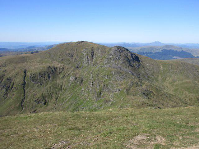
From the summit, enjoy sweeping views of Loch Earn, Ben Vorlich, and the undulating hills of the surrounding region.
History & Heritage
Name Origin
The name 'Meall nan Eanchainn' translates to 'hill of the horses', indicative of the region's historical use for livestock grazing.
Historical Significance
The mountain has been a popular destination for hiking enthusiasts for generations, contributing to the heritage of outdoor exploration in Scotland.
Getting There & Facilities
Parking
Glen Ogle car park, located just off the A84, is the most accessible point for embarking on the ascent.
Public Transport
Local buses operate from Callander to Strathyre with a bit of a walk needed to reach the start of the trails.
Nearby Facilities
There are public toilets in Callander, and several cafes offering a warm cuppa and a bite to eat after your hike.
Safety Information
Known Hazards
- Watch out for sudden weather changes; the hills have a habit of throwing tantrums. Also, be mindful of slippery rocks after rainfall.
General Safety Tips
- Check weather conditions before setting out
- Carry appropriate clothing and equipment
- Let someone know your planned route
- Take a map, compass, and GPS device
- Carry emergency supplies: food, water, first aid kit, torch
Hills
Some common questions about the hills answered
Are there group walks up Meall nan Eanchainn?
Many walkers use Walkmates to join or organise walks with others. You can check for group walks around Meall nan Eanchainn through the maps
Are there other walkers around Meall nan Eanchainn?
Activity varies by location and time, but Walkmates lets you see whether others have shared walks or shown interest in this area. Find other people through the walking friends search walking friends for Meall nan Eanchainn search or of course create your own walk for Meall nan Eanchainn
Can I organise a walk to Meall nan Eanchainn?
Yes. If there aren’t any walks listed already, you can create a walk and make it available for others to join.
If you're signed up to Walkmates, you can create a walk to Meall nan Eanchainn.
How do I find a walk up this hill?
There are often multiple ways to walk this hill, depending on experience and route preference. Walkmates helps you explore walks and routes that others have shared.
Can I suggest a new route up Meall nan Eanchainn?
Yes. You can suggest or create routes to share with others. Walkmates focuses on the social side of walking, so routes are used to help people organise walks and explore areas together, rather than as detailed navigation tools or route libraries.
Other uses really appreciate knowledgeable walkers sharing their routes. Share your favourite route to Meall nan Eanchainn here
The is an error or something incorrect about this hill. How do I let you know?
We always strive to keep the information on Walkmates as accurate as possible. If you find an error, please let us know through the contact form and we'll aim to correct it as quickly as possible
Community Discussion
Comments
Location
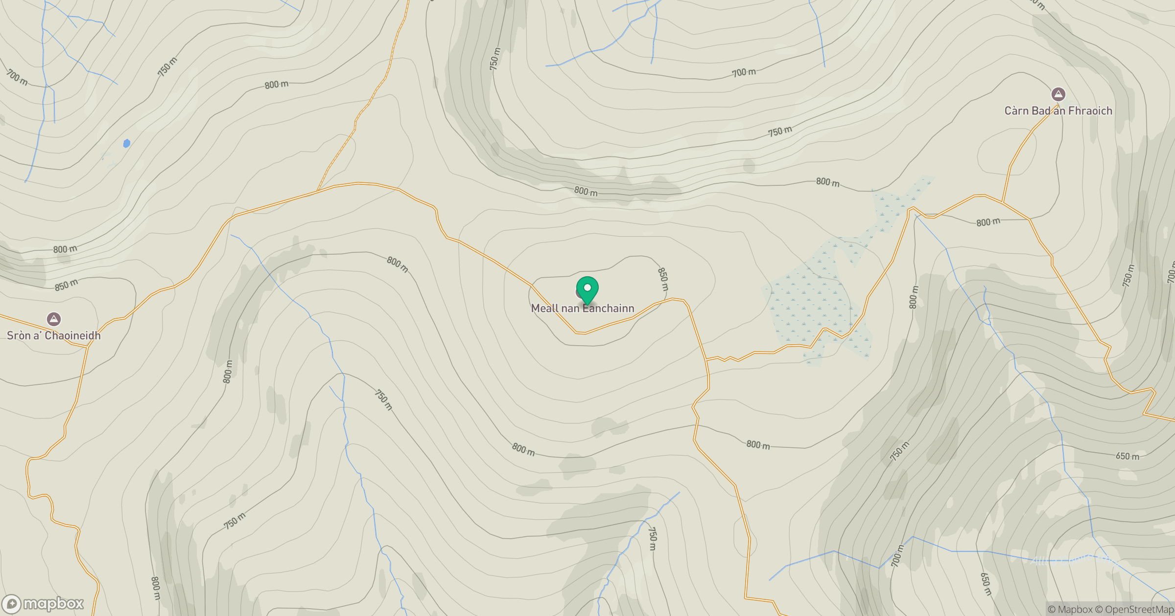
Grid reference: NN787367
View on OpenStreetMapOpens a map in a new tab, centred on the hill.
No comments yet. Be the first.