

Meall Corranaich
Good walks are even better shared.
NN6140 : Path towards Meall Corranaich
Peter S Photo source
Overview
Meall Corranaich
Meall Corranaich is a captivating Munro located in the heart of the Scottish Highlands, standing tall at an elevation of 1068 meters. This hill, well-loved by walkers and nature lovers alike, offers both a fulfilling challenge and breathtaking views.
Geology
The geology of Meall Corranaich is primarily characterised by ancient volcanic rock. The rugged terrain and weathered surfaces provide hikers with a visible history of the natural forces that shaped this majestic region. Perfect for appreciating Scotland’s geological stories, it’s as if the mountain is whispering tales of yore with every step taken.
Routes
There are several routes to the summit, but two of the most popular include the Kilaven Path, which is moderate in difficulty and perfect for a leisurely hike, and the more challenging South Ridge, where determination is key! Whether you choose the quiet charm of Kilaven or the adventuresome ridge, you’re in for splendid scenery.
Summit Features
One cannot miss the impressive stone cairn and redundant trig point at the summit, providing the perfect backdrop for selfies. Forget filter apps; the natural beauty here is Instagram-worthy straight off the camera!
Terrain Type
The terrain is a delightful mix of grassy slopes and rugged rocky outcrops, with a little boggy surprise waiting here and there. Navigating these will keep you on your toes—literally!
Views
As you reach the top, your efforts will be rewarded with stunning panoramic views, including highlights like the majestic Ben Lawers and the tranquil Loch Tay. The best seasons for these countryside vistas are late spring and early autumn; the low sun enhances the beauty, making the landscape even more picturesque.
Hazards
Hikers should be mindful of changing weather conditions, especially in the Highlands, where it can go from sunny to blustery quicker than you can say 'pothole'. Remember, caution is the name of the game when navigating any steep drops.
Access
The nearest parking is located in Kilaven, giving you a jump-start on your adventure. Alternatively, while public transport access is slightly limited, the vibrant town of Killin is just a stone's throw away, offering ample cafes and facilities for hiker's needs.
History
In Gaelic, Meall Corranaich translates to 'hill of the corner', a moniker that might suggest there’s always something wondrous just around the bend. Historically, this mountain has served as a cherished landmark within local traditions and folklore.
Whether you're a seasoned climber or just fancy a good ramble with fantastic company (the Scottish landscape, of course), Meall Corranaich is waiting for you to lace up those boots and make the ascent!
Enjoy the climb and don't forget to pack your sense of adventure!
Explore routes near Meall Corranaich
Walks starting near this hill. Open a route to check its map, distance and full itinerary.
Killin: Falls of Dochart, Finlarig and Moirlanich Longhouse
View route
Kenmore: Drummond Hill Black Rock Trail above Loch Tay
View route
Aberfeldy: Glassie Woodland and River Tay Circular
View route
Crieff: Lady Mary's Walk and the River Earn
View route
Route planning notes
These notes describe possible approaches. Check a route's map and access information when planning your walk.
Kilaven Path
This popular route starts at Kilaven and gently ascends through heather and grassland, offering a manageable climb with picturesque views.
South Ridge
A more challenging ascent begins at the end of the track from the village of Balquhidder, traversing a steep incline with some rocky sections, leading to sweeping views at the summit.
Make a day of it, together
Find someone to share the walk with, or organise a day out along a route you like.
Photo Gallery
View all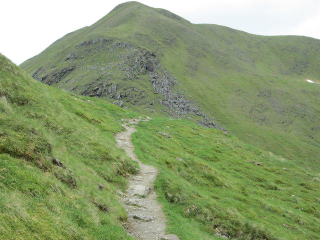 Photo could not load
NN6140 : Path towards Meall Corranaich
Peter S
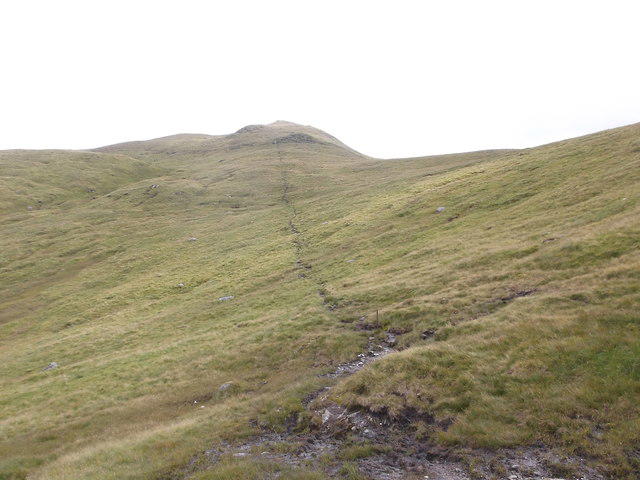 Photo could not load
NN6140 : Approaching Meall Corranaich
Iain Russell
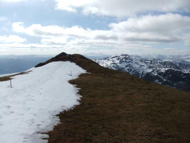 Photo could not load
NN6140 : On Meall Corranaich
David Brown
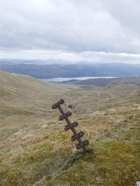 Photo could not load
NN6140 : No longer taking the strain
James T M Towill
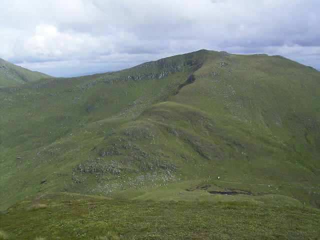 Photo could not load
NN6140 : Beinn Ghlas from Meall Corranaich
Tony Teperek
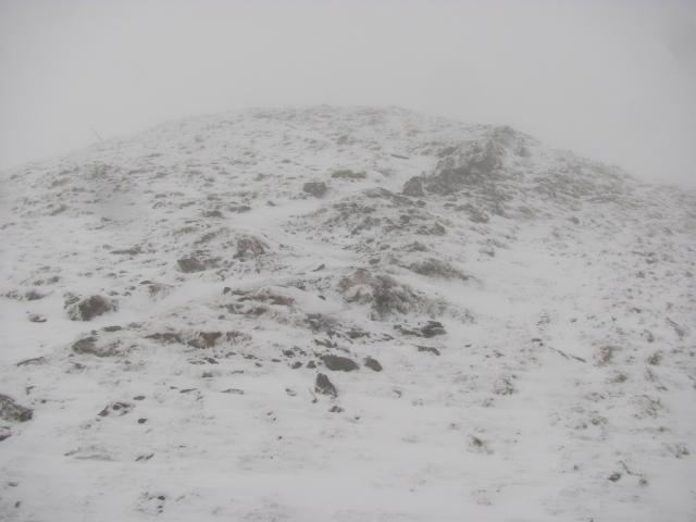 Photo could not load
NN6140 : Meall Corranaich
Richard Webb
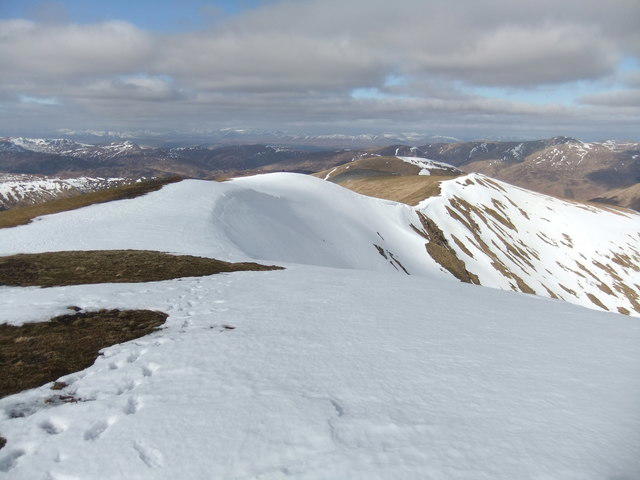 Photo could not load
NN6141 : North ridge of Meall Corranaich
David Brown
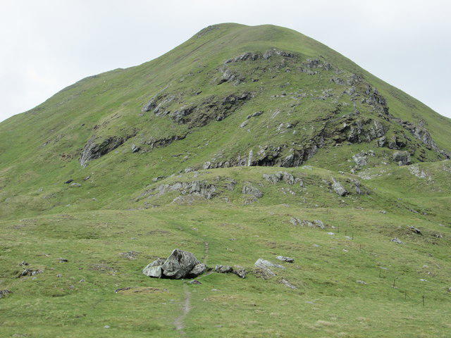 Photo could not load
NN6140 : Meall Corranaich
Peter S
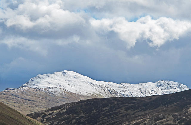 Photo could not load
NN6141 : Meall Corranaich
William Starkey
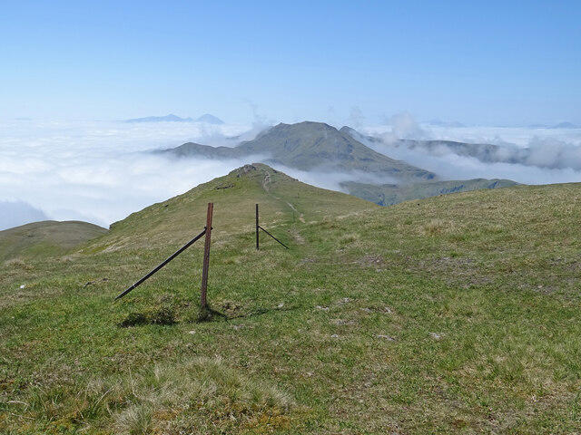
NN6141 : Old Fence, Meall Corranaich
Adam Ward
Hill facts and local notes
Classifications
Elevation
1,067m
3,501 ft
Prominence
201m
Coordinates
56.5410, -4.2535
NN615410
OS Map
51
Explorer: OL48E 378E
At the Summit
The summit features a large stone cairn and a trig point, where hikers can proudly take a photo proving they’ve conquered this stunning Munro.
Terrain & Geology
Meall Corranaich is primarily composed of ancient volcanic rock, predominantly from the Old Red Sandstone period. The rugged terrain and distinctive crags provide a classic example of Highland geology, with its weathered surfaces and impressive cliffs.
Views & Scenery
From the summit, enjoy stunning views of the surrounding glens, including the mighty Ben Lawers and the sparkling waters of Loch Tay.
History & Heritage
Name Origin
The name 'Meall Corranaich' derives from the Gaelic 'Meall' meaning hill, and 'Corranaich', which translates to 'hill of the corner'.
Historical Significance
This mountain has been a beloved hiking destination, steeped in local legend and often featured in discussions about Munros and their challenging climbs.
Getting There & Facilities
Parking
Parking is available at the end of a track near the village of Kilaven, providing a convenient start point for those tackling the Munro.
Public Transport
Public transport is limited, but local bus services can get you to nearby towns. Check with local operators for schedules.
Nearby Facilities
In Killin, you’ll find cafes, restaurants, and public toilets. Just enough amenities to keep your spirits high before the climb!
Safety Information
Known Hazards
- Potential for rapid weather changes, slippery rocks, and steep drops in some areas. Be sure to check the forecast, and always pack your common sense!
General Safety Tips
- Check weather conditions before setting out
- Carry appropriate clothing and equipment
- Let someone know your planned route
- Take a map, compass, and GPS device
- Carry emergency supplies: food, water, first aid kit, torch
Hills
Some common questions about the hills answered
Are there group walks up Meall Corranaich?
Many walkers use Walkmates to join or organise walks with others. You can check for group walks around Meall Corranaich through the maps
Are there other walkers around Meall Corranaich?
Activity varies by location and time, but Walkmates lets you see whether others have shared walks or shown interest in this area. Find other people through the walking friends search walking friends for Meall Corranaich search or of course create your own walk for Meall Corranaich
Can I organise a walk to Meall Corranaich?
Yes. If there aren’t any walks listed already, you can create a walk and make it available for others to join.
If you're signed up to Walkmates, you can create a walk to Meall Corranaich.
How do I find a walk up this hill?
There are often multiple ways to walk this hill, depending on experience and route preference. Walkmates helps you explore walks and routes that others have shared.
Can I suggest a new route up Meall Corranaich?
Yes. You can suggest or create routes to share with others. Walkmates focuses on the social side of walking, so routes are used to help people organise walks and explore areas together, rather than as detailed navigation tools or route libraries.
Other uses really appreciate knowledgeable walkers sharing their routes. Share your favourite route to Meall Corranaich here
The is an error or something incorrect about this hill. How do I let you know?
We always strive to keep the information on Walkmates as accurate as possible. If you find an error, please let us know through the contact form and we'll aim to correct it as quickly as possible
Community Discussion
Comments
Location
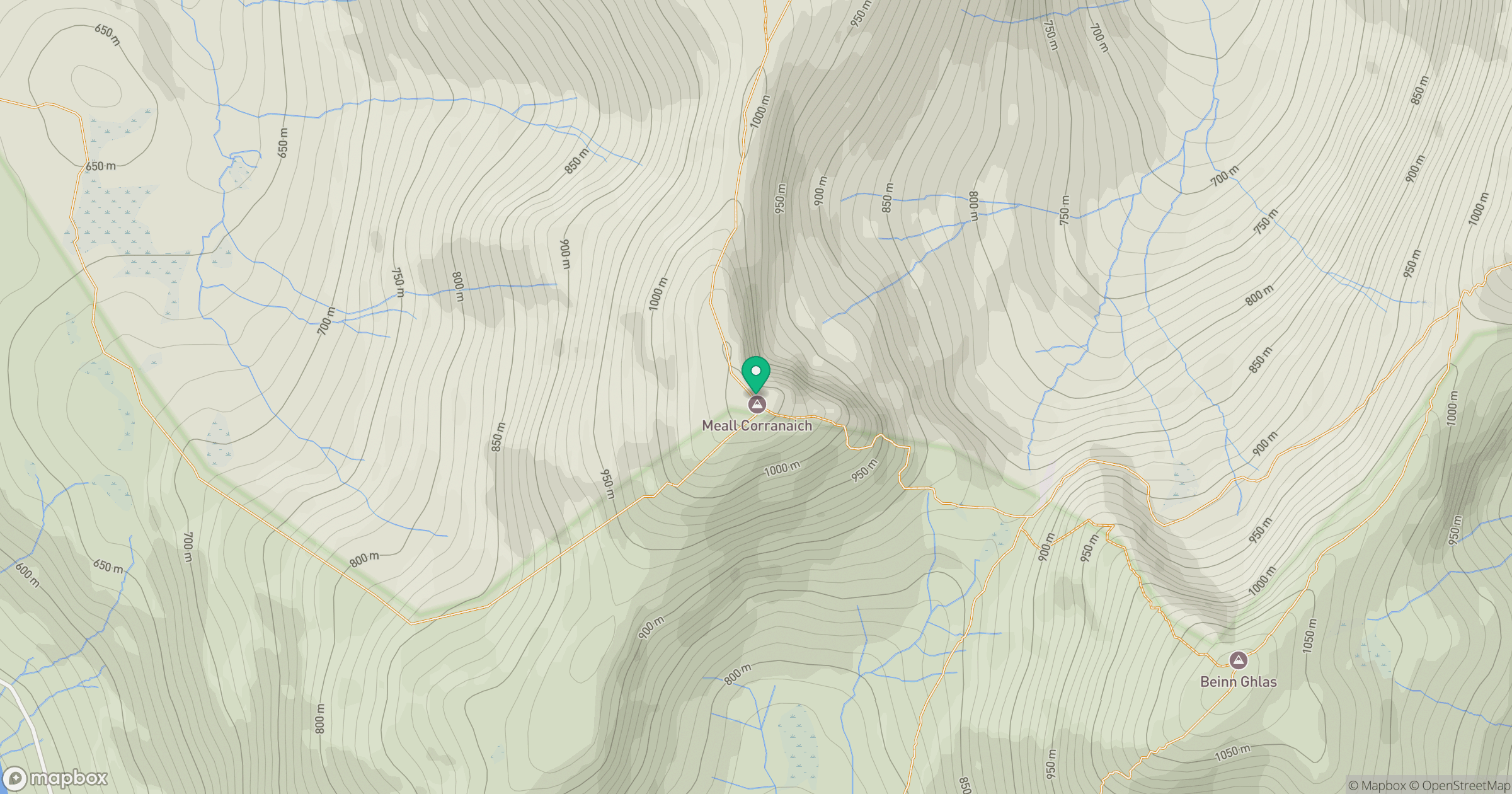
Grid reference: NN615410
View on OpenStreetMapOpens a map in a new tab, centred on the hill.


No comments yet. Be the first.