

Great Dun Fell
Good walks are even better shared.
NY7132 : Great Dun Fell Radar/Comms Station
James T M Towill Photo source
Overview
Great Dun Fell
Situated in the heart of the North Pennines, Great Dun Fell stands proudly at 842 meters. This Marilyn of a mountain offers not just elevation but also a healthy dose of adventure for those willing to take on its grassy slopes and rocky outcrops.
Geology
The geology of Great Dun Fell is an intriguing mix. Composed mainly of Carboniferous limestone and sandstone, you'll find yourself wandering over a landscape that has been shaped over millions of years. Don't be surprised if you spot a few fragments of ancient volcanic rock; these tough little guys hint at the dramatic geological history lurking just below your feet.
Route Details
One popular route to the summit starts at Cow Green Reservoir, which is a stone's throw away from the foot of the mountain. This Moderate hike covers 6.5 km and takes approximately 3.5 hours. Be prepared for a few steep sections that might leave your calves singing—but trust us, it's worth it!
Summit Features
The summit is marked by a sturdy trig point, a steadfast companion to the views that stretch as far as the eye can see. Grab a selfie with the trig point, and don't forget to take in the breathtaking scenery!
Terrain
The terrain ranges from grassy hillsides to sporadic rocky patches. And yes, you’ll want to watch your step—some areas can be quite boggy, especially after a bit of rain. It’s all part of the charm of hiking in the British hills!
Views
On a clear day, Great Dun Fell rewards you with jaw-dropping views of neighboring fells and the famous Lake District peaks. The best seasons for sights like these are Spring and Autumn, when the air is crisp and the landscapes are painted in vibrant hues.
Hazards
Do keep in mind that while the paths are generally clear, muddy sections can catch you off guard. And of course, the weather can change without so much as a wink—bring a waterproof jacket unless you fancy a wetting!
Nearby Summits
For the more ambitious, nearby Little Dun Fell presents an excellent opportunity for an extended hike. Another neighbour, Mickle Fell, is equally enticing for those wishing to bag a few peaks in one outing.
Access
The Cow Green Reservoir car park is your gateway, and it's well-equipped for eager walkers. For those relying on public transport, regular buses connect to Middleton-in-Teesdale, making subsequent walks practically effortless.
Facilities
Unfortunately, facilities are minimal at the reservoir, but fear not! The delightful village of Middleton-in-Teesdale boasts several cafes and a few friendly pubs where one can unwind after a day's exertion.
History
The name 'Great Dun Fell' carries historical weight. 'Dun' refers to its hillock-like features, while 'Great' simply nods to its majesty and status in the region. Additionally, being part of the North Pennines Area of Outstanding Natural Beauty, it’s a site of cultural and ecological importance that resonates with locals and visitors alike.
So there you have it! Pack your gear, lace up your boots, and set out for a hike that promises not only stunning views but also a taste of the rugged British countryside. But remember, the hills have ears, or at least they have sheep that will judge your hiking prowess!
Explore routes near Great Dun Fell
Walks starting near this hill. Open a route to check its map, distance and full itinerary.
Long Meg and Lacy's Caves
View route
Stanhope, the River Wear and the Fossil Tree
View route
Blanchland Geotrail
View route
Allen Banks and Morralee Tarn
View route
Route planning notes
These notes describe possible approaches. Check a route's map and access information when planning your walk.
Great Dun Fell via Knock Village
This route begins in the small village of Knock, following a well-established bridleway that climbs steadily up the eastern slopes of Great Dun Fell. The path offers excellent views of the Eden Valley and the Pennines as you ascend. The route passes Knock Old Man, a prominent cairn, before reaching the radar station at the summit.
Great Dun Fell Circular from Dufton
Starting in the picturesque village of Dufton, this circular route follows the Pennine Way up to Knock Fell and then onto Great Dun Fell. The descent loops around the northern slopes of the fell, offering a mix of moorland and valley scenery. It's a varied route with both well-defined paths and some rough terrain.
Great Dun Fell and Cross Fell Traverse
This longer and more challenging route links Great Dun Fell with Cross Fell, the highest peak in the Pennines. Starting from Kirkland or Garrigill, the route climbs Cross Fell first before heading south along the ridge to Little Dun Fell and Great Dun Fell. It requires good navigation skills and stamina but rewards you with breathtaking views.
Great Dun Fell via Milburn and Knock Pike
This quieter route starts in the village of Milburn and ascends via Knock Pike, a smaller hill with excellent panoramic views. From there, the route continues up to Knock Old Man and onto the summit of Great Dun Fell. It’s a great alternative for those looking to avoid busier trails.
Great Dun Fell Direct Ascent via Radar Road
This is the easiest and most direct route, following the private tarmac Radar Road that leads directly to the summit. Starting from the gate near Knock, this route is ideal for beginners or those looking for a quick ascent, although it lacks the charm of a traditional hillwalking experience.
Make a day of it, together
Find someone to share the walk with, or organise a day out along a route you like.
Photo Gallery
View all Photo could not load
NY7132 : Great Dun Fell Radar/Comms Station
James T M Towill
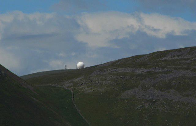 Photo could not load
NY7132 : Great Dun Fell Radar/Comms Station
Anthony Parkes
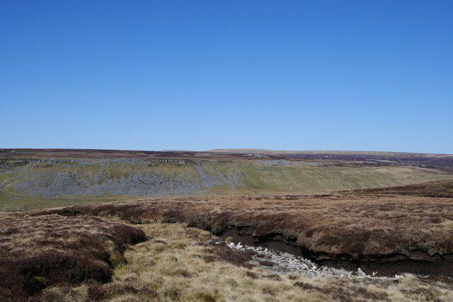 Photo could not load
NY7132 : A view across High Cup Gill and Dufton Fell to Great Dun Fell
James T M Towill
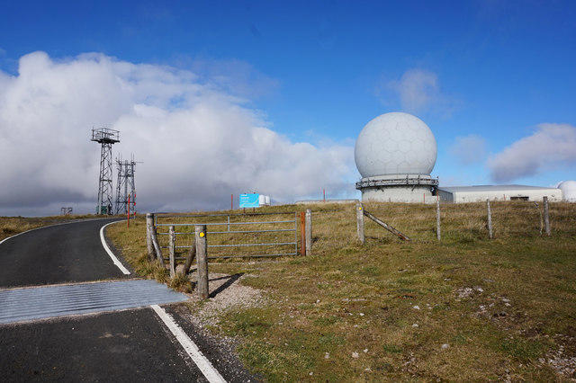 Photo could not load
NY7132 : NATS Radar / Comms Station on Great Dun Fell
Ian S
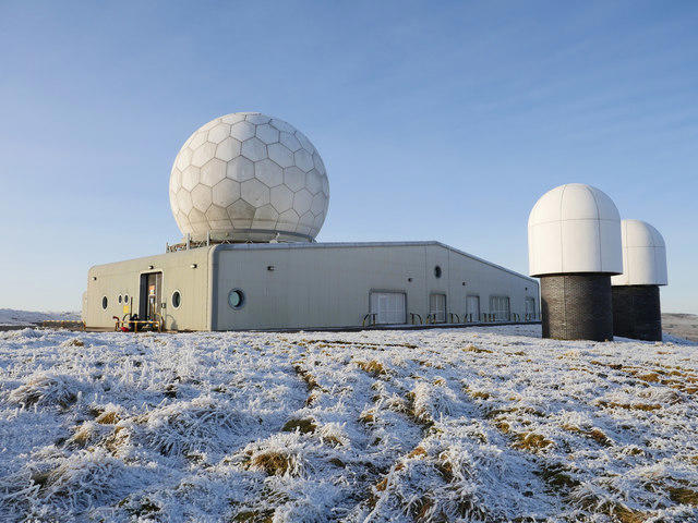 Photo could not load
NY7132 : NATS Radar/Comms Station on a cold December morning
James T M Towill
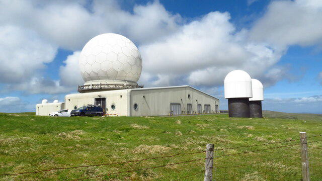 Photo could not load
NY7132 : Great Dun Fell Radar Station
Colin Park
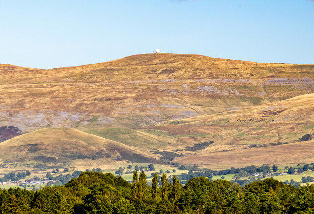 Photo could not load
NY7132 : Great Dun Fell
Peter McDermott
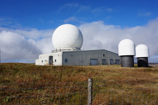 Photo could not load
NY7132 : NATS Radar / Comms Station on Great Dun Fell
Ian S
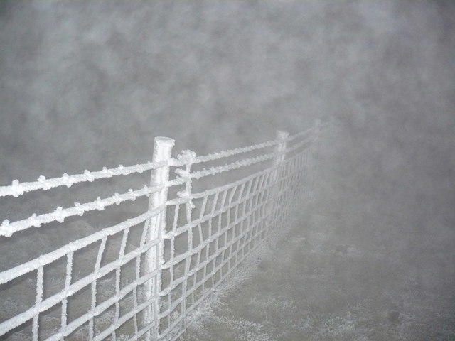 Photo could not load
NY7132 : Hoar frost and fog on Great Dun Fell
Phil Catterall
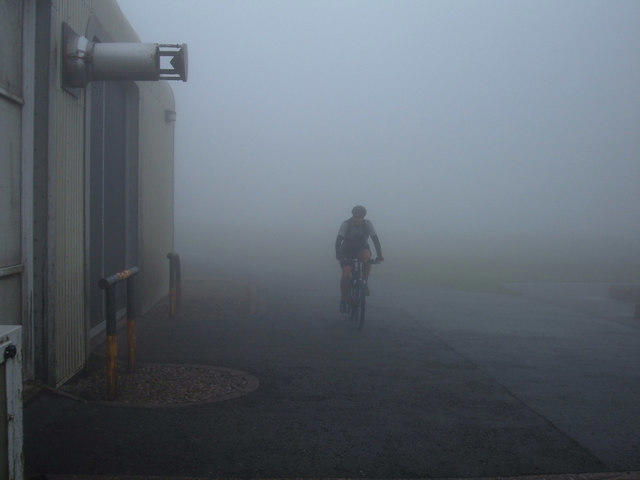
NY7132 : In cloud on Great Dun Fell
michael ely
Hill facts and local notes
Classifications
Elevation
848m
2,781 ft
Prominence
74m
Coordinates
54.6839, -2.4513
NY710321
OS Map
91
Explorer: OL31W
At the Summit
The summit features a distinctive trig point, surrounded by expanses of heather and stunning views into the far distance, perfect for holiday snaps or dramatic poses.
Terrain & Geology
The mountain is primarily composed of Carboniferous limestone and sandstone, with some fascinating patches of volcanic rock offering a taste of the ancient geological history beneath your feet.
Views & Scenery
On a clear day, you can spot the Lake District peaks to the west, the Yorkshire Dales to the south, and a patchwork of lush valleys below.
History & Heritage
Name Origin
The name 'Dun' is derived from the Old English word for a hillock or hill, and 'Great' refers to its status as one of the higher peaks in the region.
Historical Significance
Great Dun Fell is part of the North Pennines Area of Outstanding Natural Beauty, recognised for its picturesque landscapes and rich biodiversity.
Getting There & Facilities
Parking
Cow Green Reservoir car park, which offers ample parking and easy access to the trails.
Public Transport
Regular bus services run to the village of Middleton-in-Teesdale, from where a short taxi ride can take you to the reservoir.
Nearby Facilities
There are limited facilities at the Cow Green Reservoir, but the village of Middleton-in-Teesdale has cafes and pubs for post-hike refreshments.
Safety Information
Known Hazards
- Muddy paths and sudden changes in weather can create challenging conditions. Make sure to pack a waterproof jacket and a sense of humor!
General Safety Tips
- Check weather conditions before setting out
- Carry appropriate clothing and equipment
- Let someone know your planned route
- Take a map, compass, and GPS device
- Carry emergency supplies: food, water, first aid kit, torch
Hills
Some common questions about the hills answered
Are there group walks up Great Dun Fell?
Many walkers use Walkmates to join or organise walks with others. You can check for group walks around Great Dun Fell through the maps
Are there other walkers around Great Dun Fell?
Activity varies by location and time, but Walkmates lets you see whether others have shared walks or shown interest in this area. Find other people through the walking friends search walking friends for Great Dun Fell search or of course create your own walk for Great Dun Fell
Can I organise a walk to Great Dun Fell?
Yes. If there aren’t any walks listed already, you can create a walk and make it available for others to join.
If you're signed up to Walkmates, you can create a walk to Great Dun Fell.
How do I find a walk up this hill?
There are often multiple ways to walk this hill, depending on experience and route preference. Walkmates helps you explore walks and routes that others have shared.
Can I suggest a new route up Great Dun Fell?
Yes. You can suggest or create routes to share with others. Walkmates focuses on the social side of walking, so routes are used to help people organise walks and explore areas together, rather than as detailed navigation tools or route libraries.
Other uses really appreciate knowledgeable walkers sharing their routes. Share your favourite route to Great Dun Fell here
The is an error or something incorrect about this hill. How do I let you know?
We always strive to keep the information on Walkmates as accurate as possible. If you find an error, please let us know through the contact form and we'll aim to correct it as quickly as possible
Community Discussion
Comments
Location
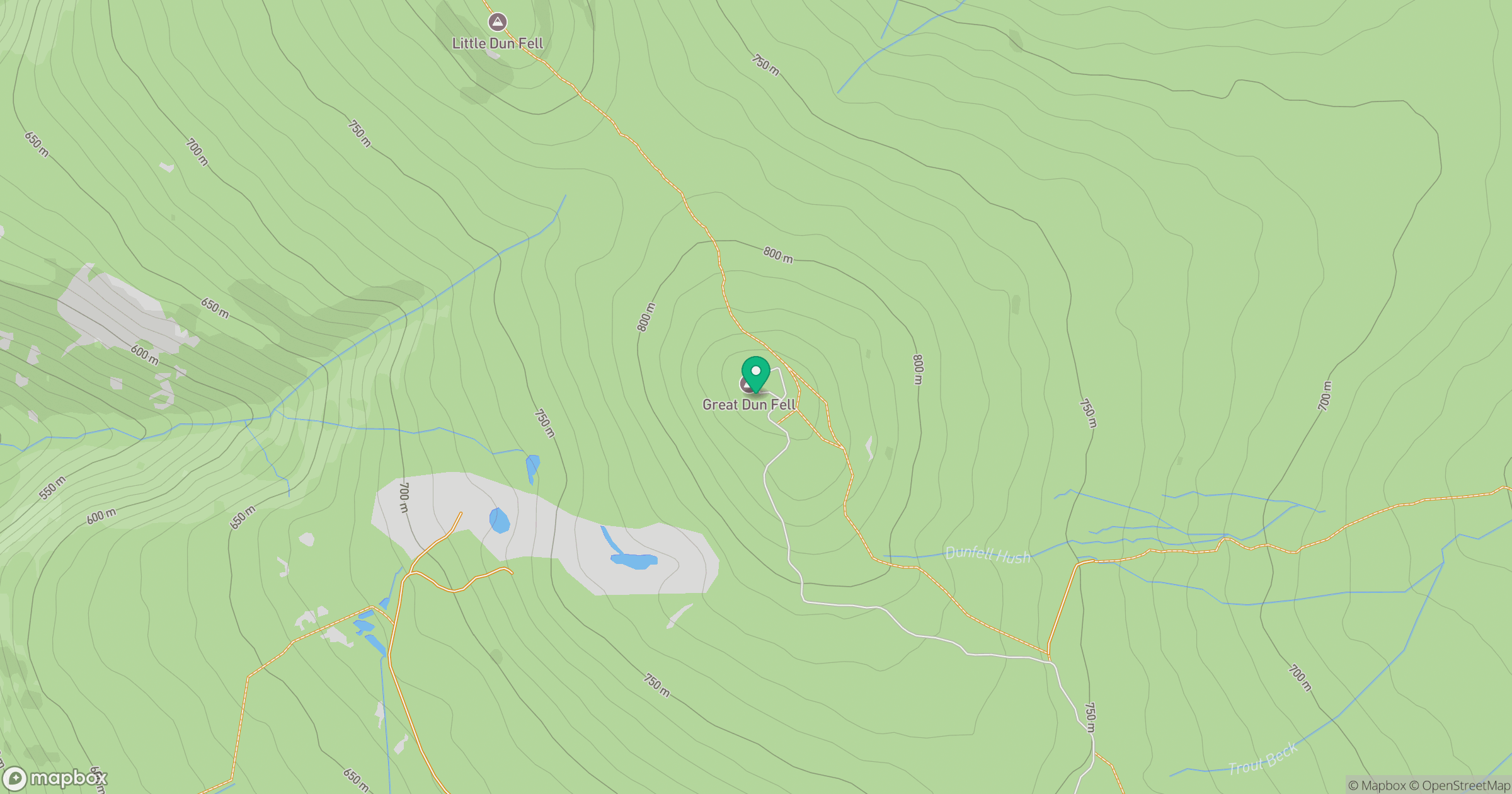
Grid reference: NY710321
View on OpenStreetMapOpens a map in a new tab, centred on the hill.



No comments yet. Be the first.