
Cutwellcombe Hill
Good walks are even better shared.
Overview
Cutwellcombe Hill
Overview
Cutwellcombe Hill, sitting proudly in the scenic county of Cornwall, is a Marilyn that beckons both seasoned hikers and casual wanders alike. With an elevation of 350 meters and a notable prominence of 50 meters, it offers a satisfying ascent without the excessive puffing and panting.
Geology
The hill is underpinned by sturdy granite, a splendid choice of rock that adds character to the landscape. Erosion has sculpted the rock into intriguing forms, making it a delight to explore.
Routes
The Cutwellcombe Trail is a popular choice, taking roughly 2.5 hours to complete a circular route of 6.5 km. Starting from St. Breward, this moderate trek leads through picturesque woodlands and moorland before conquering the hill itself.
Summit Features
At the summit, you'll find a charming stone cairn as well as a trig point that has likely seen more selfies than a celebrity at a film premiere.
Views
Once at the top, you'll be rewarded with sweeping views of Cornwall's beautiful landscape, including a breathtaking glimpse of Tintagel Castle on clear days. For the most majestic vista, visit in spring or early autumn when the scenery comes alive.
Hazards
As you traverse these delightful terrains, be mindful of the fickle Cornish weather; a sunny start can quickly turn moody. Also, keep an eye on your footing – nobody needs a sprained ankle when there are gorgeous views to enjoy!
Nearby Summits
If you're on a hill-hopping spree, both Brown Willy and Roughtor are nearby giants you won’t want to miss.
Access
Driving is the most convenient option, with parking available in St. Breward. Those relying on public transport will find it best to travel to Bodmin and plan ahead to reach the trailhead.
Facilities
Post-adventure, treat yourself to a local pub meal or a slice of cake in St. Breward’s tea room. Don’t forget the necessary toilet breaks – because no one wants an uncomfortable trek back!
History
The name 'Cutwellcombe' reflects the landscape's unique characteristics, steeped in local lore and history. It's said that Druids once walked these hills, engaged in undisclosed rituals which, let’s face it, would probably outperform any modern-day retreat!
In conclusion, Cutwellcombe Hill isn’t just another peak; it’s a delightful trip for the senses blending history, breathtaking views, and the joy of physical activity. So, lace up those boots and go have a laugh with nature!
Explore routes near Cutwellcombe Hill
Walks starting near this hill. Open a route to check its map, distance and full itinerary.
Salcombe, Batson Creek and Snapes Point estuary circuit
View route
Moretonhampstead to Lustleigh: Wray Valley woodland railway trail
View route
Cotehele: Danescombe Valley and Mining Heritage Circuit
View route
Castle Drogo and Fingle Bridge: Teign Gorge woodland circuit
View route
Route planning notes
These notes describe possible approaches. Check a route's map and access information when planning your walk.
Cutwellcombe Trail
This is a delightful circular route starting from the village of St. Breward, winding through lush woodland and open moorland before ascending to the summit of Cutwellcombe Hill.
Make a day of it, together
Find someone to share the walk with, or organise a day out along a route you like.
Hill facts and local notes
Classifications
Elevation
177m
581 ft
Prominence
30m
Coordinates
50.4084, -3.8396
SX693581
OS Map
202
Explorer: OL20W OL28S
At the Summit
The summit features a small stone cairn and a trig point, perfect for that classic summit selfie. On a clear day, you might even spot the distant sea shimmering in the sunlight.
Terrain & Geology
Cutwellcombe Hill is primarily formed from granite, which provides a sturdy platform amid the softer sandstone hills of the region. The erosion patterns create interesting rock formations, appealing to both geomorphologists and curious hikers.
Views & Scenery
From the summit, enjoy panoramic views of the rolling Cornish countryside, the distant coastline, and, if you're lucky, a glimpse of the iconic Tintagel Castle far away.
History & Heritage
Name Origin
Cutwellcombe is believed to derive from 'cwt,' which means 'cove' in Cornish, reflecting the natural features of the area.
Historical Significance
Historically, this hill has been a quiet sanctuary, with legends of Druids utilizing its heights for rituals that would make any modern-day wellness retreat look like child's play.
Getting There & Facilities
Parking
There is a car park at St. Breward, approximately 1 km from the trailhead. Ensure your vehicle is parked neatly as the Cornish locals have an eye for tidiness!
Public Transport
The nearest bus services can be found in Bodmin, with limited services to St. Breward. Planning ahead is key, as service can be as sparse as a Poldark plotline.
Nearby Facilities
St. Breward offers a lovely local pub and tea room, perfect for a post-hike pint or a cream tea. Public toilets can be found nearby.
Safety Information
Known Hazards
- Watch out for sudden weather changes; Cornwall can be as unpredictable as a squirrel on caffeine. Also, uneven terrain may prove tricky if not navigated carefully.
General Safety Tips
- Check weather conditions before setting out
- Carry appropriate clothing and equipment
- Let someone know your planned route
- Take a map, compass, and GPS device
- Carry emergency supplies: food, water, first aid kit, torch
Hills
Some common questions about the hills answered
Are there group walks up Cutwellcombe Hill?
Many walkers use Walkmates to join or organise walks with others. You can check for group walks around Cutwellcombe Hill through the maps
Are there other walkers around Cutwellcombe Hill?
Activity varies by location and time, but Walkmates lets you see whether others have shared walks or shown interest in this area. Find other people through the walking friends search walking friends for Cutwellcombe Hill search or of course create your own walk for Cutwellcombe Hill
Can I organise a walk to Cutwellcombe Hill?
Yes. If there aren’t any walks listed already, you can create a walk and make it available for others to join.
If you're signed up to Walkmates, you can create a walk to Cutwellcombe Hill.
How do I find a walk up this hill?
There are often multiple ways to walk this hill, depending on experience and route preference. Walkmates helps you explore walks and routes that others have shared.
Can I suggest a new route up Cutwellcombe Hill?
Yes. You can suggest or create routes to share with others. Walkmates focuses on the social side of walking, so routes are used to help people organise walks and explore areas together, rather than as detailed navigation tools or route libraries.
Other uses really appreciate knowledgeable walkers sharing their routes. Share your favourite route to Cutwellcombe Hill here
The is an error or something incorrect about this hill. How do I let you know?
We always strive to keep the information on Walkmates as accurate as possible. If you find an error, please let us know through the contact form and we'll aim to correct it as quickly as possible
Community Discussion
Comments
Location
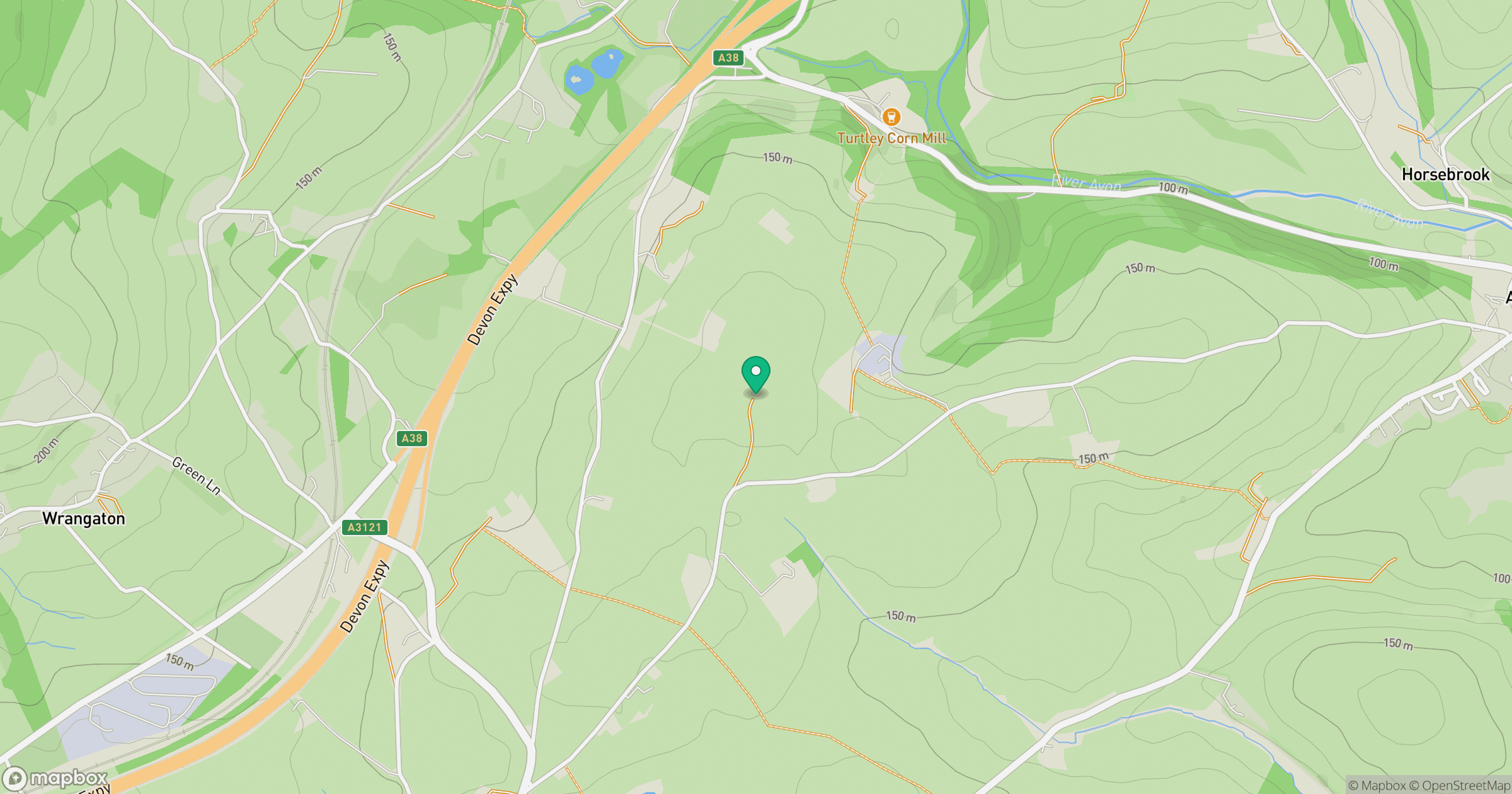
Grid reference: SX693581
View on OpenStreetMapOpens a map in a new tab, centred on the hill.
Nearby Hills

High Willhays
622m

Brent Tor
334m
Brown Willy
420m

Dunkery Beacon
520m
Rhossili Down - The Beacon
193m
No comments yet. Be the first.