

Coinneach Mhor (1974 position)
Good walks are even better shared.
NG9560 : Path on Ruadh-stac Mòr
Chris Wimbush Photo source
Overview
Coinneach Mhor (1974 position)
Introduction
Coinneach Mhor is one of the notable Munros in the Scottish Highlands, standing proud at 1003 meters. This mountain offers not just a physical challenge but also a spiritual one, inviting hikers to engage with the rugged beauty of Scotland’s landscapes.
Geology
The granite gneiss that forms the bulk of Coinneach Mhor's mass serves as a reminder of the immense geological forces at play over millions of years. The mountain’s rounded summit is a testament to glacial activity, which sculpted the hills into their current forms.
Routes
The most popular route starts at Achnasheen and is often referred to as the Northwest Ridge. This moderate trail is approximately 10 kilometers long and normally takes about 4.5 hours to complete, making it an excellent choice for a day out. As you ascend, the scenery becomes increasingly dramatic, paving the way to a rewarding summit experience.
Summit Features
On reaching the summit, hikers are greeted by a substantial cairn, which is a perfect spot for a well-deserved snack break. The views here are nothing short of spectacular, with the landscape unfolding in all directions.
Terrain
Be prepared for a mixed bag of terrain; rocky paths can quickly turn boggy should the weather decide to take a turn for the worse. Good hiking boots are essential to navigate this beautifully unpredictable landscape.
Views
From the top, the vistas are breathtaking. You can spot the peaks of the Fannichs and even the coastline on a clear day. The best times to enjoy these views are late spring or early autumn when the air is crisp and clear.
Hazards
While the allure of Coinneach Mhor is undeniable, caution is warranted. The weather can change on a dime, and the rocky terrain is prone to becoming slippery. Always check the forecast before setting out.
Access
Access to Coinneach Mhor starts from Achnasheen, where you can find parking, though it’s wise to arrive early. Public transport is available via train, but be sure to check the schedule to avoid being stranded.
Facilities
The village offers basic facilities, including a shop and a restroom. Post-hike, warm yourself at the Achnasheen Hotel with a comforting hot drink.
History
The mountain's name, 'Coinneach Mhor', carries cultural significance, hinting at historical ties to local lore. Embracing this heritage adds a layer of richness to your hiking experience.
Conclusion
In conclusion, Coinneach Mhor is not just a hill; it’s an adventure waiting to unfold. Whether you are a seasoned hiker or a newbie looking to test your mettle, it will certainly offer a day to remember. Just don’t forget your camera - the views are worth capturing for posterity!
Thanks for choosing Coinneach Mhor as your next hiking destination! Happy trails!
Explore routes near Coinneach Mhor (1974 position)
Walks starting near this hill. Open a route to check its map, distance and full itinerary.
Beinn Eighe Lancaster Wreckage at Coire Mhic Fhearchair
View route
Fairy Lochs Liberator Wreckage Circuit
View route
Glen Affric: Coire Loch Woodland Trail
View route
Fort Augustus to Kytra Lock: Caledonian Canal Towpath
View route
Route planning notes
These notes describe possible approaches. Check a route's map and access information when planning your walk.
Northwest Ridge
Starting from the village of Achnasheen, this route gently ascends the northwest ridge, providing a manageable climb with breathtaking views.
Make a day of it, together
Find someone to share the walk with, or organise a day out along a route you like.
Photo Gallery
View all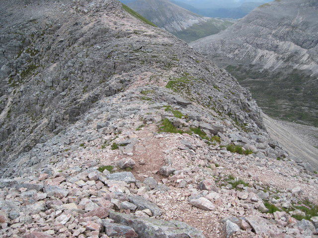 Photo could not load
NG9560 : Path on Ruadh-stac Mòr
Chris Wimbush
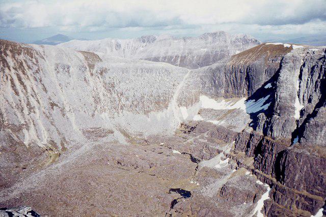 Photo could not load
NG9560 : Coire Mhic Fhearchair from Sail Mhor
Jim Barton
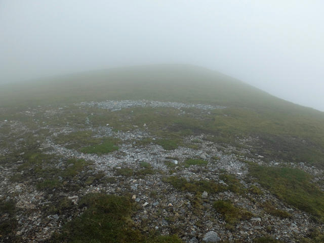 Photo could not load
NG9460 : The flat top of Còinneach Mhòr, Beinn Eighe
John Allan
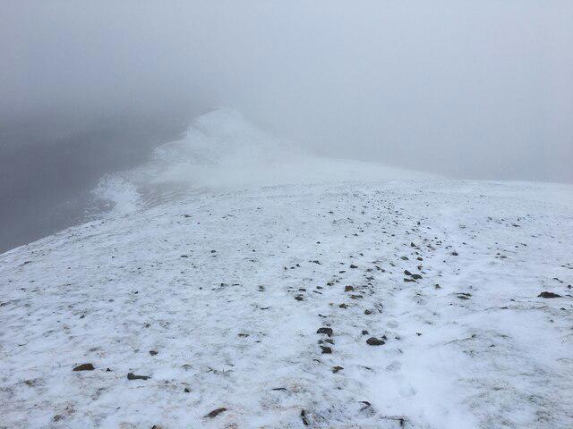 Photo could not load
NG9560 : Snowy slopes on Beinn Eighe
Steven Brown
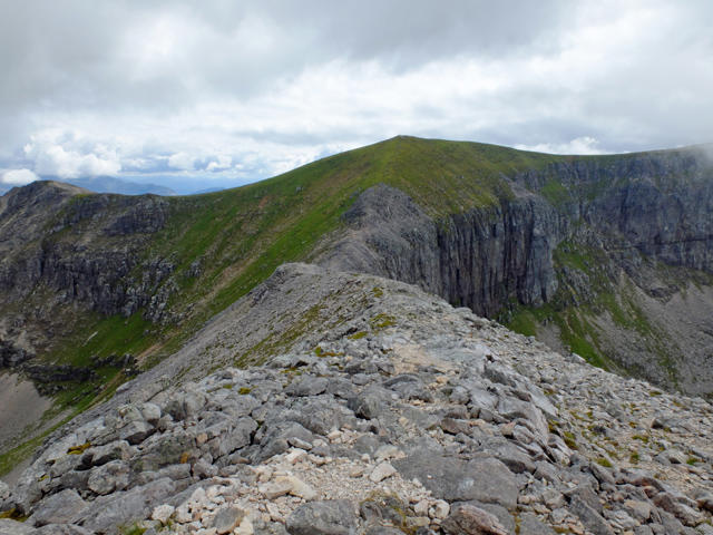 Photo could not load
NG9560 : The bealach below Ruadh-stac Mòr
John Allan
Hill facts and local notes
Classifications
Elevation
954m
3,130 ft
Prominence
9m
Coordinates
57.5843, -5.4306
NG950601
OS Map
19
Explorer: 433
At the Summit
The summit is marked by a prominent cairn surrounded by stunning views of the surrounding hills; the sheer drop-offs might take your breath away (in more ways than one).
Terrain & Geology
Primarily composed of granitic gneiss, Coinneach Mhor showcases the ancient pressures that formed this rugged terrain. The rounded summits and steep slopes are typical of glacial erosion, offering a glimpse into the region’s geological past.
Views & Scenery
From the summit, one can see the distant peaks of the Fannichs, Loch Maree, and on a clear day, the coastline of Wester Ross.
History & Heritage
Name Origin
The name 'Coinneach Mhor' translates to 'Big Kenneth', likely reflecting a historical or mythical figure associated with the mountain or surrounding area.
Historical Significance
This mountain holds cultural significance for local communities and has often been mentioned in Scottish folklore.
Getting There & Facilities
Parking
There is a small car park located at Achnasheen, providing easy access to the trailhead. Make sure to arrive early as it fills up quickly on weekends.
Public Transport
Achnasheen is accessible via the Strathcarron train line; check local schedules as services can be infrequent.
Nearby Facilities
Facilities in Achnasheen include a public restroom and a small convenience store. The Achnasheen Hotel is a great place to warm up with a hot drink after your hike.
Safety Information
Known Hazards
- Be cautious of sudden weather changes, which are common in the Highlands. The rocky terrain can be treacherous, especially when wet.
General Safety Tips
- Check weather conditions before setting out
- Carry appropriate clothing and equipment
- Let someone know your planned route
- Take a map, compass, and GPS device
- Carry emergency supplies: food, water, first aid kit, torch
Hills
Some common questions about the hills answered
Are there group walks up Coinneach Mhor (1974 position)?
Many walkers use Walkmates to join or organise walks with others. You can check for group walks around Coinneach Mhor (1974 position) through the maps
Are there other walkers around Coinneach Mhor (1974 position)?
Activity varies by location and time, but Walkmates lets you see whether others have shared walks or shown interest in this area. Find other people through the walking friends search walking friends for Coinneach Mhor (1974 position) search or of course create your own walk for Coinneach Mhor (1974 position)
Can I organise a walk to Coinneach Mhor (1974 position)?
Yes. If there aren’t any walks listed already, you can create a walk and make it available for others to join.
If you're signed up to Walkmates, you can create a walk to Coinneach Mhor (1974 position).
How do I find a walk up this hill?
There are often multiple ways to walk this hill, depending on experience and route preference. Walkmates helps you explore walks and routes that others have shared.
Can I suggest a new route up Coinneach Mhor (1974 position)?
Yes. You can suggest or create routes to share with others. Walkmates focuses on the social side of walking, so routes are used to help people organise walks and explore areas together, rather than as detailed navigation tools or route libraries.
Other uses really appreciate knowledgeable walkers sharing their routes. Share your favourite route to Coinneach Mhor (1974 position) here
The is an error or something incorrect about this hill. How do I let you know?
We always strive to keep the information on Walkmates as accurate as possible. If you find an error, please let us know through the contact form and we'll aim to correct it as quickly as possible
Community Discussion
Comments
Location
View the hill's mapped position and surrounding paths.
Grid reference: NG950601
View on OpenStreetMapOpens a map in a new tab, centred on the hill.
No comments yet. Be the first.