

Box Hill
Good walks are even better shared.
ST8469 : Box Mine Wilts
Nick Chipchase Photo source
Overview
Box Hill is a 149.7 m hill above Box in western Wiltshire, with 42 m of prominence. Its recorded highest point is unmarked ground on a playing field. Local paths explore commons, woodland and the By Brook valley, with a landscape shaped by Bath Stone quarrying and Brunel’s Box Tunnel.
Box Hill, Wiltshire
Box Hill rises above Box and the By Brook valley in western Wiltshire. Its stone-quarrying history, wooded slopes and local footpath network make it an interesting place to explore. This page is for the Wiltshire hill at ST841695. The Box Hill in Surrey is a separate destination.
Summit and local viewpoints
The Database of British and Irish Hills records this summit as 149.7 m high, with 42 m of prominence. Its highest-point description is unmarked ground on a playing field, at ST 84194 69565. A summit coordinate identifies a location; it does not establish a public right of access.
Box Parish Council highlights Box Common as a local viewpoint. Walks on the hillside look across the By Brook valley, with woodland and the old quarrying landscape adding interest. The Common viewpoint and the database summit should not be assumed to be the same spot.
Planning a walk
Start with the parish walking map and the published Box Heritage Trail, which explore the wider village and its industrial landscape. Public paths pass through commons, woods and meadows; some approaches from the valley are steep. Choose a complete route on a current map and use public rights of way, following signs and any local restrictions. OS Explorer 156 covers the area.
The five inherited route entries below describe Surrey landmarks and are marked as inapplicable. They do not supply directions to this summit. For useful local planning information, see Box Parish Council’s visitor and walking guide.
Stone and railway heritage
Limestone quarrying shaped the settlement, leaving workers’ cottages and former quarry sites around Box Hill. Bath Stone was worked here, while the geology encountered beneath the hill by the railway also included other limestone and clay layers. Brunel’s Box Tunnel carried the Great Western Railway through the hill when it opened in 1841. The tunnel is railway infrastructure, not a walking route.
Access, facilities and care
Box village has shops, cafes and pubs. The parish council lists bus links with Bath, Chippenham and Devizes; check current routes, stops and the last return service before travelling. Confirm legal parking for your chosen start rather than navigating to a Surrey National Trust car park.
Wear footwear with good grip for steep and potentially slippery paths. Take care where footpaths meet roads. Keep away from quarry edges, shafts and underground entrances, and do not enter old workings. Respect private land and any activity on playing fields. Carry a suitable map, water and clothing for the weather.
Sources and review
- Database of British and Irish Hills: version 18.6, hill 17382; summit and source data.
- Box Parish Council: local walking, viewpoints, transport and visitor information.
- Network Rail: tunnel construction and geology.
- Historic England: tunnel location and opening date.
- Box People and Places: local quarrying and settlement history.
Information reviewed: 15 October 2026.
Explore routes near Box Hill
Walks starting near this hill. Open a route to check its map, distance and full itinerary.
Chippenham Walk with Men Walking & Talking
View route
Bath Skyline hills and Rainbow Wood from central Bath
View route
Bitton to Kelston Bridge: Bristol and Bath Railway Path Return
View route
Devizes Wharf and Caen Hill Lock Flight Towpath Walk
View route
Route planning notes
These notes describe possible approaches. Check a route's map and access information when planning your walk.
Not applicable (Surrey): Stepping Stones circular
The inherited Stepping Stones route follows the River Mole at Box Hill in Surrey. It does not reach this Wiltshire hill. Use the separate Box Hill, Surrey page for that destination; this entry is retained only to flag the previous location error.
Not applicable (Surrey): Westhumble station circular
Box Hill and Westhumble station and Denbies are in Surrey. The station circular previously shown here is not an approach to Box Hill in Wiltshire. For local walking, consult Box Parish Council’s walking map and the Box Heritage Trail.
Not applicable (Surrey): Happy Valley and Broadwood’s Tower
Happy Valley and Broadwood’s Tower belong to the National Trust’s Box Hill estate in Surrey. This inherited route does not apply to the Wiltshire summit at ST841695. Its former distance, time and difficulty have been withdrawn from this record.
Not applicable (Surrey): Box Hill Hike
The National Trust’s Box Hill Hike starts at its Shepherd’s Hut in Surrey, postcode KT20 7LB. It is not a Wiltshire route. Do not use its car park, landmarks or walking statistics to plan a visit to this Box Hill.
Not applicable (Surrey): North Downs Way to Reigate Hill
The North Downs Way section between Box Hill and Reigate Hill is in Surrey. It has no connection to an ascent of this Wiltshire hill. Plan a local walk using a current Box-area map; no replacement itinerary or route statistics are implied by this retained entry.
Make a day of it, together
Find someone to share the walk with, or organise a day out along a route you like.
Photo Gallery
View all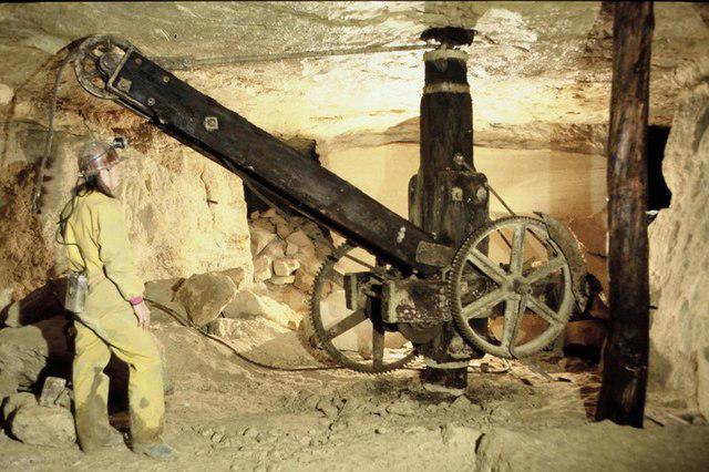 Photo could not load
ST8469 : Box Mine Wilts
Nick Chipchase
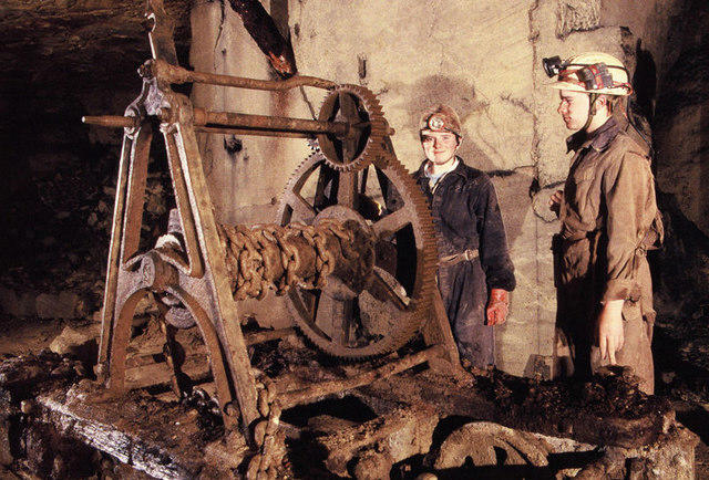 Photo could not load
ST8469 : Box stone mine
Nick Chipchase
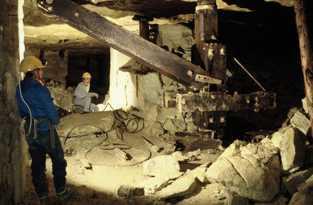 Photo could not load
ST8469 : Box Stonemine
Nick Chipchase
Hill facts and local notes
Classifications
Elevation
150m
491 ft
Prominence
42m
Coordinates
51.4248, -2.2287
ST841695
OS Map
173
Explorer: 156
At the Summit
DoBIH records unmarked ground on a playing field at ST 84194 69565 as the highest point. The summit coordinate does not establish a public right of access.
Terrain & Geology
Bath Stone limestone was quarried around Box Hill. Network Rail records Bath Stone, Inferior Oolite, Fuller’s Earth and Lias Clay among the strata encountered by Box Tunnel beneath the hill.
Views & Scenery
Box Common is a local viewpoint over the By Brook valley. Views depend on position and visibility; the Common viewpoint is distinct from the catalogue’s playing-field summit.
History & Heritage
Historical Significance
Limestone quarrying shaped Box Hill’s settlement and workers’ cottages. Brunel’s Box Tunnel carried the Great Western Railway through the hill when it opened in 1841.
Getting There & Facilities
Parking
Check legal parking for your chosen local starting point in Box. No summit car park is established here; the National Trust car parks for Box Hill in Surrey serve a different hill.
Public Transport
Box Parish Council lists bus links with Bath, Chippenham and Devizes. Check current stops, timetables and the last return before travelling. Box Hill and Westhumble railway station is in Surrey and does not serve this hill.
Nearby Facilities
Box village has shops, cafes and pubs. Check opening times and carry water. The National Trust cafe and visitor facilities at Box Hill in Surrey are not facilities for this Wiltshire hill.
Safety Information
Known Hazards
- Steep paths can be slippery in wet weather; wear footwear with good grip.
- Keep away from quarry edges, shafts and underground entrances; do not enter old workings.
- Take care at road crossings and on lanes.
- Use public rights of way and respect private land, signs and activity on playing fields.
General Safety Tips
- Check weather conditions before setting out
- Carry appropriate clothing and equipment
- Let someone know your planned route
- Take a map, compass, and GPS device
- Carry emergency supplies: food, water, first aid kit, torch
Hills
Some common questions about the hills answered
Are there group walks up Box Hill?
Many walkers use Walkmates to join or organise walks with others. You can check for group walks around Box Hill through the maps
Are there other walkers around Box Hill?
Activity varies by location and time, but Walkmates lets you see whether others have shared walks or shown interest in this area. Find other people through the walking friends search walking friends for Box Hill search or of course create your own walk for Box Hill
Can I organise a walk to Box Hill?
Yes. If there aren’t any walks listed already, you can create a walk and make it available for others to join.
If you're signed up to Walkmates, you can create a walk to Box Hill.
How do I find a walk up this hill?
There are often multiple ways to walk this hill, depending on experience and route preference. Walkmates helps you explore walks and routes that others have shared.
Can I suggest a new route up Box Hill?
Yes. You can suggest or create routes to share with others. Walkmates focuses on the social side of walking, so routes are used to help people organise walks and explore areas together, rather than as detailed navigation tools or route libraries.
Other uses really appreciate knowledgeable walkers sharing their routes. Share your favourite route to Box Hill here
The is an error or something incorrect about this hill. How do I let you know?
We always strive to keep the information on Walkmates as accurate as possible. If you find an error, please let us know through the contact form and we'll aim to correct it as quickly as possible
Community Discussion
Comments
Location
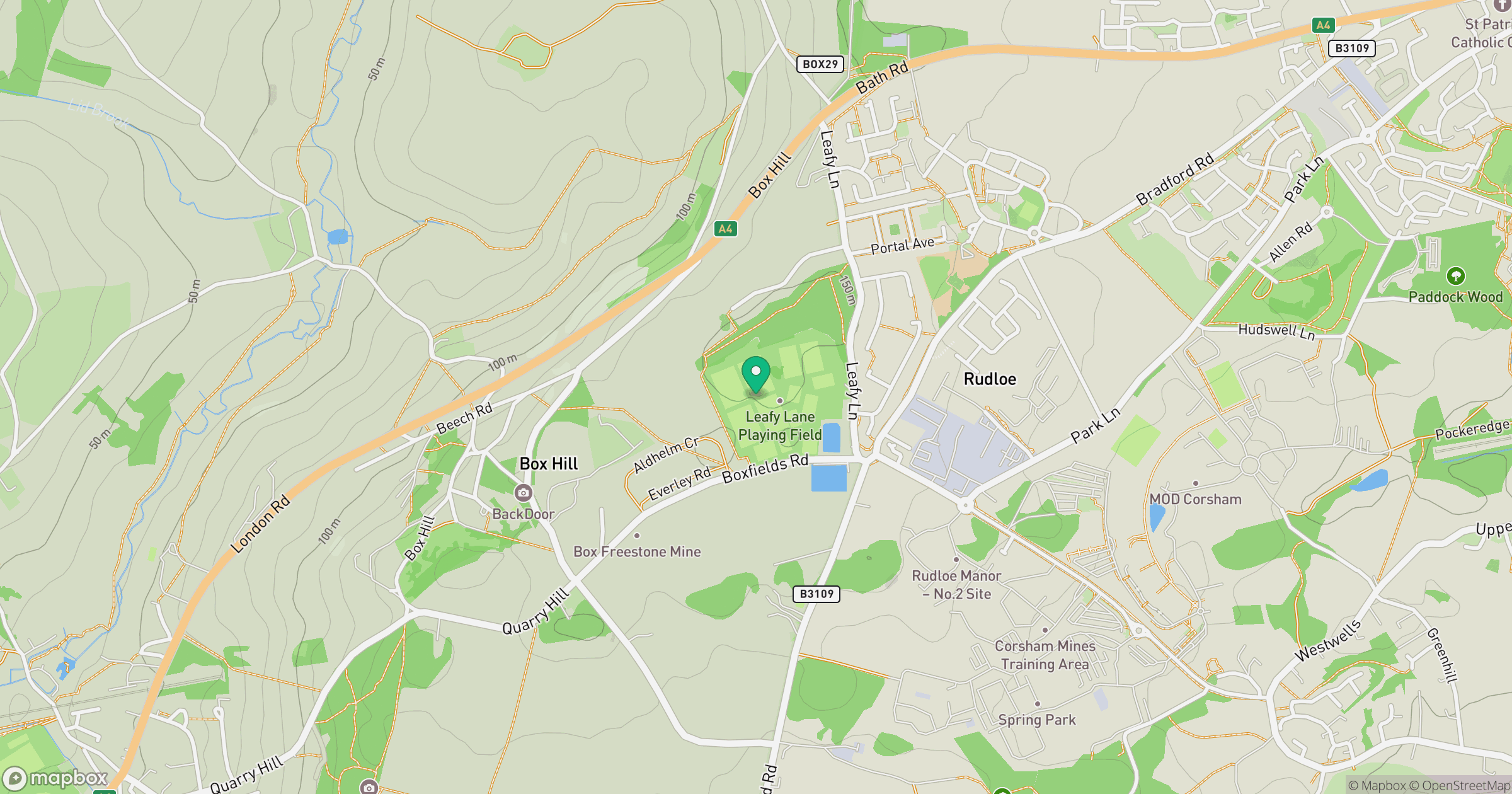
Grid reference: ST841695
View on OpenStreetMapOpens a map in a new tab, centred on the hill.
Nearby Hills
Glastonbury Tor
158m
Worcestershire Beacon
425m
Titterstone Clee Hill
533m

Cribyn
794m

The Wrekin
407m
No comments yet. Be the first.