

Beinn na Lap
Good walks are even better shared.
NN3769 : Small lochan near the summit of Beinn na Lap
John Ferguson Photo source
Overview
Beinn na Lap
Beinn na Lap is a stunning mountain located in the heart of the Scottish Highlands, with an elevation of 942 meters. This Munro offers an engaging challenge for hikers, boasting impressive geological features and breathtaking vistas.
Geology
As is the norm for these rugged highlands, Beinn na Lap is primarily made up of schists and gneisses. These types of rocks, shaped by the forces of nature over millions of years, tell an ancient story. If rocks could talk, they’d probably boast about their fabulous transformations!
Access and Parking
To access Beinn na Lap, you will find a designated parking area at the southern end of Loch Treig, near the West Highland Way trailhead. This facility, while basic, serves as a handy launching pad for your adventure.
Public transport options exist, with Fort William being the nearest railway hub, and bus services connecting you to nearby villages such as Spean Bridge. Just like every good mountaineer, plan ahead!
Routes
There are two notable routes to suggest:
- West Highland Way Approach: A scenic trek of about 12 km that leads up through the West Highland Way, with splendid views of Loch Treig.
- Hardy’s Route from Laggan Locks: This less trodden path provides a fleshy experience for those who crave solitude, spanning about 14 km.
Both routes provide moderate challenges but reward you with magnificent views.
Terrain and Summit Features
The terrain is rocky and grassy, with some boggy sections to keep your footing nimble. The summit features a substantial cairn alongside a trig point—perfect for that triumphant Instagram post!
Views
Once at the summit, keep your eyes peeled for the sights! Loch Treig sprawls beneath you, and on a clear day, you can spot the iconic peaks of Ben Nevis in the background. Time your climb for spring or summer to bask in the scenic splendour, avoiding the dampness of winter.
Hazards
As any Scot will tell you, the weather can change faster than you can put on your waterproofs! Expect potential hazards including loose rocks and muddy trails. Be prepared, and leave your sandals at home!
Nearby Summits
Nearby peaks include Sgurr na h-Eaglaise and the king of them all, Ben Nevis.
Facilities
While Beinn na Lap has no direct facilities, nearby Fort William is brimming with cafés, shops, and essential amenities to ensure you can refuel after a long day of hiking.
History
The name ‘Beinn na Lap’ translates to 'Hill of the Lady', suggesting a tranquil, regal history. This area is steeped in local folklore and ancient tales. Hikers might just find themselves enchanted by the surroundings!
In summary, Beinn na Lap offers a perfect mix of challenge, beauty, and rich history. So grab your boots, bring your sense of humour, and prepare for an unforgettable Highland adventure!
Explore routes near Beinn na Lap
Walks starting near this hill. Open a route to check its map, distance and full itinerary.
Ben Nevis via Mountain Path
View route
Banavie to Glen Loy Aqueduct: Neptune’s Staircase Canal Towpath
View route
Fort Augustus to Kytra Lock: Caledonian Canal Towpath
View route
Killin: Falls of Dochart, Finlarig and Moirlanich Longhouse
View route
Route planning notes
These notes describe possible approaches. Check a route's map and access information when planning your walk.
West Highland Way Approach
A scenic route that joins the West Highland Way leading up towards Beinn na Lap, offering splendid views over Loch Treig.
Hardy’s Route from Laggan Locks
Starting from Laggan Lodge, this longer trek provides a more secluded experience as it winds its way up the less trodden paths.
Make a day of it, together
Find someone to share the walk with, or organise a day out along a route you like.
Photo Gallery
View all Photo could not load
NN3769 : Small lochan near the summit of Beinn na Lap
John Ferguson
 Photo could not load
NN3769 : The lochan near the summit of Beinn na Lap
Russel Wills
 Photo could not load
NN3769 : Rough shelter near summit of Beinn na Lap
Jim Barton
 Photo could not load
NN3769 : Shattered rocks and a shallow lochan on Beinn na Lap
Richard Law
 Photo could not load
NN3769 : Lochan close to summit of Ben na Lap
Trevor Littlewood
 Photo could not load
NN3769 : Summit of Beinn na Lap
Hill Walker
 Photo could not load
NN3769 : Loch Ossian
charlie kennedy
 Photo could not load
NN3769 : Beinn na Lap
Rude Health
 Photo could not load
NN3769 : Across the summit plateau of Beinn na Lap
Richard Law

NN3769 : Summit cairn, Beinn na Lap
Alan Reid
Hill facts and local notes
Classifications
Elevation
935m
3,068 ft
Prominence
406m
Coordinates
56.7894, -4.6600
NN376695
OS Map
41
Explorer: OL50 385W 393
At the Summit
The summit features a prominent cairn and a small trig point, providing the perfect backdrop for your victory selfie – don’t forget to flex those biceps!
Terrain & Geology
The mountain is primarily composed of schists and gneisses, with some impressive granite formations sprinkled about for good measure, typical of the region’s ancient geological history.
Views & Scenery
From the summit, you can gaze down at Loch Treig, with the iconic silhouette of Ben Nevis also gracing the horizon on a clear day.
History & Heritage
Name Origin
The name 'Beinn na Lap' translates from Scots Gaelic as 'Hill of the Lady', perhaps referring to the gentle slopes that could easily accommodate a picnic of royal proportions.
Historical Significance
The area has historical significance, with ancient paths and connections to local folklore, including tales of mythical creatures lurking in the mists.
Getting There & Facilities
Parking
There is a designated parking area near the West Highland Way trailhead at the south end of Loch Treig, accommodating several vehicles.
Public Transport
The nearest railway station is in Fort William, with bus services available to nearby villages, including Spean Bridge.
Nearby Facilities
While there are no facilities directly on the mountain, Fort William has numerous cafés, shops, and toilets, ensuring you’re well-fuelled for your adventure.
Safety Information
Known Hazards
- Potential for sudden weather changes, loose rocks, and muddy trails, so make sure to bring your best hiking boots and an umbrella – just in case the Scottish weather has a laugh at your expense.
General Safety Tips
- Check weather conditions before setting out
- Carry appropriate clothing and equipment
- Let someone know your planned route
- Take a map, compass, and GPS device
- Carry emergency supplies: food, water, first aid kit, torch
Hills
Some common questions about the hills answered
Are there group walks up Beinn na Lap?
Many walkers use Walkmates to join or organise walks with others. You can check for group walks around Beinn na Lap through the maps
Are there other walkers around Beinn na Lap?
Activity varies by location and time, but Walkmates lets you see whether others have shared walks or shown interest in this area. Find other people through the walking friends search walking friends for Beinn na Lap search or of course create your own walk for Beinn na Lap
Can I organise a walk to Beinn na Lap?
Yes. If there aren’t any walks listed already, you can create a walk and make it available for others to join.
If you're signed up to Walkmates, you can create a walk to Beinn na Lap.
How do I find a walk up this hill?
There are often multiple ways to walk this hill, depending on experience and route preference. Walkmates helps you explore walks and routes that others have shared.
Can I suggest a new route up Beinn na Lap?
Yes. You can suggest or create routes to share with others. Walkmates focuses on the social side of walking, so routes are used to help people organise walks and explore areas together, rather than as detailed navigation tools or route libraries.
Other uses really appreciate knowledgeable walkers sharing their routes. Share your favourite route to Beinn na Lap here
The is an error or something incorrect about this hill. How do I let you know?
We always strive to keep the information on Walkmates as accurate as possible. If you find an error, please let us know through the contact form and we'll aim to correct it as quickly as possible
Community Discussion
Comments
Location
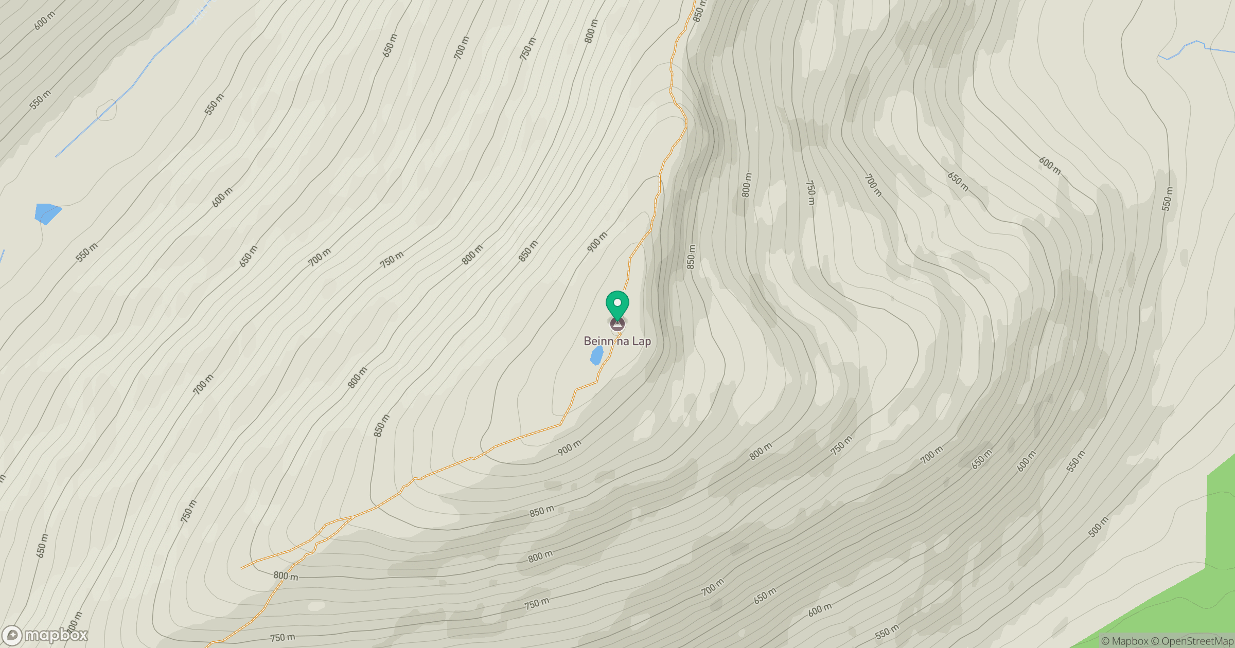
Grid reference: NN376695
View on OpenStreetMapOpens a map in a new tab, centred on the hill.
No comments yet. Be the first.