

Beinn Molurgainn
Good walks are even better shared.
NN0140 : Summit of Beinn Molurgainn
ronnie leask Photo source
Explore routes near Beinn Molurgainn
Walks starting near this hill. Open a route to check its map, distance and full itinerary.
Ben Nevis via Mountain Path
View route
Banavie to Glen Loy Aqueduct: Neptune’s Staircase Canal Towpath
View route
Beinn Ime from Succoth
View route
The Cobbler from Succoth Carpark
View route
Route planning notes
These notes describe possible approaches. Check a route's map and access information when planning your walk.
Mullach route
This route begins at the small village of Struy, offering a gradual ascent with stunning views of the surrounding glens.
Creag an Tuirc route
Starting from the car park at Achnasheen, this route takes you through beautiful heather-covered hills before reaching the summit.
Make a day of it, together
Find someone to share the walk with, or organise a day out along a route you like.
Photo Gallery
View all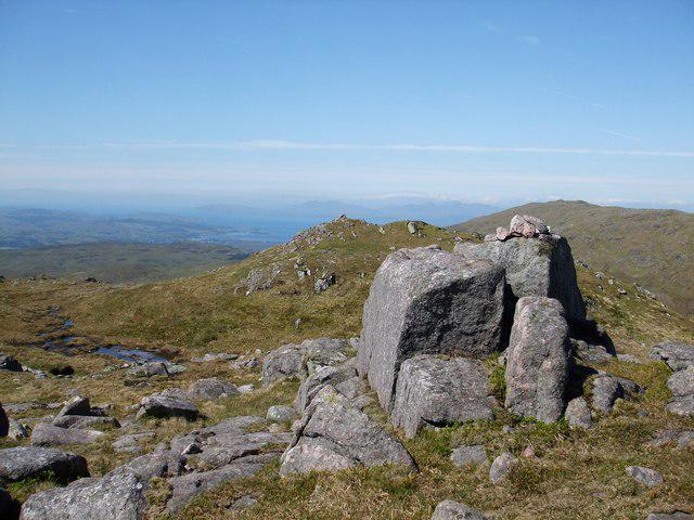 Photo could not load
NN0140 : Summit of Beinn Molurgainn
ronnie leask
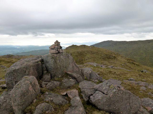 Photo could not load
NN0140 : Beinn Molurgainn
Rude Health
Hill facts and local notes
Classifications
Elevation
688m
2,258 ft
Prominence
150m
Coordinates
56.5109, -5.2202
NN019400
OS Map
50
Explorer: 377W
At the Summit
The summit features a large stone cairn with breathtaking panoramic views of the surrounding mountains and glens, as well as a small, weathered trig point for the keenest of peak baggers.
Terrain & Geology
Beinn Molurgainn is primarily composed of schist and granite, which gives the mountain its rugged terrain and beautiful glacial features. The landscape was largely shaped by glacial activity, resulting in deep valleys and smooth hillsides.
Views & Scenery
From the summit, you can spot notable landmarks such as Loch Awe and the peaks of the Ben Nevis range on a clear day, proving that hard work pays off with such spectacular rewards.
History & Heritage
Name Origin
The name 'Molurgainn' is believed to derive from the Gaelic 'Beinn Mholurgainn' meaning 'Mountain of the Little Moors.'
Historical Significance
Beinn Molurgainn has been a beloved peak for local outdoor enthusiasts, often featured in hiking guides and cherished for its natural beauty.
Getting There & Facilities
Parking
There is a small car park at Struy, which provides convenient access to various routes leading to Beinn Molurgainn.
Public Transport
Regular bus services operate from Inverness to Achnasheen, which is the nearest major town. A bit of a hop and a skip, and you can start your adventure!
Nearby Facilities
Unfortunately, facilities are minimal; best to pack a picnic. However, the nearby village of Achnasheen has a small café that offers hot drinks and a welcoming atmosphere.
Safety Information
Known Hazards
- Watch for sudden weather changes, which can turn from sunny to stormy in a blink. The terrain can be rocky and slippery, so care is required, especially on steep descents.
General Safety Tips
- Check weather conditions before setting out
- Carry appropriate clothing and equipment
- Let someone know your planned route
- Take a map, compass, and GPS device
- Carry emergency supplies: food, water, first aid kit, torch
Hills
Some common questions about the hills answered
Are there group walks up Beinn Molurgainn?
Many walkers use Walkmates to join or organise walks with others. You can check for group walks around Beinn Molurgainn through the maps
Are there other walkers around Beinn Molurgainn?
Activity varies by location and time, but Walkmates lets you see whether others have shared walks or shown interest in this area. Find other people through the walking friends search walking friends for Beinn Molurgainn search or of course create your own walk for Beinn Molurgainn
Can I organise a walk to Beinn Molurgainn?
Yes. If there aren’t any walks listed already, you can create a walk and make it available for others to join.
If you're signed up to Walkmates, you can create a walk to Beinn Molurgainn.
How do I find a walk up this hill?
There are often multiple ways to walk this hill, depending on experience and route preference. Walkmates helps you explore walks and routes that others have shared.
Can I suggest a new route up Beinn Molurgainn?
Yes. You can suggest or create routes to share with others. Walkmates focuses on the social side of walking, so routes are used to help people organise walks and explore areas together, rather than as detailed navigation tools or route libraries.
Other uses really appreciate knowledgeable walkers sharing their routes. Share your favourite route to Beinn Molurgainn here
The is an error or something incorrect about this hill. How do I let you know?
We always strive to keep the information on Walkmates as accurate as possible. If you find an error, please let us know through the contact form and we'll aim to correct it as quickly as possible
Community Discussion
Comments
Location
View the hill's mapped position and surrounding paths.
Grid reference: NN019400
View on OpenStreetMapOpens a map in a new tab, centred on the hill.
Nearby Hills
Ben Cruachan
1,127m
Beinn a' Bheithir - Sgorr Dhonuill
1,002m
Beinn a' Bheithir - Sgorr Dhearg
1,024m
Ben Starav
1,080m
Sgurr na h-Ulaidh [Sgor na h-Ulaidh]
994m
No comments yet. Be the first.