

Battlesbury Hill
Good walks are even better shared.
ST8945 : Western Ramparts and Fortifications of Battlesbury Camp
Chris Heaton Photo source
Overview
Battlesbury Hill
Battlesbury Hill, standing at a proud 227 meters, is a gem nestled in the rolling hills of Wiltshire. This hill not only offers invigorating walks but also a peek into the rich geological and historical tapestry of the region.
Geology
Battlesbury Hill is primarily composed of limestone, boasting fascinating karst topography. The limestone rocks, shaped by eons of weathering, include some intriguing formations such as sinkholes and limestone pavements. This geological wonder is a remnant of ancient marine environments, a perfect playground for inquisitive geologists and hikers alike.
Routes
Two popular routes lead you up to the hilltop, each offering a unique experience:
- Battlesbury Hill Circular Walk: This 6.5 km circular route begins in the charming village of Mere. Traversing through delightful woodlands, it culminates in a satisfying summit experience.
- Direct Ascent from Mere: A simpler, more direct option for those pressed for time or looking for a leisurely stroll. This route is just 3.1 km long and is suitable for a family outing.
Summit Features
Reaching the summit, you’re greeted by a classic trig point—an ideal place for reflection and of course, Instagram-worthy snaps! The top also hosts remnants of ancient earthworks, whispering the tales of the past to the attentive visitor.
Terrain Type
Expect grassy paths with rocky outcrops as you make your ascent. The terrain eases you in gently, but watch your step on the final stretch where rocky patches might test your footing.
Views
The views from the top are nothing short of spectacular. Gaze across the rolling landscapes of Wiltshire, spot the unmistakable Stonehenge in the distance, and if the weather permits, you might even see the impressive spires of Salisbury Cathedral. The finest scenes can be enjoyed during spring and autumn, particularly around sunrise and sunset when the world seems to glow with a golden hue.
Hazards
While the climb isn’t particularly perilous, do keep an eye out for slippery rocks, especially in the misty or damp conditions. Sturdy footwear is recommended, particularly in winter when paths can be muddy.
Nearby Summits
If you’re keen to further your adventure, consider nearby hills such as Giverny Hill (215 meters) or Long Knoll (185 meters) which add variety to your hiking repertoire.
Access
Parking is available in Mere, with the nearest public transport links running regular bus services from nearby towns like Warminster.
Facilities
Mere offers a host of facilities, including charming cafes ideal for a restorative cuppa before or after your hike.
History
The name 'Battlesbury' hints at its historical roots, possibly linked to battles or burials from a bygone era. This hill was significant to ancient communities, evidenced by archaeological finds that remind us of the rich tapestry of human history.
In conclusion, Battlesbury Hill is much more than just a bump in the landscape; it's a place of beauty, history, and fine views that can make any outdoor enthusiast's heart skip a beat!
So, pack your rucksack, grab a buddy (or two), and take to the hills!
Explore routes near Battlesbury Hill
Walks starting near this hill. Open a route to check its map, distance and full itinerary.
Heal Somerset wetland ranger walk
View route
Heal Somerset wetland ranger walk
View route
Mindful photowalk at Heal Somerset
View route
Beaver Moon dusk walk at Heal Somerset
View route
Route planning notes
These notes describe possible approaches. Check a route's map and access information when planning your walk.
Battlesbury Hill Circular Walk
A delightful circular route starting from the village of Mere, leading you through scenic woodlands and up to the summit of Battlesbury Hill.
Direct Ascent from Mere
A straightforward ascent directly from Mere, taking you up to the hilltop with relatively gentle gradients.
Make a day of it, together
Find someone to share the walk with, or organise a day out along a route you like.
Photo Gallery
View all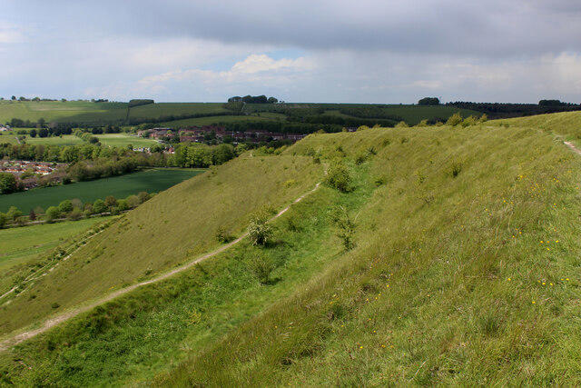 Photo could not load
ST8945 : Western Ramparts and Fortifications of Battlesbury Camp
Chris Heaton
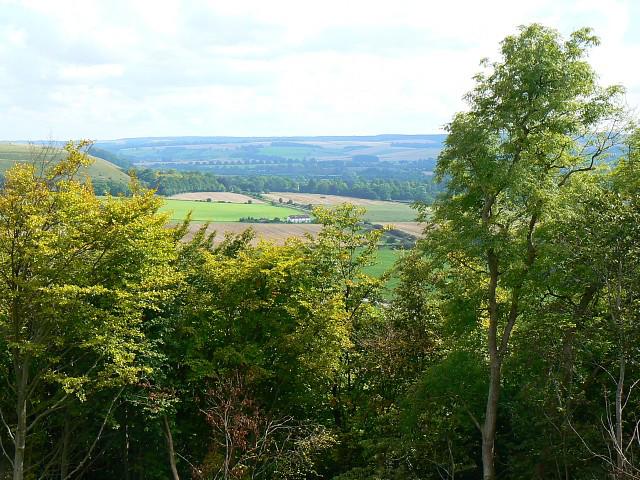 Photo could not load
ST8945 : View south-east from Battlesbury Hill, near Warminster
Brian Robert Marshall
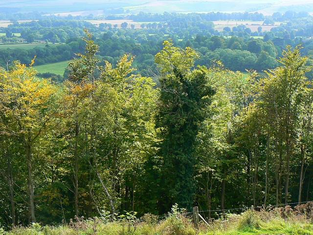 Photo could not load
ST8945 : Woodland south of Battlesbury Hill, near Warminster
Brian Robert Marshall
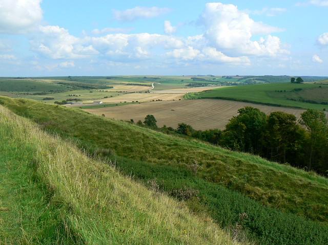 Photo could not load
ST8945 : Battlesbury Hill southern earthwork, near Warminster
Brian Robert Marshall
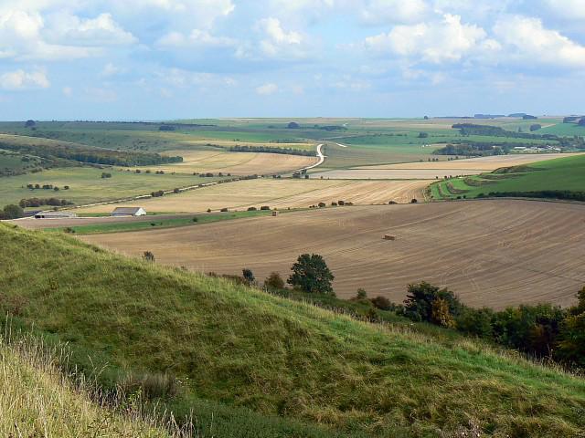 Photo could not load
ST8945 : Battlesbury Hill southern earthwork, near Warminster
Brian Robert Marshall
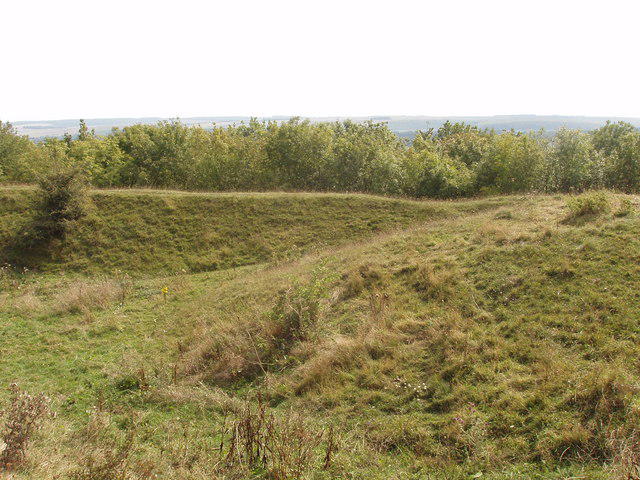 Photo could not load
ST8945 : Round barrow, Battlesbury Hill, Warminster
David Hawgood
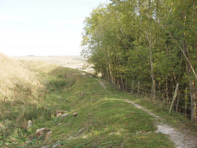 Photo could not load
ST8945 : Self-seeded trees on Battlesbury Hill, near Warminster
David Hawgood
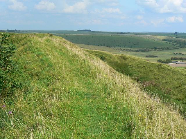 Photo could not load
ST8945 : Earthwork, Battlesbury Hill, near Warminster
Brian Robert Marshall
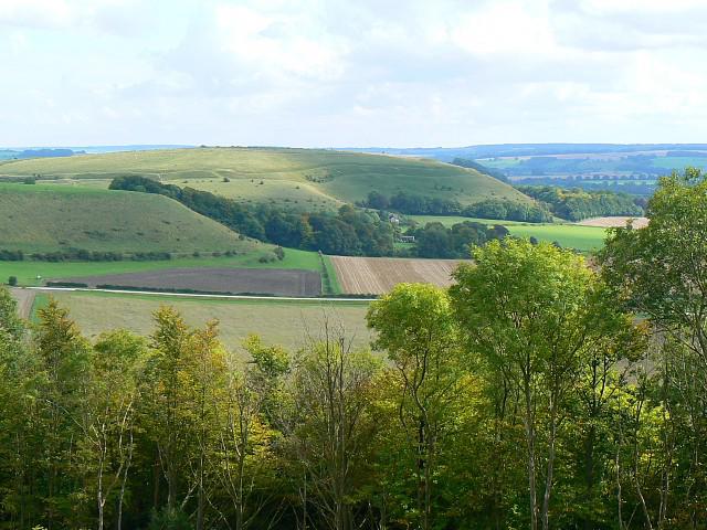 Photo could not load
ST8945 : View south-east from Battlesbury Hill, near Warminster
Brian Robert Marshall
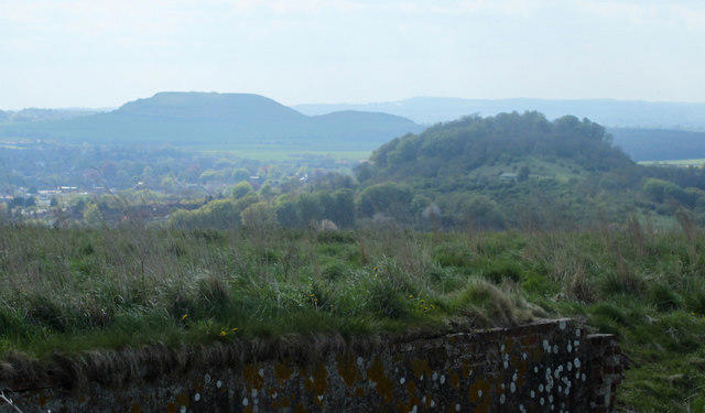
ST8945 : 2010 : West from Battlesbury Hill
Maurice Pullin
Hill facts and local notes
Classifications
Elevation
208m
682 ft
Prominence
39m
Coordinates
51.2091, -2.1461
ST898455
OS Map
184
Explorer: 143
At the Summit
The summit features a prominent trig point, which doubles as a great spot to catch your breath (and if you’re lucky, a panoramic view!). Nearby, you’ll find remnants of ancient earthworks that hint at its historical significance.
Terrain & Geology
Battlesbury Hill is primarily composed of limestone. The hill showcases classic karst topography including limestone pavements and some intriguing sinkholes, making it a geologist’s playground. The rock formations tell tales of ancient marine environments, creating a fascinating backdrop for hikers.
Views & Scenery
From the summit, you can glimpse the rolling Wiltshire hills, the iconic Stonehenge in the distance, and on a clear day, even the spires of Salisbury Cathedral.
History & Heritage
Name Origin
The name 'Battlesbury' is thought to derive from 'battle' and 'bury', hinting at the hill's potential as a site of historical conflict or burial.
Historical Significance
Archaeological digs have revealed signs of ancient settlement and fortifications, suggesting Battlesbury was significant to prehistoric communities.
Getting There & Facilities
Parking
There is parking available in Mere at the Salisbury Road car park, which is about a 20-minute walk from the beginning of the climb.
Public Transport
Mere is accessible by bus from surrounding towns like Warminster and Frome, making it easy to plan your hiking day without a car.
Nearby Facilities
There are several cafes and public toilets in Mere, perfect for a pre-hike coffee or after-hike treat!
Safety Information
Known Hazards
- Caution is advised on rocky sections, especially when wet. The paths can be muddy in winter, so sturdy footwear is a must!
General Safety Tips
- Check weather conditions before setting out
- Carry appropriate clothing and equipment
- Let someone know your planned route
- Take a map, compass, and GPS device
- Carry emergency supplies: food, water, first aid kit, torch
Hills
Some common questions about the hills answered
Are there group walks up Battlesbury Hill?
Many walkers use Walkmates to join or organise walks with others. You can check for group walks around Battlesbury Hill through the maps
Are there other walkers around Battlesbury Hill?
Activity varies by location and time, but Walkmates lets you see whether others have shared walks or shown interest in this area. Find other people through the walking friends search walking friends for Battlesbury Hill search or of course create your own walk for Battlesbury Hill
Can I organise a walk to Battlesbury Hill?
Yes. If there aren’t any walks listed already, you can create a walk and make it available for others to join.
If you're signed up to Walkmates, you can create a walk to Battlesbury Hill.
How do I find a walk up this hill?
There are often multiple ways to walk this hill, depending on experience and route preference. Walkmates helps you explore walks and routes that others have shared.
Can I suggest a new route up Battlesbury Hill?
Yes. You can suggest or create routes to share with others. Walkmates focuses on the social side of walking, so routes are used to help people organise walks and explore areas together, rather than as detailed navigation tools or route libraries.
Other uses really appreciate knowledgeable walkers sharing their routes. Share your favourite route to Battlesbury Hill here
The is an error or something incorrect about this hill. How do I let you know?
We always strive to keep the information on Walkmates as accurate as possible. If you find an error, please let us know through the contact form and we'll aim to correct it as quickly as possible
Community Discussion
Comments
Location
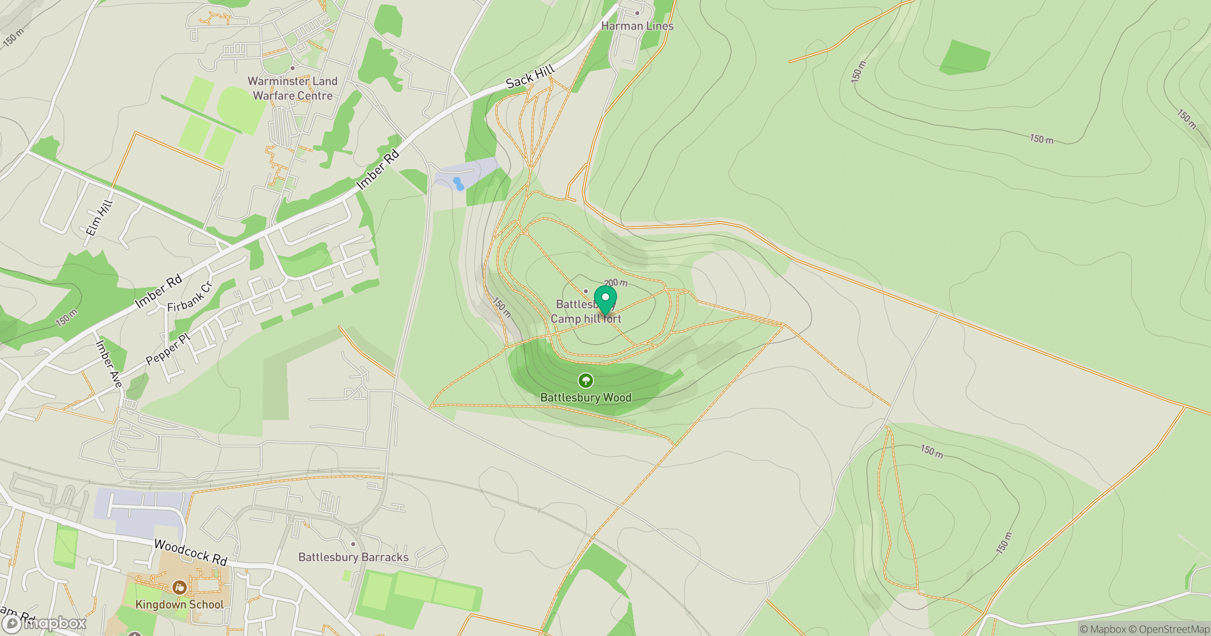
Grid reference: ST898455
View on OpenStreetMapOpens a map in a new tab, centred on the hill.
Nearby Hills
Glastonbury Tor
158m
Worcestershire Beacon
425m
Titterstone Clee Hill
533m

Cribyn
794m

Dunkery Beacon
520m
No comments yet. Be the first.