

Askwith Moor
Good walks are even better shared.
SE1651 : Railway Wagon on Shooting House Hill
Chris Heaton Photo source
Overview
Askwith Moor
Overview
Askwith Moor, sitting proudly at 418 meters, is a delightful and accessible Marilyn located in the picturesque Yorkshire Dales. Renowned for its limestone landscape, scenic views, and varied terrain, Askwith Moor offers a splendid day out for hikers of all levels. Whether you're a seasoned walker or just fancy a leisurely meander, this moor won't disappoint.
Geology
The geology of Askwith Moor is fascinating, with limestone being the prominent rock type. The results of karst processes are apparent throughout the area, where limestone pavements and sinkholes feature prominently. The diverse landscape is not only a visual delight but also a geological wonderland.
Access and Parking
Getting to Askwith Moor is straightforward. Park at the small car park near Askwith Village, around 1.5 km from the main walking routes. Early birds get the worm—or, in this case, a parking spot! Alternatively, you can hop on a bus from Ilkley, ensuring a stress-free start to your adventure.
Walking Routes
A popular choice is the Askwith Moor Circular Walk. This moderate 8.5 km route takes approximately 3.5 hours to complete, beautifully showcasing the rugged charm of the moor. Along the way, you'll enjoy stunning vistas and perhaps encounter some friendly sheep who seem to own the place.
Summit Features
The summit is crowned by a sturdy stone cairn, a great spot for a quick rest or a cheeky photo op. Keep an eye out for inquisitive hikers trying to snap the perfect selfie with this classic Yorkshire backdrop!
Views
The views from the summit are truly rewarding. On clear days, you'll behold the majestic rolling hills of the Yorkshire Dales and even the distant outlines of the North York Moors. Spring and early autumn are particularly splendid times for a visit, as the weather tends to play ball, giving you a clearer perspective on the stunning landscape.
Terrain and Hazards
Expect a mix of grassy slopes interspersed with rocky outcrops and occasional boggy patches. It's the kind of place where a sturdy boot is your best friend. As with all moorland, the weather can change at the drop of a hat, so dress accordingly and don’t forget that waterproof jacket—because let’s be honest, you’re in Yorkshire!
Nearby Summits
For those seeking more exploration, nearby summits like Ilkley Moor and Rombalds Moor are tantalising options that offer additional flavours of the stunning Yorkshire landscape.
Facilities
While Askwith Moor may not have amenities at the summit, the nearby town of Ilkley is a bustling hub with various cafés and toilets. Ideal for grabbing a well-earned slice of cake or a cup of Yorkshire tea after your trekking escapade.
Final Thoughts
In summary, Askwith Moor is a delightful destination that promises both adventure and breathtaking views. Don your hiking boots, pack a snack, and venture out to discover this jewel of the Yorkshire Dales. Happy hiking!
Explore routes near Askwith Moor
Walks starting near this hill. Open a route to check its map, distance and full itinerary.
Bolton Abbey: Strid Wood and Barden Bridge Circuit
View route
Harrogate: Pinewoods and Valley Gardens
View route
Golden Acre Park Arboretum and Lake
View route
Saltaire to Bingley Five Rise Locks
View route
Route planning notes
These notes describe possible approaches. Check a route's map and access information when planning your walk.
Askwith Moor Circular Walk
A scenic circular route offering a chance to explore Askwith Moor and surrounding areas, with stunning views throughout.
Make a day of it, together
Find someone to share the walk with, or organise a day out along a route you like.
Photo Gallery
View all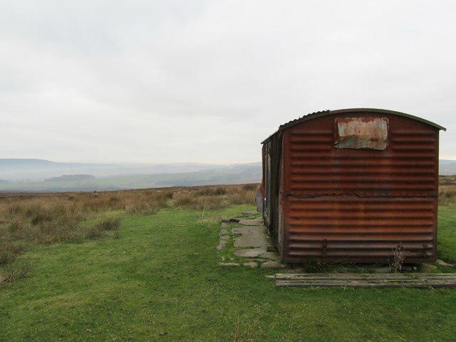 Photo could not load
SE1651 : Railway Wagon on Shooting House Hill
Chris Heaton
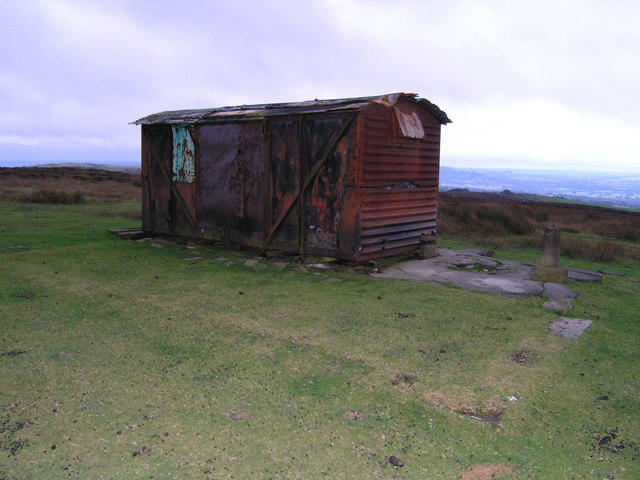 Photo could not load
SE1651 : Box-car on the top of Shooting House Hill
Mick Borroff
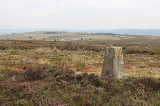 Photo could not load
SE1751 : Trig pillar on Shooting House Hill, Askwith Moor
Alan Reid
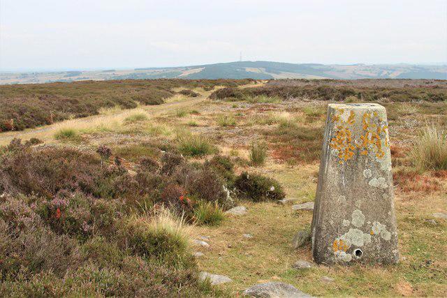 Photo could not load
SE1751 : Trig pillar on Shooting House Hill, Askwith Moor
Alan Reid
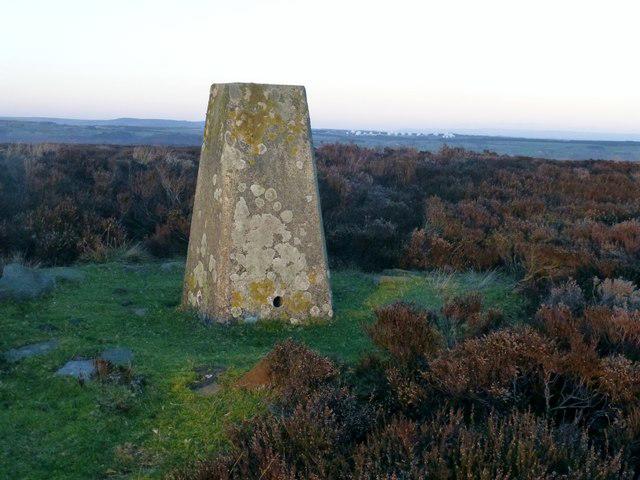 Photo could not load
SE1751 : Askwith Moor
Rude Health
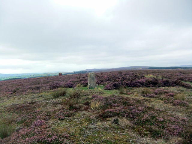 Photo could not load
SE1751 : On Askwith Moor
David Brown
Hill facts and local notes
Classifications
Elevation
300m
984 ft
Prominence
32m
Coordinates
53.9555, -1.7410
SE170510
OS Map
104
Explorer: 297
At the Summit
A stone cairn marks the summit of Askwith Moor, allowing for a satisfying photo opportunity. Don't forget to take a selfie with a bit of Yorkshire grit!
Terrain & Geology
Dominated by limestone, Askwith Moor presents a fascinating landscape shaped by karst processes. Expect to find limestone pavements and numerous sinkholes, making the area a geological treasure for enthusiasts.
Views & Scenery
From the summit, you can see the rolling hills of the Yorkshire Dales, and on a clear day, the distant peaks of the North York Moors and even the Three Peaks.
History & Heritage
Name Origin
The name 'Askwith' derives from Old Norse, where 'askr' means 'ash tree' and 'wīcas' means 'dwellings or farm'. So technically, you've just walked around an ancient ash-farm—how quaint!
Historical Significance
The moor has historical significance as part of the hunting grounds for the nearby estate of the Ilkley Clan, with legends of the area steeped in local folklore.
Getting There & Facilities
Parking
There is a small car park at the Askwith Village, which is approximately 1.5 km from the start of the walk. Please consider arriving early, especially on sunny weekends.
Public Transport
Buses run from Ilkley to Askwith, making it accessible if you'd rather leave the car behind. Check local schedules to plan your journey.
Nearby Facilities
While facilities are limited directly on Askwith Moor, nearby Ilkley boasts numerous cafés, restaurants, and public toilets. Make sure to refuel after your adventure!
Safety Information
Known Hazards
- Watch out for the typical moorland conditions, which can lead to sudden weather changes. Always prepare for damp underfoot and the possibility of poor visibility.
General Safety Tips
- Check weather conditions before setting out
- Carry appropriate clothing and equipment
- Let someone know your planned route
- Take a map, compass, and GPS device
- Carry emergency supplies: food, water, first aid kit, torch
Hills
Some common questions about the hills answered
Are there group walks up Askwith Moor?
Many walkers use Walkmates to join or organise walks with others. You can check for group walks around Askwith Moor through the maps
Are there other walkers around Askwith Moor?
Activity varies by location and time, but Walkmates lets you see whether others have shared walks or shown interest in this area. Find other people through the walking friends search walking friends for Askwith Moor search or of course create your own walk for Askwith Moor
Can I organise a walk to Askwith Moor?
Yes. If there aren’t any walks listed already, you can create a walk and make it available for others to join.
If you're signed up to Walkmates, you can create a walk to Askwith Moor.
How do I find a walk up this hill?
There are often multiple ways to walk this hill, depending on experience and route preference. Walkmates helps you explore walks and routes that others have shared.
Can I suggest a new route up Askwith Moor?
Yes. You can suggest or create routes to share with others. Walkmates focuses on the social side of walking, so routes are used to help people organise walks and explore areas together, rather than as detailed navigation tools or route libraries.
Other uses really appreciate knowledgeable walkers sharing their routes. Share your favourite route to Askwith Moor here
The is an error or something incorrect about this hill. How do I let you know?
We always strive to keep the information on Walkmates as accurate as possible. If you find an error, please let us know through the contact form and we'll aim to correct it as quickly as possible
Community Discussion
Comments
Location
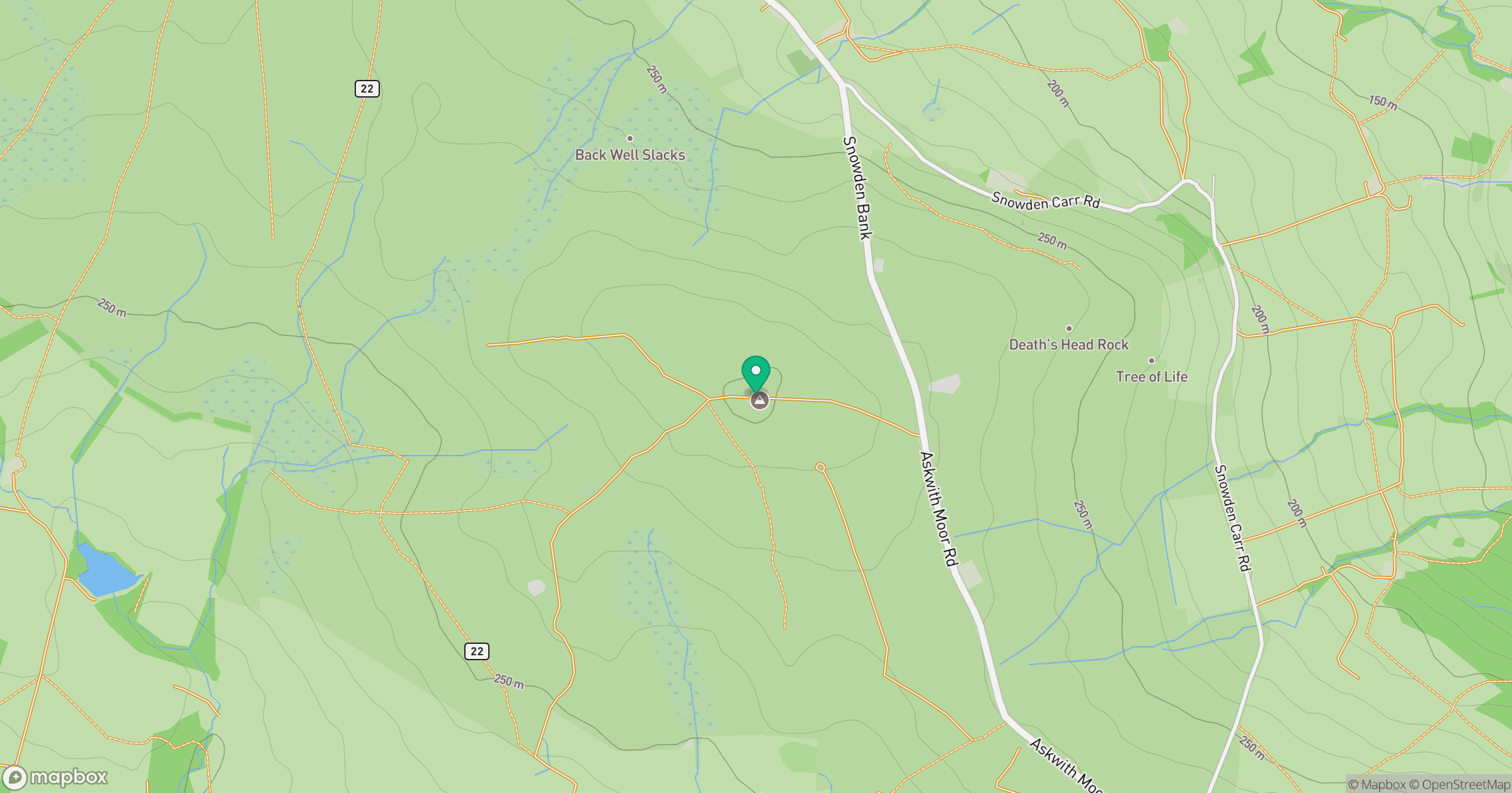
Grid reference: SE170510
View on OpenStreetMapOpens a map in a new tab, centred on the hill.
Nearby Hills
Rombalds Moor [Ilkley Moor]
402m
Buckden Pike
702m

Pen-y-ghent
694m

Pendle Hill
557m

Kinder Scout
636m
No comments yet. Be the first.