

Almscliff Crag
Good walks are even better shared.
Overview
Almscliff Crag
Almscliff Crag, located in the picturesque Yorkshire countryside, stands at a respectable 339 meters above sea level. This impressive gritstone formation isn't just a pretty face; it's a climber's paradise with its challenging routes and stunning views. Whether you're a seasoned climber or just out for a leisurely walk, Almscliff has something for everyone.
Geology
The crag consists predominantly of gritstone, a material that has faced erosion and weathering over the years, resulting in striking vertical faces and jagged edges. The sturdiness of the rock makes it an excellent site for various climbing disciplines. So bring your chalk and don your climbing shoes, as this crag offers a mix of routes suitable for both beginners and seasoned climbers alike.
Routes
One of the most popular ways to experience this stunning rock face is via the Almscliff Circular Walk, a moderate 5.5 km route circling the area, allowing walkers to take in the breathtaking views from different angles. If you're feeling adventurous, the Crag Approach leads you directly to the base for a closer look (and a bit of a scramble).
Summit Features
At the summit, you'll find an impressive gritstone edge beckoning you to sit and absorb the splendid views. On a bright day, you'll be greeted by the sight of the Wharfe Valley as it sprawls out beneath you, peppered with charming villages and majestic woodlands.
Views
The views from Almscliff Crag are nothing short of spectacular. On clear days, you can see the lush Yorkshire landscape stretching out before you, including far-off hills and valleys, making it a photographer's dream come true. If you're lucky, you might catch a sunset here—just remember to bring a picnic and perhaps some bubbly!
Hazards
Despite its beauty, hikers and climbers should be mindful of loose rocks and steep drop-offs, especially when venturing off the established paths. Also, Yorkshire's weather can be as unpredictable as a cat on a hot tin roof, so come prepared with appropriate clothing.
Access and Facilities
Getting to Almscliff Crag is relatively easy. The nearest parking is only a stone's throw away, though it can fill up quicker than a Yorkshire pudding in the oven. If public transport is more your cup of tea, catch a bus to East Keswick and enjoy a lovely 20-minute walk. As for facilities, you may need to venture into Otley for a warm cuppa or a loo break.
History
The name ‘Almscliff’ has intriguing roots, possibly referring to the cliffs being a location for charitable acts in the past. It has also played a significant role in English climbing heritage, drawing enthusiasts to its rugged beauty since the 1800s.
Whether you're climbing, walking, or just soaking up the views, Almscliff Crag offers a delightful day out in the great outdoors. Just remember, the only blisters you should return with are from conquering those climbs, not from your walking shoes falling apart!
Explore routes near Almscliff Crag
Walks starting near this hill. Open a route to check its map, distance and full itinerary.
Harrogate: Pinewoods and Valley Gardens
View route
Golden Acre Park Arboretum and Lake
View route
Adel Dam barefoot walking introduction
View route
Fewston and Swinsty: both reservoir circuits
View route
Route planning notes
These notes describe possible approaches. Check a route's map and access information when planning your walk.
Almscliff Crag Circular Walk from Huby
This popular circular route starts in the village of Huby and leads walkers through quiet countryside paths and farmland before ascending to Almscliff Crag. Enjoy panoramic views of the Wharfe Valley from the top, and then descend back to Huby via a scenic loop.
Almscliff Crag via North Rigton
Beginning in North Rigton, this route takes you through charming rural paths and past quintessential Yorkshire scenery. The ascent to Almscliff Crag provides stunning views, and the return journey offers a gentle descent back to the village.
Almscliff Crag and Kirkby Overblow Loop
This longer and more varied walk combines a visit to Almscliff Crag with a scenic loop through the picturesque village of Kirkby Overblow. The route features a mix of trails, quiet lanes, and open countryside, making it perfect for those seeking a slightly more challenging day out.
Almscliff Crag Short Walk from Stainburn
Ideal for those seeking a shorter outing, this route starts in the small hamlet of Stainburn and takes a direct path to Almscliff Crag. The walk is perfect for families or those with limited time, offering great views in a compact route.
Almscliff Crag and Lindley Wood Reservoir Loop
This scenic and diverse route combines a visit to Almscliff Crag with a loop around Lindley Wood Reservoir. The walk features woodland trails, open fields, and waterside paths, offering a varied landscape and plenty of photo opportunities.
Make a day of it, together
Find someone to share the walk with, or organise a day out along a route you like.
Photo Gallery
View all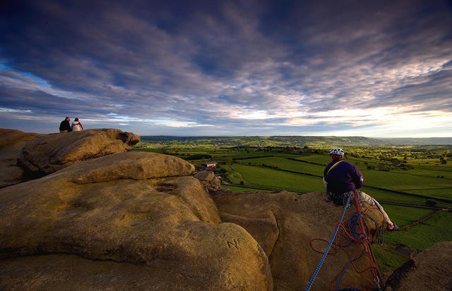 Photo could not load
SE2649 : Almscliffe Crag
Les McLean
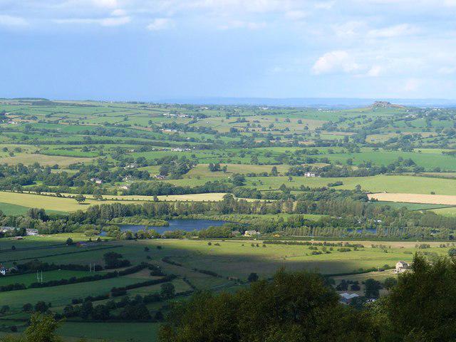 Photo could not load
SE2649 : View from The Chevin, with Almscliff Crag on the right.
John M Wheatley
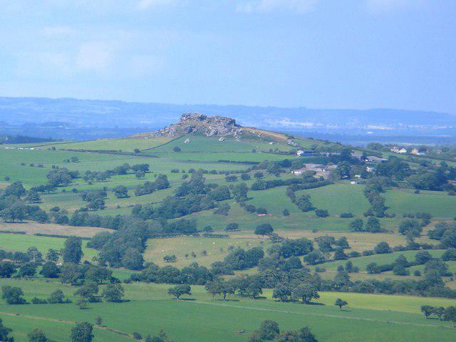 Photo could not load
SE2649 : Zoom shot of Almscliff Crag from The Chevin,
John M Wheatley
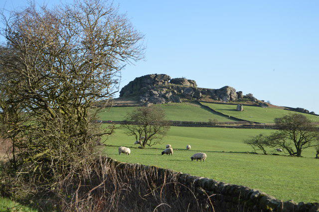 Photo could not load
SE2649 : Almscliff Crag
N Chadwick
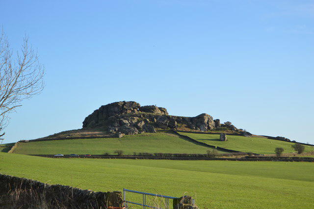 Photo could not load
SE2649 : Almscliff Crag
N Chadwick
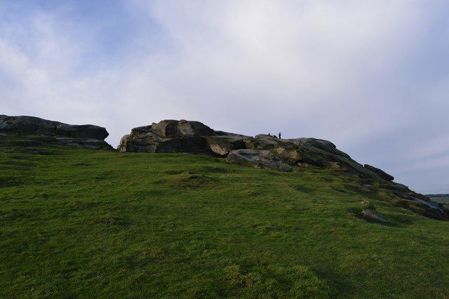 Photo could not load
SE2649 : Almscliff Crag
N Chadwick
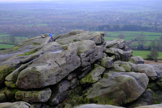 Photo could not load
SE2649 : Almscliffe Crag
John Winder
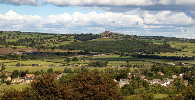 Photo could not load
SE2648 : Almscliff Crag
Peter McDermott
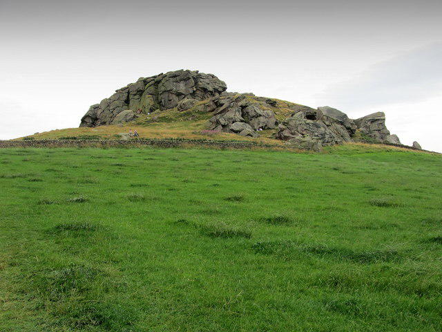 Photo could not load
SE2649 : Almscliff Crag
Chris Heaton
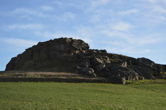
SE2649 : Almscliff Crag
N Chadwick
Hill facts and local notes
Classifications
Elevation
213m
699 ft
Prominence
39m
Coordinates
53.9365, -1.5932
SE268490
OS Map
104
Explorer: 297
At the Summit
The summit of Almscliff Crag features a prominent gritstone edge with panoramic views and a few large boulders, perfect for resting before continuing your adventure.
Terrain & Geology
Almscliff Crag is primarily composed of gritstone, which has been shaped over millions of years into striking cliffs and crags, offering excellent climbing opportunities. The surrounding area features impressive rock formations, making it a geological wonder.
Views & Scenery
You can see the stunning landscape of the Wharfe Valley, Harrogate, and the distant peaks of the Yorkshire Dales on a clear day.
History & Heritage
Name Origin
The name 'Almscliff' is thought to derive from the Old English meaning 'cliff of the alms,' possibly referring to the area’s historical ties to offering assistance or charity.
Historical Significance
Almscliff Crag has been a popular climbing destination since the late 19th century, holding historical significance in the English climbing community.
Getting There & Facilities
Parking
There is a small parking area near the crag, just off the A661, which can hold around 10 cars. Additional parking can be found down the road.
Public Transport
The nearest bus stop is in the village of East Keswick, with services from Leeds and Harrogate. It's about a 20-minute walk to the crag from there.
Nearby Facilities
While there are no facilities directly at the crag, Otley offers cafes, restaurants, and public toilets.
Safety Information
Known Hazards
- Loose rocks, steep drop-offs, and potential for sudden weather changes.
General Safety Tips
- Check weather conditions before setting out
- Carry appropriate clothing and equipment
- Let someone know your planned route
- Take a map, compass, and GPS device
- Carry emergency supplies: food, water, first aid kit, torch
Hills
Some common questions about the hills answered
Are there group walks up Almscliff Crag?
Many walkers use Walkmates to join or organise walks with others. You can check for group walks around Almscliff Crag through the maps
Are there other walkers around Almscliff Crag?
Activity varies by location and time, but Walkmates lets you see whether others have shared walks or shown interest in this area. Find other people through the walking friends search walking friends for Almscliff Crag search or of course create your own walk for Almscliff Crag
Can I organise a walk to Almscliff Crag?
Yes. If there aren’t any walks listed already, you can create a walk and make it available for others to join.
If you're signed up to Walkmates, you can create a walk to Almscliff Crag.
How do I find a walk up this hill?
There are often multiple ways to walk this hill, depending on experience and route preference. Walkmates helps you explore walks and routes that others have shared.
Can I suggest a new route up Almscliff Crag?
Yes. You can suggest or create routes to share with others. Walkmates focuses on the social side of walking, so routes are used to help people organise walks and explore areas together, rather than as detailed navigation tools or route libraries.
Other uses really appreciate knowledgeable walkers sharing their routes. Share your favourite route to Almscliff Crag here
The is an error or something incorrect about this hill. How do I let you know?
We always strive to keep the information on Walkmates as accurate as possible. If you find an error, please let us know through the contact form and we'll aim to correct it as quickly as possible
Community Discussion
Comments
Location
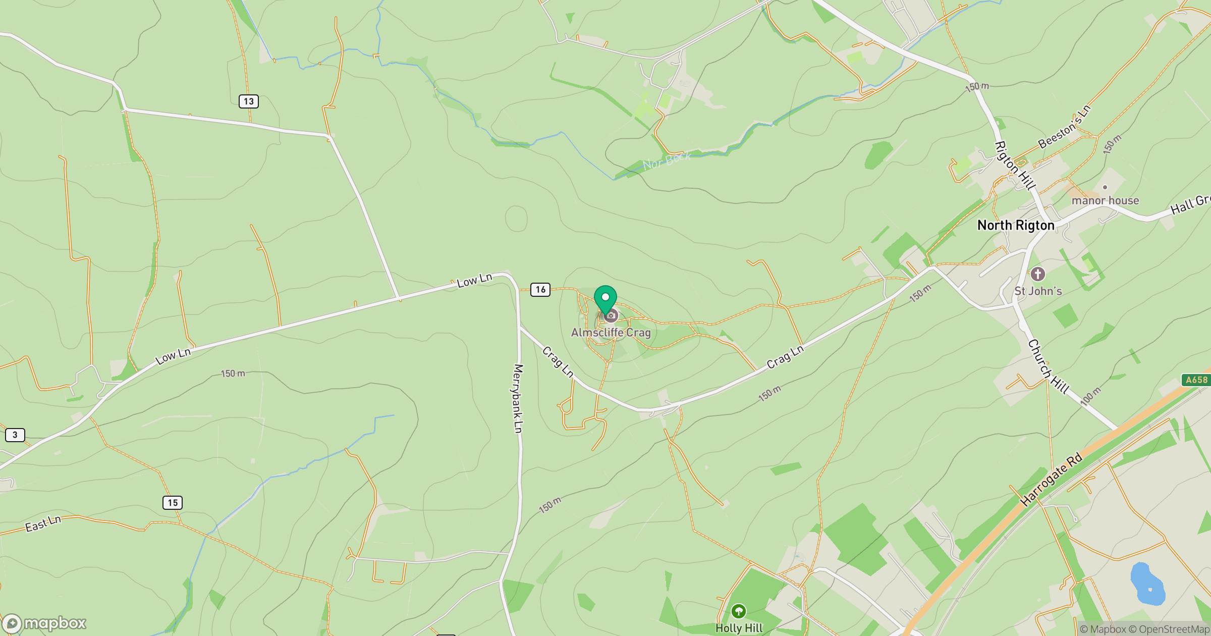
Grid reference: SE268490
View on OpenStreetMapOpens a map in a new tab, centred on the hill.
Nearby Hills
Rombalds Moor [Ilkley Moor]
402m
Buckden Pike
702m

Kinder Scout
636m

Pen-y-ghent
694m

Pendle Hill
557m
No comments yet. Be the first.