

Stinchcombe Hill
Good walks are even better shared.
ST7398 : 2008 : West of north from Stinchcombe Hill
Maurice Pullin Photo source
Overview
Stinchcombe Hill: A Hiker's Delight
Stinchcombe Hill, standing proudly at 202 meters, offers one of the most rewarding hikes in the Cotswolds region. It is not just a hill, but a portal to breathtaking views and a history that lightens the mind with curiosity.
Geology
Stinchcombe is dressed in beautiful limestone and dates back to the Jurassic period. As you walk up, you may stumble upon remnants of ancient seas etched in the rocks, which should get any geology buff excited! Plus, don't forget to look at those classic dry stone walls – they're as iconic as afternoon tea.
Routes
This hill offers routes to suit every steed. The Circular Walk is perfect for families and those looking for a casual stroll. Meanwhile, The Ascent from Dursley brings a delightful challenge, rewarding your effort with stunning panoramas from the summit. Whether you're a sofa king or a seasoned trekker, there's a path for you!
Summit Features
Upon reaching the top, you'll be greeted by a trig point standing sentinel against the sky. Nearby, a commemorative plaque reminds visitors of the rich history that this hill carries. As you catch your breath, take a moment to ponder the earthworks around you – it's like wandering through a history book.
Terrain
Here, the terrain is as mixed as a fruit salad. Expect grassy slopes, rocky outcrops, and friendlier woodlands, particularly lovely in spring when nature bursts into colour.
Views
The views are a scenic treasure! Gaze out at the Severn Vale, and if you squint hard enough, perhaps you'll spot that persistent sheep that thinks it can outrun you.
Hazards
While the ascent is generally gentle, keep an eye out for steep drops and muddy patches on your journey. We wouldn’t want you taking an unexpected mud bath!
Access
Reaching Stinchcombe is as easy as pie. With a small car park at ST739976 and friendly bus services from nearby towns, adventure awaits. The closest town, Dursley, offers all the amenities and is just a stone's throw away.
Facilities
After your hike, you'll find refreshing local cafes awaiting you in Stinchcombe, and Dursley is equipped with public toilets to clean off any accumulated dirt from your adventurous activities.
History
The name, 'Stinchcombe', evokes gallant historical tales, hinting at a marshy descent that perhaps smelled a bit ripe in earlier times. Oh, the tales this hill could tell! It's been a cherished walking spot for as long as anyone can remember, not to mention its strategic importance during the Civil War.
Conclusion
Stinchcombe Hill isn’t just a hike; it's a mosaic of experience, nature, and history that continues to charm its visitors. So lace up those walking boots and head on up! You won't regret it.
Explore routes near Stinchcombe Hill
Walks starting near this hill. Open a route to check its map, distance and full itinerary.
Woodchester Park: Tinkley Gate, lakes and Mansion woodland walk
View route
Forest of Dean Full Colliers Trail from Cannop Ponds
View route
Forest of Dean Hicksters Way Woodland Circuit from Cannop
View route
Conham River Park to Hanham Mills: River Avon towpath return
View route
Route planning notes
These notes describe possible approaches. Check a route's map and access information when planning your walk.
The Circular Walk
A pleasant circular route that starts from the village of Stinchcombe and takes you around the hillside, offering great views and a leisurely walk through woodland and open fields.
The Ascent from Dursley
This route starts in the nearby town of Dursley and climbs directly up to the summit, providing a more strenuous experience but with rewarding views at the top.
Make a day of it, together
Find someone to share the walk with, or organise a day out along a route you like.
Photo Gallery
View all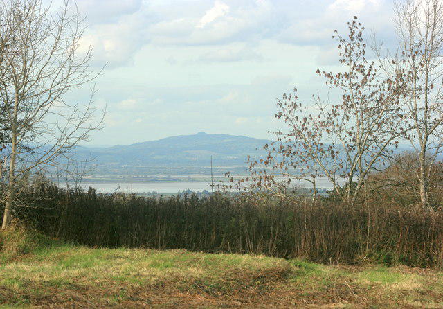 Photo could not load
ST7398 : 2008 : West of north from Stinchcombe Hill
Maurice Pullin
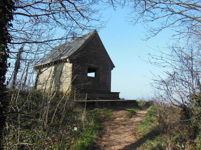 Photo could not load
ST7398 : A shelter on Stinchcombe Hill
Ian S
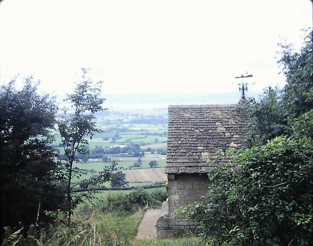 Photo could not load
ST7398 : Shelter on Stinchcombe Hill 1980
Clint Mann
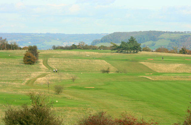 Photo could not load
ST7398 : 2008 : Stinchcombe Hill golf course, general view
Maurice Pullin
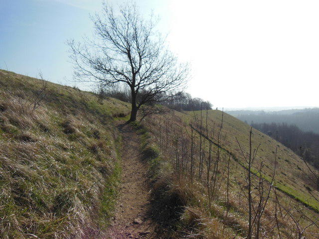 Photo could not load
ST7398 : The Cotswold Way at Stinchcombe Hill
Ian S
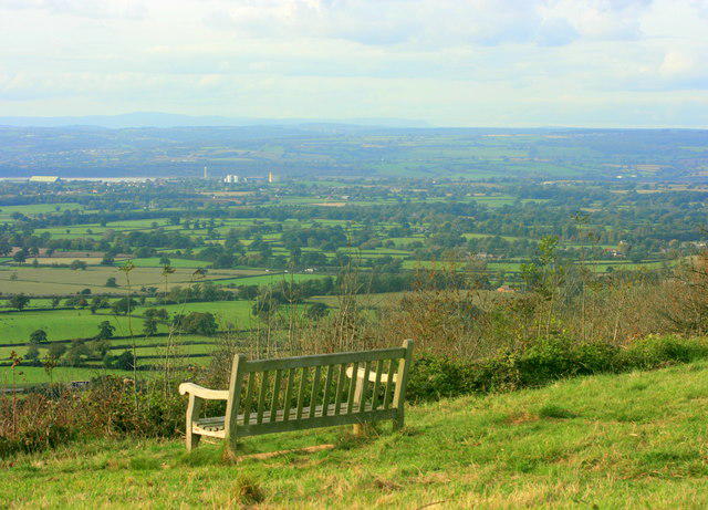 Photo could not load
ST7398 : 2008 : North of west from Stinchcombe Hill
Maurice Pullin
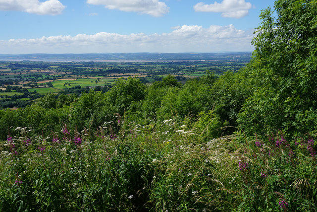 Photo could not load
ST7398 : The western side of Stinchcombe Hill
Bill Boaden
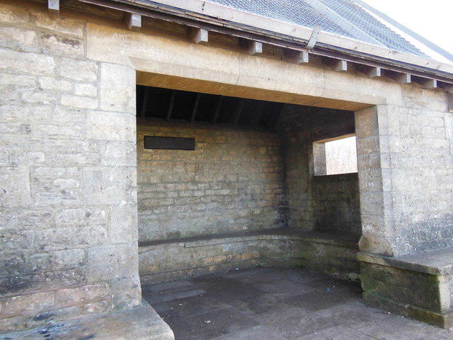 Photo could not load
ST7398 : A shelter on Stinchcombe Hill
Ian S
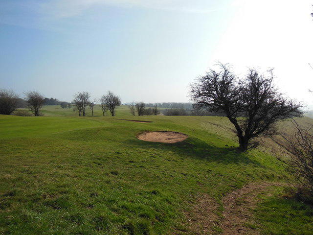 Photo could not load
ST7398 : The Cotswold Way at Stinchcombe Hill golf course
Ian S
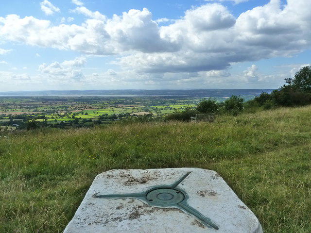
ST7398 : View from the trig point, Stinchcombe Hill
Ruth Sharville
Hill facts and local notes
Classifications
Elevation
219m
718 ft
Prominence
48m
Coordinates
51.6820, -2.3815
ST737982
OS Map
162
Explorer: 167
At the Summit
The summit is crowned with a noticeable trig point and a commemorative plaque, making it a rewarding spot for photographs. There are also remnants of ancient earthworks that add a touch of historical intrigue.
Terrain & Geology
Stinchcombe Hill is primarily composed of limestone, which gives rise to picturesque dry stone walls and sparse but interesting flora. The geological layers date back to the Jurassic period, making it a fascinating site for amateur geologists and nature lovers alike.
Views & Scenery
From the summit, hikers can spot the Severn Vale, the Malvern Hills, and on a clear day, even the Brecon Beacons in Wales. It's a viewpoint that'd make a postcard blush.
History & Heritage
Name Origin
The name 'Stinchcombe' is believed to derive from the Old English words 'stinc' (stinking) and 'cumb' (valley), likely a reference to the area’s marshy origins.
Historical Significance
Stinchcombe Hill has been a popular walking destination for centuries and was part of an important defence line during the English Civil War, with remnants still observable today.
Getting There & Facilities
Parking
There is a small car park located on the south side of Stinchcombe Hill at ST739976, suitable for a handful of vehicles.
Public Transport
Regular bus services operate from Dursley and nearby towns to Stinchcombe, making it accessible for those without their own transport.
Nearby Facilities
The nearby village of Stinchcombe provides a lovely café for refreshments, while public toilets can be found in Dursley.
Safety Information
Known Hazards
- Be cautious of steep drops on some parts of the path, and watch out for muddy sections after rain, which could leave you looking like a mud monster.
General Safety Tips
- Check weather conditions before setting out
- Carry appropriate clothing and equipment
- Let someone know your planned route
- Take a map, compass, and GPS device
- Carry emergency supplies: food, water, first aid kit, torch
Hills
Some common questions about the hills answered
Are there group walks up Stinchcombe Hill?
Many walkers use Walkmates to join or organise walks with others. You can check for group walks around Stinchcombe Hill through the maps
Are there other walkers around Stinchcombe Hill?
Activity varies by location and time, but Walkmates lets you see whether others have shared walks or shown interest in this area. Find other people through the walking friends search walking friends for Stinchcombe Hill search or of course create your own walk for Stinchcombe Hill
Can I organise a walk to Stinchcombe Hill?
Yes. If there aren’t any walks listed already, you can create a walk and make it available for others to join.
If you're signed up to Walkmates, you can create a walk to Stinchcombe Hill.
How do I find a walk up this hill?
There are often multiple ways to walk this hill, depending on experience and route preference. Walkmates helps you explore walks and routes that others have shared.
Can I suggest a new route up Stinchcombe Hill?
Yes. You can suggest or create routes to share with others. Walkmates focuses on the social side of walking, so routes are used to help people organise walks and explore areas together, rather than as detailed navigation tools or route libraries.
Other uses really appreciate knowledgeable walkers sharing their routes. Share your favourite route to Stinchcombe Hill here
The is an error or something incorrect about this hill. How do I let you know?
We always strive to keep the information on Walkmates as accurate as possible. If you find an error, please let us know through the contact form and we'll aim to correct it as quickly as possible
Community Discussion
Comments
Location
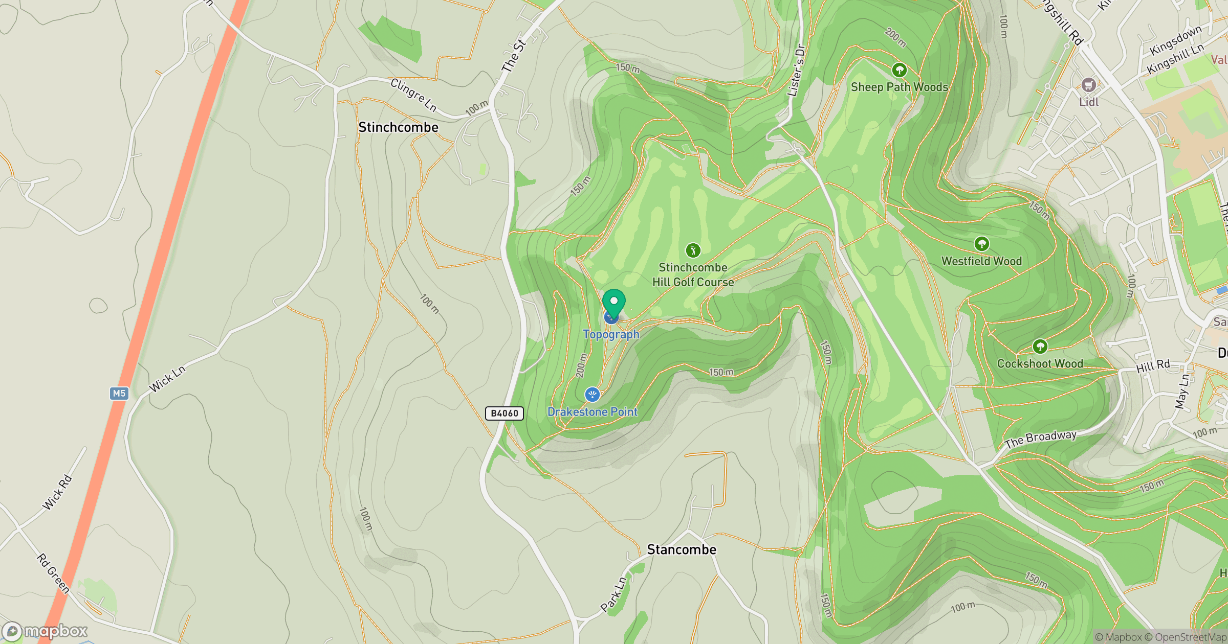
Grid reference: ST737982
View on OpenStreetMapOpens a map in a new tab, centred on the hill.
Nearby Hills
Worcestershire Beacon
425m
Glastonbury Tor
158m
Titterstone Clee Hill
533m
Long Mynd - Pole Bank
517m

The Wrekin
407m
No comments yet. Be the first.